Posts Tagged ‘waterfalls’
Palouse Falls–showy cataract of Eastern Washington’s coulee country
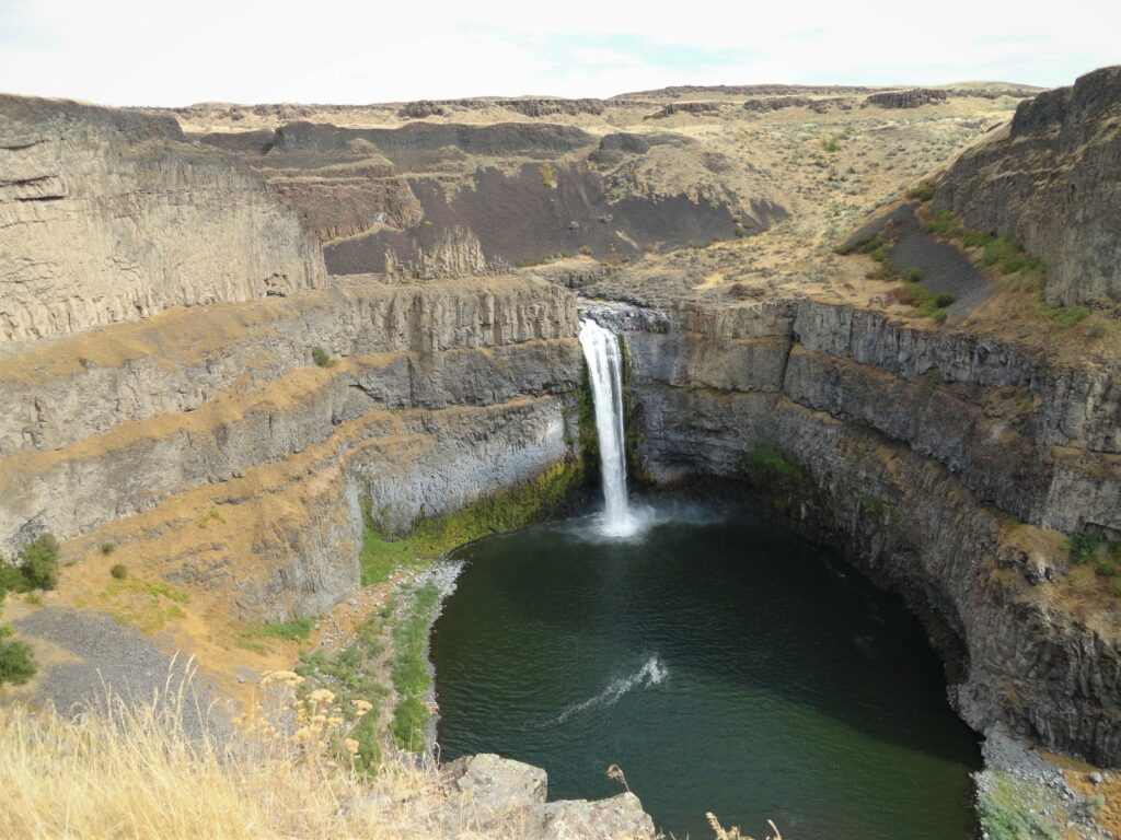
Quick Facts: Location: Channeled Scablands Eastern Washington Land Agency: Washington State Parks Roundtrip: 1.3 miles Elevation Gain: 150 feet Contact: Washington State Parks Guidebook: Day Hiking Eastern Washington (Mountaineers Books) Notes: Discover Pass required. Dogs permitted on leash. Watch for rattlesnakes Access: From Pasco, take US 395 north to Connell. Then follow SR 260 east for 25 miles…
Read MoreLake Serene — Placid lake tucked beneath the terrifying towers of Mount Index
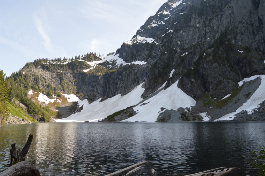
Quick Facts: Location: US 2 near Index Land Agency: Mount Baker-Snoqualmie National Forest Roundtrip: 7.2 miles Elevation gain: 2020 feet Green Trails Maps: Index WA- No. 142 Recommended Guidebook: Day Hiking Central Cascades 2nd edition (Mountaineers Books) Contact: Skykomish Ranger District: Mount Baker Snoqualmie National Forest Notes: NW Forest Pass or Interagency Pass required Access:…
Read MoreBridal Veil Falls — Visit after heavy rains for a bridal shower!

Quick Facts: Location: US 2 near Index, Land Agency: Mount Baker-Snoqualmie National Forest Roundtrip: 4.4 miles Elevation gain: 850 feet Green Trails Maps: Green Trails, Alpine Lakes Stevens Pass 176S Contact: Skykomish Ranger District: Mount Baker -Snoqualmie National Forest Notes: NW Forest Pass or Interagency Pass required Access: From Everett follow US 2 east for…
Read MoreEagle Creek — Classic Hike overflows with stunning waterfalls
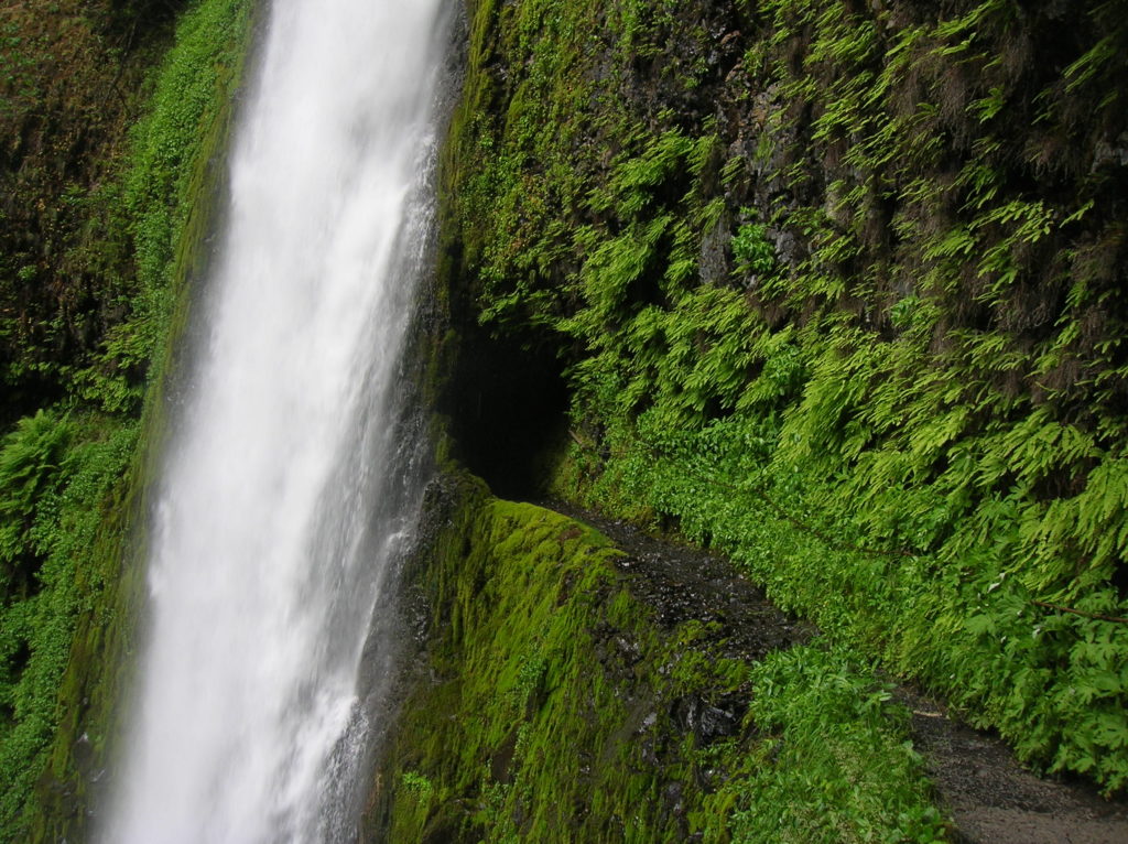
Quick Facts: Location: Columbia River Gorge near Cascades Locks, Oregon Land Agency: National Forest Service Roundtrip: 12 miles High Point: 1,100 feet Elevation gain: 1,600 feet Difficulty: moderate Green Trails Maps: Columbia Gorge West no. 428S Contact: Columbia Gorge National Scenic Area Notes: Northwest Forest Pass or Interagency Pass required; Dogs permitted (but not recommended) on leash; steep drop offs and exposure—keep children near.…
Read MoreGoat Falls –“Kid-friendly” snowshoe trip near Mount Rainier National Park
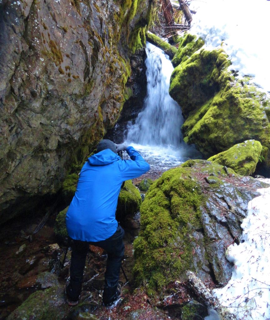
Quick Facts: Location: White River Valley Land Agency: Mount Baker-Snoqualmie National Forest Roundtrip: 2.5 miles Elevation gain: 500 feet Green Trails Map: Mount Rainier Wonderland no. 269SX Contact: Mount Baker-Snoqualmie National Forest; Snoqualmie Ranger DistrictNotes: Northwest Forest Pass required at actual trailhead. When snow level is low, parking may be a challenge. Do not block…
Read MoreCora Lake– Emerald lake cradled beneath craggy High Rock
Quick Facts: Location: Nisqually River Valley Land Agency: National Forest Service Roundtrip: 1.4 miles Elevation Gain: 400 feet Contact: Gifford Pinchot National Forest Green Trails Map: Randle, WA no. 301 Notes: no pass needed; creek crossing might be challenging early in the season; trail is open to mountain and motor bikes Access: From Elbe, follow SR 706 east…
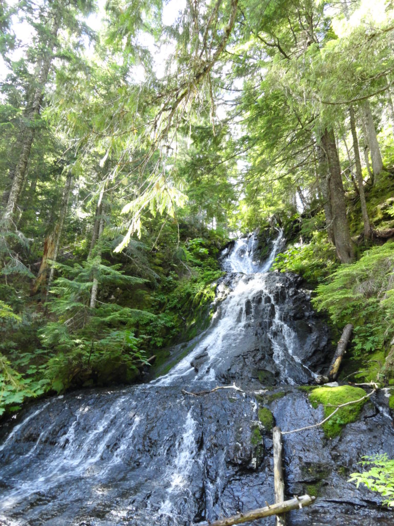
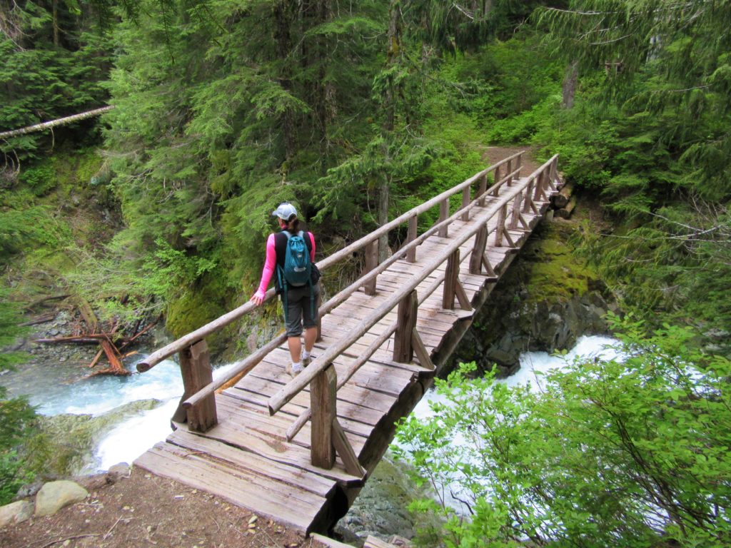
Read MoreSilver Falls Loop– Thundering Waterfall at Rainier’s Ohanapecosh
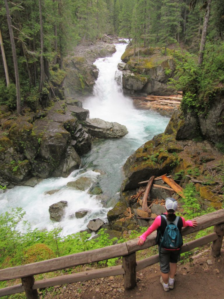
Quick Facts: Location: Ohanapecosh Land Agency: Mount Rainier National Park Roundtrip: 2.7 miles Elevation Gain: 350 feet Contact: Mount Rainier National Park Detailed Information: Day Hiking Mount Rainier (Mountaineers Books) Green Trails Map: Mount Rainier National Park 269S Notes: National Park Entrance Fee or Interagency Pass required; dog prohibited Access: From Packwood, follow US 12 east for 7.5…
Read MoreEastside Trail — Big trees, big waterfalls, and lots of tranquility
Quick Facts: Location: Mount Rainier National park Land Agency: National Park Service One way: 9.0 miles Elevation Loss: 2,200 feet Contact: Mount Rainier National Park Green Trails Maps: Mount Rainier National Park 269S Notes: National Park entry fee; Dogs prohibited; Keep children nearby around waterfalls and creek sides as a slip or fall can lead to…
Read MoreGreen Lake and Ranger Falls –Towering trees and a three-tiered cataract
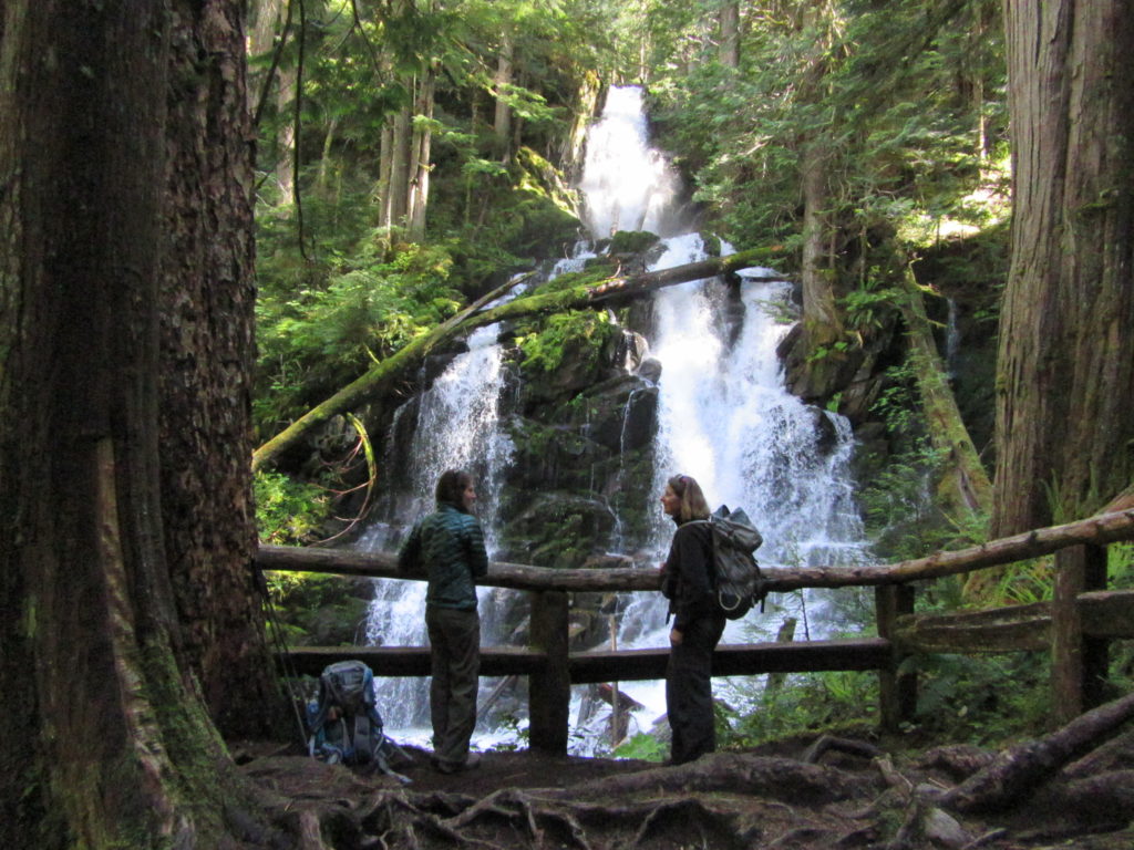
Quick Facts: Location: Carbon River Valley, Mount Rainier National Park Land Agency: National Park Service Roundtrip: 9.6 miles Elevation Gain: 1,350 feet Contact: Mount Rainier National Park Green Trails Map: Mount Rainier National Park 269SX Notes: National Park entrance fee; Dogs Prohibited; Practice Leave No Trace Principles; camping only in designated spots and with a permit Access: From Buckley,…
Read MoreExplorer Falls–It's an easy search to find these falls

Quick Facts: Location: Near Lake Roesiger between Monroe and Granite Falls Land Agency: Washington DNR Roundtrip: 2.0 miles Elevation gain: 200 feet Contact: Washington DNR Notes: Do not block gate, nor drive past it if open. Active logging area, be alert to trucks on roadway and yield right-of-way. Access: From Monroe, follow Woods Road north…
Read More