Posts Tagged ‘Washington State Parks’
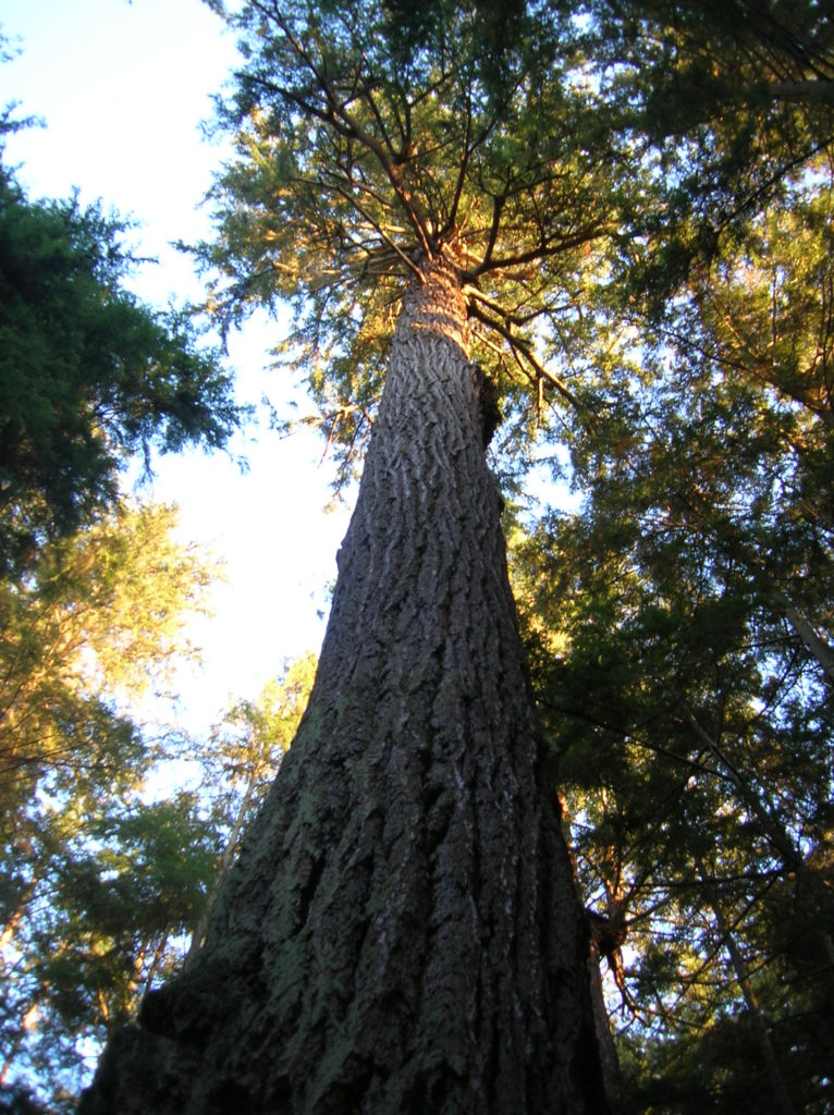
Rainbow Falls State Park
Stroll through groves of Old-growth above the Chehalis River Quick Facts: Location: Chehalis River Valley Land Agency: Washington State Parks Roundtrip: up to 3.0 miles Elevation gain: 300 feet Contact: Rainbow Falls State Park Notes: Discover Pass required; dogs must be leashed Access: From Chehalis (exit 77 on I-5) follow SR 6 west for 16…
Read MoreTolmie State Park
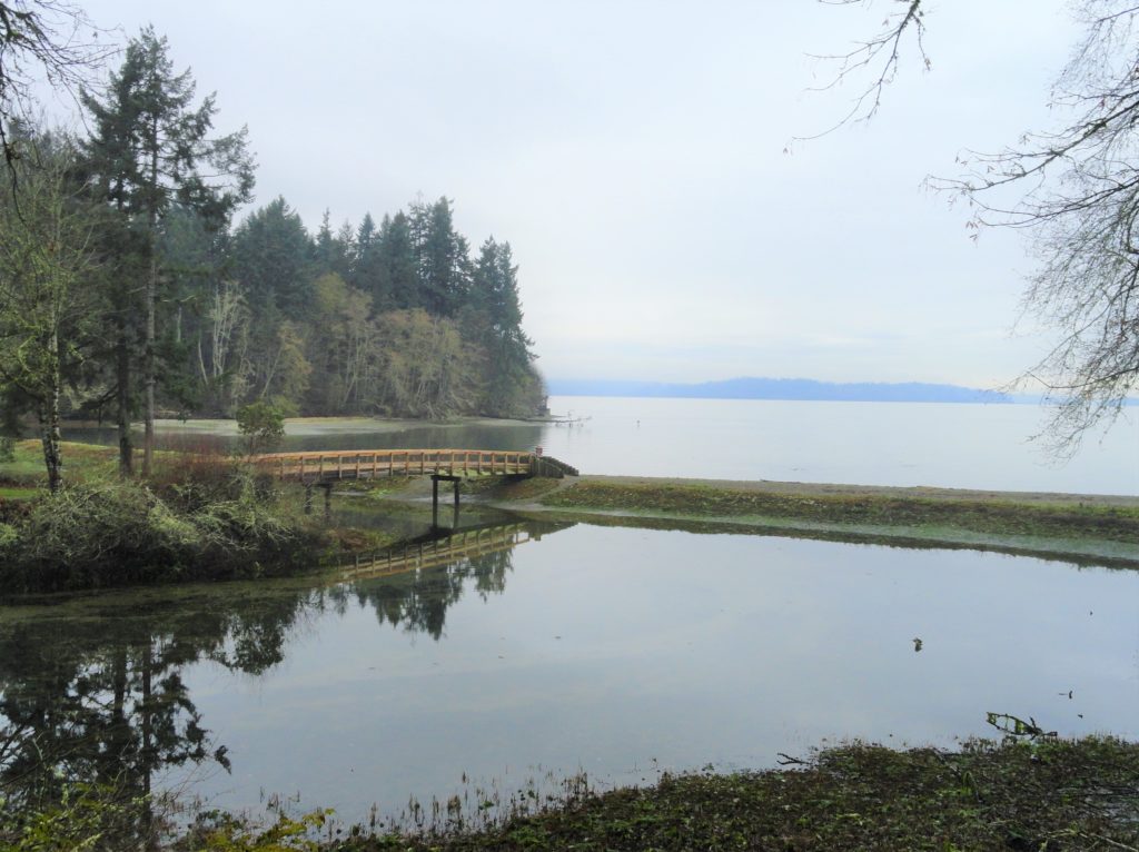
Explore a small trail network on the Nisqually Reach Quick Facts: Location: Lacey Land Agency: Washington State Parks Distance: 3.0 miles of trails Elevation Gain: up to 225 feet Contact: Tolmie State Park Notes: Discover Pass required; dogs permitted on leash: Hours: April 20-September 20: 8 a.m to dusk September 21-April 19, Wed—Sunday 9 a.m.-dusk…
Read MoreDash Point State Park
Make a dash for more than 10 miles of trails! Quick Facts: Location: Federal Way Land Agency: Washington State Parks Distance: more than 10 miles of trails Elevation Gain: up to 475 feet Contact: Dash Point State Park Notes: Discover Pass required; dogs permitted on leash, Recommended Guidebook: Urban Trails Tacoma (Mountaineers Book) Access: From…
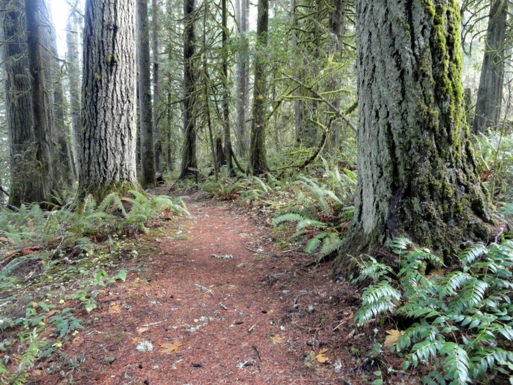
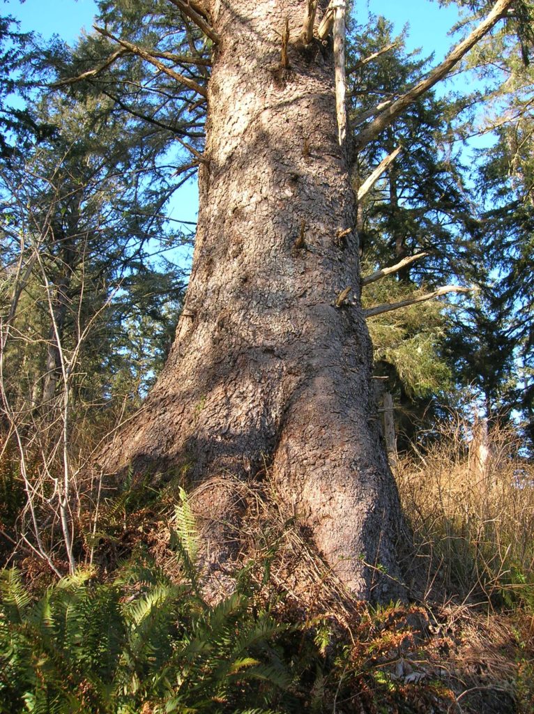
Read MoreLewis and Clark State Park─Discover beautiful Old Growth Forest along the old highway ninety-nine
Quick Facts: Location: Chehalis River Valley Land Agency: Washington State Parks Roundtrip: 2.0 miles Elevation Gain: 125 feet Note: Discover Pass required; dogs permitted on leash. Access: From Exit 68 on I-5, proceed 2.5 miles east on US 12 to Mary’s Corner. Turn right onto Jackson Highway entering state park in .7 mile. Continue another…
Read MoreScarborough Hill─Giant Sitka Spruces at historic fort on the Columbia River
Quick Facts Location: Fort Columbia State Park, Pacific County, WA Land Agency: Washington State Parks Roundtrip: 2.4 miles Elevation Gain: 630 feet Access: From Kelso head west 56 miles on SR 4 to Naselle. Turn left onto SR 401 proceeding 12 miles to a junction with US 101 at the Astoria-Megler Bridge. Continue west on…
Read MoreMillersylvania State Park─Amble among ancient trees just minutes from Olympia
Quick Facts: Location: Thurston County Land Agency: Washington State Parks Roundtrip: 3.0 miles Elevation Gain: 75 feet Contact: Washington State Parks Recommended Resource: Urban Trails Olympia Notes: Discover Pass required; Dogs must be leashed. Access: From Olympia, head south on I-5 to Exit 99. Continue southeast on SR 121 for 4.2 miles. Turn right (west) into main…
Read MoreMount Spokane–Savor spectacular views from this prominent peak above Washington’s second city
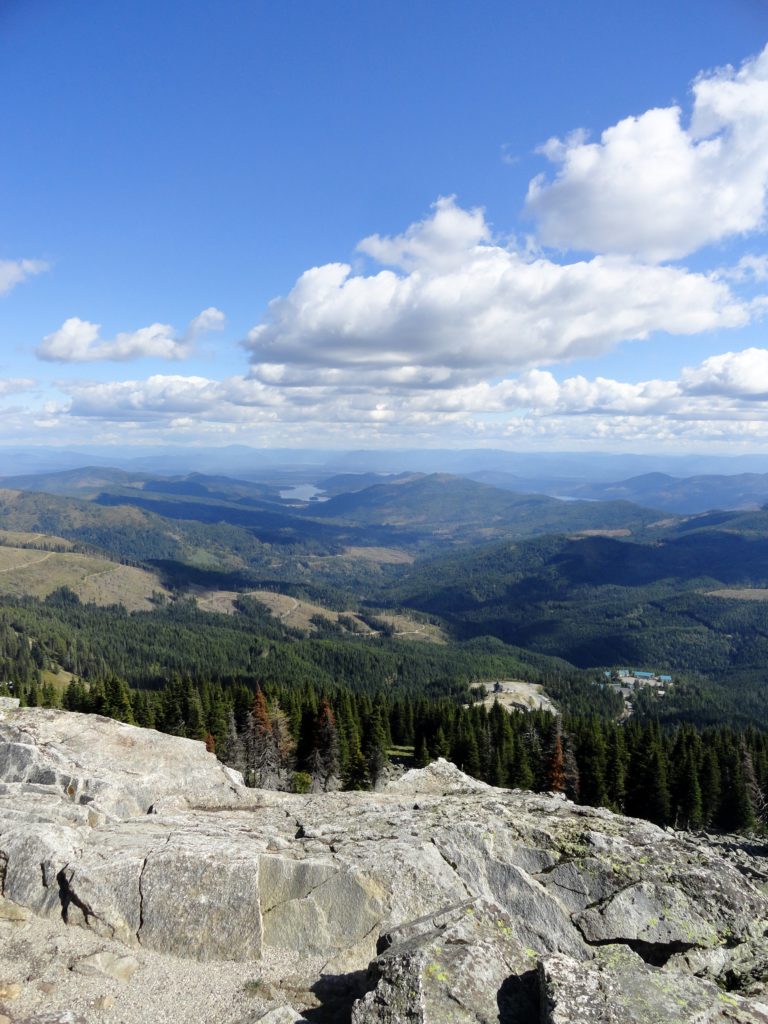
Location: Mount Spokane State Park Land Agency: Washington State Parks Roundtrip: 6.0 miles High Point: 5,883 feet Elevation gain: 1,000 feet Difficulty: moderate Map: Mount Spokane State Park (Dharma Maps) Contact: Washington State Parks Note: Discover Pass Required; dogs permitted on leash Access: From Spokane, follow US 2 north 10 miles to Mead. Turn right…
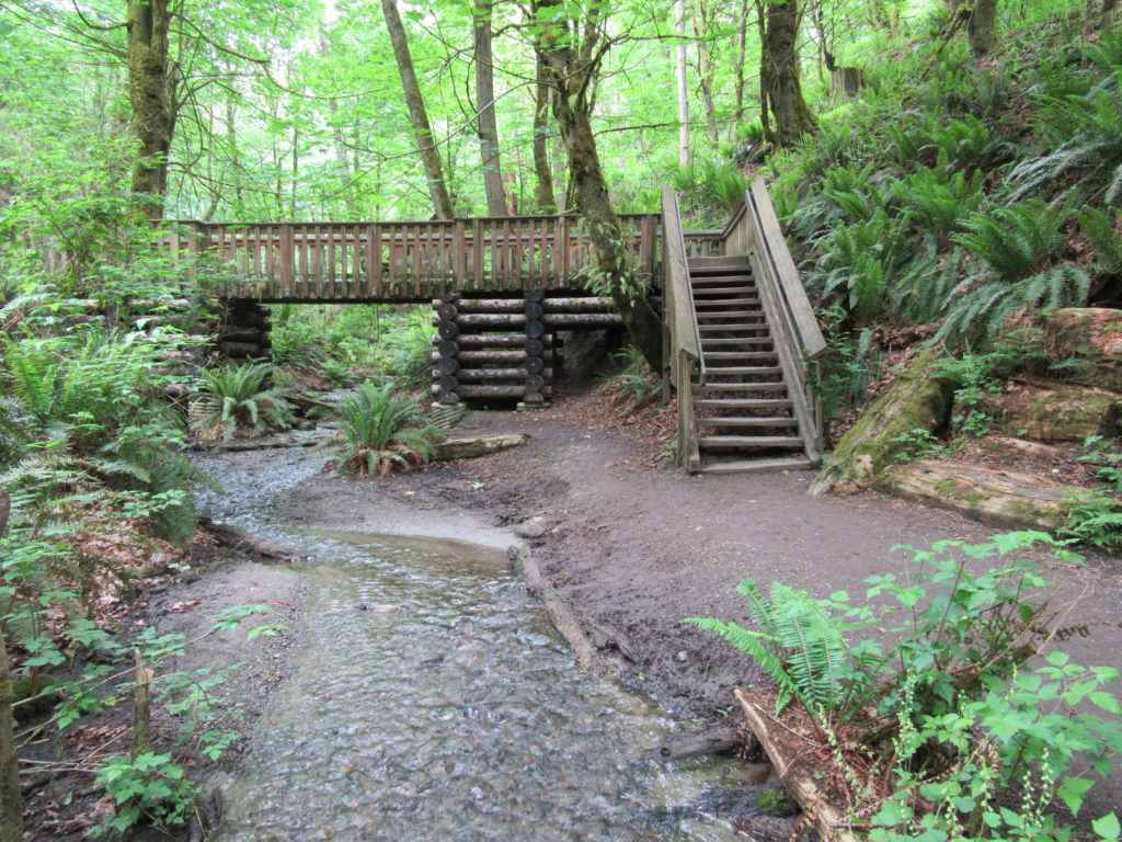
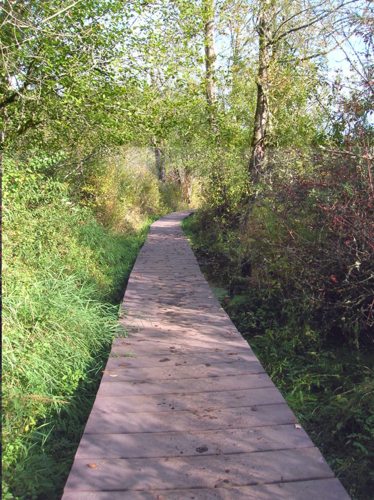
Read MoreDosewallips State Park Loop — Hike back in time through a quiet forest
Quick Facts: Location: Olympic Peninsula Land Agency: Washington State Parks Roundtrip: 3.6 miles Elevation Gain: 550 feet Contact: Dosewallips State Park Green Trails Map: Olympic Mountains East 168SX Detailed Information: Day Hiking Olympic Peninsula (Mountaineers Books) Notes: Discover Pass required; Dog must be leashed Recommended Resource: Day Hiking Olympic Peninsula Access: From Quilcene drive US 101 south for 12…
Read MoreHoyt Beach–Shoreline of solitude at the Mouth of the Sekiu River
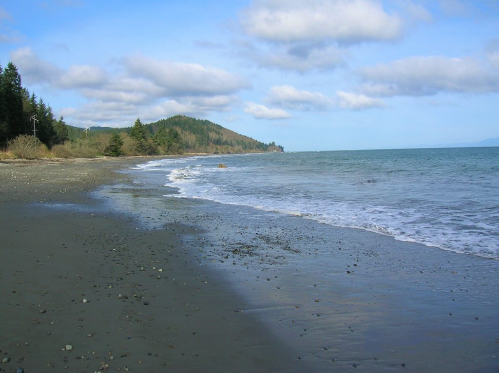
Location: Northwest Olympic Peninsula Land Agency: Washington State Parks Roundtrip: 2.0 miles High Point: sea level Elevation gain: none Contact: Washington State Parks Notes: Discover Pass required; Dogs permitted on leash Access: From Port Angeles, head west of US 101 for 5 miles. Turn right onto SR 112 and follow west for 46 miles to Clallam…
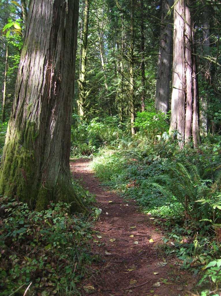
Read MoreSouth Whidbey State Park—Amble among ancient trees above the sound
Quick Facts: Location: Whidbey Island Land Agency: Washington State Parks Roundtrip: 2.3 miles Elevation Gain: 200 feet Contact: South Whidbey State Park Notes: Discover Pass Required: Dogs must be leashed Access: From the Clinton Ferry Terminal on Whidbey Island follow SR 525 north for 9.4 miles turning left onto Bush Point Road. After 2.2 miles road…
Read More