Posts Tagged ‘spring wildflowers’
Peshastin Pinnacles — Hike though a magical kingdom of rocky spires

Quick Facts: Location: Wenatchee River Valley near Leavenworth Land Agency: Washington State Parks Roundtrip: 1.5 miles Elevation gain: 400 feet Green Trails Maps: Wenatchee Mission Ridge no. 211S Contact: Peshastin Pinnacles State Park Notes: Discover Pass required; dogs must be leashed. Access: From Leavenworth follow US 2 east for 9 miles turning left onto North…
Read MoreJuniper Dunes Wilderness –A wilderness “sans” trails
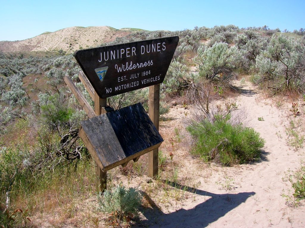
Quick Facts Location: Franklin County, Eastern Washington Land Agency: Bureau of Land Management Roundtrip: 2.0 miles Elevation gain: 200 feet Difficulty: Moderate Contact: Bureau of Land Management (BLM) Spokane Office Notes: All approaches to this wilderness area are currently via private roads and land. The southern approach cannot be recommended due to poor roads and changing…
Read MoreSwan Lake and Christmas Hill –A very merry hike minutes from downtown Victoria

Quick Facts: Location: Saanich Peninsula, Vancouver Island Land Agency: Swan Lake Christmas Hill Sanctuary Roundtrip: 3.5 miles/ 5.6 kilometers Elevation gain: 325 feet/ 100 meters Contact: Swan Lake Christmas Hill Sanctuary Notes: dogs prohibited Access: From Victoria or Sidney, follow BC 17 (Patricia Bay Highway) exiting onto McKenzie Ave. Proceed east turning right onto Rainbow…
Read MoreEbey’s Landing—A Sound Hiking Adventure
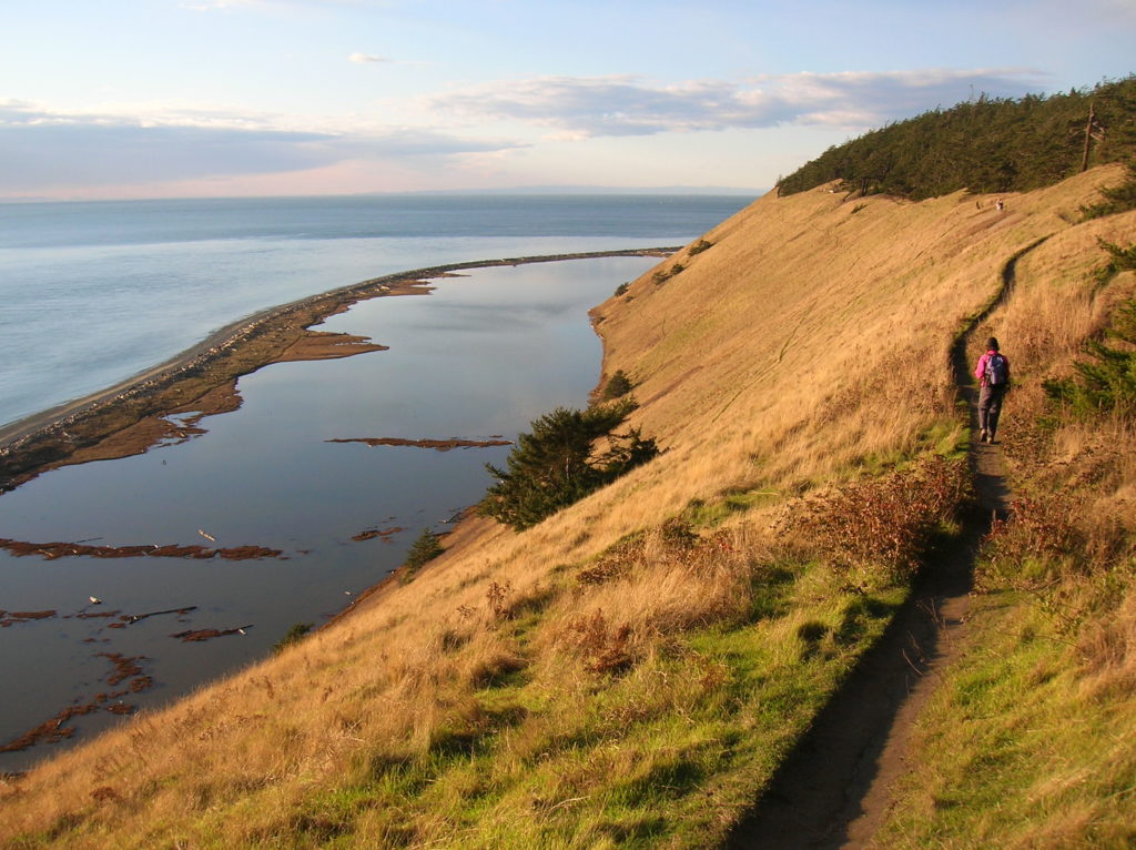
Quick Facts: Location: Whidbey Island Land Agency: National Park Service and Washington State Parks Roundtrip: 5.2 miles Elevation Gain: 260 feet Contact: Ebey’s Landing National Historical Reserve Suggested Guidebook: Urban Trails Everett Special note: Dogs permitted on leash. Access: Take Washington State Ferry from Mulkiteo to Clinton on Whidbey Island. Continue north on SR 525…
Read MoreWhispering Firs Trail– While away a winter day on this Paradise Valley trail

Location: Maltby Land Agency: Snohomish County Parks Roundtrip: 0.6 mile Elevation gain: minimal Contact: Snohomish County Parks; map available on line Notes: Dogs must be on a leash Access: From SR 522 in Maltby (5.0 miles east of Woodinville; 8.0 miles west of Monroe) head east on Paradise Lake Road for 1.7 miles to trailhead.…
Read MoreLower Gray Wolf River– A nice place to hang out with the pack

Quick Facts: Location: Northeast Olympic Peninsula Land Agency: Olympic National Forest Roundtrip: 7.0 miles Elevation gain: 900 feet Contact: Hood Canal Ranger District, Quilcene Green Trails Map: Olympic Mountains East no. 168SX Notes: wilderness rules apply Recommended Guidebook: Day Hiking Olympic Peninsula Good to Know: dog-friendly; kid-friendly; easy backpacking options, Buckhorn Wilderness Access: From US…
Read MoreHamilton Mountain — Breathtaking views from above Beacon Rock
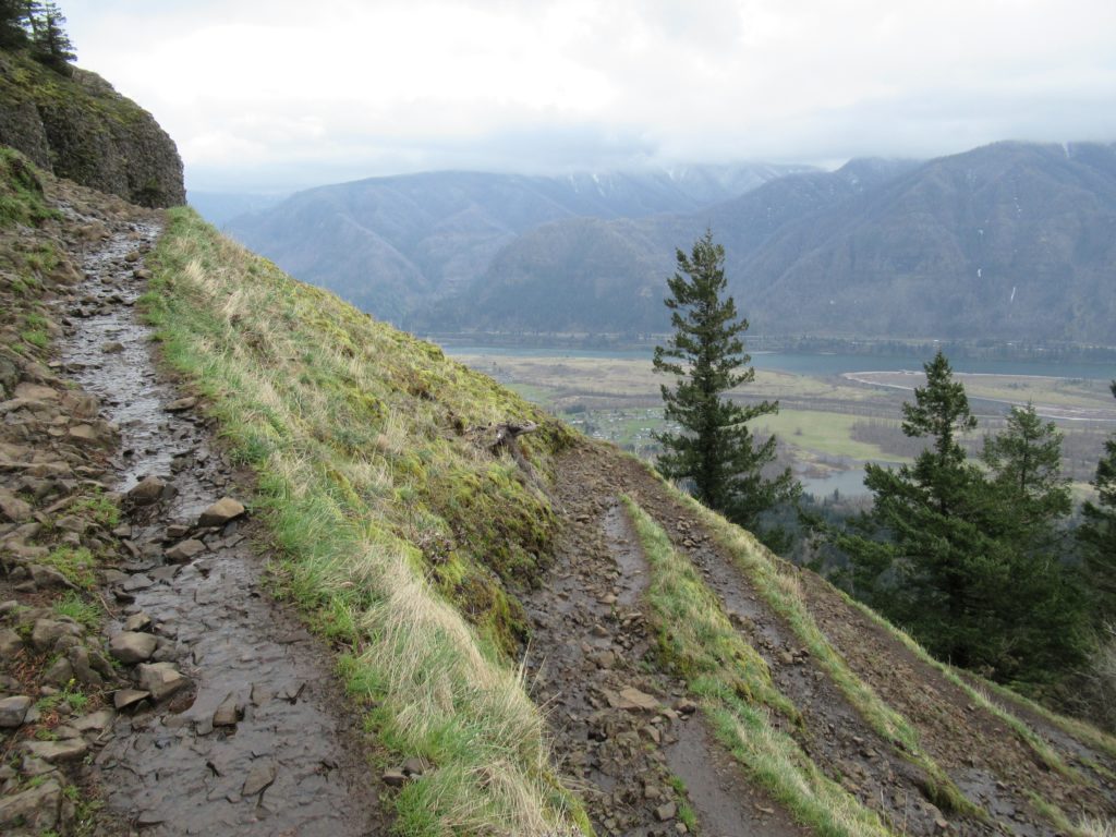
Quick Facts: Location: Beacon Rock State Park, Columbia River Gorge National Scenic Area Land Agency: Washington State Parks Roundtrip: 7.5 miles Elevation gain: 2,100 feet Contact: Beacon Rock State Park Notes: Discover Pass required; Dogs permitted on leash. Green Trails Map: Columbia River Gorge West No. 428S Recommended Guidebooks: Day Hiking Columbia River Gorge, 100…
Read MoreMount Pisgah–Hike to a promising land of spectacular wildflowers
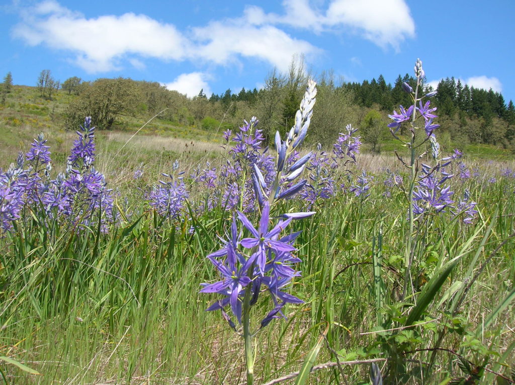
Quick Facts: Location: Willamette Valley south of Eugene Land Agency: Lane County Parks Roundtrip: 3.0 miles Elevation gain: 1,050 feet Map: Park map available online Contact: Friends of Buford Park and Mount Pisgah Notes: $5.00 day use fee; dogs must be leashed Access: From Eugene follow Franklin Blvd (Exit 189 I-5 southbound or Exit 188B northbound…
Read MoreTracy Hill — Wild turkeys and sublime views
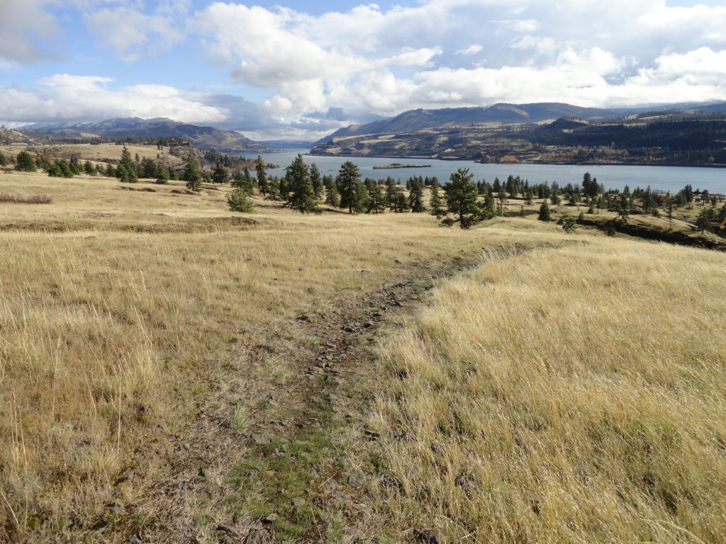
Quick Facts: Location: Columbia River Gorge National Scenic Area Land Agency: Columbia Gorge National Scenic Area Roundtrip: 5.0 miles Elevation gain: 1150 feet Difficulty: Moderate Contact: Columbia Gorge National Scenic Area Notes: Dogs permitted on leash. Be aware of ticks and poison oak. Green Trails Map: Columbia River Gorge East No. 432S Good to Know:…
Read MorePatterson Mountain — Bitterroot and Balsamroot and a bevy of other blossoms
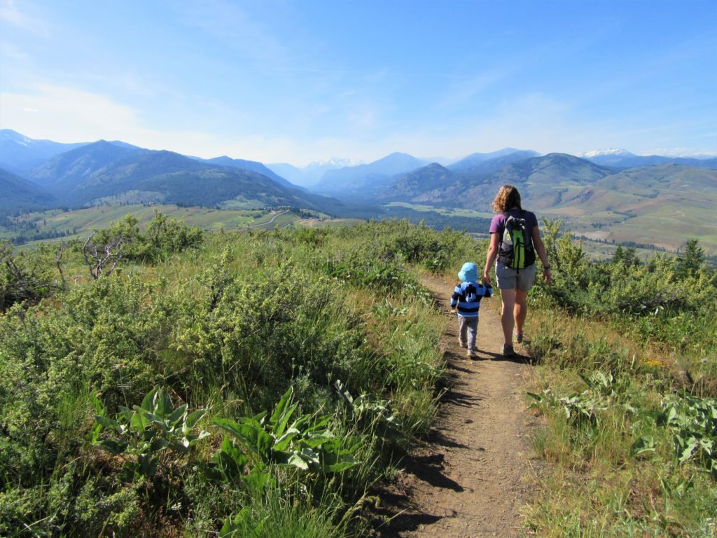
Quick Facts: Location: Methow Valley Land Agency: WA Department of Natural Resources Roundtrip: 3.7 miles Elevation Gain: 1,100 feet Contact: WA Department of Natural Resources Green Trails Map: Sun Mountain, WA- No.83S Notes: Discover Pass Required Access: From Winthrop head east on SR 20 for .6 mile immediately turning right onto Twin lakes Road. Follow for 3.0 miles turning right…
Read More