Posts Tagged ‘snow free winter hikes’
Christmas Lake and Cedar Butte- Bad tidings and spelling
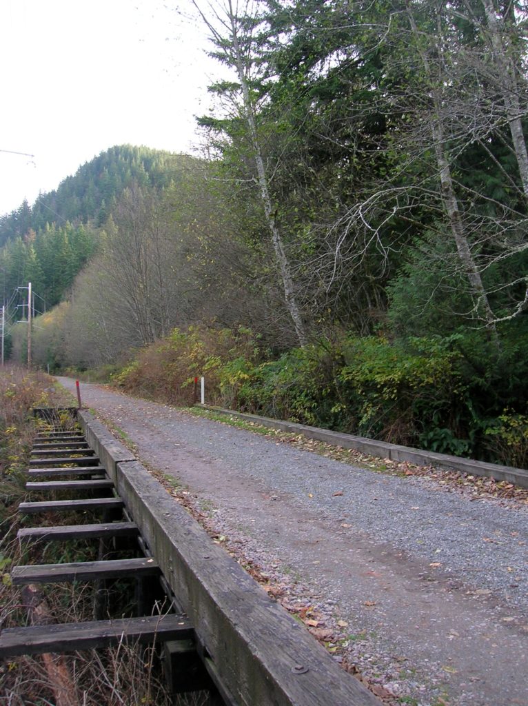
Quick Facts: Location: Snoqualmie Valley near North Bend Land Agency: Washington State Parks Roundtrip: 4.2 miles Elevation Gain: 900 feet Green Trails Map: Rattlesnake Mountain Upper Snoqualmie Valley 205S Access: From Seattle take I-90 east to exit 32 in North Bend turning right (south) onto 436th Ave SE which soon becomes Cedar Falls Road. Follow for 3.1…
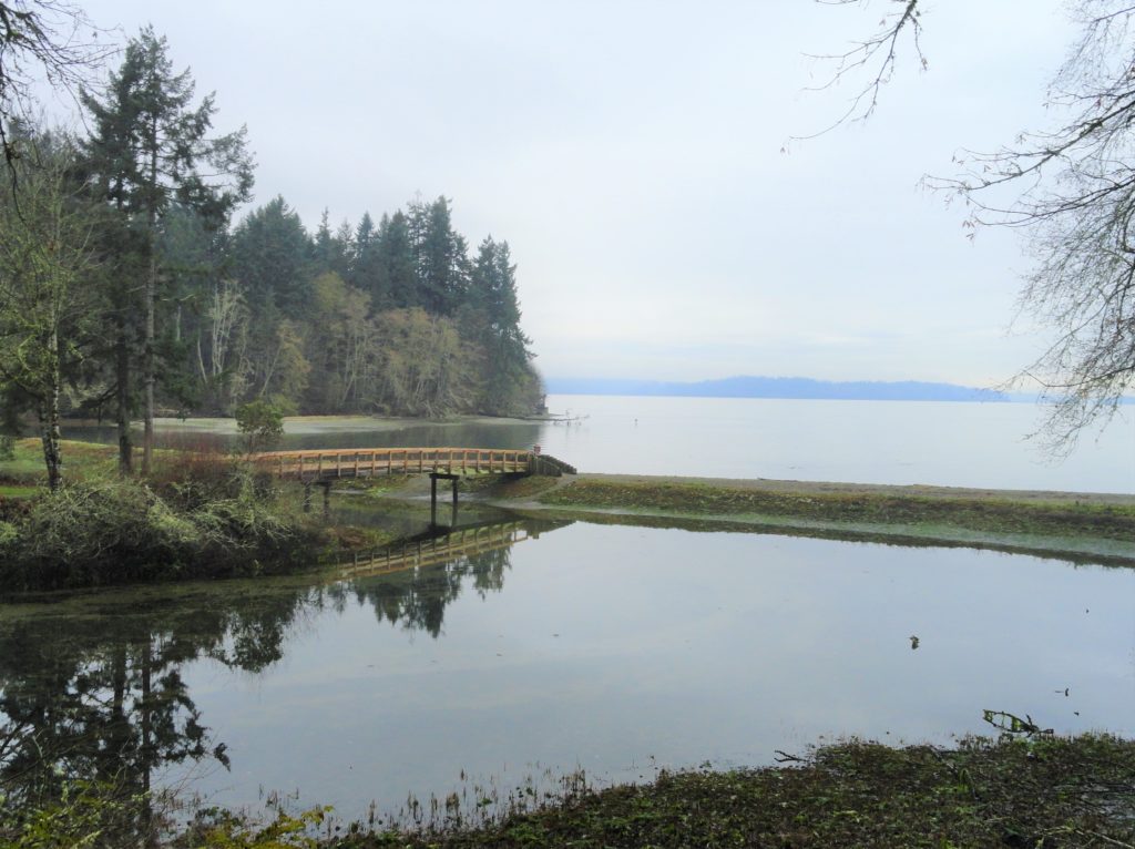
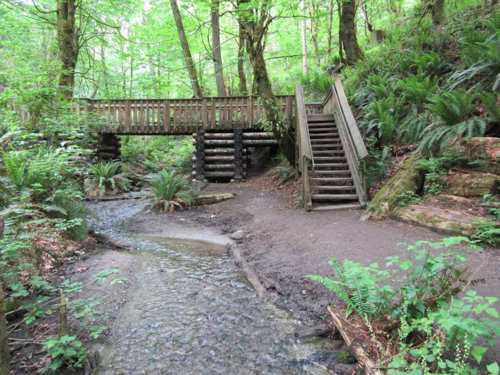
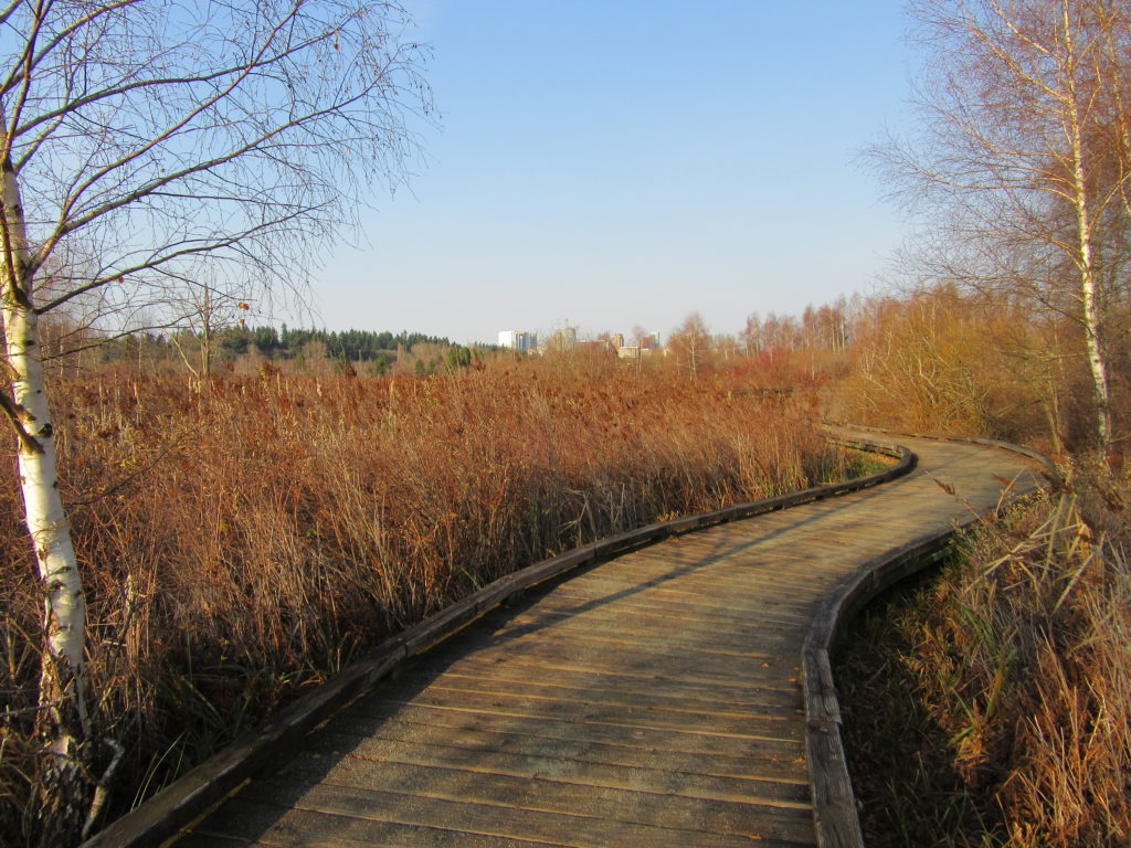
Read MoreMcLane Creek– Wetland wonderland within minutes from downtown Olympia
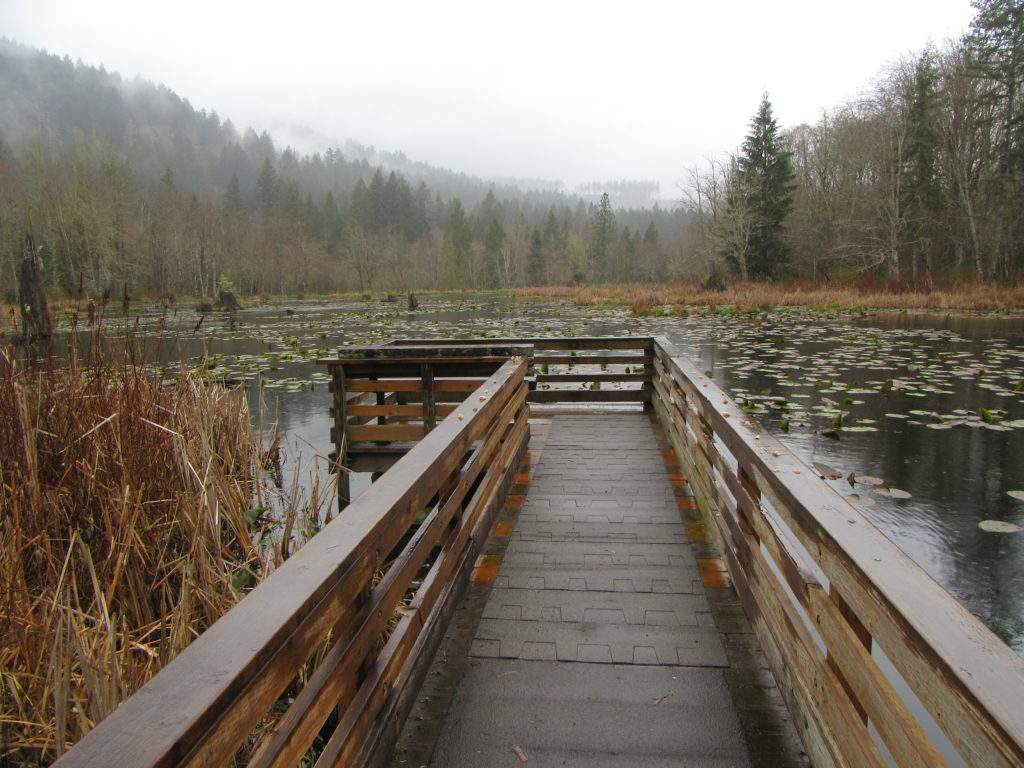
Quick Facts: Location: Capitol State Forest Land Agency: Washington Department of Natural Resources (DNR) Roundtrip: 1.5 miles Elevation Gain: minimal Contact: Washington Department of Natural Resources (DNR); South Puget Sound Region Office Notes: Discover Pass required; dogs permitted on leash Access: From Exit 104 on I-5 in Olympia, head west on US 101 taking the Black…
Read MoreCape Flattery─Hike to the northwestern most point in Washington State

Quick Facts: Location: Olympic Peninsula Coast Land Agency: Makah Nation Reservation Roundtrip: 1.5 miles Elevation Gain: 300 feet Contact: Makah Indian Nation Green Trails Map: Cape Flattery, WA- No 98S Notes: Dogs allowed on leash, Makah Recreation Pass required ($20, available at Washburn’s General Store ,the Makah Museum and several other locations in Neah Bay).…
Read MoreIceberg Point — Maritime scenery will leave you frozen in astonishment
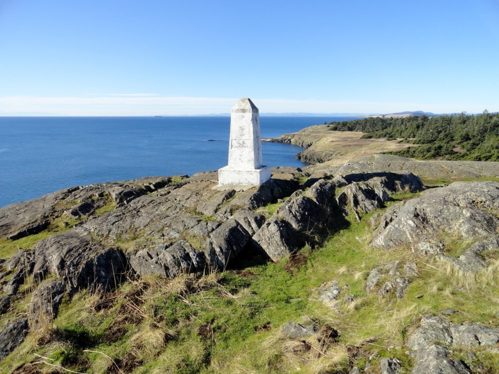
Quick Facts: Location: San Juan Islands National Monument Land Agency: Bureau of Land Managment Roundtrip: 3.8 miles Elevation gain: 380 feet Contact: San Juan Islands National Monument, Spokane District Office BLM Notes: Dogs permitted on leash; do not park beyond Agate Beach Park; access is via private property which owners have generously granted permission—stay on…
Read MoreRainbow Falls State Park
Stroll through groves of Old-growth above the Chehalis River Quick Facts: Location: Chehalis River Valley Land Agency: Washington State Parks Roundtrip: up to 3.0 miles Elevation gain: 300 feet Contact: Rainbow Falls State Park Notes: Discover Pass required; dogs must be leashed Access: From Chehalis (exit 77 on I-5) follow SR 6 west for 16…
Read MoreBob Heirman Wildlife Preserve at Thomas’ Eddy – Swans, steelhead, and serenity on the Snohomish River

Quick Facts: Location: Snohomish River, south of Snohomish Land Agency: Snohomish County Parks Roundtrip: 1.5 miles Elevation Gain: 50 feet Contact: Snohomish County Parks and Recreation Special Note: Dogs prohibited. Trails can flood during rainy period. Expect wet and muddy trails. Access: From the city of Snohomish, travel south on SR 9 for 2.6 miles…
Read MoreTolmie State Park
Explore a small trail network on the Nisqually Reach Quick Facts: Location: Lacey Land Agency: Washington State Parks Distance: 3.0 miles of trails Elevation Gain: up to 225 feet Contact: Tolmie State Park Notes: Discover Pass required; dogs permitted on leash: Hours: April 20-September 20: 8 a.m to dusk September 21-April 19, Wed—Sunday 9 a.m.-dusk…
Read MoreDash Point State Park
Make a dash for more than 10 miles of trails! Quick Facts: Location: Federal Way Land Agency: Washington State Parks Distance: more than 10 miles of trails Elevation Gain: up to 475 feet Contact: Dash Point State Park Notes: Discover Pass required; dogs permitted on leash, Recommended Guidebook: Urban Trails Tacoma (Mountaineers Book) Access: From…
Read MoreMercer Slough Nature Park
Hike a slew of trails near the heart of Bellevue Quick Facts: Location: Bellevue Land Agency: City of Bellevue Parks and Recreation Distance: more than 7.0 miles of trails Elevation Gain: minimal Contact: City of Bellevue Parks and Recreation Notes: dogs permitted on leash, Recommended Guidebook: Urban Trails Eastside (Mountaineers Book) Access: Take Exit 12…
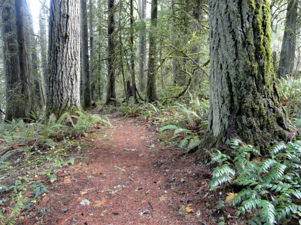
Read MoreTracy Hill — Wild turkeys and sublime views
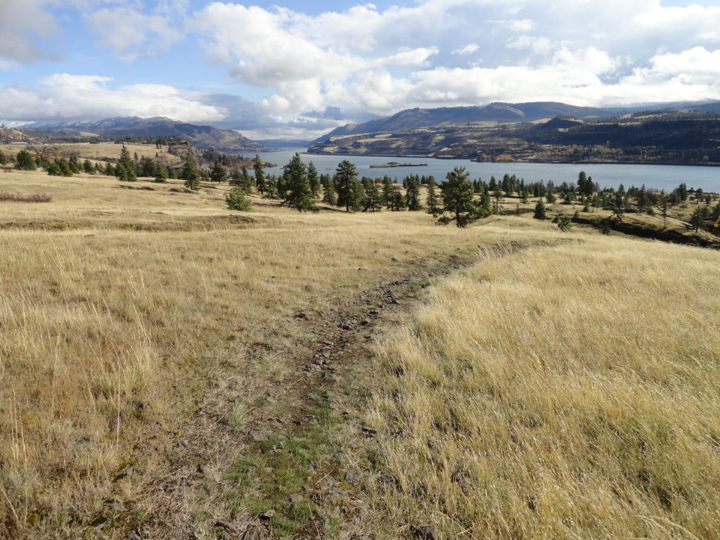
Quick Facts: Location: Columbia River Gorge National Scenic Area Land Agency: Columbia Gorge National Scenic Area Roundtrip: 5.0 miles Elevation gain: 1150 feet Difficulty: Moderate Contact: Columbia Gorge National Scenic Area Notes: Dogs permitted on leash. Be aware of ticks and poison oak. Green Trails Map: Columbia River Gorge East No. 432S Good to Know:…
Read More