Posts Tagged ‘snow-free winter hike’
Guillemot Cove─Quiet nature retreat on Hood Canal
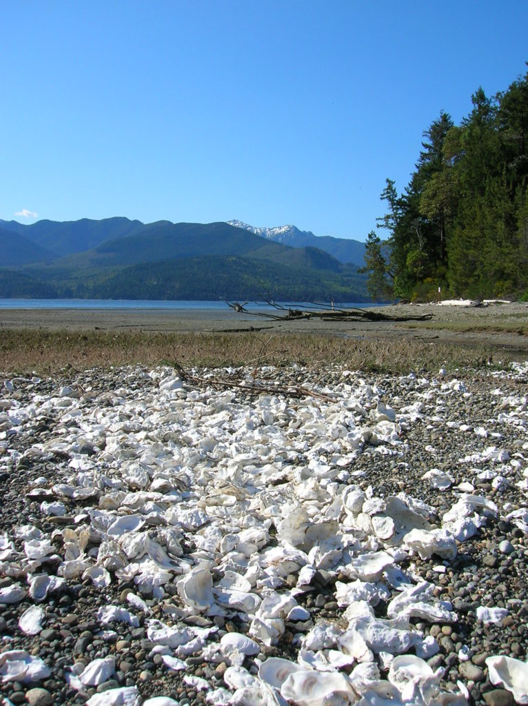
Quick Facts: Location: Kitsap Peninsula Land Agency: Kitsap County Parks Roundtrip: 2.5 miles Elevation Gain: 350 feet Contact: Kitsap County Parks Notes: Dogs prohibited. Access: From Bremerton, follow SR 3 North to Newberry Hill Road Exit. Then head west for 3.0 miles turning right onto Seabeck Highway. Continue for 5.0 miles to Seabeck turning right…
Read MoreBilly Frank Jr. Nisqually National Wildlife Refuge– Delightful hiking on the delta
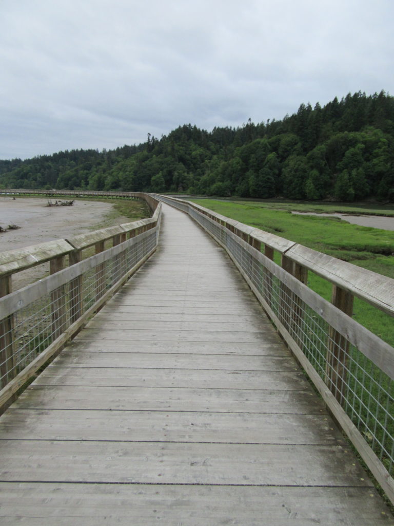
Quick Facts: Location: Nisqually River Delta Land Agency: United States Fish and Wildlife Service Roundtrip: 4.2 miles Elevation Gain: minimal Contact: Billy Frank Jr. Nisqually National Wildlife Refuge Map: Refuge Map Notes: $3.00 per four adults entrance fee; or Interagency Passes accepted; dogs prohibited; Northern end of the Nisqually Estuary Trail is closed from October to…
Read MoreMainline Trail—Hike through the heart of the Paradise Valley Conservation Area
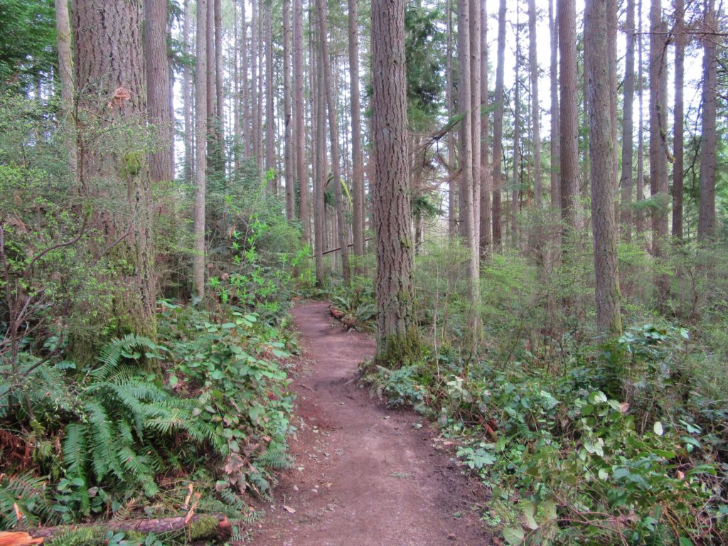
Quick Facts: Location: Maltby Land Agency: Snohomish County Parks Roundtrip: 3.2 miles Elevation Gain: minor ups and downs Access: From SR 522 in Maltby (5.0 miles east of Woodinville; 8.0 miles west of Monroe) head east on Paradise Lake Road for 1.7 miles to trailhead. Notes: Dogs must be on leash. Park open 7 am…
Read MoreRooster Rock State Park- Hike above the Columbia River Buffs!
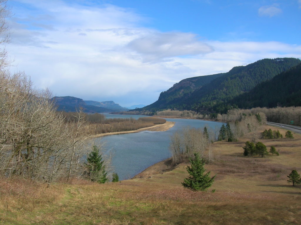
Quick Facts: Location: Columbia River Gorge, Oregon Land Agency: Oregon State Parks Roundtrip: 3.3 miles Elevation Gain: 300 feet Contact: Oregon State Parks Notes: $5.00 day use fee or $30 annual pass; dogs must be leashed Green Trails Maps: Columbia River Gorge West No. 428S Access: From Portland follow I-84 east to Exit 25. At .5…
Read MoreAnderson Point County Park
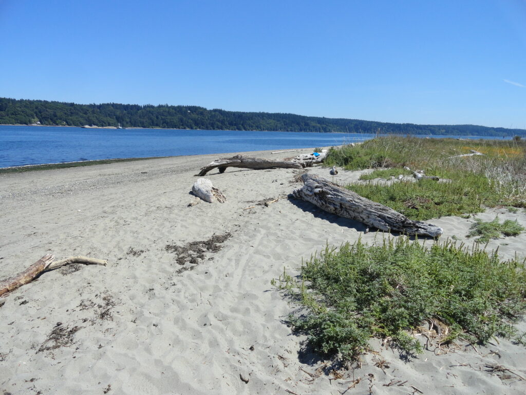
Short hike to one of the finest beaches on the Kitsap Peninsula Quick Facts: Location: Kitsap Peninsula Distance: 1.4 miles roundtrip Elevation Gain: 250 feet Contact: Kitsap County Parks Recommended Guidebook: Urban Trails Kitsap (Mountaineers Books) Notes: dogs permitted on leash; Park open from 6:00 am to 8:30 pm; do not park along Millihanna Road…
Read MoreChambers Creek Regional Park
Explore an old quarry resurrected as a grand park Quick Facts: Location: University Place (Tacoma) Distance: more than 6.0 miles of trails Elevation Gain: up to 230 feet Contact: Pierce County Parks Recommended Guidebook: Urban Trails Tacoma (Mountaineers Books) Notes: dogs permitted on leash and there is an off-leash area; some trails jogger-stroller and wheel…
Read MoreSaint Edward State Park
Explore a different—and wilder side of Lake Washington Quick Facts: Location: Eastside (Seattle) Distance: more than 9.0 miles of trails Elevation Gain: up to 500 feet Contact: Washington State Parks Recommended Guidebook: Urban Trails Eastside (Mountaineers Books) Notes: Discover Pass required; dogs permitted on leash; park open 8am to dusk Trailhead directions: From Bellevue follow…
Read MoreTurtlehead — It’s one shell of a view from this Turtleback Mountain summit
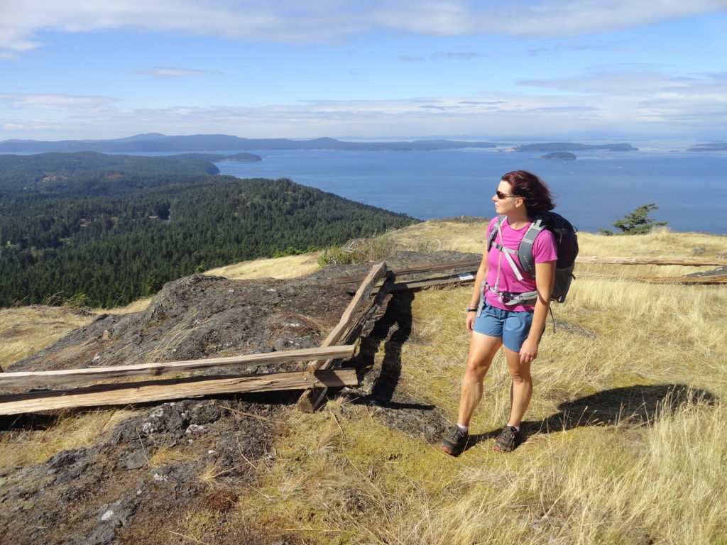
Quick Facts: Location: Orcas Island, San Juan Islands Land Agency: San Juan County Land Bank Roundtrip: 5.6 miles Elevation Gain: 1295 feet Contact: San Juan County Land Bank Notes: Dogs permitted on leash; trail (partial) open to bikes (even days) and horses (odd days) Access: Take Washington State Ferry from Anacortes to Orcas Island. Then head…
Read MoreRobe Canyon─Follow a silenced railroad into a thundering chasm
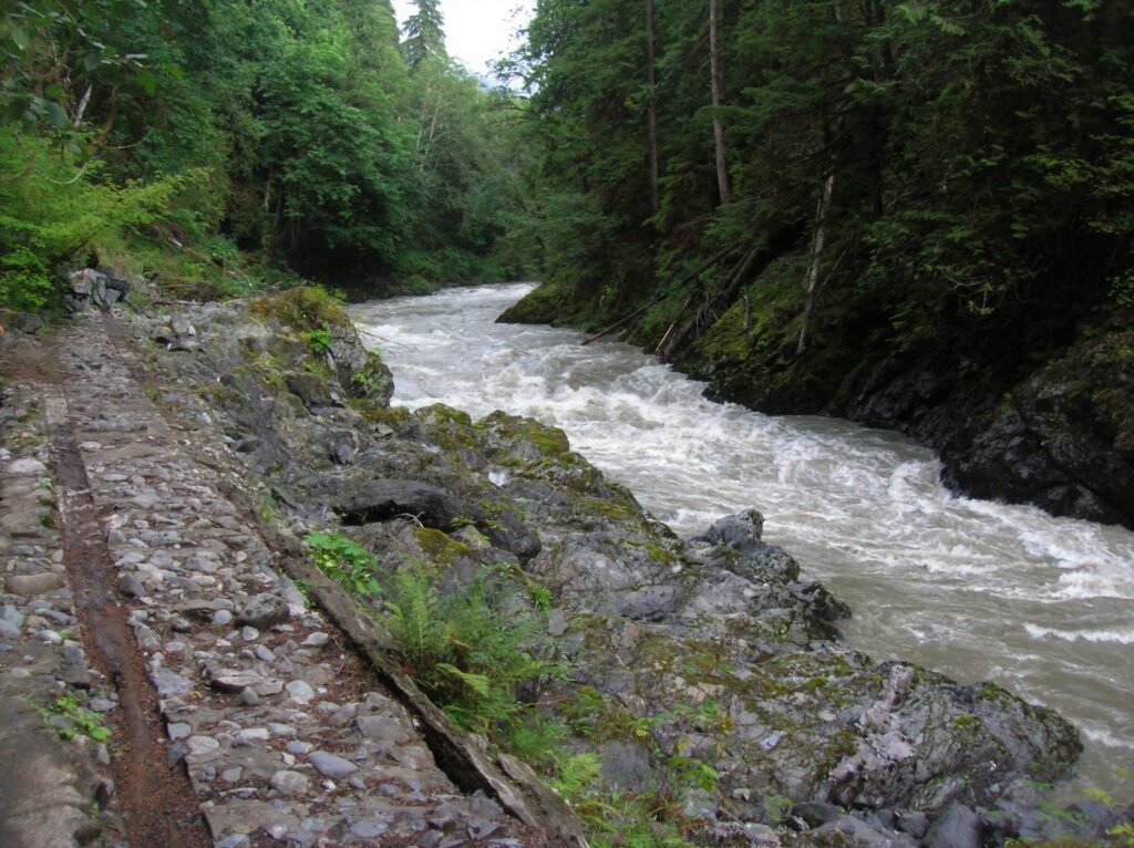
Quick Facts: Location: Mountain Loop Highway near Granite Falls Land Agency: Snohomish County Parks Roundtrip: 2.4 miles Elevation Gain: 300 feet Green trails Map: Mountain Loop Highway 111SX Access: From Granite Falls follow the Mountain Loop Highway east for 7.0 miles to trailhead located on your right, directly across from Forest Road 41. Park on…
Read MoreHeart O' the Forest Trail─Peaceful path in the shadow of Hurricane Ridge
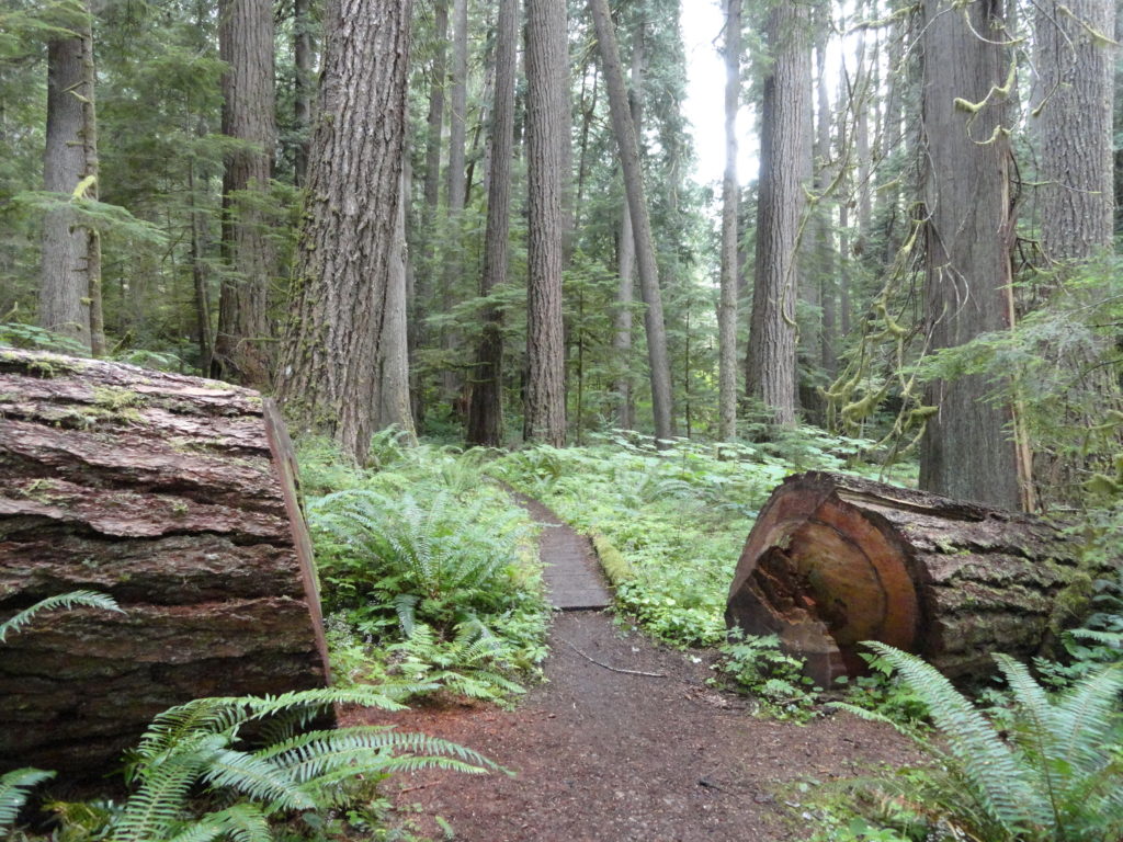
Quick Facts: Location: Heart O’ the Hills Campground Land Agency: Olympic National Park Roundtrip: 4.6 miles Elevation Gain: 550 feet Notes: Dogs prohibited, National Park Entry fee. Green Trails Map: Elwha North/ Hurricane Ridge No-134S Access: From Olympic National Park Visitors Center in Port Angeles, follow Hurricane Ridge Road (aka Heart O’ the Hills Parkway) south. Continue 5.4 miles turning left into…
Read More