Posts Tagged ‘Historic’
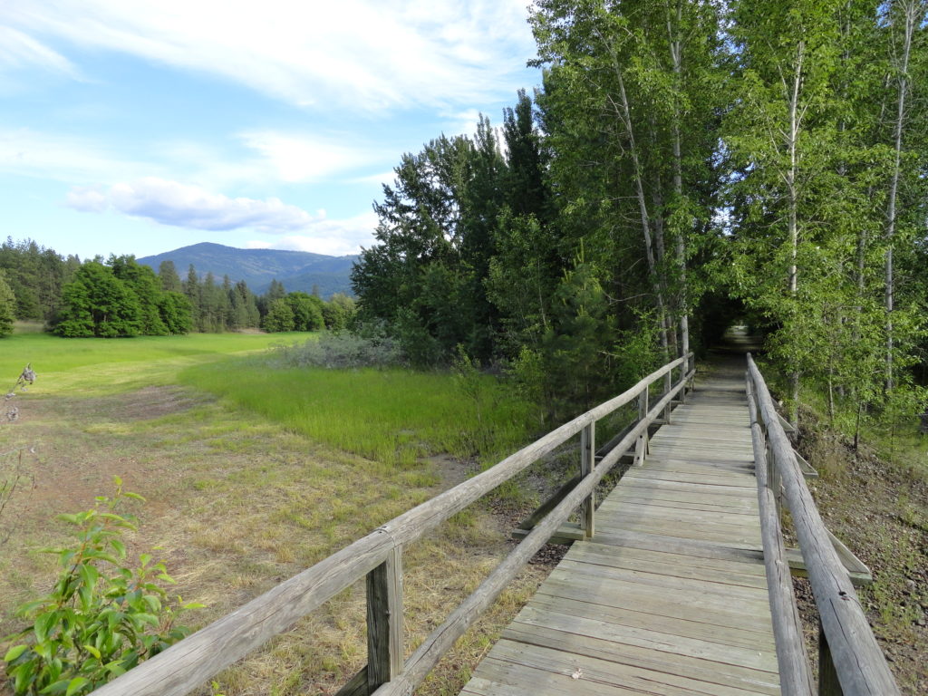
Willapa Hills Trail─ Follow the Chehalis River back into time

Quick Facts: Location: Western Lewis County Land Agency: Washington State Parks Roundtrip: 10.0 miles Elevation Gain: 100 feet Access: From Chehalis (exit 77 on I-5) follow SR 6 west for 23 miles to the town of Pe Ell. At blinking red light turn left onto 6th Ave and proceed 0.1 mile to Trailhead at old…
Read MoreHeadlee Pass and Lake Elon─An old mining trail is a terrible thing to waste!
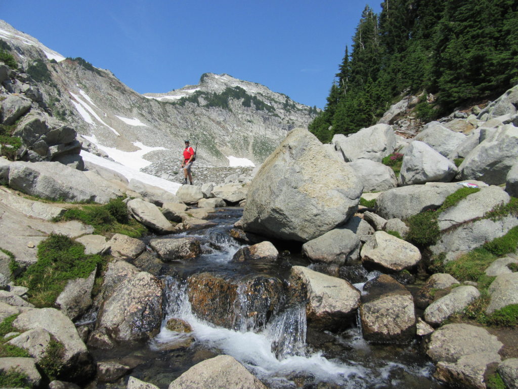
Quick Facts: Location: Mountain Loop Highway Land Agency: Mount Baker-Snoqualmie National Forest Roundtrip: 7.0 miles Elevation Gain: 2,650 feet Contact: Darrington Ranger District: Mount Baker -Snoqualmie National Forest Green Trails Map: Mountain Loop Highway 111SX Recommended Guidebook: Day Hiking North Cascades 2nd edition (Mountaineers Books) Special Note: Northwest Trail Pass or Interagency Pass required. Access:…
Read MoreBarnaby Buttes
Mega-fauna hot spot in the Kettle River Range Quick Facts: Location: Kettle River Range Land Agency: National Forest Service Distance: 7.4 miles Elevation Gain: 1975 feet Contact: Colville National Forest Three Rivers Ranger District Recommended Guidebook: Day Hiking Eastern Washington (Mountaineers Books) Access: From Kettle Falls, travel west on SR 20 for 14 miles turning…
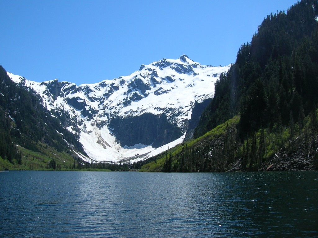
Read MoreHome Sweet Home
Bear haven in Olympic National Park Quick Facts: Location: Olympic National Park Land Agency: National Park Service Distance: 27.0 miles Elevation Gain: 4300 feet Contact: Olympic National Park www.nps.gov/olym Map: Green Trails Olympic Mountains East 168SX Notes: dogs prohibited; National Park entry fee (or Interagency pass) and Backcountry camping permit for overnight camping Access: From…
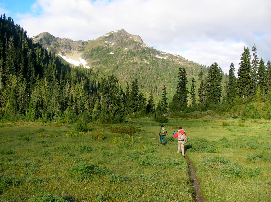
Read MoreGoat Lake─A family friendly hike for old goats and kids alike!
Quick Facts: Location: Mountain Loop Highway near Darrington Land Agency: Mount Baker-Snoqualmie National Forest Roundtrip: 10.4 miles Elevation Gain: 1,400 feet Green trails Map: Mountain Loop Highway-No. 111SX Access: From Granite Falls, follow the Mountain Loop Highway east for 31 miles to Barlow Pass and end of pavement. Continue for 3.5 miles turning right onto FR…
Read MoreHidden Lake Lookout
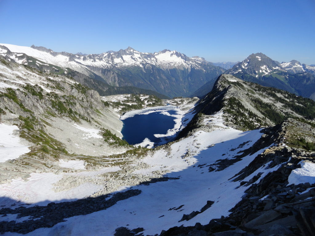
Savor stunning views from an historic fire lookout teetering on a lofty precipitous knoll Quick Facts: Location: Cascade River Road Land Agency: Mount Baker-Snoqualmie National Forest Roundtrip: 9.0 miles Elevation Gain: 3,340 feet Green Trails Maps: Diablo, WA-No. 48; Cascade Pass, WA-No. 80 Access: From Marblemount, head east on the Cascade River Road for 9.7…
Read MoreHigh Rock– The view of Rainier simply rocks from this precipitous peak!
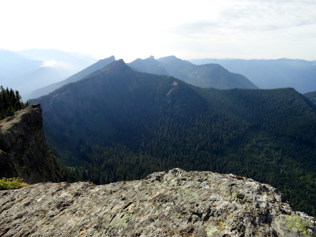
Quick Facts: Location: Sawtooth Ridge near Ashford and Packwood, WA Land Agency: Gifford Pinchot National Forest Roundtrip: 3.2 miles Elevation gain: 1,350 feet Green Trails Maps: Randle, WA no. 301 Contact: Cowlitz Valley Ranger Station (Randle); Gifford Pinchot National Forest Notes: Dogs are allowed, but should be on leash because of steep and dangerous drop offs.…
Read MoreCrystal Peak
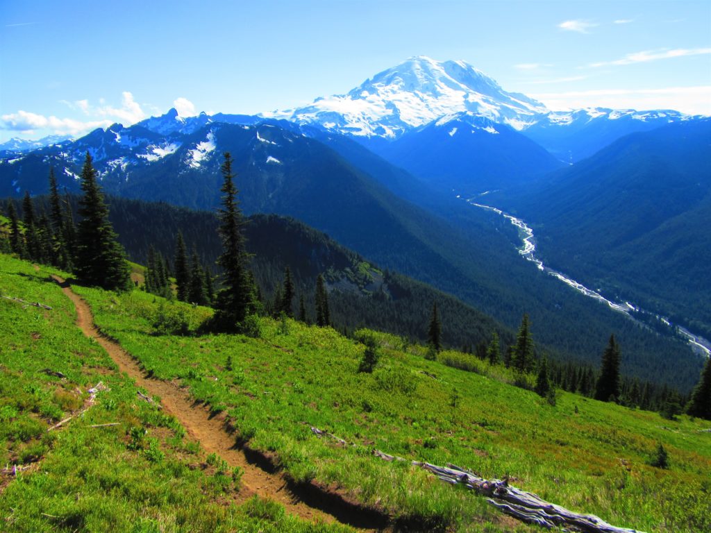
Old fire lookout site grants some of the best views in Mount Rainier NP Quick Facts: Location: Mount Rainier National Park Land Agency: National Park Service Distance: 7.8 miles Elevation Gain: 3,400 feet Contact: Mount Rainier National Park Map: Green Trails Mount Rainier National Park 269SX Notes: National Park Entrance Fee or Interagency Pass, Dogs-prohibited…
Read MoreMarten Creek─Overlooked trail off the Mountain Loop Highway offers plenty of solitude
Quick Facts Location: Boulder River Wilderness, Mountain Loop Highway near Granite Falls Land Agency: Mount Baker-Snoqualmie National Forest Roundtrip: 5.2 miles Elevation Gain: 1,300 feet Green Trails Map: Mountain Loop Highway WA- No. 111SX Recommended Guidebook: Day Hiking North Cascades 2nd edition (Mountaineers Books) Access: From Granite Falls follow the Mountain Loop Highway east for…
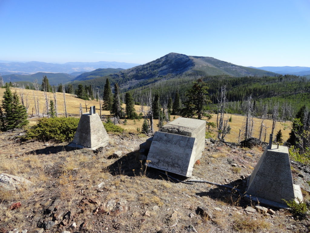
Read MoreOld Kettle Falls Trail
Hike through an old town site along a tamed river Quick Facts: Location: Lake Roosevelt, Stevens County, WA Land Agency: National Park Service Roundtrip: 2.6 miles Elevation Gain: minimal Contact: Lake Roosevelt National Recreation Area Detailed Information: Day Hiking Eastern Washington (Mountaineers Books) Notes: Dogs permitted on leash Access: From Kettle Falls head west on SR 20-US 395…
Read More