Posts Tagged ‘Historic’
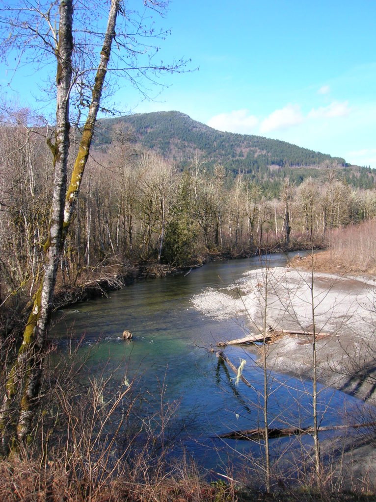
Cedar Butte–Bad spelling on the summit and bad tidings at Christmas Lake below

Location: Snoqualmie Valley near North Bend Land Agency: Washington State Parks Roundtrip: 4.0 miles Elevation gain: 900 feet Green Trails Maps: Rattlesnake Mountain Upper Snoqualmie Valley No. 205S Contact: Washington State Parks (360) 902-8844 Notes: Discover Pass required; Dogs must be leashed Access: From Seattle take I-90 east to exit 32 in North Bend turning right (south)…
Read MoreRobe Canyon─Follow a silenced railroad into a thundering chasm
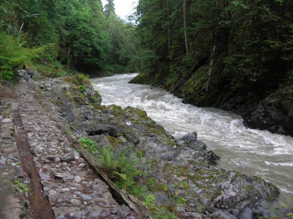
Quick Facts: Location: Mountain Loop Highway near Granite Falls Land Agency: Snohomish County Parks Roundtrip: 2.4 miles Elevation Gain: 300 feet Green trails Map: Mountain Loop Highway 111SX Access: From Granite Falls follow the Mountain Loop Highway east for 7.0 miles to trailhead located on your right, directly across from Forest Road 41. Park on…
Read MoreBarlow Point–Little known lookout site on Mountain Loop Highway
Location: Mountain Loop Highway near Granite Falls Land Agency: Mount Baker-Snoqualmie National Forest Roundtrip: 2.5 miles High Point: 3,222 feet Elevation gain: 850 feet Difficulty: moderate Green Trails Maps: Mountain Loop Highway 111SX Contact: Darrington Ranger District: Mount Baker Snoqualmie National Forest Note: Northwest Forest Pass or Inter-agency Pass required Access: From Granite Falls, follow…
Read MoreTubal Cain Mine and Buckhorn Lake — Take a “rhody trip” to an historic mine
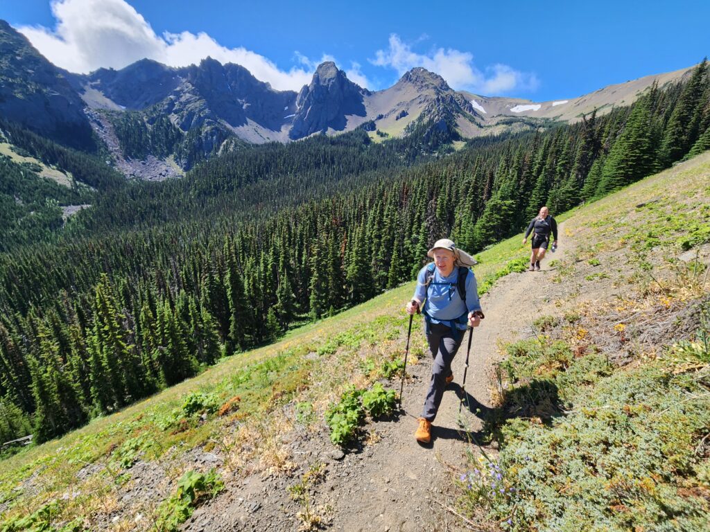
Quick Facts: Location: Buckhorn Wilderness, Olympic National Forest Land Agency: National Forest Service Roundtrip: 12.4 miles Elevation Gain: 2,100 feet Contact: Olympic National Forest, Hood Canal Ranger District, Quilcene, Green Trails Map: Olympic Mountains East 168SX Notes: Wilderness regulations apply Access: From Discovery Bay (Jct SR 20 and US 101), drive no US 101 north and turn left…
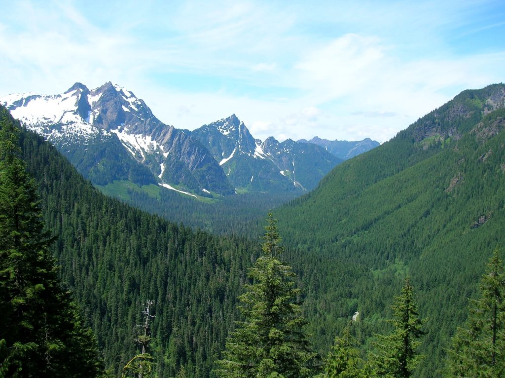
Read MoreLookout Mountain
Look out over the Methow Valley and beyond Quick Facts: Location: Methow Valley, WA Distance: 3.0 miles one way Elevation Gain: 1170 feet Contact: Okanogan-Wenatchee National Forest, Methow Valley Ranger District Maps: Green Trails Methow Valley 51SX Recommended Guidebook: Day Hiking North Cascades (Mountaineers Books) Notes: trail open to mountain bikes and motorcycles; Final 1.5…
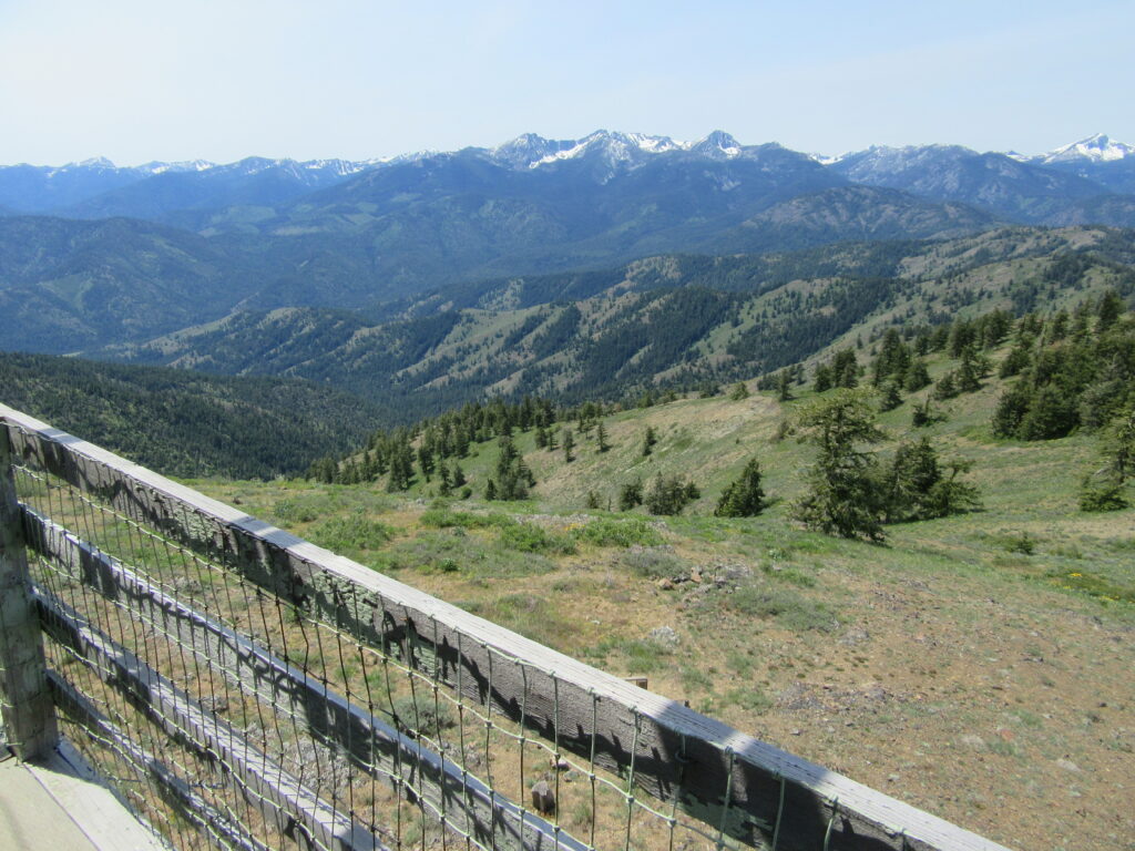
Read MoreMount Wells– Victoria area summit gushes with flowers and views

Quick Facts: Location: Victoria—Langford, BC Land Agency: Capital Regional District Parks Roundtrip: 2.0 miles/ 3.2 km Elevation gain: 865 feet/ 264 m Maps: CRDP site Contact: Capital Regional District Parks Notes: dogs permitted on leash; please stay on trail to protect rare plants Access: From Victoria, follow Trans-Canada Highway 10.5 for miles (17 km) exiting…
Read MoreWhitehorse Trail East–Hike along the North Fork Stilly
Quick Facts: Location: SR 530 Darrington Land Agency: Snohomish County Parks Roundtrip: 14 miles Elevation gain: 160 feet Difficulty: Easy Contact: Snohomish County Parks Green Trails Map: Mountain Loop Highway no. 111SX Recommended Guidebook: Day Hiking North Cascades (Mountaineers Books) Notes: Dogs allowed on leash Access: Take exit 208 off of I-5 and drive 25 miles east…
Read MoreTollgate Farm
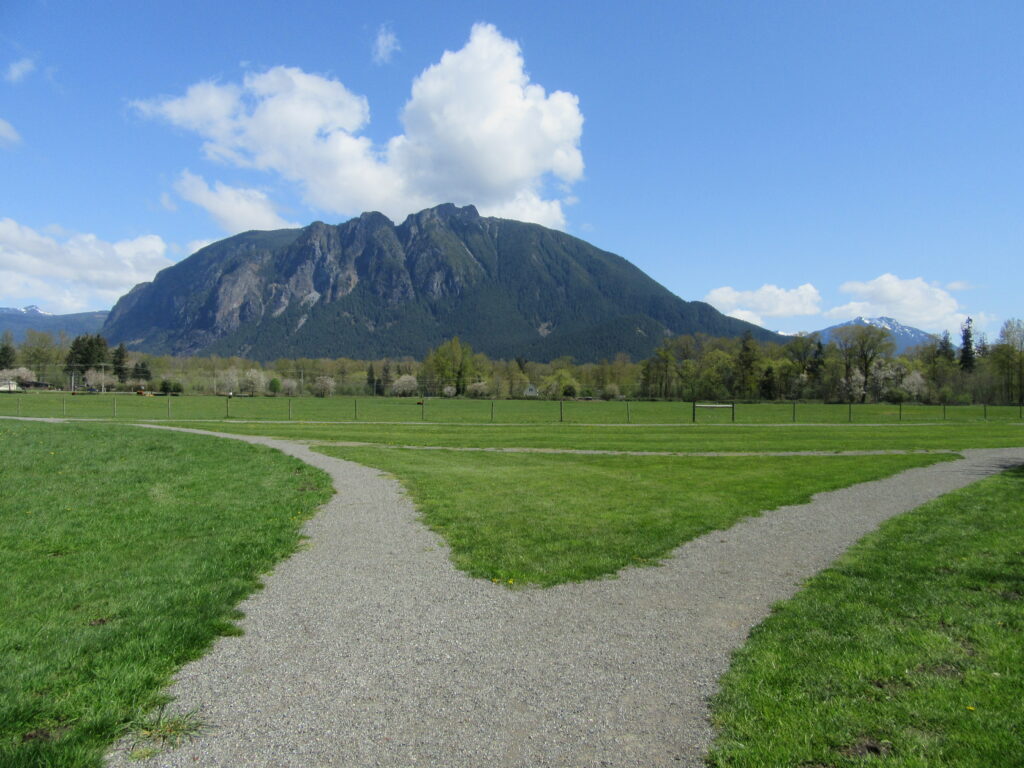
Historic prairie at the Forks of the Snoqualmie Quick Facts: Location: North Bend, WA Distance: 1.5 miles of trails Elevation Gain: minimal Contact: Si View Metropolitan District Green Trails Map: Mount Si NRCA no. 206S Notes: Dogs permitted on leash Trailhead directions: From Seattle follow I-90 east to Exit 27. Turn left onto Winery Road…
Read MoreSnoqualmie Falls
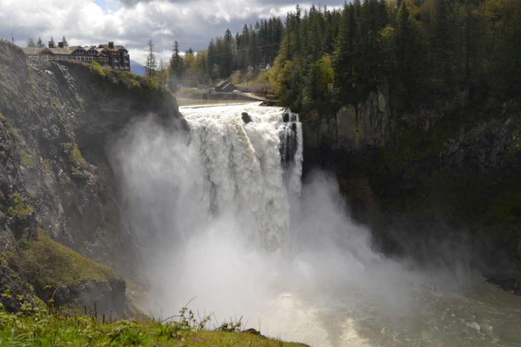
Hike to the base of the falls where heaven connects to earth Quick Facts: Location: Snoqualmie Valley Distance: 1.4 miles Elevation Gain: 280 feet Contact: Puget Sound EnergyDetailed Information: Urban Trails Eastside (Mountaineers Books) Green Trails Map: Rattlesnake Mountain/ Mountains to Sound Greenway No. 205S Notes: dogs permitted on leash. Parking lot on west side…
Read MoreNorthern State Recreation Area
Wander the former farm grounds of a state mental health hospital Quick Facts: Location: Skagit Valley Distance: more than 7.0 miles of trails Elevation Gain: up to 400 feet Contact: Skagit County ParksDetailed Information: Urban Trails Bellingham (Mountaineers Books) Notes: dogs permitted on leash; park open dawn to dusk. Access: From Exit 230 on I-5…
Read More