Posts Tagged ‘dog-friendly hike’
Centennial Trail: Haller Park to Lake Bryant–river, wetlands, and rural charm
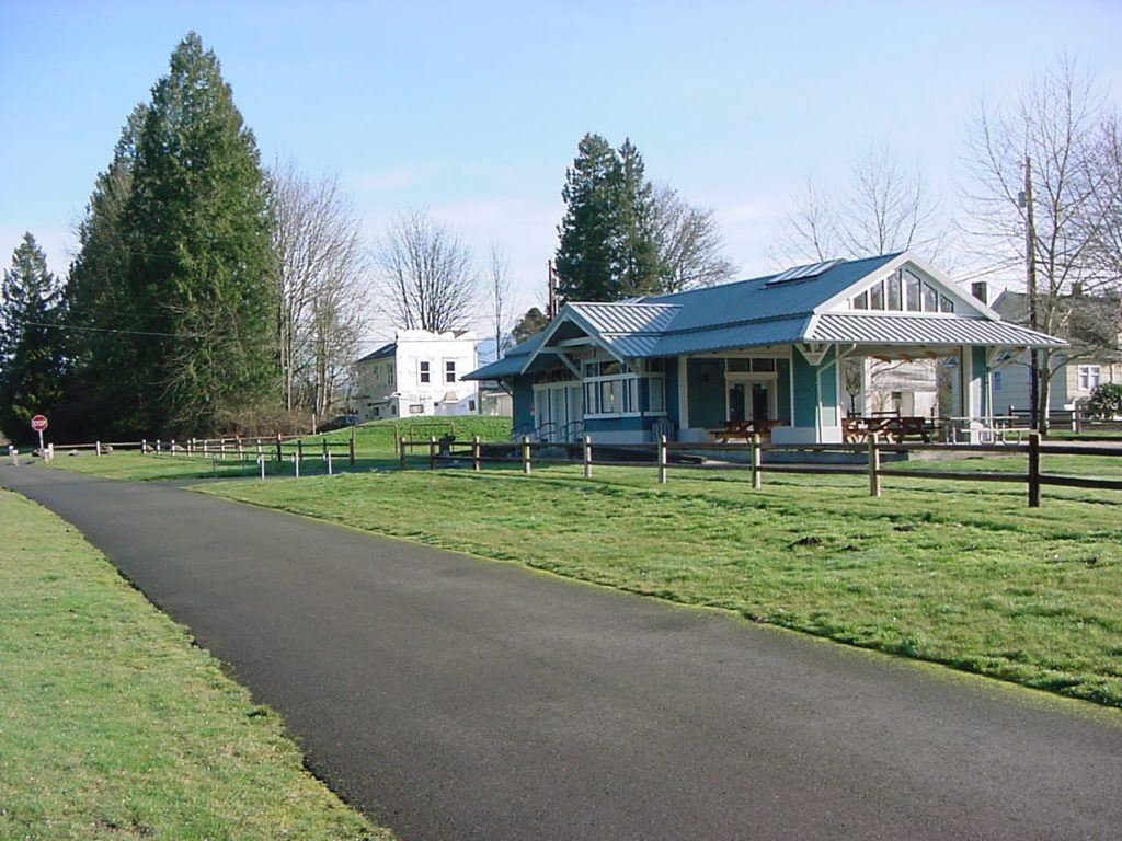
Quick Facts: Location: Arlington Land Agency: Snohomish County Parks Roundtrip: 6.2 miles Elevation Gain: 100 feet Contact: Snohomish County Parks Notes: Paved trail is also open to bicycles and is wheelchair accessible; dogs must be leashed. Access: Southern Access is from Haller Park in Arlington near the junction of SR 9 and SR 530, four miles…
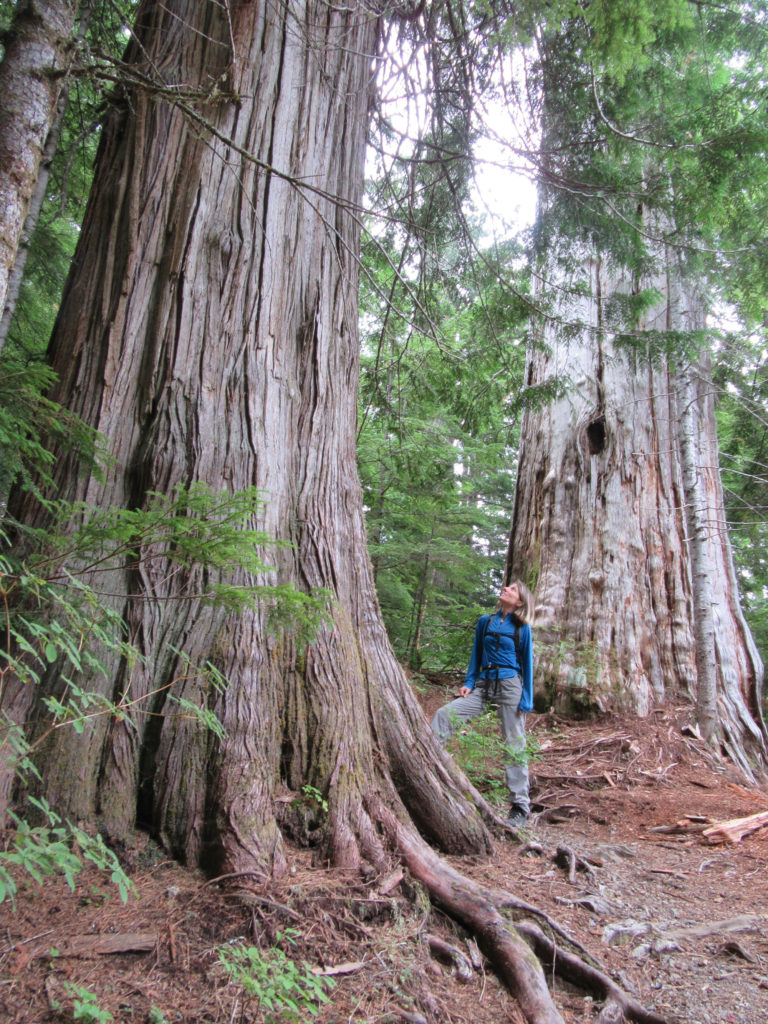
Read MoreNorth Fork Sauk River — Walk among ancient giants
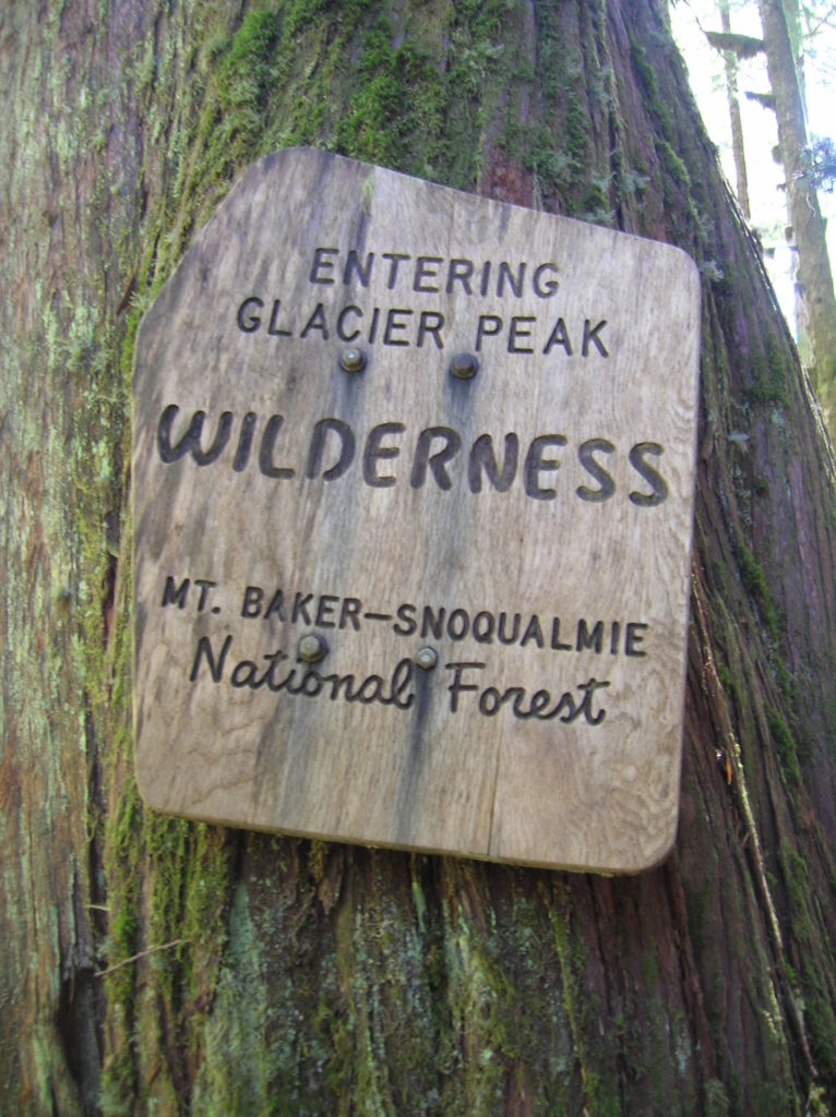
Quick Facts: Location: Mountain Loop Highway Land Agency: Mount Baker-Snoqualmie National Forest Roundtrip: 11.6 miles Elevation gain: 900 feet Green Trails Maps: Mountain Loop Highway Map 111SX Contact: Darrington Ranger District: Mount Baker Snoqualmie National Forest Guidebook Resource: Day Hiking North Cascades (Mountaineers Books) Notes: NW Forest Pass or Interagency Pass required Access: From Darrington,…
Read MorePinnacle Lake — Pretty little lake perched on a shoulder of Mount Pilchuck
Quick Facts: Location: Mountain Loop Highway, near Granite Falls Land Agency: Mount Baker-Snoqualmie National Forest; Washington State Parks Roundtrip: 4.2 miles Elevation gain: 1,100 feet Green Trails Maps: Mountain Loop Highway 111SX Contact: Darrington Ranger District: Mount Baker-Snoqualmie National Forest Notes: access road is rough, high clearance vehicles recommended. Access: From Granite Falls follow the…
Read MoreCooney Lake–larches at the edge of the North Cascades
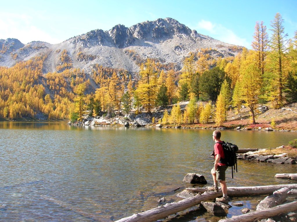
Location: Sawtooth Ridge Roadless Area Land Agency: Okanogan-Wenatchee National Forest Roundtrip: 16 miles High Point: 7,300 feet Elevation gain: 3,800 feet Difficulty: moderate Green Trails Maps: Prince Creek, WA- No. 115 Contact: Methow Valley Ranger District: Okanogan-Wenatchee National Forest Notes: Northwest Forest Pass Required Access: From Twisp follow SR 153 south turning right onto Gold…
Read MoreBalch Creek–Dramatic Ravine a Forest Park highlight
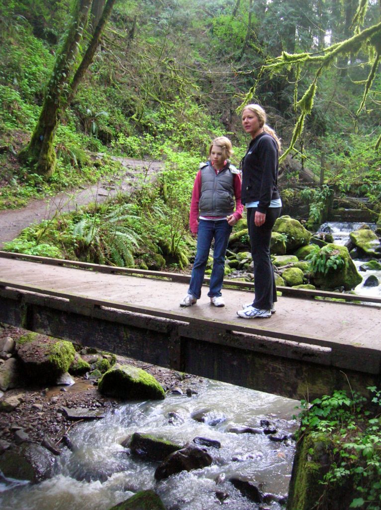
Location: Forest Park, Portland, Oregon Land Agency: Portland Parks and Recreation Roundtrip: 2.4 miles High Point: 425 feet Elevation gain: 300 feet Difficulty: easy Green Trails Map: Forest Park No 426S Contact: Contact/permits: Portland Parks and Recreation ; Forest Park Conservancy; Notes: dogs must be leashedAccess: From downtown Portland, follow NW Vaughn Street west turning…
Read MoreImage Lake — Wilderness lake reflects Snohomish County’s supreme peak
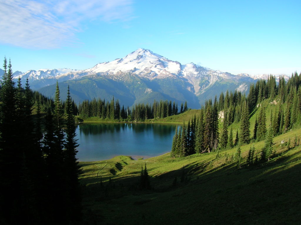
Quick Facts: Location: Glacier Peak Wilderness Land Agency: Mount Baker-Snoqualmie National Forest Roundtrip: 33.0 miles Elevation Gain: 4,700 feet Green Trails Map: Mountain Loop Highway 111SX Contact: Darrington Ranger District: Mount Baker Snoqualmie National Forest Notes: NW Forest or Interagency Pass required; No camping within ¼ mile of Image Lake—use established campsites; no fires at lake; respect re-vegetation…
Read MoreExplorer Falls–It's an easy search to find these falls

Quick Facts: Location: Near Lake Roesiger between Monroe and Granite Falls Land Agency: Washington DNR Roundtrip: 2.0 miles Elevation gain: 200 feet Contact: Washington DNR Notes: Do not block gate, nor drive past it if open. Active logging area, be alert to trucks on roadway and yield right-of-way. Access: From Monroe, follow Woods Road north…
Read MoreGibraltar Trail– New trail offers wildflowers and solid views
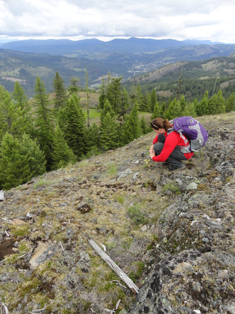
Quick Facts: Location: Colville National Forest, Ferry County, Wa Land Agency: National Forest Service Roundtrip: 3.2 miles Elevation gain: 550 feet Contact: Colville National Forest, Republic Ranger District Notes: Trail is currently under construction. Check with ranger district on progress, changes and/or closures. Once completed, trail will be a loop over 12 miles long with…
Read MoreMonte Cristo–Count down is near for clean-up of historic mining town
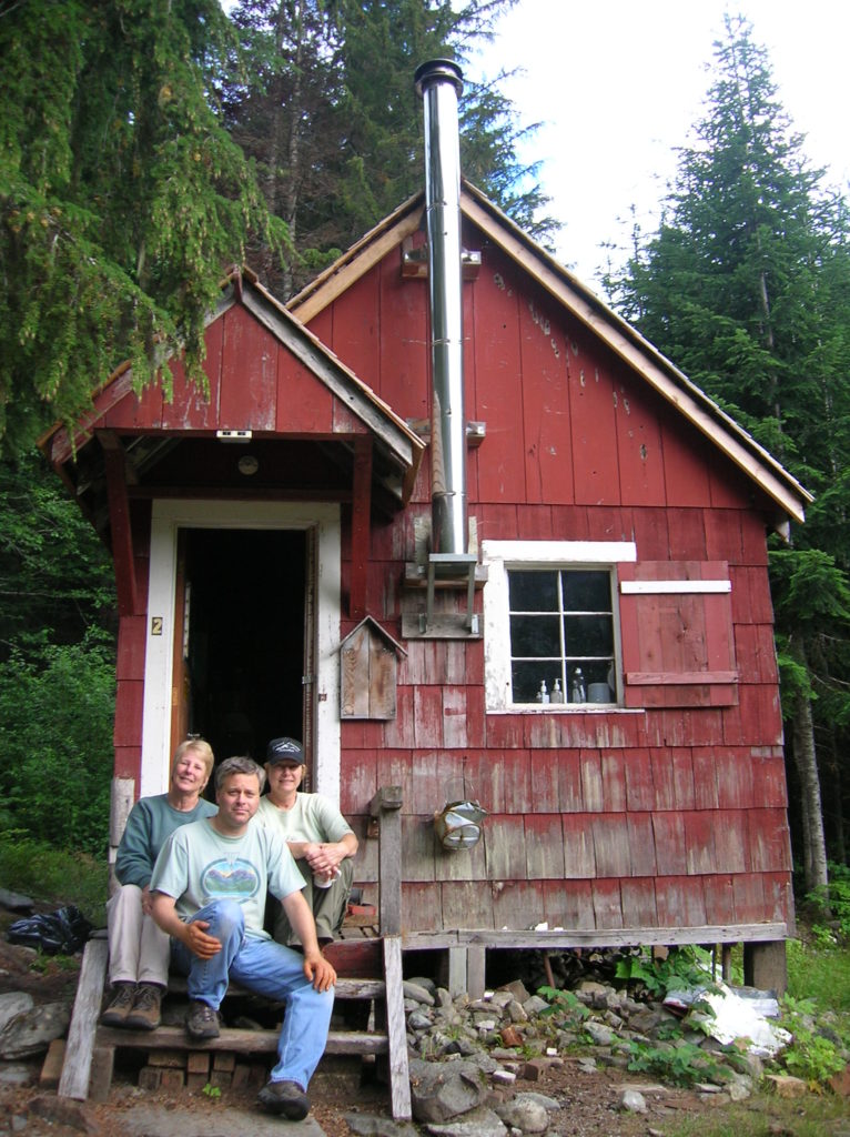
Quick Facts Location: Mountain Loop Highway near Granite Falls Land Agency: Mount Baker-Snoqualmie National Forestuntain Loop Highway near Granite Falls Roundtrip: 8.0 miles High Point: 2,800 feet Elevation gain: 500 feet Difficulty: moderate Green Trails Maps: Sloan Peak, WA- No. 111; Monte Cristo, WA- No. 143 Contact: Darrington Ranger District: Mount Baker Snoqualmie National Forest…
Read More