Posts Tagged ‘dog-friendly hike’
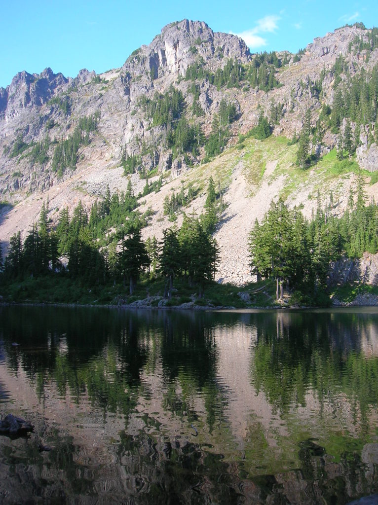
Cutthroat Lakes– Hike to a set of beautiful tarns beneath Bald Mountain
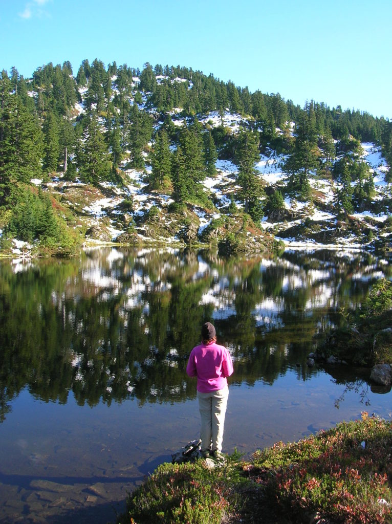
Quick Facts: Location: Mountain Loop Highway Land Agency: Mount Baker-Snoqualmie National Forest; Washington Department of Natural Resources Roundtrip: 6.0 miles Elevation gain: 1,700 feet Green Trails Maps: Mountain Loop Highway 111SX Recommended Resource: Day Hiking North Cascades (Romano; Mountaineers Books) Contact: Darrington Ranger District: Mount Baker-Snoqualmie National Forest Notes: access road is narrow and parking is limited.…
Read MoreHall Mountain via Noisy Creek– It’s a haul to this old lookout site
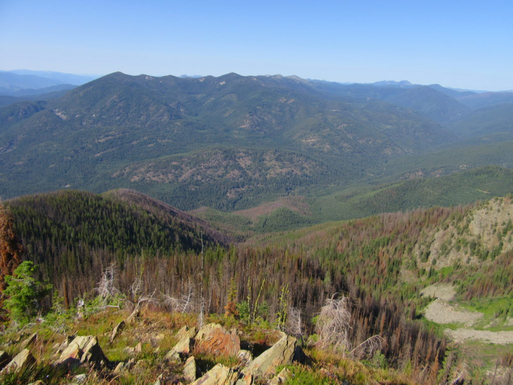
Quick Facts: Location: Selkirk Mountains, Eastern Washington Land Agency: National Forest Service Roundtrip: 14 miles Elevation Gain: 4130 feet Contact: Sullivan Lake District, Colville National Forest Notes: Practice Leave No Trace principles; grizzly habitat, trail passes recent burn zone–use caution Access: From Newport, Washington follow SR 20 north (west) 47 miles to the junction with SR 31 in…
Read MoreMount Dickerman–arduous climb to sweeping alpine views
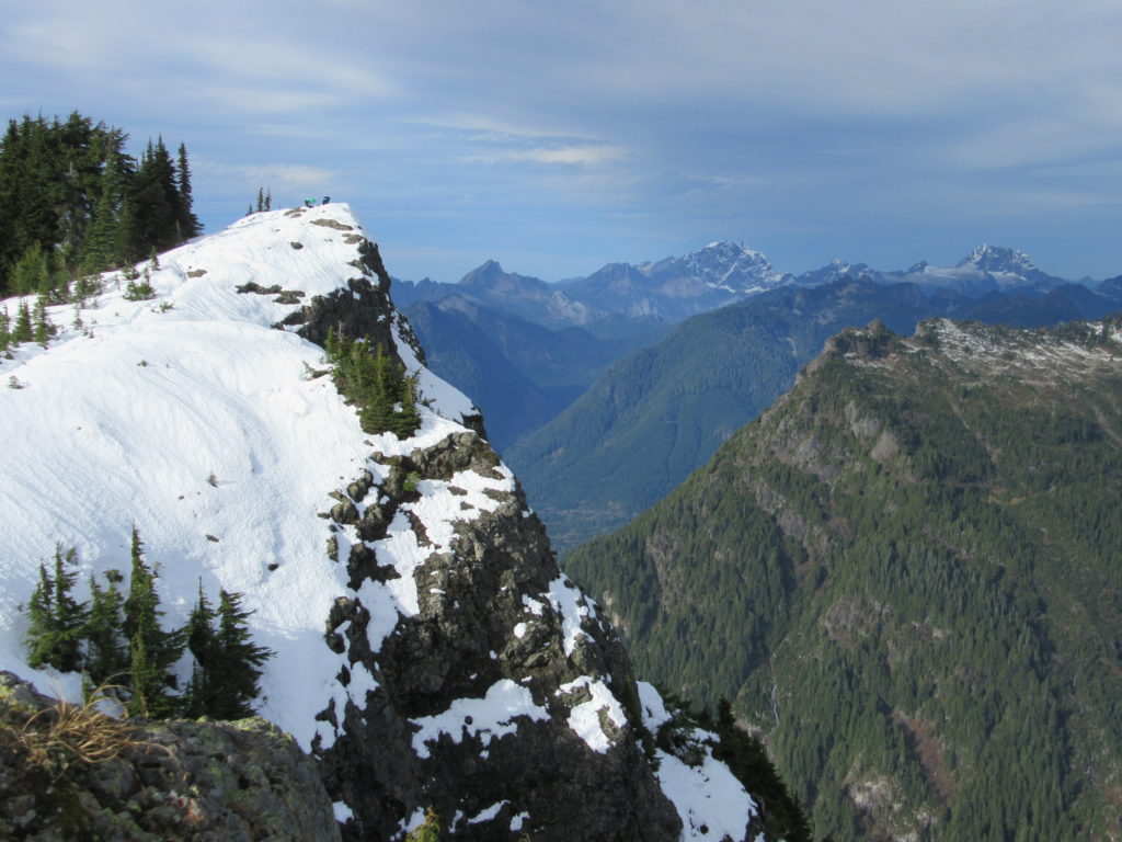
Quick Facts: Location: Mountain Loop Highway near Granite Falls Land Agency: Mount Baker-Snoqualmie National Forest Roundtrip: 8.6 miles High Point: 5,723 feet Elevation gain: 3,900 feet Difficulty: difficult Green Trails Map: Mountain Loop Highway No. 111SX Contact: Darrington Ranger District: Mount Baker Snoqualmie National Forest Notes: Northwest Forest Pass required Access: From Granite Falls follow…
Read MoreMount Spokane–Savor spectacular views from this prominent peak above Washington’s second city
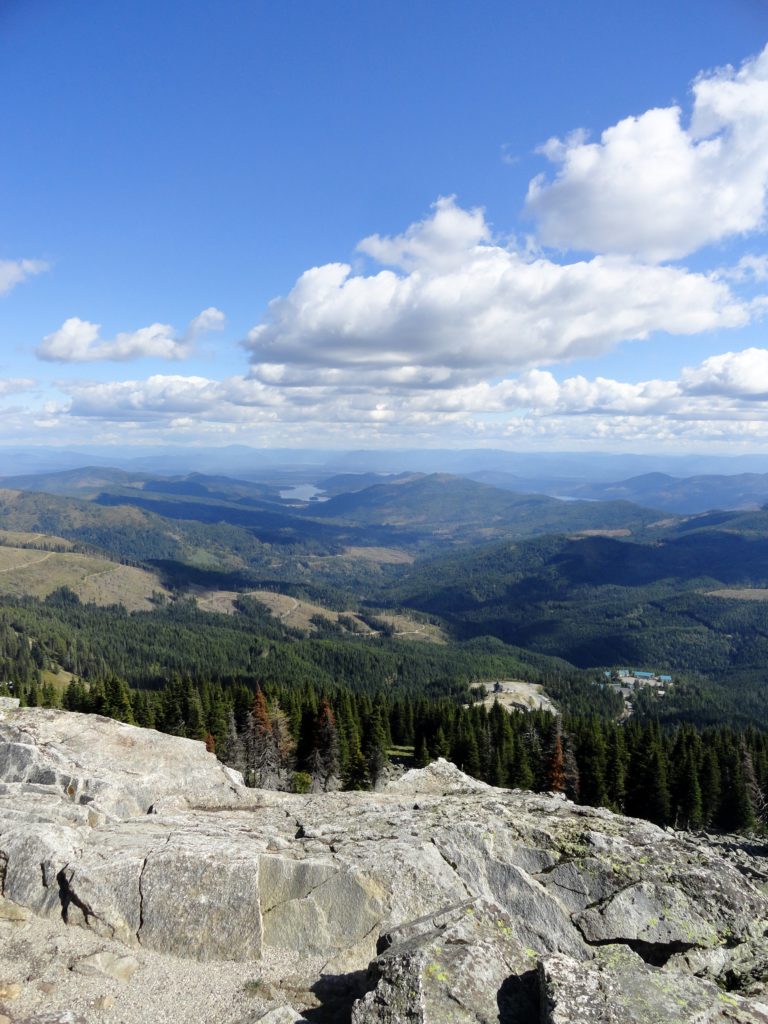
Location: Mount Spokane State Park Land Agency: Washington State Parks Roundtrip: 6.0 miles High Point: 5,883 feet Elevation gain: 1,000 feet Difficulty: moderate Map: Mount Spokane State Park (Dharma Maps) Contact: Washington State Parks Note: Discover Pass Required; dogs permitted on leash Access: From Spokane, follow US 2 north 10 miles to Mead. Turn right…
Read MoreMelakwa Lake–The buzz is out on this great Snoqualmie Pass hike
Location: Snoqualmie Pass region Land Agency: Mount Baker-Snoqualmie National Forest Roundtrip: 9.0 miles High Point: 4,600 feet Elevation gain: 2,400 feet Difficulty: difficult Green Trails Map: Snoqualmie Pass Gateway, WA- No 207S Contact: North Bend Ranger District: Mount Baker Snoqualmie National Forest Notes: NW Forest Pass or Interagency Pass required; dogs must be on a…
Read MoreDouble Bluff – Dog-friendly beach hiking on Whidbey Island
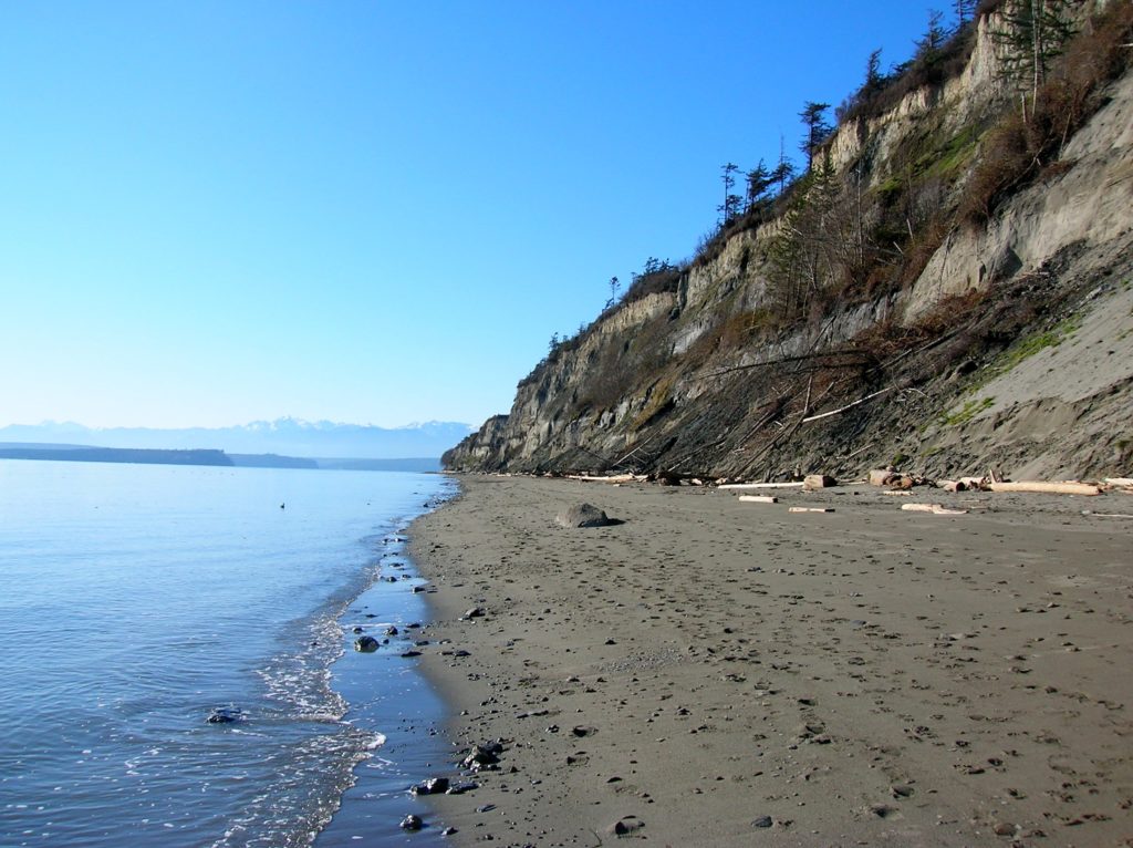
Quick Facts: Location: Whidbey Island Land Agency: Island County Parks, Washington State Parks, and the Washington DNR Roundtrip: 4.0 miles Elevation Gain: None Access: Take State Ferry from Mulkiteo to Clinton on Whidbey Island. Continue north on SR 525 for 8.5 miles turning left onto Double Bluff Road. Proceed for 2.0 miles to road end…
Read MoreHertz Trail –Hike along a wild shoreline of Lake Whatcom
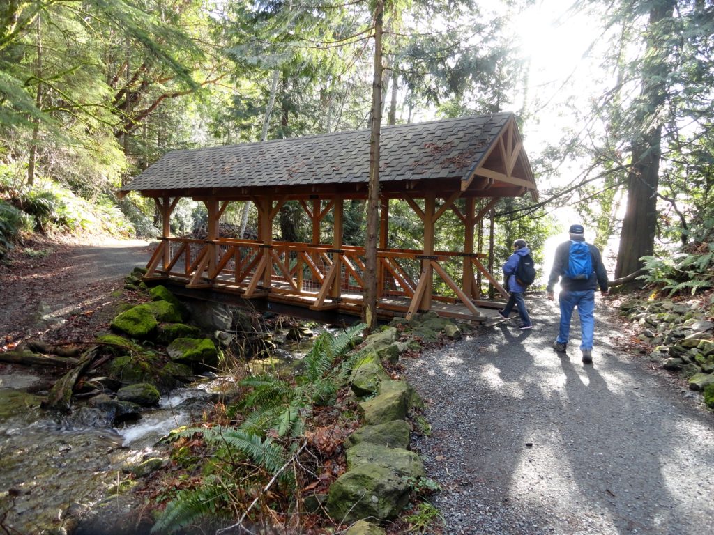
Quick Facts: Location: western Whatcom County, near Bellingham Land Agency: Whatcom County Parks Round Trip: 6.2 miles roundtrip Elevation Gain: 60 feet Contact: Whatcom County Parks Detailed Information: Urban Trails Bellingham (Mountaineers Books) Notes: Dogs allowed on leash Access: From Bellingham follow I-5 to Exit 253. Then follow Lakeway Drive east for 1.7 miles bearing…
Read MoreHeart Lake– A perfect destination for a St. Valentine’s Day hike

Quick Facts: Location: Fidalgo Island Land Agency: Anacortes Parks Department Roundtrip: 3.0 miles Green Trails Map: Deception Pass/Anacortes Community Forest Lands No. 41S Elevation gain: 160 feet Contact: City of Anacortes Parks and Recreation; Friends of the Forest Notes: Dogs must be leashed; some trails open to bicycles, horses. Access: From Exit 230 on…
Read MoreWhite River–Low country snowshoe adventure within the shadow of Mount Rainier
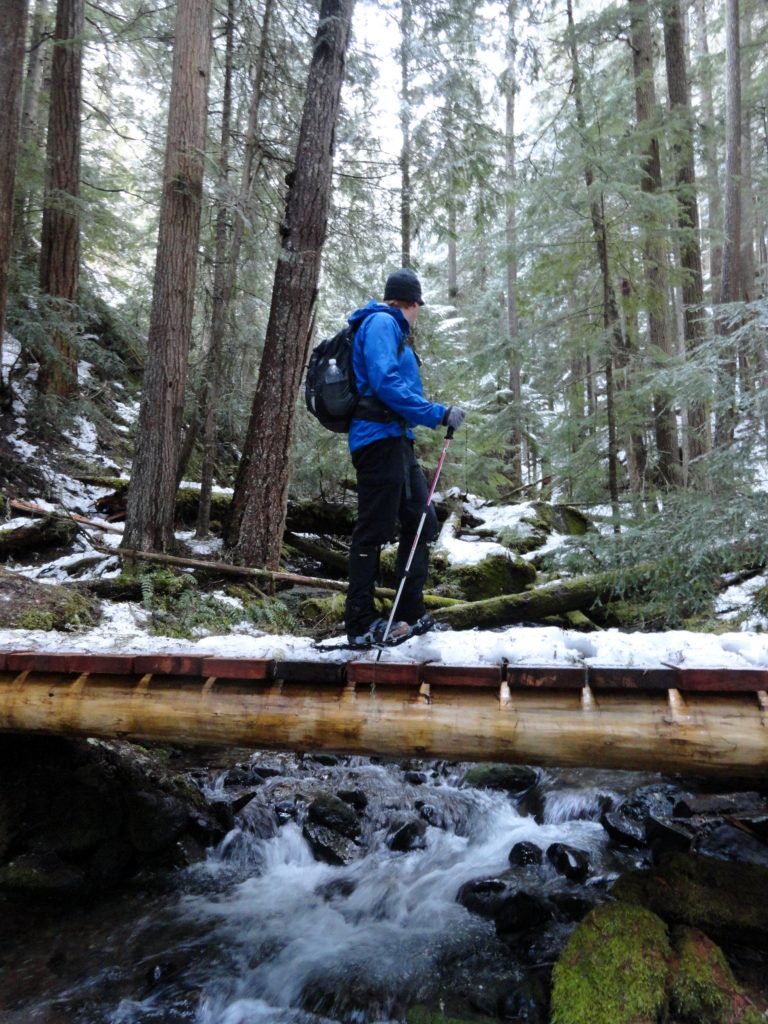
Location: White River Valley Land Agency: Mount Baker-Snoqualmie National Forest Roundtrip: up to 10.0 miles Elevation gain: 700 feet Green Trails Map: Greenwater No. 238 Contact: Mount Baker-Snoqualmie National Forest Notes: Northwest Forest Pass; Parking can be a challenge when snowfall is heavy along roads. Do not park on road shoulders, or block access to substation…
Read MoreHoyt Beach–Shoreline of solitude at the Mouth of the Sekiu River
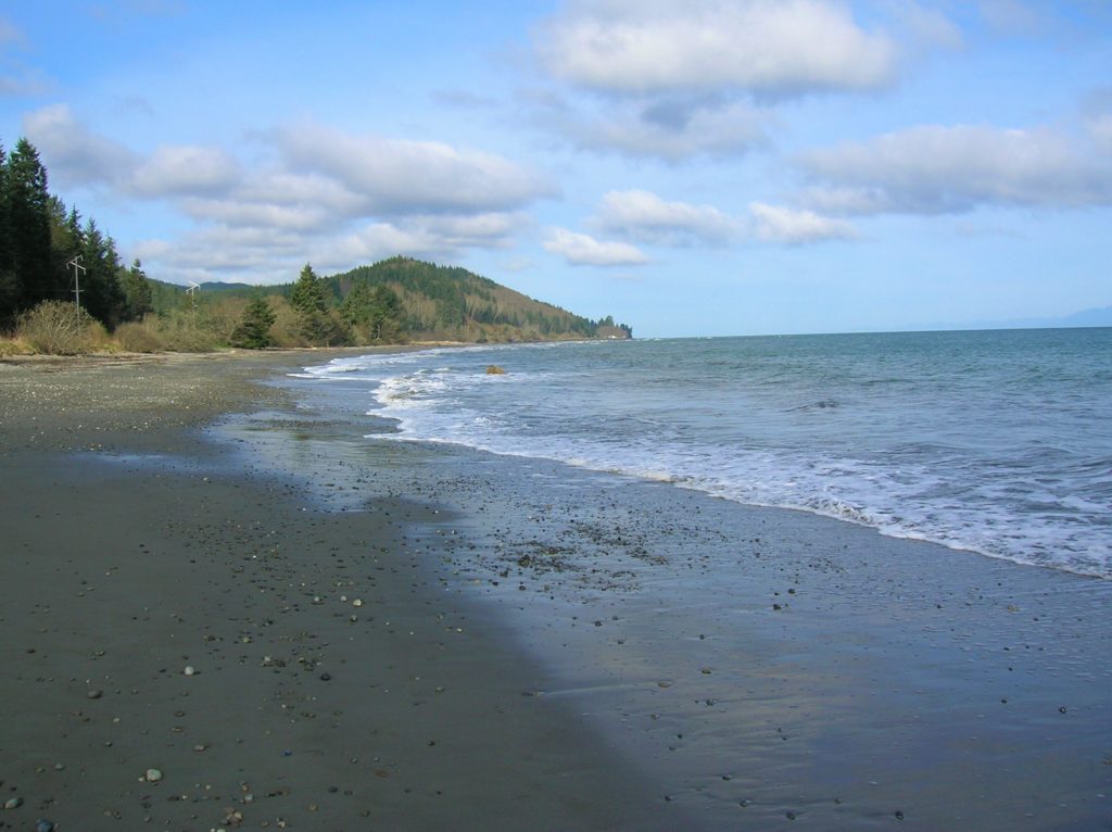
Location: Northwest Olympic Peninsula Land Agency: Washington State Parks Roundtrip: 2.0 miles High Point: sea level Elevation gain: none Contact: Washington State Parks Notes: Discover Pass required; Dogs permitted on leash Access: From Port Angeles, head west of US 101 for 5 miles. Turn right onto SR 112 and follow west for 46 miles to Clallam…
Read More