Posts Tagged ‘dog-friendly hike’
Osprey Trails — Saunter through wildlife habitat along the Sultan River
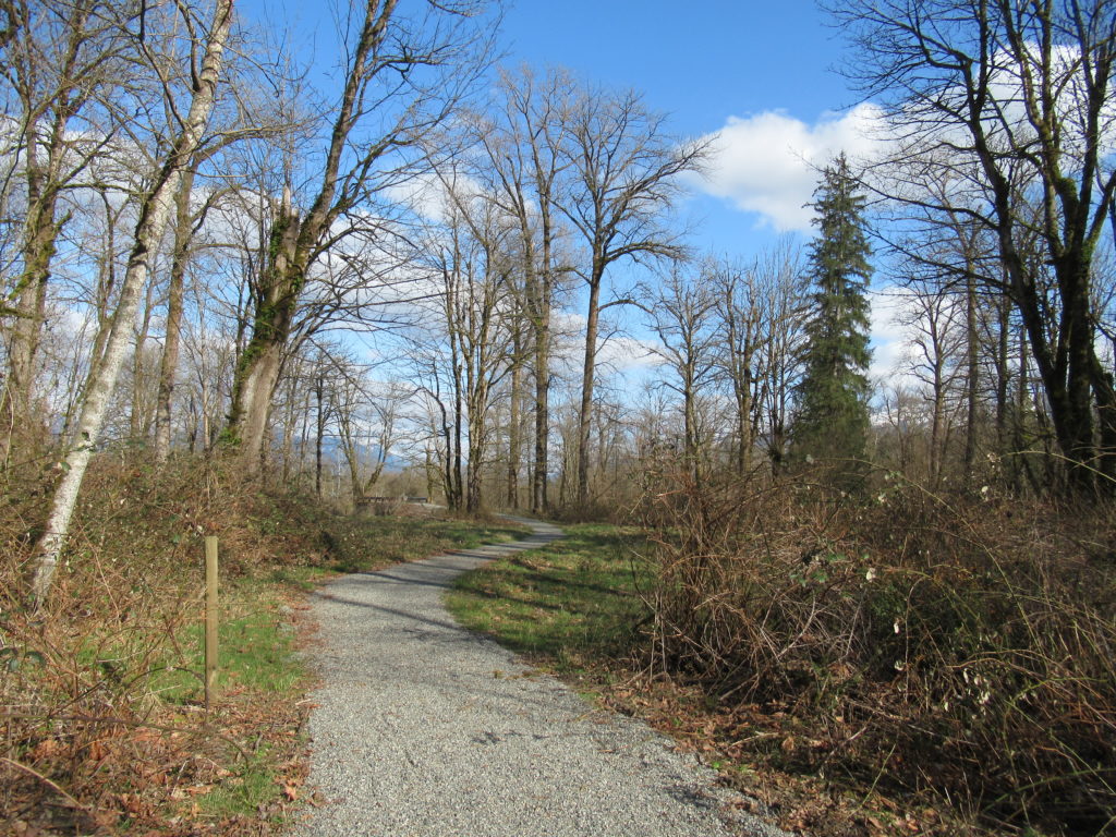
Quick Facts: Location: Sultan, Snohomish County Land Agency: City of Sultan Roundtrip: 2.0 miles Elevation Gain: level Access: From Everett, follow US 2 east to Sultan. Turn left onto 3rd Street and drive 0.6 mile north. Then turn left onto High Street and continue 0.1 mile to Osprey Park. Contact: City of Sultan Notes: Dogs permitted on leash Good to…
Read MoreUpper Dungeness River─Take shelter from the rain under a magnificent old-growth canopy
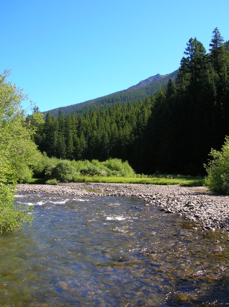
Quick Facts: Location: Buckhorn Wilderness, Olympic National Forest Land Agency: National Forest Service Roundtrip: 7.0 miles Elevation Gain: 600 feet Green Trails Map: Olympic Mountains East 168SX Note: NW Forest Pass or Interagency Pass required Access: From US 101 turn south onto Louella Road (directly across from Sequim Bay State Park entrance). In one mile…
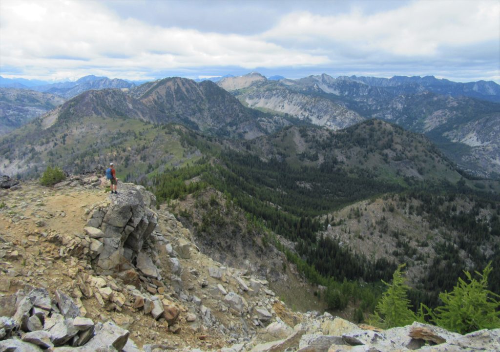
Read MoreThorp Mountain–Historic Lookout on Kachess Ridge
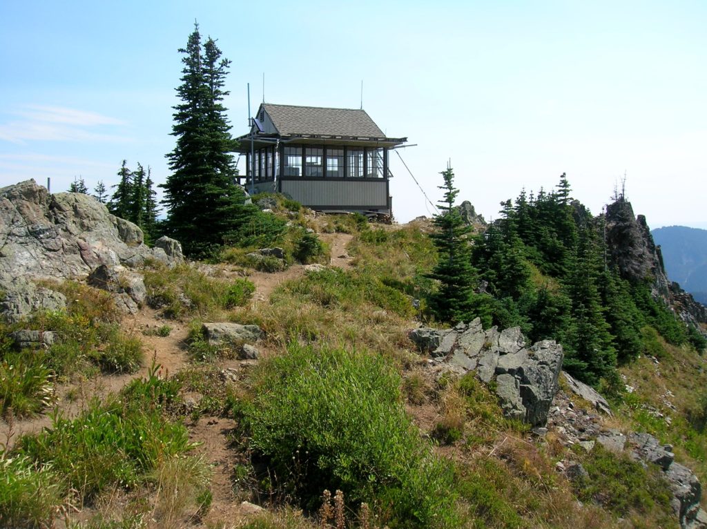
Location: Cle Elum River Valley near Salmon La Sac Land Agency: Okanogan-Wenatchee National Forest Roundtrip: 5.0 miles High Point: 5,854 feet Elevation gain: 1,700 feet Difficulty: moderate Green Trails Map: Kachess Lake – No. 208 Contact: Cle Elum Ranger District: Okanogan-Wenatchee National Forest (509) 852-1100 Note: FR 4308-120 is rough and brushy in spots. High…
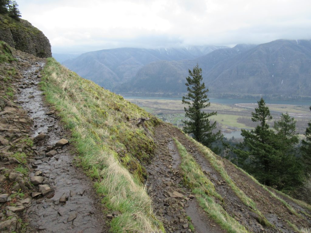
Read MoreTomlike Mountain–There’s much to like about this Columbia River Gorge peak
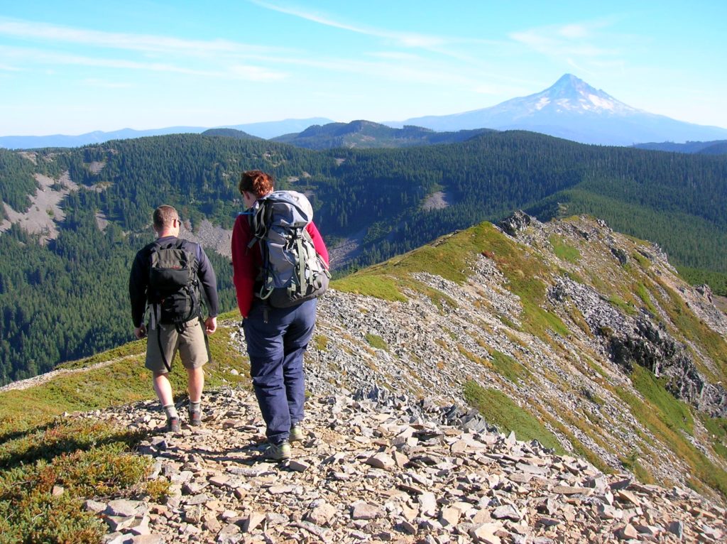
Quick Facts: Location: Mark Hatfield Wilderness, Columbia River Gorge, Oregon Land Agency: Mount Hood National Forest Roundtrip: 6.0 miles Elevation gain: 1,300 feet Green Trails Map: Columbia River Gorge -West No 428S Contact: Mount Hood National Forest, Hood River Ranger Station Notes: Northwest Forest Pass or Inter-agency Pass Required Recommended Guidebook: Day Hiking Columbia River…
Read MoreBenchmark Mountain–The meadows here measure up among the best
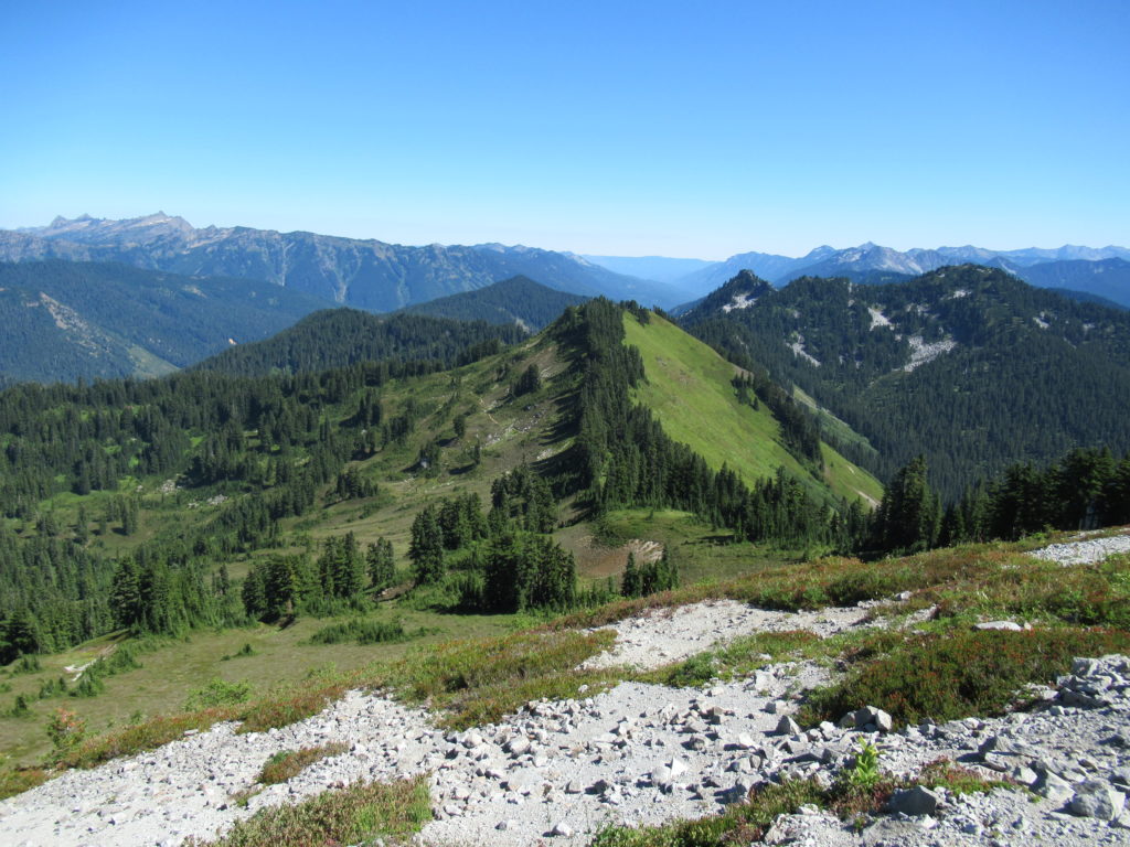
Quick Facts: Location: North Fork Skykomish River Valley Land Agency: Mount Baker-Snoqualmie National Forest Roundtrip: 14.2 miles High Point: 5,816 feet Elevation gain: 3,700 feet Green Trails Maps: Monte Cristo, WA-No. 143, Benchmark MT- No. 144 Contact: Skykomish Ranger District: Mount Baker-Snoqualmie National Forest Note: Northwest Forest or Interagency Pass Required Access: From Everett head…
Read MoreAbercrombie Mountain– Northeast Washington’s second highest summit is first rate when it comes to views
Quick Facts: Location: Abercrombie-Hooknose Roadless Area, Selkirk Mountains Land Agency: Colville National Forest Roundtrip: 7.4 miles Elevation gain: 2,300 feet Contact: Colville National Forest, Three Rivers Ranger District (Colville) (509) 684-3711 Notes: Access road requires high clearance vehicle Access: From Colville, Washington travel north on Aladdin Road (CR 9435) for 25 miles. Turn right on…
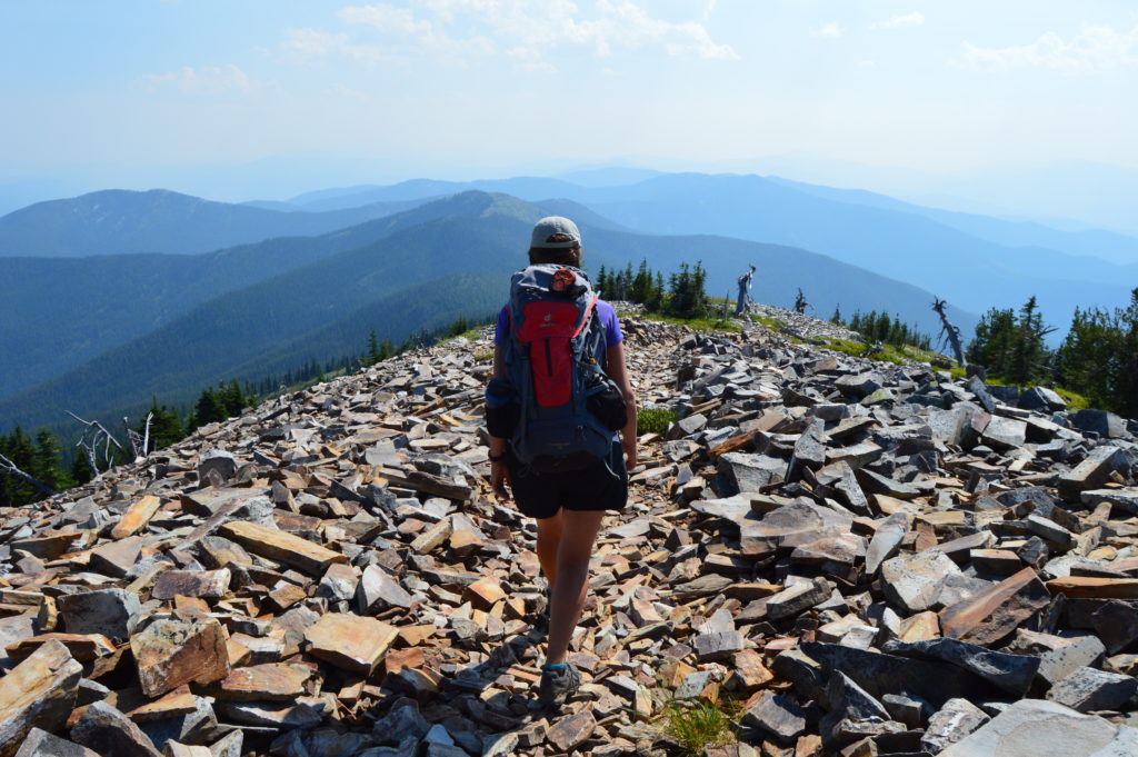
Read MoreNorth Navarre Peak–The Summer Blossom Trail blooms with extensive views!
Location: Sawtooth Ridge near Lake Chelan Land Agency: Okanogan-Wenatchee National Forest Roundtrip: 5.0 miles Elevation gain: 1,550 feet Contact: Chelan Ranger District: Okanogan-Wenatchee National Forest Green Trails Map: Prince Creek- No. 115 Notes: access is via a long and bumpy gravel road. Four-wheel drive recommended. Good to Know: Exceptional wildflowers; exceptional views; backpacking options; exceptional…
Read MoreHamilton Mountain — Breathtaking views from above Beacon Rock
Quick Facts: Location: Beacon Rock State Park, Columbia River Gorge National Scenic Area Land Agency: Washington State Parks Roundtrip: 7.5 miles Elevation gain: 2,100 feet Contact: Beacon Rock State Park Notes: Discover Pass required; Dogs permitted on leash. Green Trails Map: Columbia River Gorge West No. 428S Recommended Guidebooks: Day Hiking Columbia River Gorge, 100…
Read MoreGoat Falls –“Kid-friendly” snowshoe trip near Mount Rainier National Park
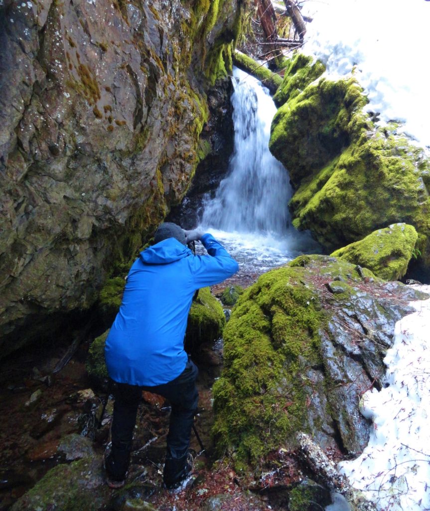
Quick Facts: Location: White River Valley Land Agency: Mount Baker-Snoqualmie National Forest Roundtrip: 2.5 miles Elevation gain: 500 feet Green Trails Map: Mount Rainier Wonderland no. 269SX Contact: Mount Baker-Snoqualmie National Forest; Snoqualmie Ranger DistrictNotes: Northwest Forest Pass required at actual trailhead. When snow level is low, parking may be a challenge. Do not block…
Read MoreOld Government Trail–Follow in the footsteps of long gone miners and adventurers
Location: Mountain Loop Highway near Granite Falls Land Agency: Mount Baker-Snoqualmie National Forest Roundtrip: 4.0 miles High Point: 2,450 feet Elevation gain: 400 feet Difficulty: difficult Green Trails Map: Mountain Loop Highway 111SX Contact: Darrington Ranger District: Mount Baker Snoqualmie National Forest ( Notes: Northwest Forest Pass required Access: : From Granite Falls, follow the Mountain…
Read More