Posts Tagged ‘dog-friendly’
Tradition Lake Plateau
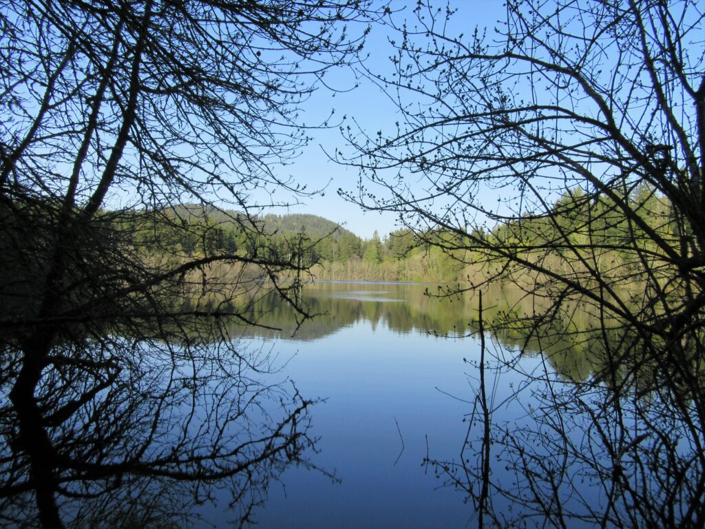
Wander family-friendly trails at the base of Tiger Mountain Quick Facts: Location: Issaquah Alps Distance: more than 8.9 miles of trails Elevation Gain: up to 250 feet Contact: Washington DNR and City of Issaquah Recommended Guidebook: Urban Trails Eastside (Mountaineers Books) Notes: Discover Pass required; parking lot fills fast on weekends requiring street parking (permissible…
Read MoreMainline Trail—Hike through the heart of the Paradise Valley Conservation Area
Quick Facts: Location: Maltby Land Agency: Snohomish County Parks Roundtrip: 3.2 miles Elevation Gain: minor ups and downs Access: From SR 522 in Maltby (5.0 miles east of Woodinville; 8.0 miles west of Monroe) head east on Paradise Lake Road for 1.7 miles to trailhead. Notes: Dogs must be on leash. Park open 7 am…
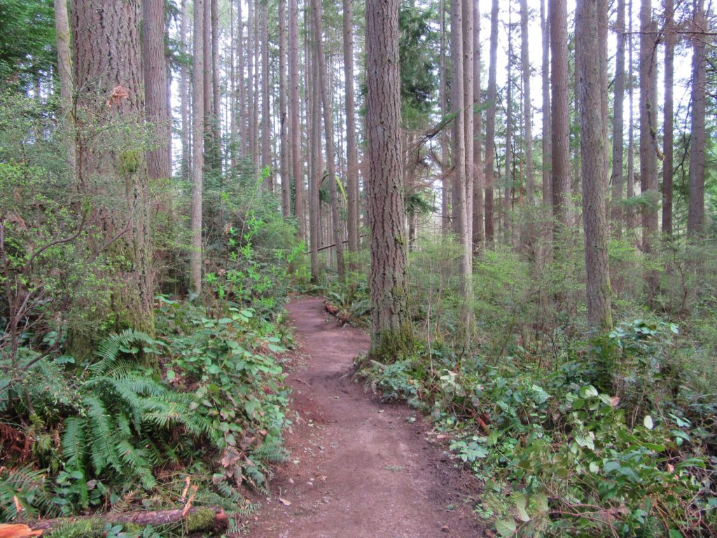
Read MoreJapanese Gulch — Historic Ravine laced with trails

Quick Facts: Location: Mukilteo Land Agency: Mukilteo Recreation Department Roundtrip: More than 7 miles of trails Elevation Gain: up to 500 feet Contact: Mukilteo Recreation Department Notes: Trail system is currently rough in places and unsigned. Access: From Everett, head west on Mukilteo Blvd (which becomes 5th Street in Mukilteo) for to parking and trailhead on…
Read MoreRooster Rock State Park- Hike above the Columbia River Buffs!
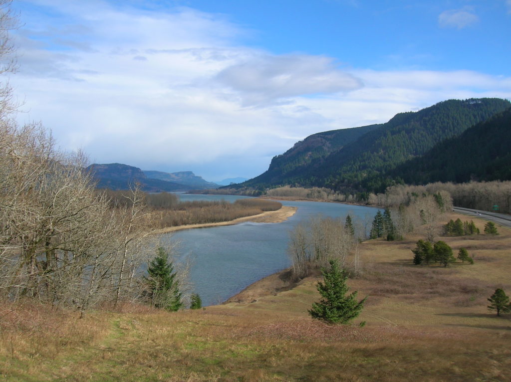
Quick Facts: Location: Columbia River Gorge, Oregon Land Agency: Oregon State Parks Roundtrip: 3.3 miles Elevation Gain: 300 feet Contact: Oregon State Parks Notes: $5.00 day use fee or $30 annual pass; dogs must be leashed Green Trails Maps: Columbia River Gorge West No. 428S Access: From Portland follow I-84 east to Exit 25. At .5…
Read MoreMeadowdale Beach—Reach the Beach through an Emerald Gulch
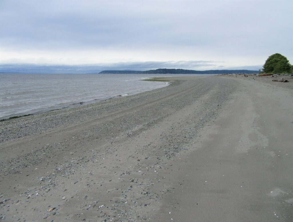
Quick Facts: Location: Lynnwood Land Agency: Snohomish County Parks Roundtrip: 2.5 miles Elevation Gain: 425 feet Contact: Snohomish County Parks Special Notes: Dogs must be leashed; park open 7 am to dusk: do not park on road Access: From Everett, head 10 miles south on I-5 to exit 183. Follow 164th Street SW west for…
Read MoreRiver Meadows Park─Wander along the Stillaguamish River
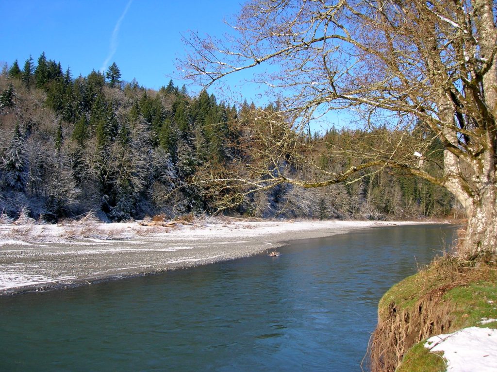
Quick Facts: Location: South Fork Stillaguamish River, near Arlington Land Agency: Snohomish County Parks Roundtrip: 2.5 miles Elevation Gain: 150 feet Contact: Snohomish County Parks Notes: Dogs must be leashed. Access: From Exit 208 on I-5 head east on SR 530 to Arlington. One mile beyond junction with SR 9 (just after crossing the South…
Read MoreChambers Creek Regional Park
Explore an old quarry resurrected as a grand park Quick Facts: Location: University Place (Tacoma) Distance: more than 6.0 miles of trails Elevation Gain: up to 230 feet Contact: Pierce County Parks Recommended Guidebook: Urban Trails Tacoma (Mountaineers Books) Notes: dogs permitted on leash and there is an off-leash area; some trails jogger-stroller and wheel…
Read MoreSaint Edward State Park
Explore a different—and wilder side of Lake Washington Quick Facts: Location: Eastside (Seattle) Distance: more than 9.0 miles of trails Elevation Gain: up to 500 feet Contact: Washington State Parks Recommended Guidebook: Urban Trails Eastside (Mountaineers Books) Notes: Discover Pass required; dogs permitted on leash; park open 8am to dusk Trailhead directions: From Bellevue follow…
Read MoreTurtlehead — It’s one shell of a view from this Turtleback Mountain summit
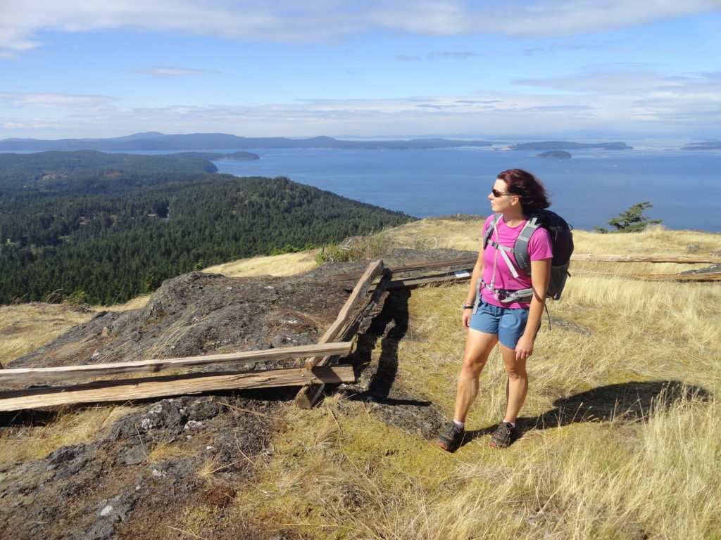
Quick Facts: Location: Orcas Island, San Juan Islands Land Agency: San Juan County Land Bank Roundtrip: 5.6 miles Elevation Gain: 1295 feet Contact: San Juan County Land Bank Notes: Dogs permitted on leash; trail (partial) open to bikes (even days) and horses (odd days) Access: Take Washington State Ferry from Anacortes to Orcas Island. Then head…
Read MorePonytail Falls Loop
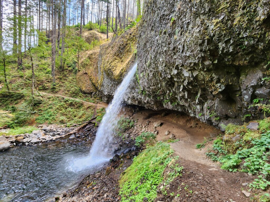
Behind the scenes beauty! Quick Facts: Location: Columbia River Gorge Oregon Distance: 2.7 miles round trip Elevation Gain: 450 feet Contact: Columbia River Gorge National Scenic Area Maps: Green Trails Columbia River Gorge–West No. 428S Recommended Guidebook: Day Hiking Columbia River Gorge (Mountaineers Books) Notes: Dogs allowed on-leash. Trailhead directions: From Portland or Hood River,…
Read More