Region
Urban Trails
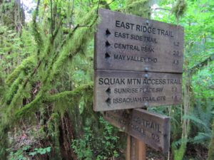
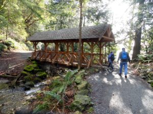
Quick Facts: Location: Issaquah Alps Land Agency: Washington State Parks Roundtrip: 8.0 miles Elevation Gain: 2000 feet Green Trails Map: Cougar Mountain/ Squak Mountain No. 203S Contact: Washington State Parks and Mountains to Sound Greenway Recommended Resource: Urban Trails Eastside Notes: Dogs must be leashed. Good to Know: snow-free winter hike, trail less taken, dog-friendly (on-leash), kid-friendly,…
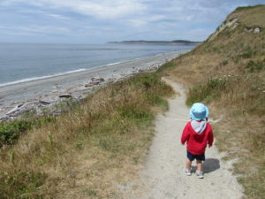
Quick Facts: Location: Whidbey Island Land Agency: Washington State Parks Round Trip: 1.8 miles of trails Elevation Gain: up to 90 feet Contact: Washington State Parks Recommended Resource: Urban Trails Everett (Mountaineers Books) Notes: Discover Pass required; Dogs allowed on leash Access: From Mukilteo take ferry to Clinton on Whidbey Island. Then continue north on…
Quick Facts: Location: Thurston County Land Agency: Washington State Parks Roundtrip: 3.0 miles Elevation Gain: 75 feet Contact: Washington State Parks Recommended Resource: Urban Trails Olympia Notes: Discover Pass required; Dogs must be leashed. Access: From Olympia, head south on I-5 to Exit 99. Continue southeast on SR 121 for 4.2 miles. Turn right (west) into main…
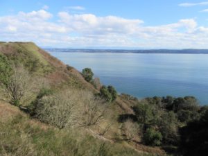
Quick Facts: Location: Whidbey Island Land Agency: Port of Coupeville Roundtrip: more than 4.0 miles of trails High Point: 300 feet Elevation gain: up to 280 feet Contact: Port of Coupeville Recommended Resource: Urban Trails Everett (Mountaineers Books) Notes: Some trails are open to equestrians; some trails are in an off-leash dog area Access: From Clinton Ferry Terminal on Whidbey…
Quick Facts: Location: South King County Land Agency: King County Parks Round Trip: more than 7 miles of trails Elevation Gain: up to 650 feet Contact: King County Parks Recommended Resource: Urban Trails Tacoma (Mountaineers Books) Notes: Dogs allowed on leash Access: From SR 18 in Auburn the exit for SR 164 (Auburn Way S)…
Quick Facts: Location: Chuckanut Mountains Land Agency: Whatcom County Parks and Washington State Parks Round Trip: 10.8 miles roundtrip Elevation Gain: 2000 feet Contact: Whatcom County Parks Recommended Resource: Urban Trails Bellingham (Mountaineers Books) Detailed map: Square One Maps Chuckanut Recreation Area Notes: Dogs allowed on leash Access: From Bellingham follow I-5 south to Fairhaven…
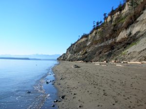
Quick Facts: Location: Whidbey Island Land Agency: Island County Parks, Washington State Parks, and the Washington DNR Roundtrip: 4.0 miles Elevation Gain: None Access: Take State Ferry from Mulkiteo to Clinton on Whidbey Island. Continue north on SR 525 for 8.5 miles turning left onto Double Bluff Road. Proceed for 2.0 miles to road end…
Quick Facts: Location: Popkum, Fraser Valley Regional District, BC Land Agency: Fraser Valley Regional Parks Round Trip: 2.5 miles (4.0 km) roundtrip Elevation Gain: minimal Contact: Fraser Valley Regional Parks Notes: Dogs prohibited Access: From Vancouver, BC follow Trans-Canada Highway 1 east to Exit 138 (12 miles /20 kilometers east of Chilliwack). Turn left and…
Quick Facts: Location: western Whatcom County, near Bellingham Land Agency: Whatcom County Parks Round Trip: 6.2 miles roundtrip Elevation Gain: 60 feet Contact: Whatcom County Parks Detailed Information: Urban Trails Bellingham (Mountaineers Books) Notes: Dogs allowed on leash Access: From Bellingham follow I-5 to Exit 253. Then follow Lakeway Drive east for 1.7 miles bearing…
Quick Facts: Location: Vashon Island Land Agency: King County Parks Round Trip: More than 10 miles of trails Elevation Gain: up to 450 feet Contact: King County Parks Detailed Information: Urban Trails Seattle (Mountaineers Books) Notes: Dogs allowed on leash Access: From Seattle take Washington State Ferry from Fauntleroy (West Seattle) to Vashon Island Ferry…