Region
Urban Trails
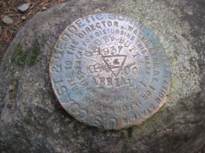
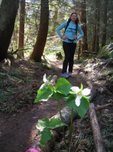
Location: Snoqualmie Valley near North Bend Land Agency: Washington State Parks Roundtrip: 4.0 miles Elevation gain: 900 feet Green Trails Maps: Rattlesnake Mountain Upper Snoqualmie Valley No. 205S Contact: Washington State Parks (360) 902-8844 Notes: Discover Pass required; Dogs must be leashed Access: From Seattle take I-90 east to exit 32 in North Bend turning right (south)…
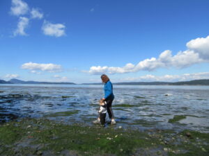
Quiet ambling on Skagit Bay Quick Facts: Location: Whidbey Island Distance: more than 5.0 miles of trails Elevation Gain: up to 500 feet Contact: Washington State Parks Recommended Guidebook: Urban Trails Everett (Mountaineers Books) Notes: Discover Pass required; dogs permitted on leash Trailhead directions: From Oak Harbor, follow State Route 20 for 4.0 miles and…

Quick Facts: Location: Anacortes-Fidalgo Island Land Agency: Anacortes Community Forest Lands Roundtrip: 1.9 miles Elevation Gain: 100 feet Access: From Exit 230 on I-5 in Burlington, head west on SR 20 to junction with SR 20-Spur. Continue right on SR 20-Spur to Anacortes. At traffic light near old town, continue left on 12th Street (still SR 20-Spur and12th Street…
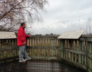
Quick Facts: Location: Ridgefield National Wildlife Refuge, Clark County Land Agency: U.S. Fish and Wildlife Roundtrip: 2.0 miles Elevation Gain: 75 feet Contact: Ridgefield National Wildlife Refuge Notes: Dogs prohibited. Recommended Guidebook: Urban Trails Vancouver WA (Mountaineers Books) Access: From Exit 14 on I-5 head west 3.0 miles on SR 501 (Pioneer Street) to its…
Location: Three Lakes, east of Snohomish Land Agency: Snohomish County Parks Roundtrip: 1.2 miles Elevation gain: 100 feet Contact: Snohomish County Parks Notes: $10.00 day use fee; Dogs must be on leash Access: From Everett follow US 2 east for 10 miles turning left onto Westwick Road. Follow Westwick Road for approximately 2.0 miles bearing…
Location: Maltby Land Agency: Snohomish County Parks Roundtrip: 4.0 miles Elevation gain: 200 feet Difficulty: Easy Contact: Snohomish County Parks Notes: Dogs must be on leash; partially open to mountain bikes and horses Access: From SR 522 in Maltby (5.0 miles east of Woodinville; 8.0 miles west of Monroe) head east on Paradise Lake Road…
Walk across Maple Valley through a “wilderness” park Quick Facts: Location: Maple Valley, WA Distance: 3.3 miles one way Contact: King County Parks Elevation Gain: 250 feet Notes: Dogs permitted on leash Trailhead directions: From Seattle follow I-5 to I-405 and take Exit 4 in Renton. Then drive SR 169 south for 11.3 miles turning…
Historic prairie at the Forks of the Snoqualmie Quick Facts: Location: North Bend, WA Distance: 1.5 miles of trails Elevation Gain: minimal Contact: Si View Metropolitan District Green Trails Map: Mount Si NRCA no. 206S Notes: Dogs permitted on leash Trailhead directions: From Seattle follow I-90 east to Exit 27. Turn left onto Winery Road…
Peaceful wandering near the Oyster Dome Quick Facts: Location: Blanchard State Forest Distance: 7.5 miles roundtrip Elevation Gain: 1,500 feet Contact: Washington Department of Natural Resources Map: Square One Maps Chuckanut Recreation Area Notes: Discover Pass required to park at trailheads Trailhead directions: From I-5 Exit 240 in Alger head north on Lake Samish Road…
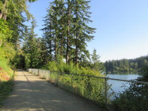
Quick Facts: Location: Edmonds Waterfront Land Agency: City of Edmonds Parks and Recreation Roundtrip: 1.8 miles Elevation Gain: Level Access: From I-5 follow SR 104 west towards the Edmonds-Kingston Ferry. One stoplight before the ferry terminal, turn left onto Dayton Street. Then continue for .1 mile to just before the railroad crossing. Turn left here…