Region
Urban Trails
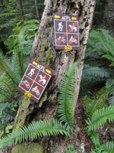
Quick Facts: Location: Fidalgo Island Land Agency: Anacortes Parks Department Roundtrip: 3.0 miles Green Trails Map: Deception Pass/Anacortes Community Forest Lands No. 41S Elevation gain: 160 feet Contact: City of Anacortes Parks and Recreation; Friends of the Forest Notes: Dogs must be leashed; some trails open to bicycles, horses. Access: From Exit 230 on…
Quick Facts: Location: Whidbey Island Land Agency: Washington State Parks Roundtrip: 2.3 miles Elevation Gain: 200 feet Contact: South Whidbey State Park Notes: Discover Pass Required: Dogs must be leashed Access: From the Clinton Ferry Terminal on Whidbey Island follow SR 525 north for 9.4 miles turning left onto Bush Point Road. After 2.2 miles road…
Quick Facts: Location: Edmonds Land Agency: Snohomish County Parks and Recreation Roundtrip: Up to 5 miles Elevation Gain: up to 250 feet Access: From Everett follow I-5 south to exit 181. Now follow SR 524 (196th St SW) west passing SR 99 and in about another mile turn right onto 76th Ave W. Proceed for about .5…
Quick Facts: Location: Arlington Land Agency: Snohomish County Parks Roundtrip: 6.2 miles Elevation Gain: 100 feet Contact: Snohomish County Parks Notes: Paved trail is also open to bicycles and is wheelchair accessible; dogs must be leashed. Access: Southern Access is from Haller Park in Arlington near the junction of SR 9 and SR 530, four miles…
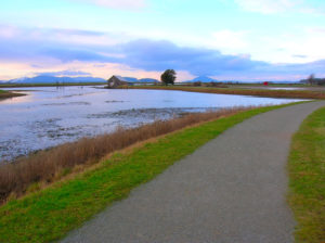
Quick Facts: Location: Skagit County Land Agency: Padilla Bay National Estuarine Research Reserve Roundtrip: 4.8 miles Elevation Gain: 30 feet Contact: Padilla Bay NERR Access: From Burlington (exit 231 on I-5) proceed through roundabouts and head west on Josh Wilson Road for 6.4 miles. Upon entering the village of Bay View turn left onto 2nd Street…
Quick Facts: Location: Mountlake Terrace, southern Snohomish County Land Agency: City of Mountlake Terrace Roundtrip: 2.0 miles Elevation Gain: 125 feet Access: From Seattle: drive I-5 north to exit 178. Turn right and follow 236th Street SW for 0.7 mile. Then turn left onto 48th Ave W and drive north 0.2 mile to park and parking on your…
Quick Facts: Location: Edmonds Land Agency: Edmonds Parks and Recreation Department Roundtrip: About 1.5 miles of trails Elevation Gain: up to 300 feet Contact: Edmonds Parks and Recreation Access: From Everett or Seattle take I-5 to Exit 179. Then head west on 220th Street SW for 2.1 miles. Turn right and head north on 96th Ave…
Quick Facts: Location: Olympia, Washington Land Agency: City of Olympia Parks and Recreation Roundtrip: 2.5 miles Elevation Gain: 300 feet Notes: Dogs must be on a leash. Access: From Lacey, follow I-5 south to Olympia taking Exit 105B to Plum Street. From Tumwater, follow I-5 north to Olympia taking Exit 105. Turn right onto Henderson…
Quick Facts: Location: Skagit Valley Land Agency: Skagit County Parks Round Trip: more than 5 miles of trails Elevation Gain: up to 150 feet Contact: Skagit County Parks and Recreation Guidebook source: Urban Trails Bellingham (Mountaineers Books) Notes: dogs permitted on leash; trails shared by mountain bikers Access: From Exit 232 on I-5 drive Cook Road…
Quick Facts Location: City of Everett Land Agency: Everett Parks and Recreation Department Roundtrip: 4.0 miles Elevation Gain: None Access: From Everett, take Exit 195 off of I-5 turning left onto East Grand Ave. In 0.5 mile bear right onto East Marine View Drive and follow for 1.0 mile to SR 529. Continue north on SR…
