Region
Urban Trails
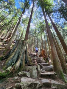
Quick Facts: Location: Lord Hill Regional Park Land Agency: Snohomish County Parks Roundtrip: 2.0 miles Elevation Gain: 250 feet Access: From Monroe, exit SR 522 onto Main Street heading west and immediately coming to a roundabout. Bear right onto Tester Road and proceed 3.0 miles to a T-intersection just after passing under SR 522. Turn left and proceed to Tester…
Quick Facts: Location: North Vancouver, BC Land Agency: Grouse Mountain Regional Park Distance: 1.6 miles (2.5 km) one way Elevation Gain: 2625 feet (800 meters) Contact: Metro Vancouver Regional Parks Detailed Information: Urban Trails Vancouver BC (Mountaineers Books) Notes: Dogs prohibited. Trail generally opened May through October (check hours) and subject to closure during inclement…
Quick Facts: Location: Whidbey Island Land Agency: Washington State Parks Roundtrip: 2.3 miles Elevation Gain: 200 feet Contact: South Whidbey State Park Notes: Discover Pass Required: Dogs must be leashed Access: From the Clinton Ferry Terminal on Whidbey Island follow SR 525 north for 9.4 miles turning left onto Bush Point Road. After 2.2 miles road…
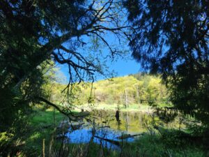
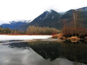
Quick Facts: Location: Near Lake Roesiger between Monroe and Granite Falls Land Agency: Washington DNR Roundtrip: 5.2 miles Elevation gain: 700 feet Contact: Washington DNR Notes: Discover Pass Required. Do not block gates, nor drive past it if open. Active logging area, be alert to trucks on roadway and yield right-of-way. Access: From Monroe, follow…
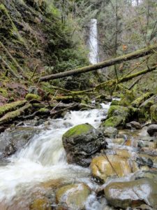
Quick Facts: Location: Popkum, Fraser Valley Regional District, BC Land Agency: Fraser Valley Regional Parks Round Trip: 2.5 miles (4.0 km) roundtrip Elevation Gain: minimal Contact: Fraser Valley Regional Parks Notes: Dogs prohibited Access: From Vancouver, BC follow Trans-Canada Highway 1 east to Exit 138 (12 miles /20 kilometers east of Chilliwack). Turn left and…
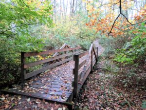
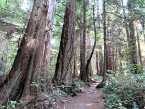
Quiet Alternative to St Edward State Park Quick Facts: Location: Kirkland Land Agency: King County Parks Distances: up to 9.5 miles of trails Elevation Gain: up to 200 feet Contact: King County Parks Detailed Information: Urban Trails Eastside (Mountaineers Books) Notes: parking area on NE 138th Street gated at dusk Access: From Kenmore follow 68th…
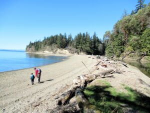
Hike to a cove and beach on Anderson Island Quick Facts: Location: Anderson Island Land Agency: Anderson Island Park and Recreation District Round Trip: 1.5 miles roundtrip Elevation Gain: 190 feet Contact: Andy’s Marine Park Detailed Information: Urban Trails Tacoma (Mountaineers Books) Notes: dogs prohibited. Trails can be slick in wet weather Access: From Anderson…
Quick Facts: Location: Skagit County Land Agency: Padilla Bay National Estuarine Research Reserve Roundtrip: 4.8 miles Elevation Gain: 30 feet Contact: Padilla Bay NERR Access: From Burlington (exit 231 on I-5) proceed through roundabouts and head west on Josh Wilson Road for 6.4 miles. Upon entering the village of Bay View turn left onto 2nd Street…
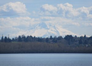
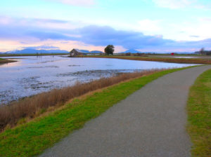
Volcano views and excellent birdwatching just west of downtown Vancouver, WA Quick Facts: Location: Vancouver, WA Land Agency: Clark County Parks Round Trip: 3.0 miles of trails Elevation Gain: minmal Contact: Vancouver Lake Regional Park Detailed Information: Urban Trails Vancouver WA (Mountaineers Books) Notes: year round parking fee of $5.00; Dogs permitted on-leash and prohibited…
Quick Facts: Location: Edmonds Land Agency: Edmonds Parks and Recreation Department Roundtrip: About 1.5 miles of trails Elevation Gain: up to 300 feet Contact: Edmonds Parks and Recreation Access: From Everett or Seattle take I-5 to Exit 179. Then head west on 220th Street SW for 2.1 miles. Turn right and head north on 96th Ave…