Region
Puget Sound Islands & Lowlands

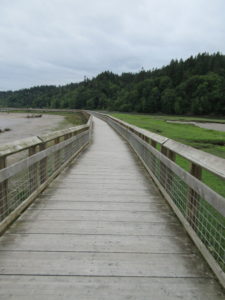
Quick Facts: Location: Indian Island near Port Hadlock Land Agency: Jefferson County Parks Roundtrip: 4.0 miles Elevation Gain: 70 feet Notes: Detailed information can be found in Day Hiking Olympic Peninsula (Mountaineers Books) Contact: Jefferson County Parks Access: From Kingston, drive State Route 104 turning right onto SR 19. Then continue north for 9 miles turning right onto…
Quick Facts: Location: Edmonds Land Agency: Edmonds Parks and Recreation Department Roundtrip: About 1.5 miles of trails Elevation Gain: up to 300 feet Contact: Edmonds Parks and Recreation Access: From Everett or Seattle take I-5 to Exit 179. Then head west on 220th Street SW for 2.1 miles. Turn right and head north on 96th Ave…
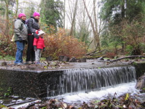
Quick Facts: Location: Olympia, Washington Land Agency: City of Olympia Parks and Recreation Roundtrip: 2.5 miles Elevation Gain: 300 feet Notes: Dogs must be on a leash. Access: From Lacey, follow I-5 south to Olympia taking Exit 105B to Plum Street. From Tumwater, follow I-5 north to Olympia taking Exit 105. Turn right onto Henderson…
Quick Facts Location: City of Everett Land Agency: Everett Parks and Recreation Department Roundtrip: 4.0 miles Elevation Gain: None Access: From Everett, take Exit 195 off of I-5 turning left onto East Grand Ave. In 0.5 mile bear right onto East Marine View Drive and follow for 1.0 mile to SR 529. Continue north on SR…
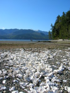
Quick Facts: Location: Kitsap Peninsula Land Agency: Kitsap County Parks Roundtrip: 2.5 miles Elevation Gain: 350 feet Contact: Kitsap County Parks Notes: Dogs prohibited. Access: From Bremerton, follow SR 3 North to Newberry Hill Road Exit. Then head west for 3.0 miles turning right onto Seabeck Highway. Continue for 5.0 miles to Seabeck turning right…

Quick Facts: Location: Skykomish River Valley, US 2 Land Agency: Washington State Parks Roundtrip: 11.5 miles Elevation gain: 1,575 feet Green Trails Map: Contact: Wallace Falls State Park Notes: Discover Pass required; Dogs must be leashed; Camping requires a permit-attain from park prior to trip. Access: From Everett, follow US 2 for 28 miles east…

Quick Facts: Location: Marysville Land Agency: Snohomish County Parks Roundtrip: 2.5 miles Elevation Gain: 50 feet Access: From Marysville (Exit 199 I-5) follow SR 528 for 3.0 miles east to SR 9. Head north on SR 9 for 1.0 mile to junction with 84th Street NE. Turn right (east) and continue for just shy of…
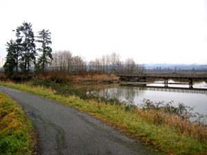
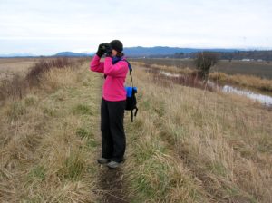
Quick Facts: Location: Nisqually River Delta Land Agency: United States Fish and Wildlife Service Roundtrip: 4.2 miles Elevation Gain: minimal Contact: Billy Frank Jr. Nisqually National Wildlife Refuge Map: Refuge Map Notes: $3.00 per four adults entrance fee; or Interagency Passes accepted; dogs prohibited; Northern end of the Nisqually Estuary Trail is closed from October to…

Quick Facts: Location: Northern Snohomish County, near Stanwood Land Agency: Pacific Denkmann Company Pilchuck Tree Farm Roundtrip: 3.2 miles Elevation Gain: 400 feet Contact: Pilchuck Recreation Association: www.pilchuckra.org Notes: All trail users MUST sign a liability release and have it on file to use these trails. Download here and mail (with $2 donation) to Pilchuck Recreation Association. Dogs…
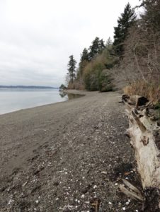
Quick Facts Location: Skagit Bay, Stanwood Land Agency: Washington Department of Fish and Wildlife Roundtrip: 3.6 miles Elevation Gain: None Access: From Exit 212 on I-5 head west on SR 532 for five miles to the town of Stanwood. Turn right onto the Pioneer Highway and proceed for 2.6 miles to the junction with the Old…