Region
Puget Sound Islands & Lowlands
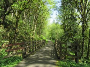
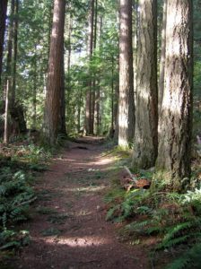
Quick Facts: Location: Preston and Snoqualmie Land Agency: King County Parks Distance: 11.0 miles roundtrip Elevation Gain: 500 feet Contact: King County Parks Notes: dogs on leash Access: From Seattle follow I-90 east to Exit 22. Then turn left on SE 82nd Street, cross freeway and turn right onto SE High Point Way. Drive 0.4…
Location: Lord Hill Park near Snohomish Land Agency: Snohomish County Parks Roundtrip: 2.2 miles High Point: 650 feet Elevation gain: 200 feet Difficulty: easy Contact: Snohomish County Parks Notes: Dogs must be on leash; Map available online Access: From Everett, head east on US 2 for 8.0 miles and take 88th Street SE Exit. Turn right…
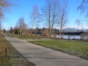
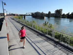
Quick Facts: Location: Lowell neighborhood, city of Everett Land Agency: Everett Parks and Recreation Contact: Everett Parks and Recreation Department Roundtrip: 4.0 miles Elevation Gain: None Access: From Exit 192 on I-5 in Everett head east on 41st Street. Turn right (south) onto 3rd Ave and proceed for 1.2 miles to four-way stop. Turn left onto…
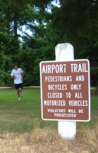
Quick Facts: Location: Arlington Land Agency: City of Arlington Roundtrip: 5.5 miles Elevation gain: 50 feet Difficulty: Easy Contact: Arlington Airport Commission Notes: Dogs must be on leash Access: From Everett, head north on I-5 to Exit 206. Continue east on SR 531 (172nd Street NE) for 1.4 miles. Turn left onto 59th Avenue NE and…
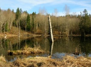
Quick Facts: Location: Snohomish County near Monroe and Snohomish Land Agency: Snohomish County Parks Roundtrip: 3.7 miles Elevation Gain: 150 feet Access: From the city of Snohomish, exit SR 9 onto 2nd Street. Proceed east for a one mile; then turn right onto Lincoln Ave which becomes the Old Snohomish-Monroe Highway. After 2.7 miles turn…
Quick Facts: Location: Throughout the Northwest Land Agency: families, HOAs, sundry municipalities and park districts Distance: as far and as long as you like, but do it regularly Elevation Gain: elevated mood Contact: Your friends and neighbors (from a safe distance) and share some good news Notes: Dogs encouraged, no fees, no groups, stay six…
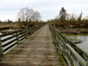
Quick Facts: Location: Snohomish River Delta, Everett Land Agency: Snohomish County Parks Roundtrip: 3.0 miles Elevation gain: none Contact: Snohomish County Parks Notes: Dogs prohibited; Washington Dept of Fish and Wildlife manages northern half of island which is open seasonally to hunting. Good to Know: Practice Leave No Trace, kid-friendly, snow free winter hike, exceptional bird…

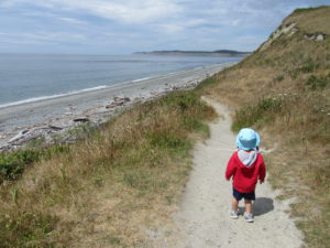
Quick Facts: Location: Anacortes, Fidalgo Island Land Agency: Anacortes Community Forest Lands Roundtrip: 2.5 miles Elevation gain: 650 feet Contact: Anacortes Parks and Recreation Notes: dogs permitted on leash; some trails open to bicycles, horses. Access: From Exit 230 on I-5 in Burlington, head west on SR 20 for 13.5 miles. Turn right onto…
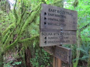
Quick Facts: Location: Issaquah Alps Land Agency: Washington State Parks Roundtrip: 8.0 miles Elevation Gain: 2000 feet Green Trails Map: Cougar Mountain/ Squak Mountain No. 203S Contact: Washington State Parks and Mountains to Sound Greenway Recommended Resource: Urban Trails Eastside Notes: Dogs must be leashed. Good to Know: snow-free winter hike, trail less taken, dog-friendly (on-leash), kid-friendly,…
Quick Facts: Location: Whidbey Island Land Agency: Washington State Parks Round Trip: 1.8 miles of trails Elevation Gain: up to 90 feet Contact: Washington State Parks Recommended Resource: Urban Trails Everett (Mountaineers Books) Notes: Discover Pass required; Dogs allowed on leash Access: From Mukilteo take ferry to Clinton on Whidbey Island. Then continue north on…