Region
Puget Sound Islands & Lowlands
Park rich with views, history, and wildlife on Oro Bay Quick Facts: Location: Anderson Island Land Agency: Anderson Island Park and Recreation Department Round Trip: 2.5 mile loop Elevation Gain: minimal Contact: Anderson Island Park and Recreation Department Detailed Information: Urban Trails Tacoma (Mountaineers Books) Notes: Dogs prohibited Access: From Steilacoom–Anderson Island Ferry terminal take…
Quick Facts: Location: Lynnwood Land Agency: City of Lynnwood Parks and Recreation Roundtrip: 1.2 miles Elevation gain: none Difficulty: Easy Contact: Lynnwood Parks and Recreation Department; (425-771-4030) Notes: Dogs must be leashed Access: From Seattle take I-5 to exit 181. Turn left onto 44th Ave NW. At third light turn left onto SR 524 (196th…
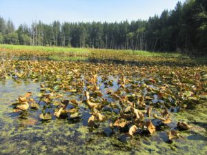
Supreme birdwatching on the Skagit River Delta Quick Facts: Location: Fir Island, Skagit County Land Agency: Washington Department of Fish and Wildlife (WDFW) Round Trip: 1.9 miles of trails Elevation Gain: minimal Contact: Washington Department of Fish and Wildlife (WDFW) Detailed Information: Urban Trails Bellingham (Mountaineers Books) Notes: Discover Pass or WDFW Vehicle Access Pass…

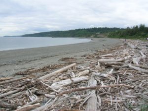
Quick Facts: Location: San Juan Islands National Monument Land Agency: Bureau of Land Managment Roundtrip: 3.8 miles Elevation gain: 380 feet Contact: San Juan Islands National Monument, Spokane District Office BLM Notes: Dogs permitted on leash; do not park beyond Agate Beach Park; access is via private property which owners have generously granted permission—stay on…
Quick Facts: Location: Sammamish Plateau Land Agency: King County Parks Distance: more than 12.0 miles of trails Elevation Gain: up to 325 feet Contact: King County Parks Notes: dogs permitted on leash; trails also open to horses and mountain bikes Map: Click Here Recommended Guidebook: Urban Trails Eastside (Mountaineers Books) Access: From Bellevue follow SR…
Quick Facts Location: Lord Hill Park near Snohomish Land Agency: Snohomish County Parks Roundtrip: 3.5 miles High Point: 650 feet Elevation gain: 400 feet Difficulty: moderate Contact: Snohomish County Parks Notes: Dogs must be on leash; trails open to bikes and horses Access: From the city of Snohomish, exit SR 9 onto 2nd Street. Proceed…
Quick Facts: Location: Camano Island Land Agency: Washington State Parks Roundtrip: 2.2 miles Elevation Gain: 125 feet Contact: Cama Beach State Park Notes: Discover Pass required; Dogs must be leashed Recommended Guidebook: Urban Trails Everett (Mountaineers Books) Access: From Exit 212 on I-5, travel west on SR 532 to Camano Island to a junction at 10.0 miles.…
Quick Facts: Location: Sultan, Snohomish County Land Agency: City of Sultan Roundtrip: 2.0 miles Elevation Gain: level Access: From Everett, follow US 2 east to Sultan. Turn left onto 3rd Street and drive 0.6 mile north. Then turn left onto High Street and continue 0.1 mile to Osprey Park. Contact: City of Sultan Notes: Dogs permitted on leash Good to…
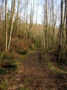
No views, but lots of big trees and pretty cascades Quick Facts: Location: Cougar Mountain Regional Wildland Park. Land Agency: King County Parks. Distance: 3.9 mile lollipop loop. Elevation Gain: 1200 feet. Contact: King County Parks. Green Trails Map: Cougar Mtn/ Squak Mtn No. 203S. Notes: dogs permitted on leash, Warning: car break-ins frequently occur…
Quick Facts: Location: Marrowstone Island Land Agency: Washington State Parks Contact: Fort Flagler State Park Roundtrip: 5.6 miles Elevation Gain: 200 feet Access: From Kingston Ferry Terminal, follow SR 104 west for 15 miles turning right onto SR 19. Continue north for 9 miles to Chimicum turning right onto Irondale Road and proceeding 1.6 miles…