Region
Olympic Peninsula
Quick Facts: Location: Marrowstone Island Land Agency: Washington State Parks Contact: Fort Flagler State Park Roundtrip: 5.6 miles Elevation Gain: 200 feet Access: From Kingston Ferry Terminal, follow SR 104 west for 15 miles turning right onto SR 19. Continue north for 9 miles to Chimicum turning right onto Irondale Road and proceeding 1.6 miles…
Stroll through groves of Old-growth above the Chehalis River Quick Facts: Location: Chehalis River Valley Land Agency: Washington State Parks Roundtrip: up to 3.0 miles Elevation gain: 300 feet Contact: Rainbow Falls State Park Notes: Discover Pass required; dogs must be leashed Access: From Chehalis (exit 77 on I-5) follow SR 6 west for 16…
Quick Facts: Location: Montesano, Olympic Peninsula Land Agency: Washington State Parks Roundtrip: 4.9 miles Elevation Gain: 220 feet Access: From US 12 in Montesano, head north on Main Street past the county courthouse. Turn left onto Spruce Avenue proceeding three blocks. Then turn right on 3rd Street which becomes Sylvia Lake Road for 1.2 miles to…
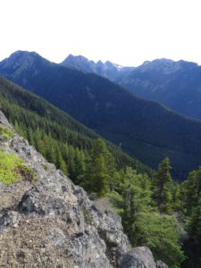
Quick Facts: Location: North Olympic Peninsula Land Agency: Olympic National Forest Roundtrip: 12.7 miles Elevation gain: 3350 feet Contact: Olympic National Forest, Pacific Ranger District, Forks, Green Trails Map: Green Trails Lake Crescent No. 101 Notes: Northwest Forest Pass or Interagency Pass required Access: From Port Angeles, follow US 101 west for 32 miles to…
Quick Facts: Location: Buckhorn Wilderness, Northeast Olympic Peninsula Land Agency: Olympic National Forest Roundtrip: 7.8 miles Elevation gain: 3,000 feet Green Trails Maps: Olympic Mountains East No. 168SX Recommended Guidebook: Day Hiking Olympic Peninsula 2nd edition (Mountaineers Books) by Craig Romano Contact: Hood Canal District, Olympic National Forest Quilcene Access: Take US 101 to Louella…
Quick Facts: Location: Northeast Olympic Peninsula Land Agency: Olympic National Forest Roundtrip: 5.0 miles Elevation gain: 2050 feet Contact: Hood Canal Ranger District Green Trails Map: Olympics East no. 168S Notes: In winter the road is gated. Park away from gate and walk .3 mile to trailhead. Recommended Guidebook: Day Hiking Olympic Peninsula 2nd edition (Mountaineers…
Quick Facts Location: Fort Columbia State Park, Pacific County, WA Land Agency: Washington State Parks Roundtrip: 2.4 miles Elevation Gain: 630 feet Access: From Kelso head west 56 miles on SR 4 to Naselle. Turn left onto SR 401 proceeding 12 miles to a junction with US 101 at the Astoria-Megler Bridge. Continue west on…
Quick Facts: Location: Olympic Peninsula Land Agency: Olympic National Forest Round Trip: 1.9 miles Elevation Gain: 250 feet Contact: Olympic National Forest, Hood Canal Ranger District, Green Trails Map: Green Trails Olympic Mountains East 168S Notes: Northwest Forest Pass required; Be sure to respect the privacy of any guests who may be staying in the…
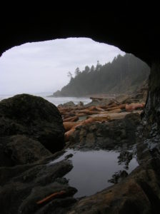
Location: Olympic National Park coast Land Agency: National Park Service Roundtrip: 4.0 miles Elevation gain: 50 feet Contact: Olympic National Park Wilderness Information Center Green Trails Map: Olympic Coast 99S Recommended Resource: Day Hiking Olympic Peninsula 2ed (Mountaineers Books) Notes: Dogs must be leashed; Browns Point can only be rounded during low tides; Practice Leave No…
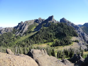
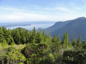
Quick Facts: Location: Hurricane Ridge-Heart of the Hills Land Agency: Olympic National Park Roundtrip: 10 miles Elevation Gain: 3,940 feet Green Trails Map: Hurricane Ridge-Elwha North No. 134S Access: From Port Angeles, follow Race Street south 1.2 miles passing the Olympic National Park Visitors Center to the Hurricane Ridge Road (Heart O the Hills Parkway).…