Region
Columbia River Gorge
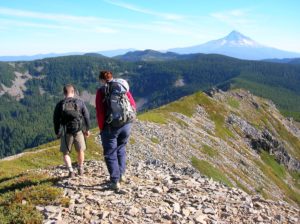
Quick Facts: Location: Mark Hatfield Wilderness, Columbia River Gorge, Oregon Land Agency: Mount Hood National Forest Roundtrip: 6.0 miles Elevation gain: 1,300 feet Green Trails Map: Columbia River Gorge -West No 428S Contact: Mount Hood National Forest, Hood River Ranger Station Notes: Northwest Forest Pass or Inter-agency Pass Required Recommended Guidebook: Day Hiking Columbia River…
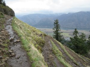
Quick Facts: Location: Beacon Rock State Park, Columbia River Gorge National Scenic Area Land Agency: Washington State Parks Roundtrip: 7.5 miles Elevation gain: 2,100 feet Contact: Beacon Rock State Park Notes: Discover Pass required; Dogs permitted on leash. Green Trails Map: Columbia River Gorge West No. 428S Recommended Guidebooks: Day Hiking Columbia River Gorge, 100…
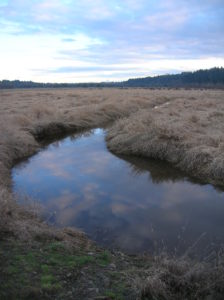
Quick Facts: Location: La Center, Clark County Wash. Land Agency: Clark County Parks Roundtrip: 2.0 miles Elevation Gain: 30 feet Special Note: Dogs permitted on leash. Access: From Vancouver, head north on I-5 to Exit 16. Turn right onto La Center Road and proceed for 1.6 miles to the bridge over the East Fork Lewis River.…
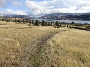
Quick Facts: Location: Columbia River Gorge National Scenic Area Land Agency: Columbia Gorge National Scenic Area Roundtrip: 5.0 miles Elevation gain: 1150 feet Difficulty: Moderate Contact: Columbia Gorge National Scenic Area Notes: Dogs permitted on leash. Be aware of ticks and poison oak. Green Trails Map: Columbia River Gorge East No. 432S Good to Know:…
Quick Facts Location: Wind River Valley Land Agency: Gifford Pinchot National Forest Roundtrip: 4.4 miles Elevation Gain: 1,250 feet Green trails Map: Green Trails Wind River No. 397 Recommended Guidebook: Day Hiking Columbia River Gorge (Craig Romano) Access: From Stevenson, head east on SR 14 for 3.0 miles turning left onto Wind River Road. Then…
Quick Facts: Location: Sellwood neighborhood, Portland, Oregon Land Agency: Portland Parks and Recreation Roundtrip: 2.8 miles Elevation gain: 60 feet Contact: Portland Parks and Recreation Notes: dogs must be leashed Access: From Ross Island Bridge follow US 26 east (Powell Boulevard) immediately turning right onto SR 99E (SE McLoughlin Boulevard). In just over one mile exit…
Location: Columbia River Gorge National Scenic Area Land Agency: Columbia Gorge National Scenic Area Roundtrip: 2.3 miles Elevation gain: 370 feet Difficulty: Easy Contact: Columbia Gorge National Scenic Area Notes: Dogs permitted on leash. Be aware or ticks and poison oak. Green Trails Map: Columbia River Gorge East No. 432S Good to Know: kid-friendly, dog-friendly…
Quick Facts: Location: Silver Star Scenic Area Land Agency: Gifford Pinchot National Forest Roundtrip: 5.0 miles High Point: 4,390 feet Elevation gain: 1,440 feet Difficulty: moderately difficult Green Trails Map: Lookout Mtn No. 396, Bridal Veil No. 428 Contact: Gifford Pinchot National Forest Mount Adams Ranger District, Note: FR 4109 is rough and recommended for high…
Quick Facts: Location: Columbia River Gorge National Scenic Area Land Agency: Oregon Nature Conservancy and Mayer State Roundtrip: 3.2 miles Elevation Gain: 1,000 feet Notes: Dogs prohibited; Trail closed from Nov 1 through Apr 30 to limit tread damage. Practice Leave No Trace Principles Green Trails Map: Columbia River Gorge East No. 432S Contact: Oregon…
Quick Facts: Location: Columbia River Gorge National Scenic Area Land Agency: Washington Department of Natural Resources Roundtrip: 5.0 miles Elevation Gain: 1,150 feet Contact: Washington DNR Southeast Region Notes: Discover Pass required; Dogs prohibited; Practice Leave No Trace Principles Recommended Resource: Day Hiking Columbia River Gorge Green trails Map: Columbia River Gorge West No. 432S Good…
- « Previous
- 1
- 2
- 3
- Next »
