Region
Columbia River Gorge
Quick Facts: Location: Columbia River Gorge National Scenic Area Land Agency: Oregon Nature Conservancy and Mayer State Roundtrip: 3.2 miles Elevation Gain: 1,000 feet Notes: Dogs prohibited; Trail closed from Nov 1 through Apr 30 to limit tread damage. Practice Leave No Trace Principles Green Trails Map: Columbia River Gorge East No. 432S Contact: Oregon…
Quick Facts: Location: Columbia River Gorge National Scenic Area Land Agency: Washington Department of Natural Resources Roundtrip: 5.0 miles Elevation Gain: 1,150 feet Contact: Washington DNR Southeast Region Notes: Discover Pass required; Dogs prohibited; Practice Leave No Trace Principles Recommended Resource: Day Hiking Columbia River Gorge Green trails Map: Columbia River Gorge West No. 432S Good…
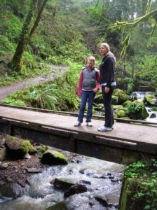
Location: Forest Park, Portland, Oregon Land Agency: Portland Parks and Recreation Roundtrip: 2.4 miles High Point: 425 feet Elevation gain: 300 feet Difficulty: easy Green Trails Map: Forest Park No 426S Contact: Contact/permits: Portland Parks and Recreation ; Forest Park Conservancy; Notes: dogs must be leashedAccess: From downtown Portland, follow NW Vaughn Street west turning…

Quick Facts: Location: Columbia River Gorge, Oregon Land Agency: Oregon State Parks Roundtrip: 3.3 miles Elevation Gain: 300 feet Contact: Oregon State Parks Notes: $5.00 day use fee or $30 annual pass; dogs must be leashed Green Trails Maps: Columbia River Gorge West No. 428S Access: From Portland follow I-84 east to Exit 25. At .5…

Behind the scenes beauty! Quick Facts: Location: Columbia River Gorge Oregon Distance: 2.7 miles round trip Elevation Gain: 450 feet Contact: Columbia River Gorge National Scenic Area Maps: Green Trails Columbia River Gorge–West No. 428S Recommended Guidebook: Day Hiking Columbia River Gorge (Mountaineers Books) Notes: Dogs allowed on-leash. Trailhead directions: From Portland or Hood River,…

Quick Facts: Location: Columbia River Gorge National Scenic Area, Oregon Land Agency: National Forest Service Roundtrip: 13.2 miles Elevation Gain: 5,130 feet Green Trails Map: Columbia River Gorge-West Map 428S Access: From Portland follow I-84 east to Exit 55 to the Starvation Creek Trailhead. Contact: Columbia Gorge National Scenic Area Recommended Guidebook: Day Hiking Columbia…

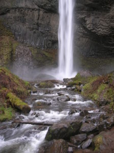
Quick Facts: Location: Mark O Hatfield Wilderness, Columbia River Gorge National Scenic Area, Oregon Land Agency: National Forest Service Roundtrip: 2.4 miles Elevation Gain: 575 feet Green Trails Map: Columbia River Gorge -West No 428S Contact: Mount Hood National Forest, Hood River Ranger Station Notes: Wilderness rules apply Access: From Portland follow I-84 east to…

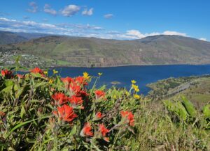
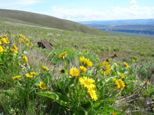
Location: Columbia River Gorge National Scenic Area Land Agency: Friends of the Columbia Gorge Roundtrip: 6.8 miles Elevation gain: 1,500 feet Contact: Friends of the Columbia Gorge Notes: Dogs permitted on leash; Beware ticks, rattlesnakes, and poison oak; parking limited especially on weekends Green Trails Map: Columbia River Gorge East No. 432S Access: From Bingen…

Quick Facts: Location: Sauvie Island (Portland, Oregon) Land Agency: Willamette River Greenway, Wapato Access (Oregon State Parks) Roundtrip: 2.4 miles Elevation Gain: 50 feet Notes: Dogs must be leashed. Access: From downtown Portland, follow US 30 (NW St Helens Road) west for just shy of 11 miles turning right onto the Suavie Island Bridge. Then…
Quick Facts: Location: Columbia River Gorge National Scenic Area Land Agency: Oregon State Parks Roundtrip: 2.3 miles Elevation Gain: 650 feet Green Trails Map: Columbia River Gorge- West no. 428S Contact: Guy Talbot State Park Access: From Portland follow I-84 east to Exit 28. Then follow the Historic Columbia Highway west 2.6 miles to trailhead.…