Region
Central Cascades
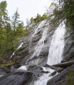
Quick Facts: Location: Skykomish River Valley Land Agency: Washington State Parks Roundtrip: 8.2 miles Elevation Gain: 1,500 feet Green trails Map: Index, WA-No. 142 Access: From Everett follow US 2 for 28 miles east to Gold Bar. Just before Milepost 28 turn left onto 1st Street (signed for Wallace Falls State Park). Proceed for .4…
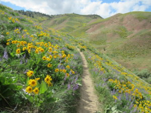
Bloomin’ good hike in Wenatchee Foothills Quick Facts: Location: Wenatchee Foothills Round Trip: 9.6 miles Elevation Gain: 1125 feet Contact: Chelan-Douglas Land Trust Detailed Information: Day Hiking Central Cascades 2nd edition (Mountaineers Books) Notes: Trail is closed from Dec 1 until March 31 to protect wintering mule deer. Dogs must be leashed; trail open to…
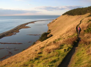
Quick Facts: Location: Whidbey Island Land Agency: National Park Service and Washington State Parks Roundtrip: 5.2 miles Elevation Gain: 260 feet Contact: Ebey’s Landing National Historical Reserve Suggested Guidebook: Urban Trails Everett Special note: Dogs permitted on leash. Access: Take Washington State Ferry from Mulkiteo to Clinton on Whidbey Island. Continue north on SR 525…
Quick Facts: Location: Near Index, Skykomish Valley Land Agency: Mount Baker-Snoqualmie National Forest Roundtrip: 2.6 miles Elevation Gain: 850 feet Access: From Everett follow US 2 east for 37 miles to trailhead located on north side of highway just after entering Mount Baker-Snoqualmie National Forest. Green Trails Map: Alpine Lakes Stevens Pass 176S Recommended Guidebook:…
Quick Facts: Location: US 2 near Index, Land Agency: Mount Baker-Snoqualmie National Forest Roundtrip: 4.4 miles Elevation gain: 850 feet Green Trails Maps: Green Trails, Alpine Lakes Stevens Pass 176S Contact: Skykomish Ranger District: Mount Baker -Snoqualmie National Forest Notes: NW Forest Pass or Interagency Pass required Access: From Everett follow US 2 east for…
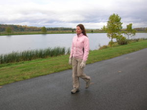
Quick Facts: Location: City of Monroe Land Agency: Monroe Parks and Recreation Department Roundtrip: 1.6 miles Elevation Gain: None Notes: Dogs must be on leash. Access: From Everett follow US 2 east towards Monroe. Turn right at first traffic light onto Fryelands Boulevard. Continue for .7 mile to junction with Wales Street. Turn right into…
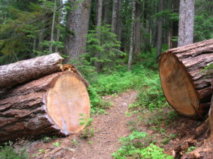
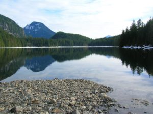
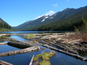
Quick Facts: Location: North Fork of the Skykomish River Land Agency: Mount Baker-Snoqualmie National Forest Roundtrip: 8.6 miles Elevation gain: 1450 feet Green Trails Maps: Monte Cristo, WA-No. 143 Contact: Skykomish Ranger District: Mount Baker Snoqualmie National Forest Notes: Northwest Forest Pass or Interagency Pass required. Access: The North Fork Skykomish River Road from Index, the…
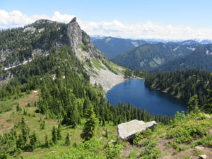
Quick Facts: Location: Henry M. Jackson Wilderness Land Agency: National Forest Service Roundtrip: 6.4 miles Elevation Gain: 1,800 feet Green Trails Map: Alpine Lakes Stevens Pass No. 176S Contact: Wenatchee River Ranger District: Okanogan-Wenatchee National Forest Access: From Everett head east on US 2 to Stevens Pass. Continue east for another 4.0 miles. Just after the…
Quick Facts: Location: Lake Wenatchee Area Land Agency: Okanogan-Wenatchee National Forest Roundtrip: 6.8 miles Elevation Gain: 1,200 feet Green Trails Map: Wenatchee Lake- No. 145 Contact: Wenatchee River Ranger District (Leavenworth) Notes: Northwest Forest Pass or Interagency Pass required; wilderness rules apply Access: From Everett head east on US 2 to Coles Corner. Turn left (north)…
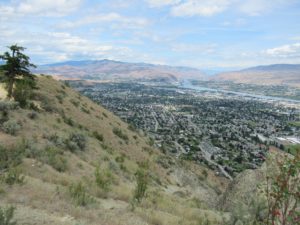
Quick Facts: Location: Wenatchee, Washington Land Agency: WA DNR and Chelan-Douglas Land Trust Roundtrip: 3.0 miles Elevation Gain: 1000 feet Contact: WA DNR and Chelan-Douglas Land Trust Notes: Dogs must be leashed; be alert for rattlesnakes Green Trails Map: Wenatchee/ Mission Ridge No. 211S Access: From US 2 in Wenatchee head south onto State Route…