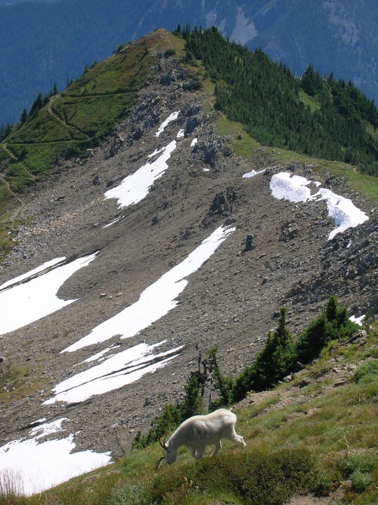
Rock Mountain via Snowy Creek—Big sky views and perhaps a goat or two
meadows of Rock Mountain.
Quick Facts:
Location: Nason Ridge near Stevens Pass
Land Agency: Okanogan-Wenatchee National Forest
Roundtrip: 9.8 miles
Elevation Gain: 3,250 feet
Green Trails Map: Alpine Lakes Stevens Pass Map 176S
Access: From Everett head east on US 2. Four miles past Stevens Pass turn left onto Smith Brook Road (FR 6700). Follow for 6.0 miles turning right onto FR 6705. Proceed for 3.6 miles to trailhead. WARNING-FR 6705 is lined with alders and other brush that will remove paint from your vehicle’s siding. Consider taking a beater or park at junction with FR 6700 and bike to the trailhead.
Note: See warning above about access road.
Contact: Wenatchee River Ranger District (Leavenworth): Okanogan-Wenatchee National Forest
Good to Know: dog-friendly, exceptional wildflowers, exceptional alpine views, Practice Leave No Trace Principles, Don’t be a surface pooper, Leave the tunes at home
A delightful mountain stream, handsome mature forest, a handful of resident mountain goats, and views that simply rock, help make this hike a Cascades classic. Nearly every peak in the Central Cascades and a quite a few others too north and south can be seen from this lofty former fire lookout site.

There are two ways to get to this summit, this one while not easy, is the saner route. Start in cool mature forest beside Snowy Creek. In far contrast from the south side approach to Rock Mountain, this route stays out of the sun for the most of the way, offers more varied terrain and requires far less elevation gain.
On nice grade, head up the narrow valley coming to a junction with the Nason Ridge Trail at 1.2 miles. The way right head 4.4 miles west to Rainy Pass. Head left and soon cross a creek in a draw kept open by frequent avalanche activity. Then begin climbing more briskly. Cross Snowy Creek twice and emerge in a gorgeous lush basin beneath cliffs and talus.
The trail here turns east to cross meadows before reentering forest and starting a steep climb. Switchbacks are tight and plentiful! At about 5,700 feet begin to reach the sky breaking out into luxuriant alpine meadows. The grade eases and the views expand as the trail approaches a 6,600-foot gap on the shoulder of Rock Mountain. Here at a junction, head left reaching Rock’s 6,852-foot summit in 0.3 mile. Savor the stunning views—you earned them! Look east along Nason Ridge to 7,063-foot Mount Howard; south to the Chiwaukums and Mount Stuart; west to Hinman, Daniel and Rainier; and north to Glacier, the Monte Cristo massif, Sloan, and countless others.
Directly below, Rock Lake twinkles in the sun. Look for marmots and mountain goats lounging and foraging. You too should plan on lounging for awhile!

Snowy Creek is featured in my Day Hiking Central Cascades Book. Check it out for more details on this and 124 other hikes.