Chuckanut Ridge — Follow a rough and tumble ridge to sweeping viewpoints
Quick Facts:
Location: Chuckanut Mountains
Land Agency: Whatcom County Parks and Washington State Parks
Round Trip: 10.8 miles roundtrip
Elevation Gain: 2000 feet
Contact: Whatcom County Parks
Recommended Resource: Urban Trails Bellingham (Mountaineers Books)
Detailed map: Square One Maps Chuckanut Recreation Area
Notes: Dogs allowed on leash
Access: From Bellingham follow I-5 south to Fairhaven Exit 250. Head 0.1 mile west on Old Fairhaven Parkway and turn left onto 30th Street. Continue for one mile turning right onto Old Samish Way. Then proceed for 0.6 mile bearing left onto Chuckanut Drive (SR 11). Reach trailhead in 0.1 mile.
Good to Know: dog-friendly (use caution on ledges), exceptional views, snow free winter hikes, practice Leave No Trace principles, don’t be a surface pooper, Can the tunes
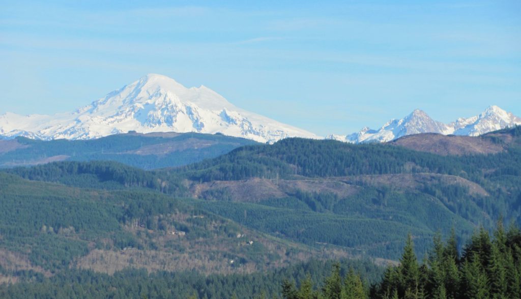
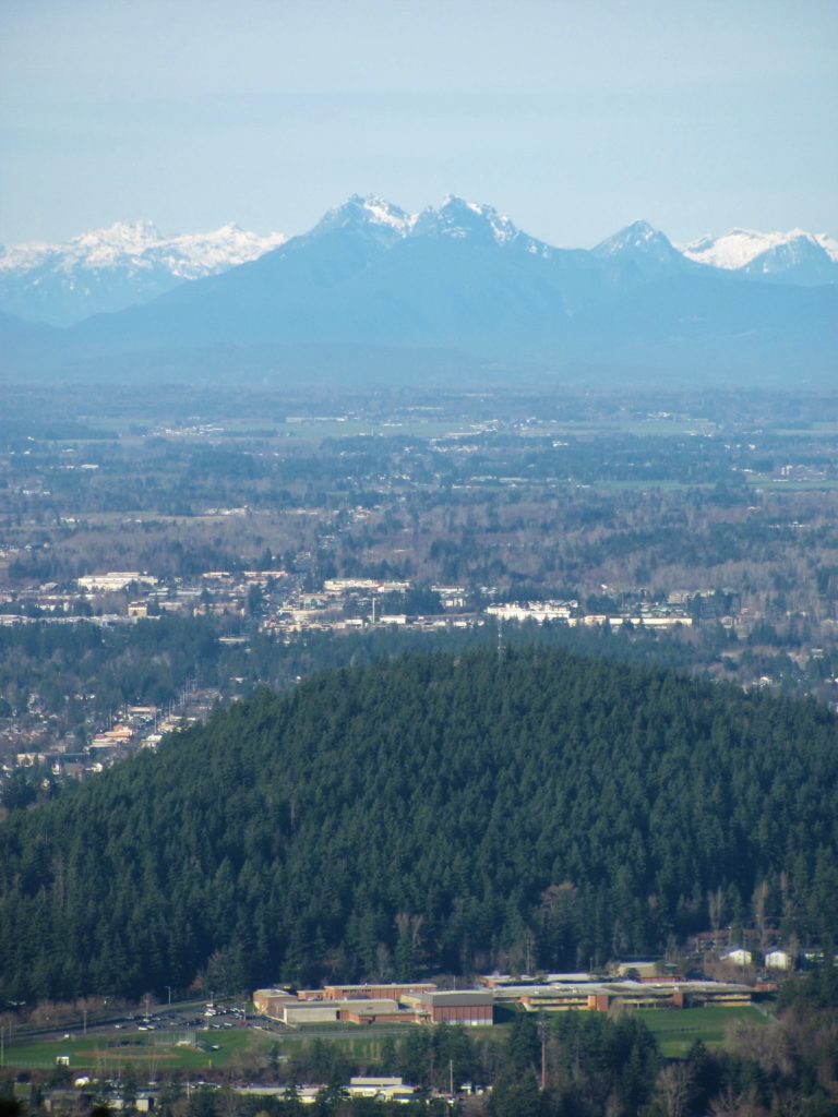
Chuckanut Ridge offers challenging hiking and sweeping views. Follow the up and down ridge clambering over steep knobs and sandstone ledges. Enjoy excellent views of Bellingham against a backdrop of craggy BC peaks. And be wooed by icy Mount Baker hovering on the eastern horizon.
From the North Chuckanut Trailhead hike a short distance to the Interurban Trail. Then turn left and reach at junction at 0.5 mile. Head right climbing through a beautiful grove of old growth trees reaching another junction. Turn right and climb some more reaching the Hemlock Trail, an old-service road. Follow this trail a short distance to a junction.
Then turn right and continue on the North Lost Lake Trail. Pass the Salal Trail and come to another junction. Straight goes to Lost Lake. You want to go right on the Ridge Trail. Now wind beneath ledges and around boulders and then begin steeply climbing up Chuckanut Ridge. The way is rough with copious rocks and roots to negotiate.
At just past 2.5 miles reach the first of several excellent viewpoints along this long ridge of sandstone cliffs and ledges. Look north over Bellingham’s Sehome Hill to BC’s prominent Golden Ears and hundreds of neighboring other snowy summits. Look northeast at Sumas and Stuart mountains and to ever-impressive Mount Baker.
Continue south through a small grove of pines followed by fir forest. The way is slow going with minor ups and downs. A few more viewpoints beg for you to take a break. Use caution at the viewpoints and keep dogs and children close by. Pass an unsigned junction where the Lower Ridge Trail leaves right reaching Cleator Road.
You want to continue left on a much rougher and brushier path now. Descend from a rocky knob and continue dipping and climbing, but slowly gaining net elevation. Pass another unmarked junction for a trail leading to Cleator Road. Your route is forward soon coming to a good view of Mount Baker and Anderson Mountain. The trail continues to ascend traversing thick stands of tenacious and wind-blasted firs. At 5.4 miles the trail ends at a bend on Cleator Road. Here enjoy a window view of Mount Baker above Lake Samish. Then retrace your steps or consider making a loop on a series of connecting trails.
For detailed descriptions (including maps) on this trail and all of the other trails in the Chuckanut Recreation Area as well as many other great area trails, pick up copy of my best selling Urban Trails Bellingham book.
For information on where to play in stay in Bellingham, consult Northwest TripFinder.