Wildflowers
Sourdough Ridge — Enjoy sweet views of Mount Rainier from this easy ridge hike
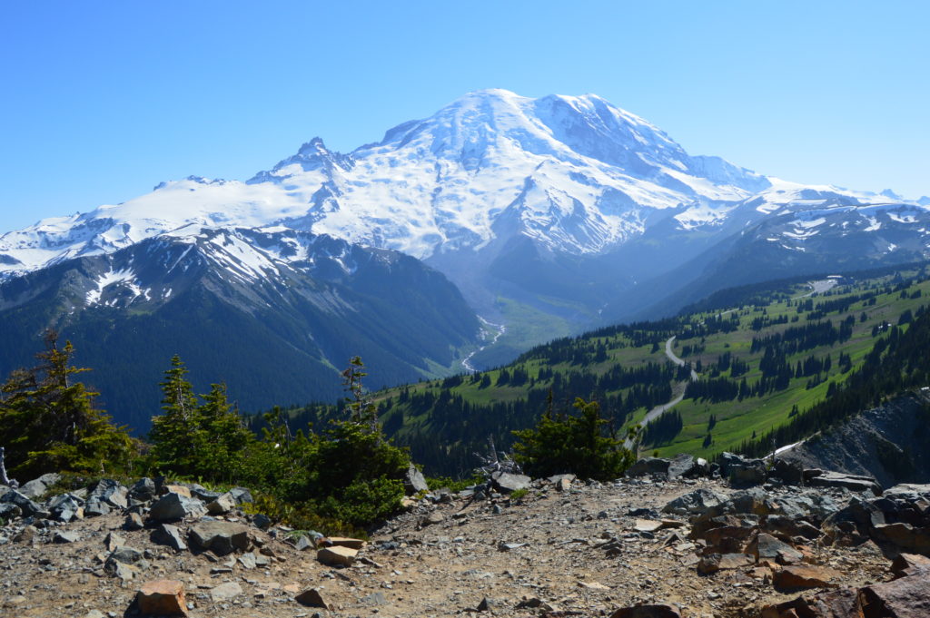
Quick Facts: Location: Sunrise, Mount Rainier National Park…
Read MoreSilver Star Mountain via Ed’s Trail–Stellar wildflowers and explosive volcanic views
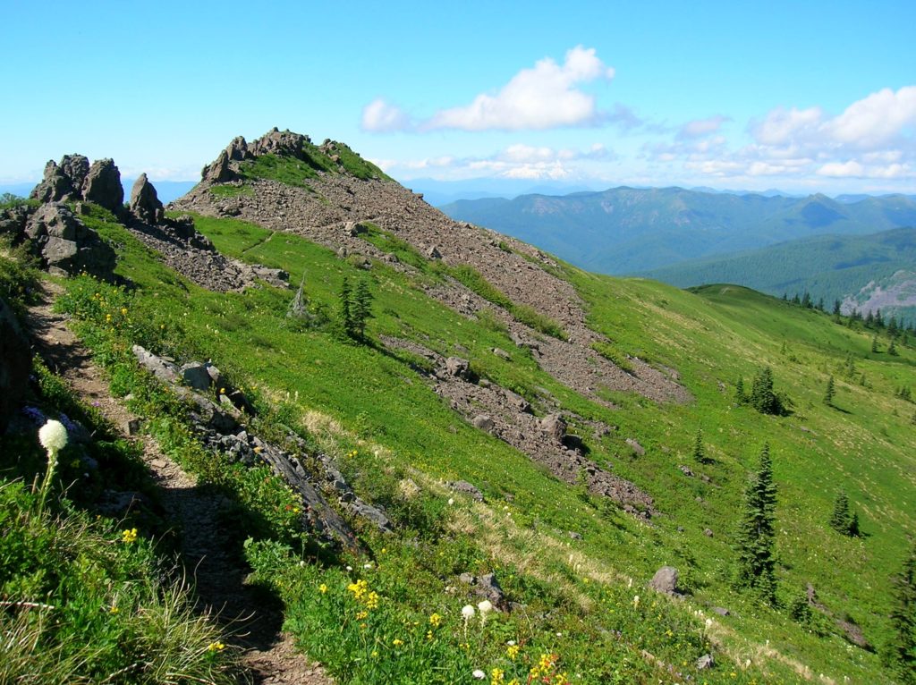
Quick Facts: Location: Silver Star Scenic Area Land Agency: Gifford Pinchot National Forest Roundtrip: 5.0 miles High Point: 4,390 feet Elevation gain: 1,440 feet Difficulty: moderately difficult Green Trails Map: Lookout Mtn No. 396, Bridal Veil No. 428 Contact: Gifford Pinchot National Forest Mount Adams Ranger District, Note: FR 4109 is rough and recommended for high…
Read MoreTom McCall Point─Legendary Columbia River Gorge Wildflower Display
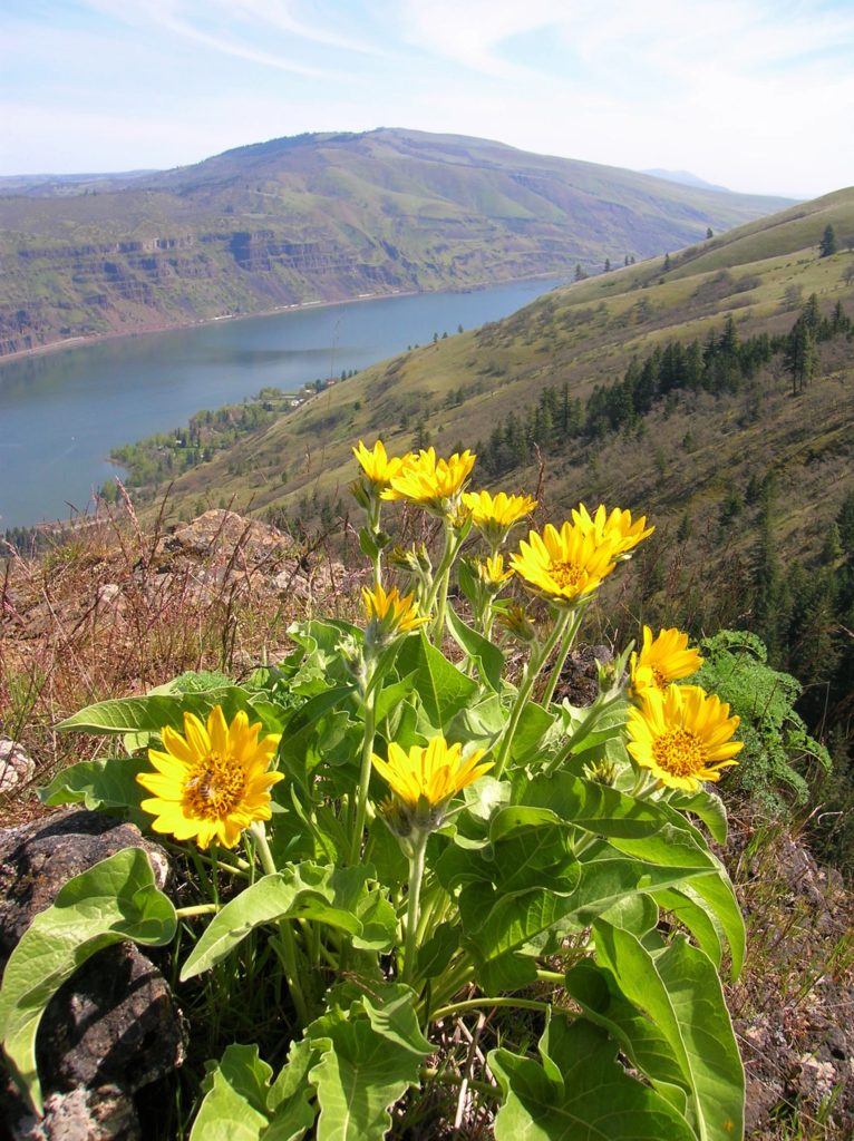
Quick Facts: Location: Columbia River Gorge National Scenic Area Land Agency: Oregon Nature Conservancy and Mayer State Roundtrip: 3.2 miles Elevation Gain: 1,000 feet Notes: Dogs prohibited; Trail closed from Nov 1 through Apr 30 to limit tread damage. Practice Leave No Trace Principles Green Trails Map: Columbia River Gorge East No. 432S Contact: Oregon…
Read MoreCowiche Mountain– Explore Snow Mountain Ranch’s flowery mountain
Quick Facts: Location: Snow Mountain Ranch, Yakima County, WA Land Agency: Cowiche Canyon Conservancy Roundtrip: 6.2 miles Elevation Gain: 1,250 feet Contact: Cowiche Canyon Conservancy Notes: Dog must be leashed Access: Follow I-90 east to I-82. Continue east on I-82 and take Exit 31A onto US 12. Then head west and take the exit for N 40th Ave.…
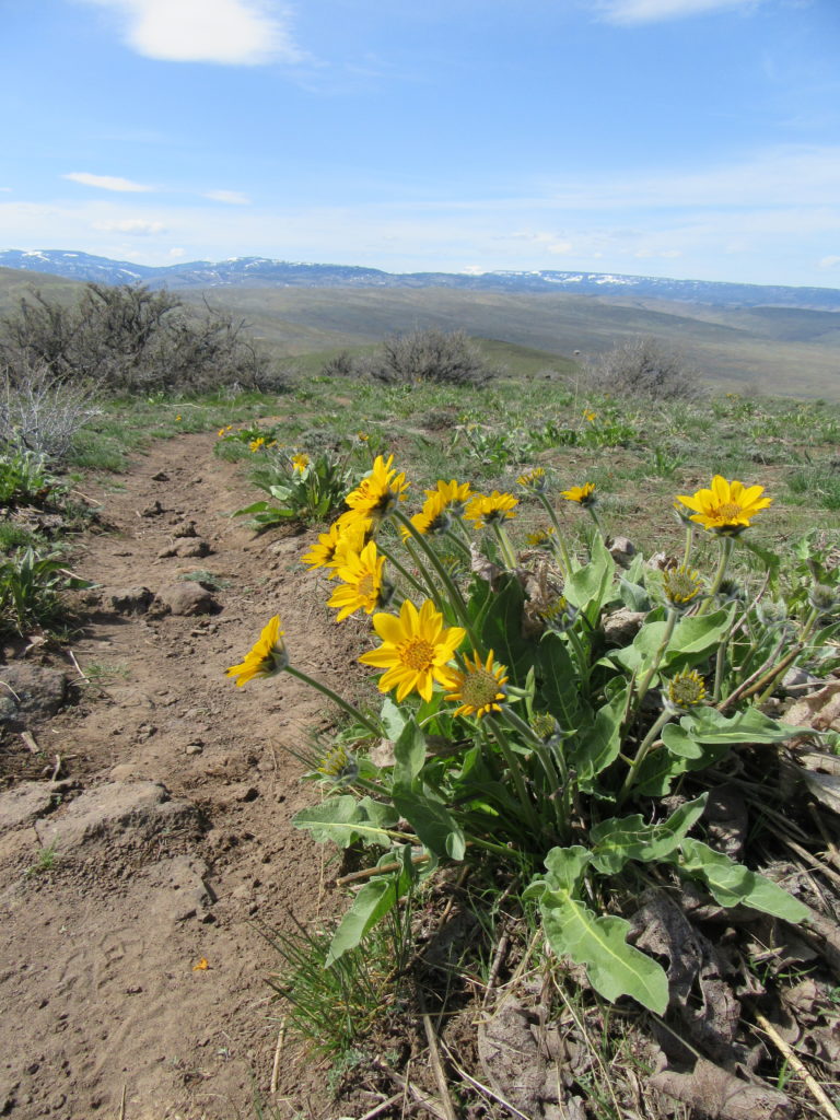
Read MoreStacker Butte─Blossoming Queen of the Columbia River Gorge
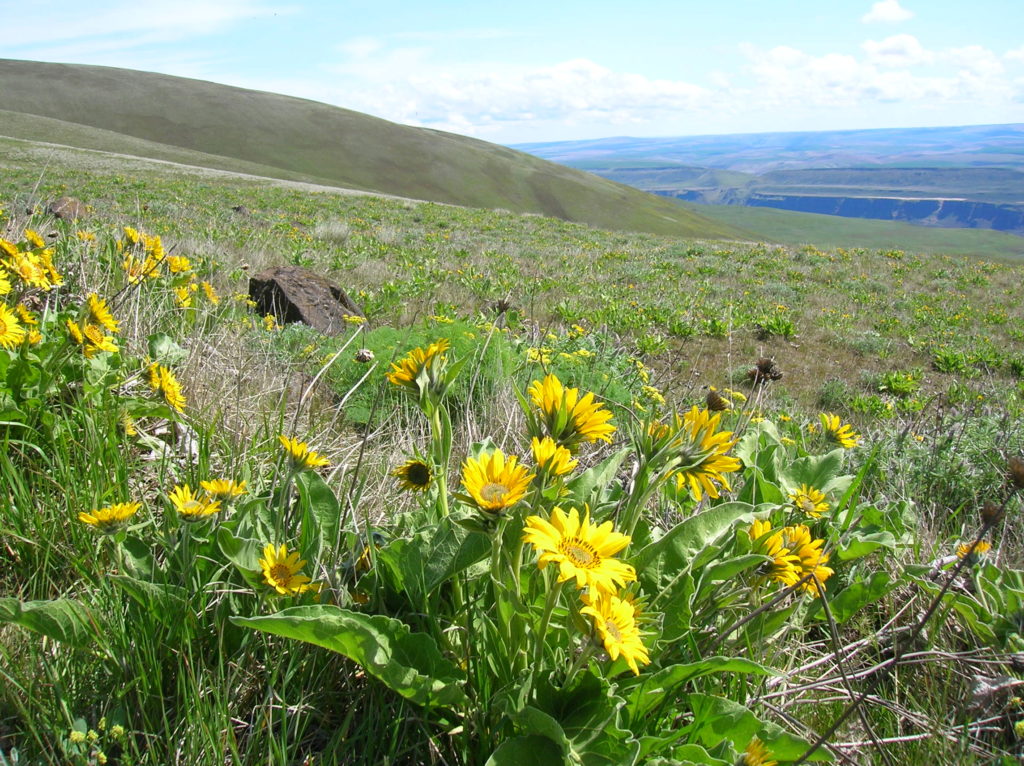
Quick Facts: Location: Columbia River Gorge National Scenic Area Land Agency: Washington Department of Natural Resources Roundtrip: 5.0 miles Elevation Gain: 1,150 feet Contact: Washington DNR Southeast Region Notes: Discover Pass required; Dogs prohibited; Practice Leave No Trace Principles Recommended Resource: Day Hiking Columbia River Gorge Green trails Map: Columbia River Gorge West No. 432S Good…
Read MoreChelan Lakeshore Trail—Spring has sprung along Washington’s inland fjord
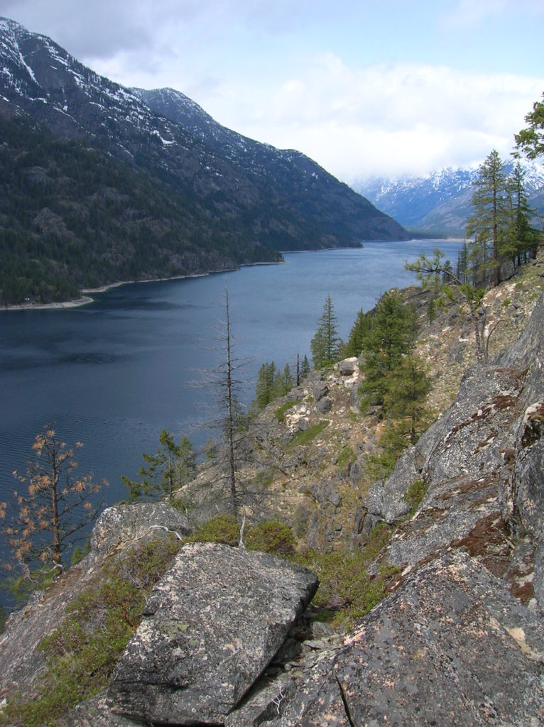
Quick Facts: Location: Central Cascades Land Agency: National Park Service Roundtrip: 10.0 miles Elevation Gain: 1,000 feet Green Trails Map: Stehekin, WA- No. 82 Contact: Lake Chelan National Recreation Area, Golden West Visitor Center in Stehekin; Special Note: Accessible only by boat or sea plane. Regular passenger ferry service is available from Chelan and Field’s…
Read MoreFrenchman Coulee — This Canyon above the Columbia River C’est magnifique!
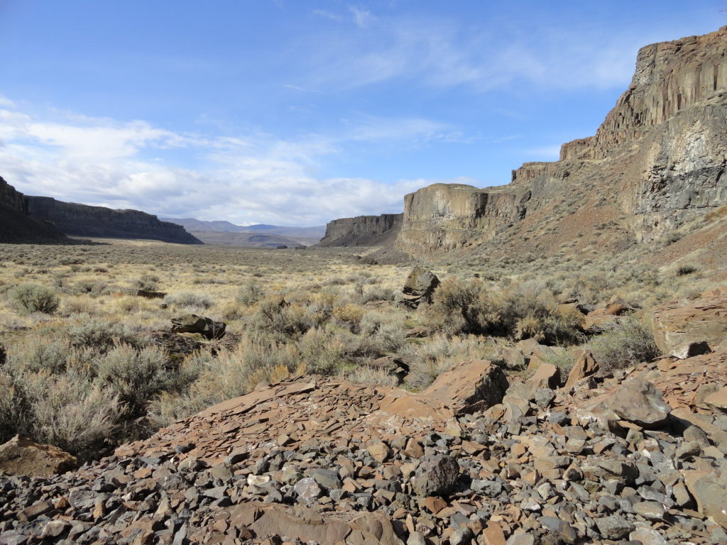
Quick Facts: Location: Columbia River Basin Land Agency: Washington Department of Fish and Wildlife Roundtrip: 4.0 miles Elevation gain: 100 feet Contact: Washington Department of Fish and Wildlife, Columbia Basin Wildlife Area (Moses Lake) Notes: Discover Pass required Detailed Source: Day Hiking Eastern Washington (Mountaineers Books) Access: Follow I-90 to Exit 143 and head north…
Read MoreGrand Valley–Aptly named valley has it all; lakes, meadows, and fantastic alpine scenery

Quick Facts Location: Obstruction Point (Hurricane Ridge) Land Agency: National Park Service Roundtrip: 9.8 miles Elevation…
Read MoreWapaloosie Mountain–a wapaloosie of a peak indeed!
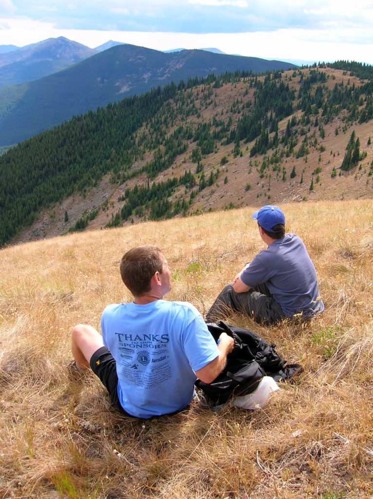
Location: Kettle River Range Land Agency: National Forest Service Roundtrip: 6.0 miles Elevation gain: 2,000 feet Contact: Colville National Forest Access: From Republic, head east on SR 20 for 21 miles turning left onto FR 2030 (Albion Hill Road). From Kettle Falls, head west on SR 20 for 22 miles, turning right onto FR 2030. Follow FR…
Read MoreGreenwood Lake–Solitude in the shadow of High Rock

Quick Facts: Location: Nisqually River Valley Land Agency: National Forest Service Round Trip: 4.0 miles Elevation Gain: 1450 feet Contact: Cowlitz Valley Ranger Station (Randle), Gifford Pinchot National Forest Green Trails Maps: Randle, WA no. 301 Notes: Road to trailhead can be rough. Trail is open to motorcycles but sees little use as it receives little…
Read More