Trail Less Taken
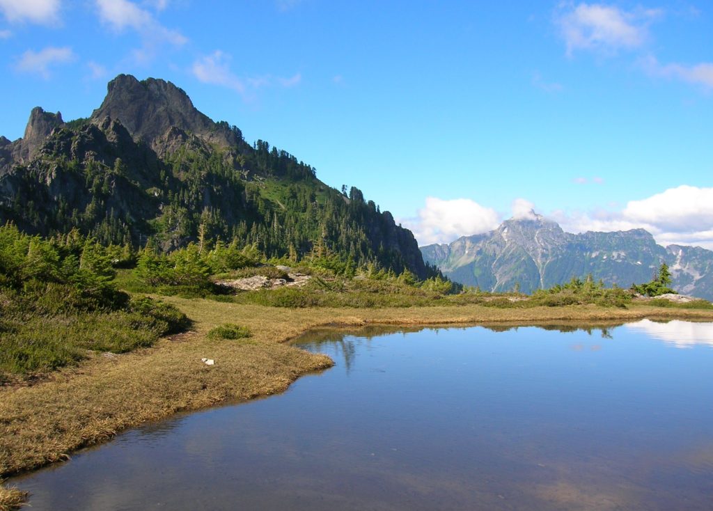
Lizard and Lily Lakes

Peaceful wandering near the Oyster Dome Quick Facts: Location: Blanchard State Forest Distance: 7.5 miles roundtrip Elevation Gain: 1,500 feet Contact: Washington Department of Natural Resources Map: Square One Maps Chuckanut Recreation Area Notes: Discover Pass required to park at trailheads Trailhead directions: From I-5 Exit 240 in Alger head north on Lake Samish Road…
Read MoreSecond Beach– Home to First Rate Scenery
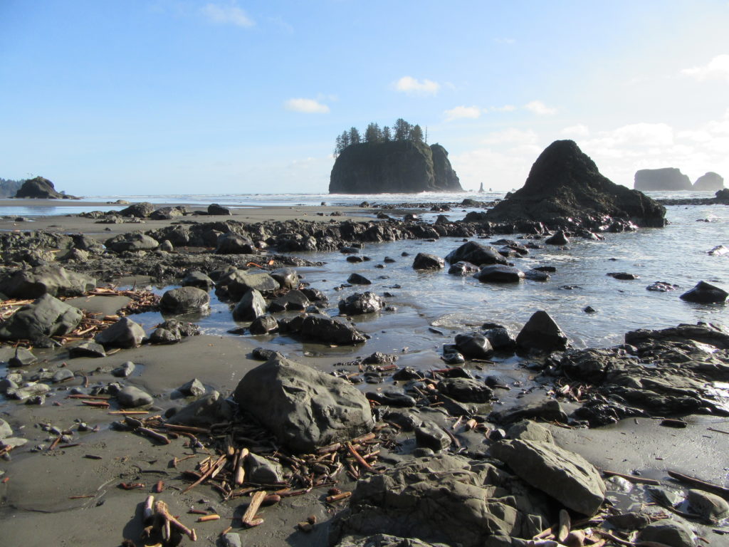
Quick Facts: Location: Olympic National Park Land Agency: Quileute Nation and National Park Service Roundtrip: 4.0 miles Elevation Gain: 310 feet Contact: Olympic National Park, Wilderness Information Center Green Trails Map: 99S Olympic Coast Beaches Notes: Dogs prohibited Access: From Forks follow US 101 north for 1.5 miles turning left onto State Route 110 (signed “Mora–La Push”). Continue…
Read MoreRiver Trail–Big maples and hidden Snohomish riverfront at Lord Hill
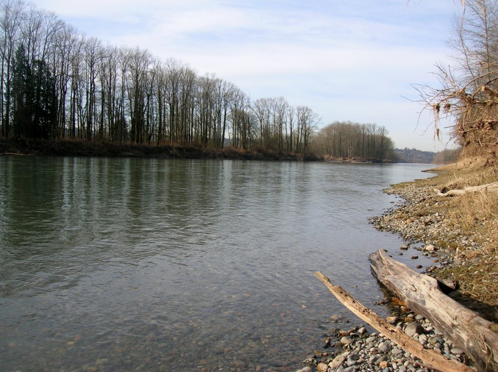
Quick Facts: Location: Snohomish Valley Land Agency: Snohomish County Parks Roundtrip: 5.2 miles Elevation gain: 650 feet Contact: Snohomish County Parks Map: Snohomish County Parks Notes: Dogs permitted on leash Good to know: Dog-friendly, kid-friendly, snow-free winter hike, good trail running Access: From Everett follow US 2 to SR 9. Head south on SR 9 and exit…
Read MoreClallam Bay Spit — Explore Washington’s deserted and spectacular North Coast
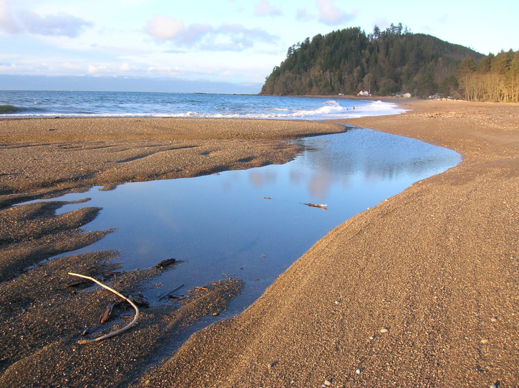
Quick Facts: Location: Strait of Juan de Fuca, North Olympic Peninsula Land Agency: Clallam County Parks and Washington State Parks Roundtrip: 2.1 miles Elevation Gain: minimal Contact: Clallam County Parks Notes: Dogs permitted on leash Access: From Port Angeles follow US 101 west for 5.4 miles to SR 112. Continue west for 44 miles on SR 112 to the community…
Read MoreTwin Falls Lake–Hike to a secluded lake between two waterfalls
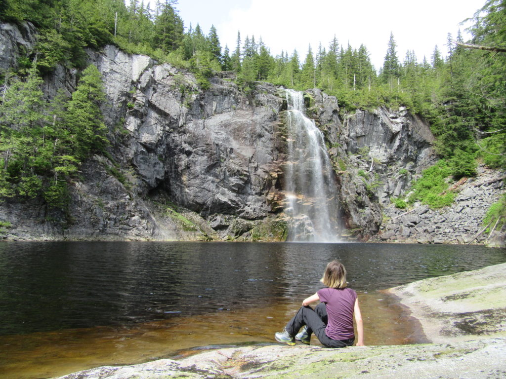
Quick Facts: Location: Mountain Loop Highway near Granite Falls Land Agency: Washington Department of Natural Resources Roundtrip: 8.8 miles Elevation gain: 1,200 feet Green Trails Map: Mountain Loop HIghway 111SX Contact: Northwest Region Ranger District WA DNR (360) 856-3500 Notes: Discover Pass required; trail beyond Ashland Lakes sees little maintenance, is extremely difficult and not…
Read MoreColumbia Mountain─Historic peak overflows with autumn colors
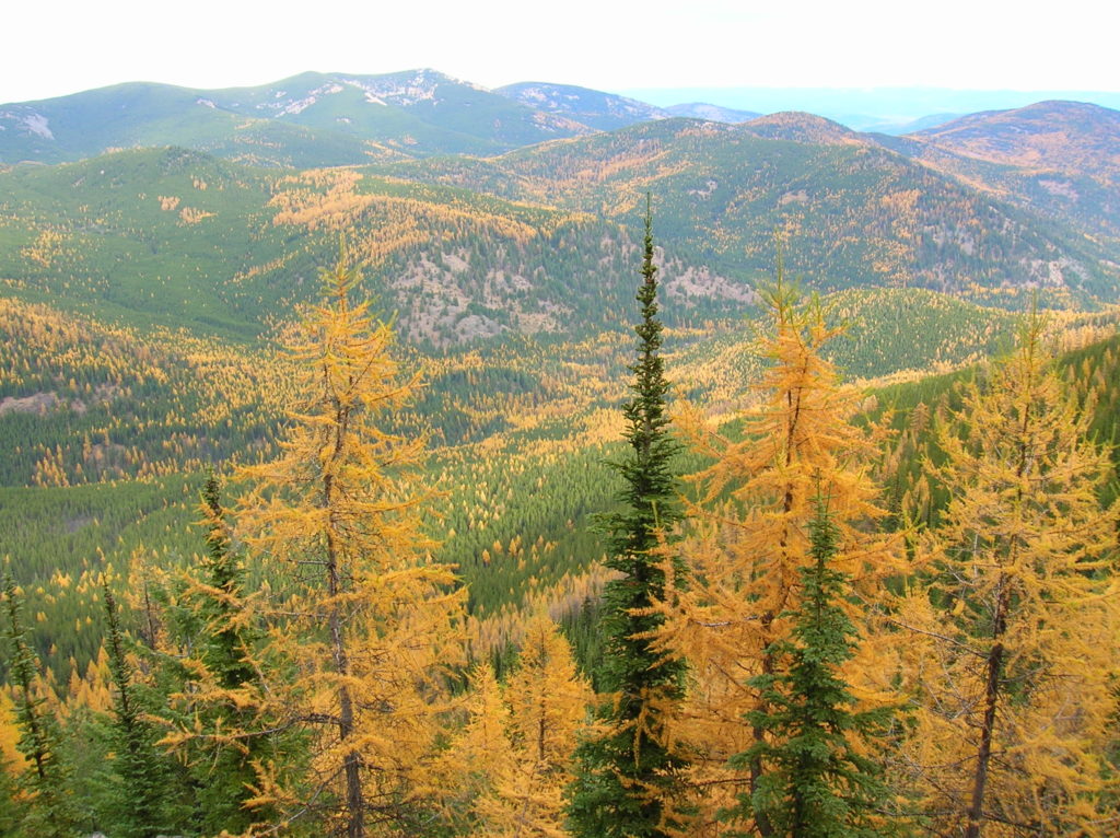
Quick Facts: Location: Kettle River Range, Sherman Pass Land Agency: Colville National Forest Roundtrip: 8.0 miles Elevation Gain: 1,360 feet Access: From Republic travel east 17 miles on SR 20 to trailhead at Sherman Pass. From Kettle Falls, follow SR 20 for 26 west miles to Sherman Pass. Contact: Colville National Forest, Republic Ranger District Good…
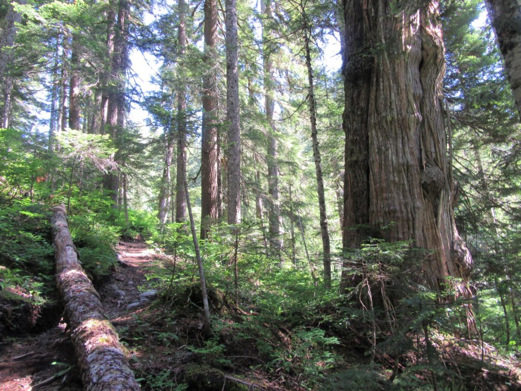
Read MorePerry Creek─Old growth, a cascade, sublime views to rugged peaks
Quick Facts: Location: Mountain Loop Highway Land Agency: National Forest Service Roundtrip: 11.4 miles Elevation Gain: 3.500 feet Green Trails Map: Mountain Loop Highway 111SX Recommended Guidebook: Day Hiking North Cascades 2nd edition (Mountaineers Books) Contact: Darrington Ranger District: Mount Baker-Snoqualmie National Forest Access: From Granite Falls follow the Mountain Loop Highway east for 27 miles…
Read MoreKelley Creek—Wild Sky gem and quiet portal to Johnson Ridge
Quick Facts: Location: Wild Sky Wilderness, Skykomish Valley Land Agency: Mount Baker-Snoqualmie National Forest Roundtrip: 8.8 miles Elevation Gain: 2,900 feet Green Trails Map: Green Trails Stevens Pass No 176, Benchmark Mtn No. 144 Recommended Guidebook: Day Hiking Central Cascades 2nd edition Contact: Skykomish Ranger District: Mount Baker Snoqualmie National Forest Notes: Northwest Forest Pass…
Read MoreWest Fork Methow River
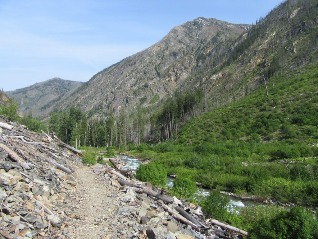
Follow a trail less traveled along a roaring waterway Quick Facts: Location: Methow Valley Round Trip: 5.0 miles Elevation Gain: 450 feet Contact: Okanogan-Wenatchee National Forest, Methow Valley Ranger District Detailed Information: Day Hiking North Cascades 2nd edition (Mountaineers Books) Notes: Northwest Forest Pass or Interagency Pass required; watch for rattlesnakes Green Trails Map: Methow…
Read MorePyramid Lake–A puny lake, but monumental surrounding forest
Quick Facts: Location: Ross Lake NRA, North Cascades Scenic Highway Land Agency: National Park Service Roundtrip: 4.5 miles High Point: feet Elevation gain: 1500 feet Difficulty: moderate Contact: North Cascades National Park Green Trails Map: North Cascades Ross Lake 16SX Notes: Dogs permitted on leash. Access: From Marblemount follow the North Cascades Highway (SR 20) east for 21 miles to trailhead located…
Read More