Trail Less Taken
Mount Wells– Victoria area summit gushes with flowers and views

Quick Facts: Location: Victoria—Langford, BC Land Agency: Capital Regional District Parks Roundtrip: 2.0 miles/ 3.2 km Elevation gain: 865 feet/ 264 m Maps: CRDP site Contact: Capital Regional District Parks Notes: dogs permitted on leash; please stay on trail to protect rare plants Access: From Victoria, follow Trans-Canada Highway 10.5 for miles (17 km) exiting…
Read MoreJuniper Dunes Wilderness –A wilderness “sans” trails
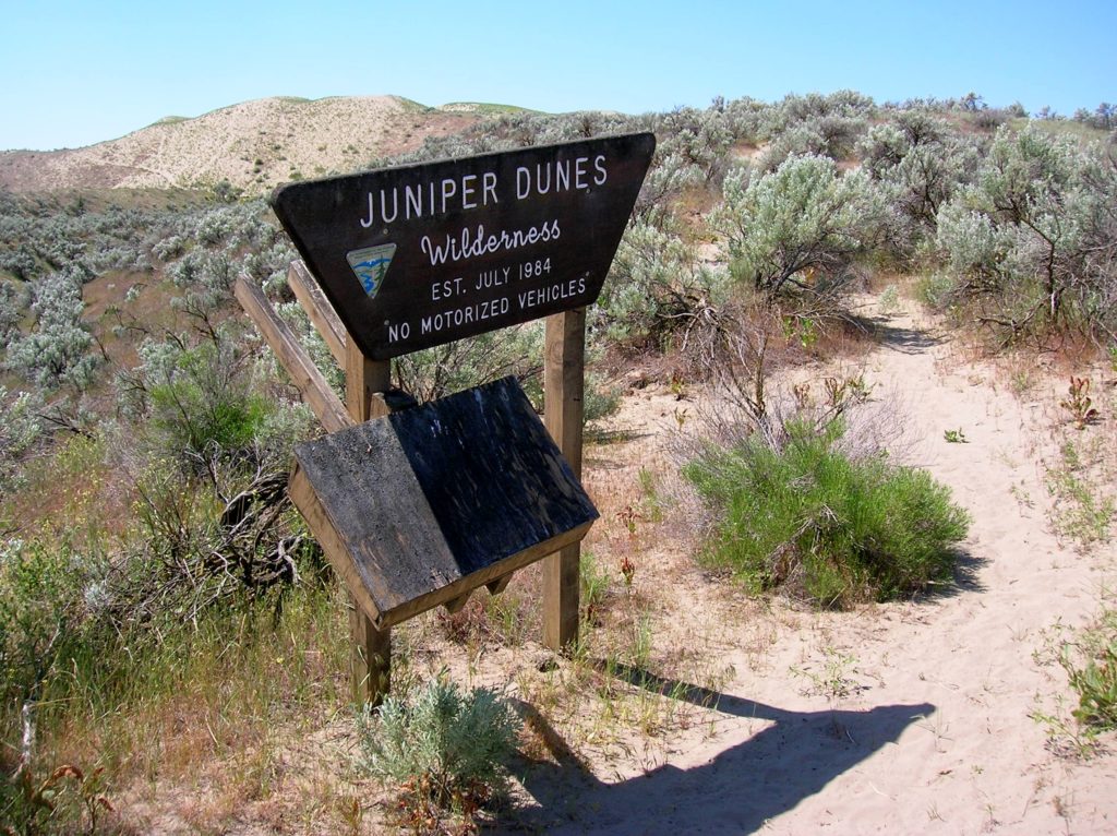
Quick Facts Location: Franklin County, Eastern Washington Land Agency: Bureau of Land Management Roundtrip: 2.0 miles Elevation gain: 200 feet Difficulty: Moderate Contact: Bureau of Land Management (BLM) Spokane Office Notes: All approaches to this wilderness area are currently via private roads and land. The southern approach cannot be recommended due to poor roads and changing…
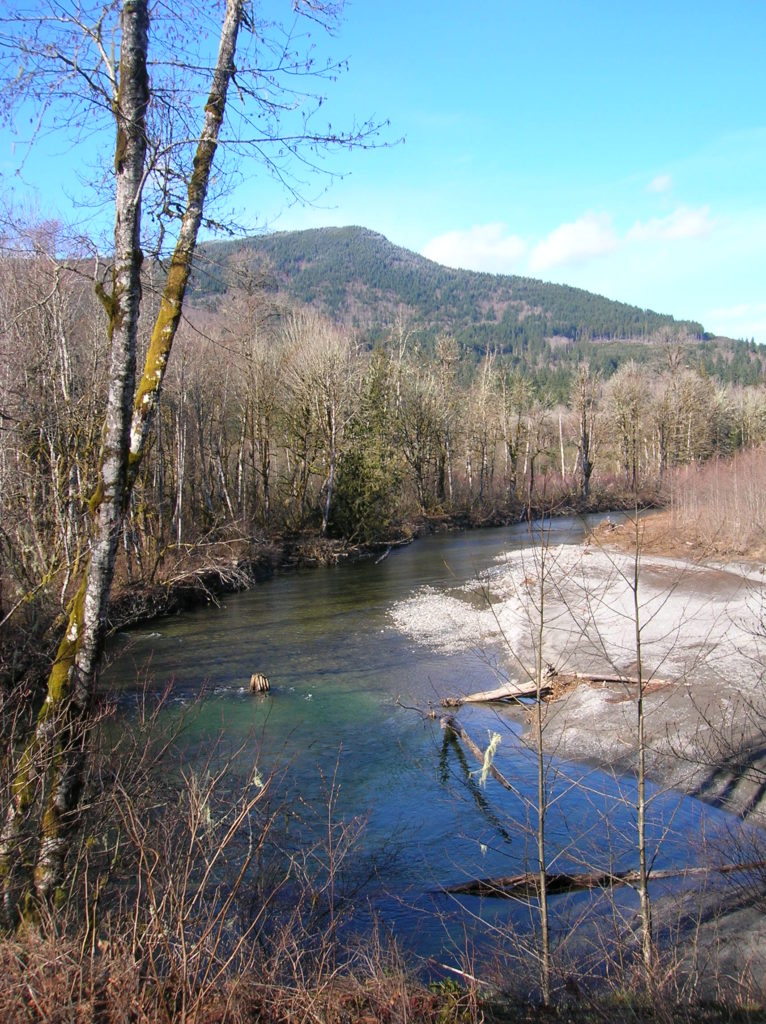
Read MoreFletcher Canyon– Explore a rugged rift in the Quinault Ridge
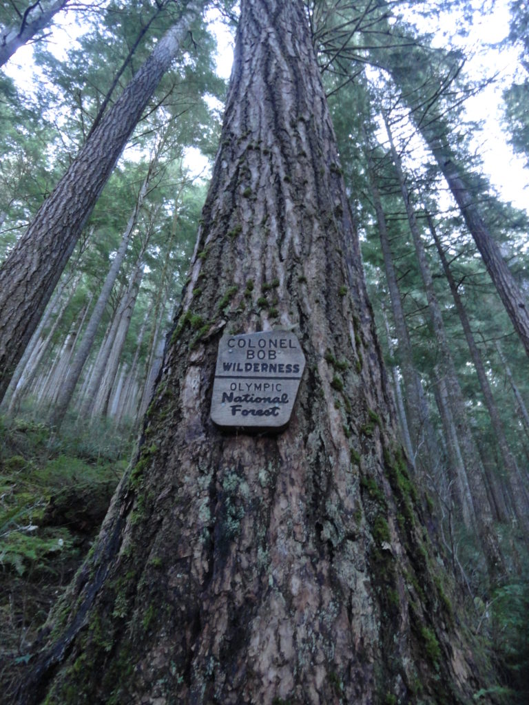
Quick Facts: Location: Colonel Bob Wilderness Land Agency: Olympic National Forest Roundtrip: 3.8 miles Elevation Gain: 1100 feet Contact: Olympic National Forest, Pacific Ranger District, Quinault Green Trails Map: Mt Christie No. 166 Recommended Guidebook: Day Hiking Olympic Peninsula 2nd edition (Mountaineers Books) Access: From Hoquiam, travel north on US 101 for 38 miles turning right onto South…
Read MoreBlythe and Chukar Lakes─Birds and beauty in the Channeled Scablands
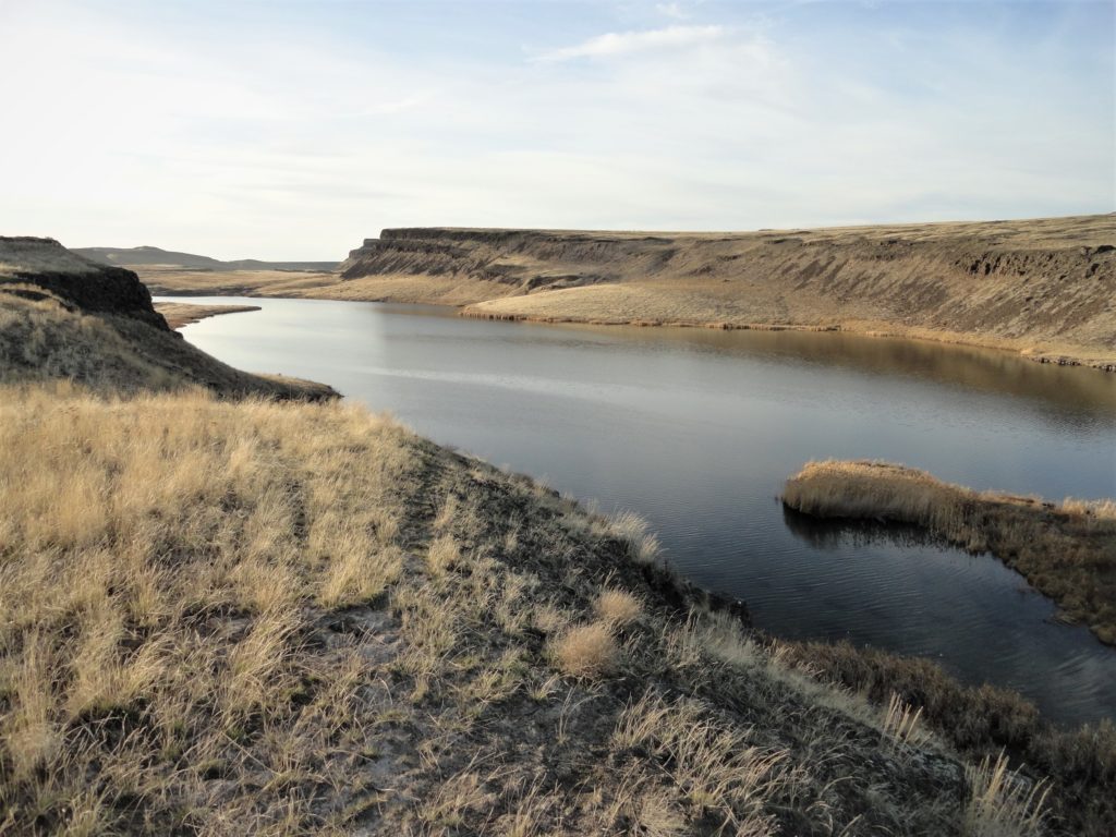
Location: Columbia National Wildlife Refuge, Grant County Land Agency: U.S. Department of the Interior Contact: Columbia National Wildlife Refuge Roundtrip: 3.0 miles Elevation Gain: 300 feet Note: Dogs permitted on leash. Be snake and tick aware Good to know: dog-friendly, kid-friendly, spring wildflowers, exceptional birdwatching, snow-free hike Access: From Spokane, take I-90 west to Exit 179…
Read MoreOaks to Wetlands Trail─ A slough of birds and delights along the Columbia River
Quick Facts: Location: Ridgefield National Wildlife Refuge, Clark County Land Agency: U.S. Fish and Wildlife Roundtrip: 2.0 miles Elevation Gain: 75 feet Contact: Ridgefield National Wildlife Refuge Notes: Dogs prohibited. Recommended Guidebook: Urban Trails Vancouver WA (Mountaineers Books) Access: From Exit 14 on I-5 head west 3.0 miles on SR 501 (Pioneer Street) to its…
Read MoreWhitehorse Trail East–Hike along the North Fork Stilly
Quick Facts: Location: SR 530 Darrington Land Agency: Snohomish County Parks Roundtrip: 14 miles Elevation gain: 160 feet Difficulty: Easy Contact: Snohomish County Parks Green Trails Map: Mountain Loop Highway no. 111SX Recommended Guidebook: Day Hiking North Cascades (Mountaineers Books) Notes: Dogs allowed on leash Access: Take exit 208 off of I-5 and drive 25 miles east…
Read MoreLanham Lake—Sublime snowshoeing above Stevens Pass
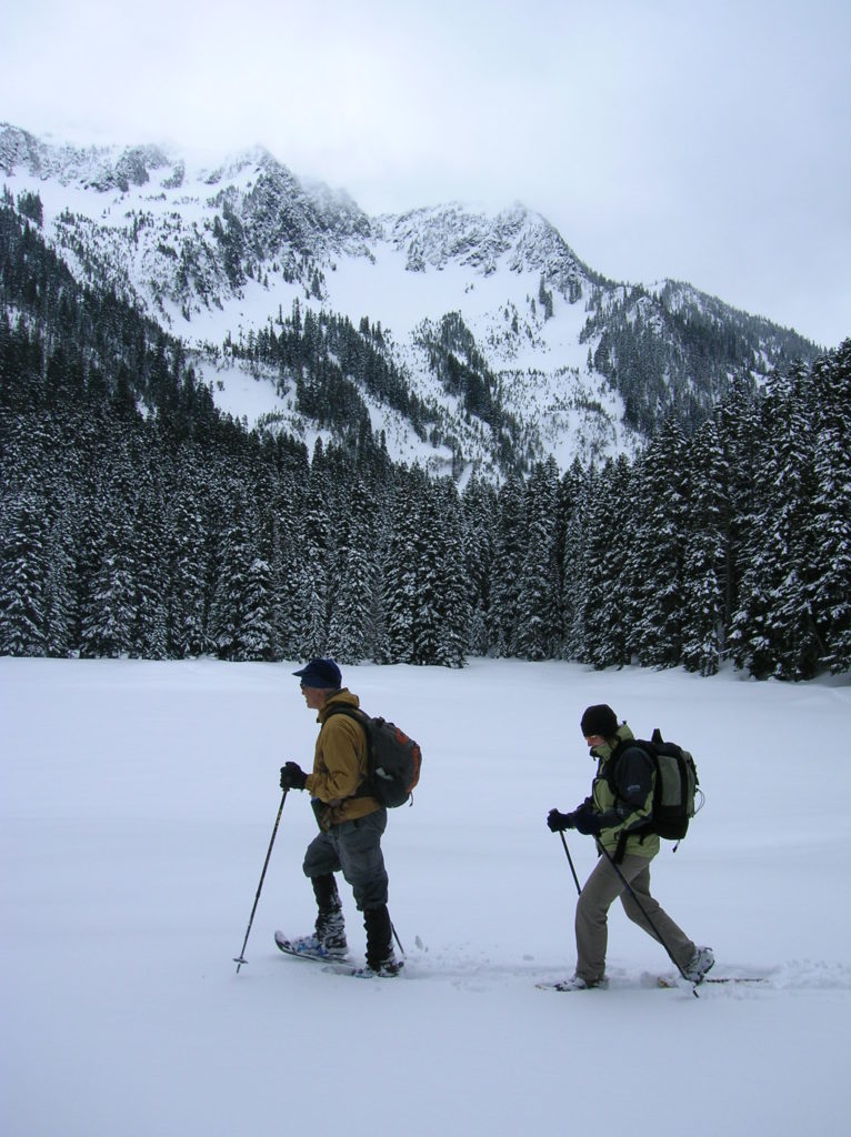
Quick Facts: Location: Stevens Pass Land Agency: Okanogan-Wenatchee National Forest Roundtrip: 3.2 miles Elevation Gain: 1,140 feet Green Trails Map: Alpine Lakes-Stevens Pass WA No. 176S Special Note: Slight avalanche concern. Contact: Okanogan-Wenatchee National Forest Access: From Everett head east on US 2 to Stevens Pass. Continue east for another 5.8 miles turning right into the…
Read MoreGreen to Cedar Rivers Trail
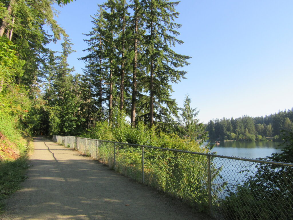
Walk across Maple Valley through a “wilderness” park Quick Facts: Location: Maple Valley, WA Distance: 3.3 miles one way Contact: King County Parks Elevation Gain: 250 feet Notes: Dogs permitted on leash Trailhead directions: From Seattle follow I-5 to I-405 and take Exit 4 in Renton. Then drive SR 169 south for 11.3 miles turning…
Read MoreHeart O' the Forest Trail─Peaceful path in the shadow of Hurricane Ridge
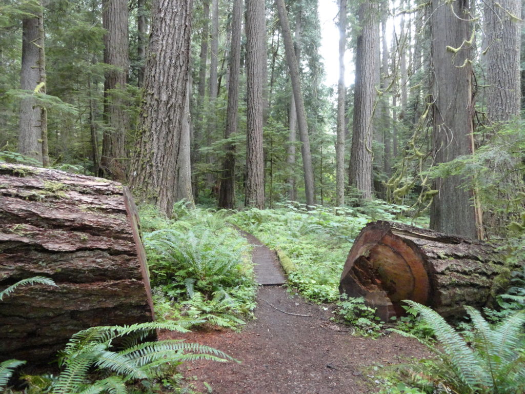
Quick Facts: Location: Heart O’ the Hills Campground Land Agency: Olympic National Park Roundtrip: 4.6 miles Elevation Gain: 550 feet Notes: Dogs prohibited, National Park Entry fee. Green Trails Map: Elwha North/ Hurricane Ridge No-134S Access: From Olympic National Park Visitors Center in Port Angeles, follow Hurricane Ridge Road (aka Heart O’ the Hills Parkway) south. Continue 5.4 miles turning left into…
Read MoreMount Finlayson─This spoil of war now offers peaceful wandering
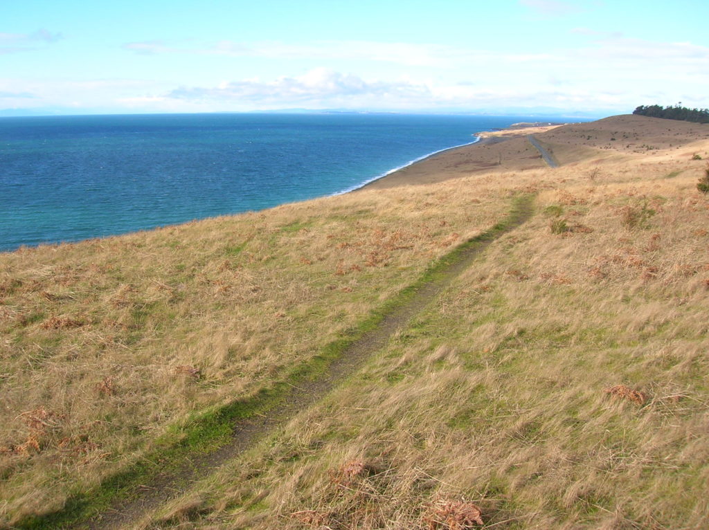
Quick Facts Location: San Juan Island Land Agency: National Park Service Roundtrip: 3.5 miles Elevation Gain: 290 feet Contact: San Juan Island National Historic Park Notes: Dogs must be leashed. Access: Take Washington State Ferry from Anacortes to Friday Harbor on San Juan Island. Follow Spring Street for .5 mile through town turning left onto…
Read More