Trail Less Taken
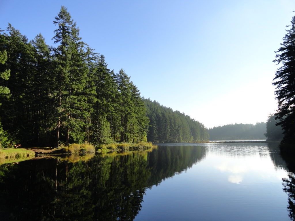
Fortson Ponds –An old mill site on an emerging long distance trail
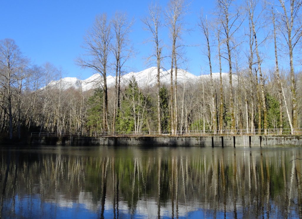
Quick Facts: Location: Darrington Land Agency: Snohomish County Parks Roundtrip: 2.0 miles Elevation gain: none Difficulty: Easy Contact: Snohomish County Parks Green Trails Map: Mountain Loop Highway 111SX Notes: Dogs allowed on leash Access: From Exit 208 on I-5 (Arlington) travel east on SR 530 for 25.2 miles turning left onto Fortson Mill Road (near…
Read MoreAnderson Point County Park
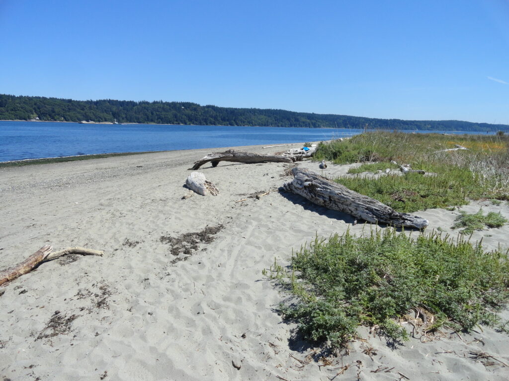
Short hike to one of the finest beaches on the Kitsap Peninsula Quick Facts: Location: Kitsap Peninsula Distance: 1.4 miles roundtrip Elevation Gain: 250 feet Contact: Kitsap County Parks Recommended Guidebook: Urban Trails Kitsap (Mountaineers Books) Notes: dogs permitted on leash; Park open from 6:00 am to 8:30 pm; do not park along Millihanna Road…
Read MoreDugualla State Park
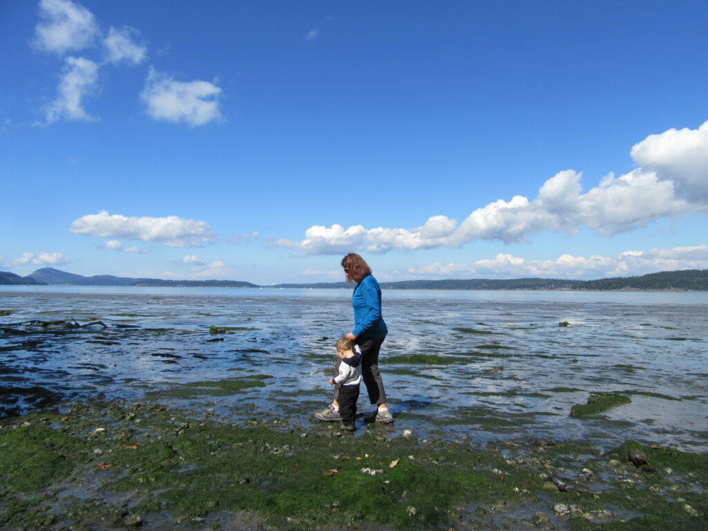
Quiet ambling on Skagit Bay Quick Facts: Location: Whidbey Island Distance: more than 5.0 miles of trails Elevation Gain: up to 500 feet Contact: Washington State Parks Recommended Guidebook: Urban Trails Everett (Mountaineers Books) Notes: Discover Pass required; dogs permitted on leash Trailhead directions: From Oak Harbor, follow State Route 20 for 4.0 miles and…
Read MoreTurtlehead — It’s one shell of a view from this Turtleback Mountain summit
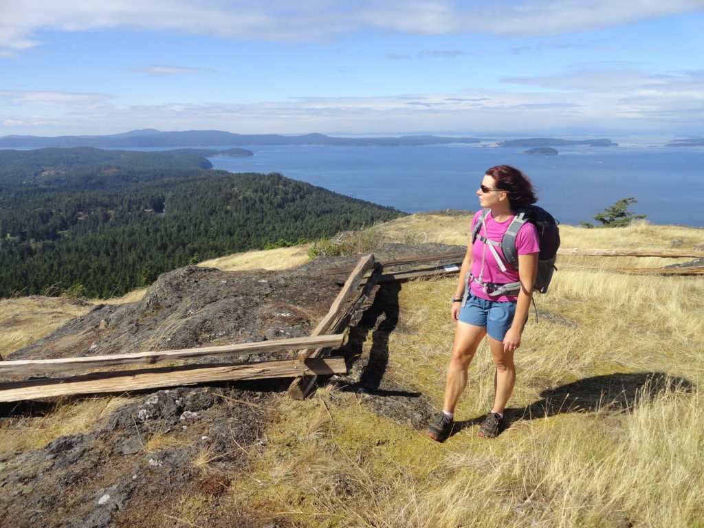
Quick Facts: Location: Orcas Island, San Juan Islands Land Agency: San Juan County Land Bank Roundtrip: 5.6 miles Elevation Gain: 1295 feet Contact: San Juan County Land Bank Notes: Dogs permitted on leash; trail (partial) open to bikes (even days) and horses (odd days) Access: Take Washington State Ferry from Anacortes to Orcas Island. Then head…
Read MoreLittle Cranberry Lake — A perfect complement hike to your Thanksgiving Day celebration
Quick Facts: Location: Anacortes-Fidalgo Island Land Agency: Anacortes Community Forest Lands Roundtrip: 1.9 miles Elevation Gain: 100 feet Access: From Exit 230 on I-5 in Burlington, head west on SR 20 to junction with SR 20-Spur. Continue right on SR 20-Spur to Anacortes. At traffic light near old town, continue left on 12th Street (still SR 20-Spur and12th Street…
Read MoreRobe Canyon─Follow a silenced railroad into a thundering chasm
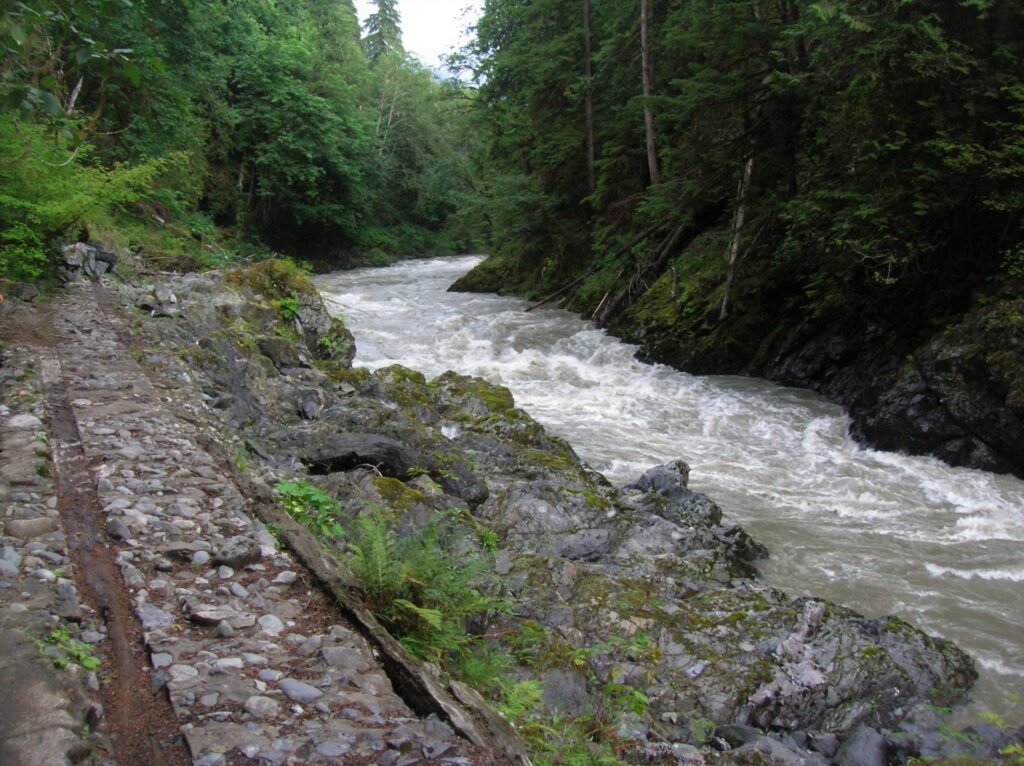
Quick Facts: Location: Mountain Loop Highway near Granite Falls Land Agency: Snohomish County Parks Roundtrip: 2.4 miles Elevation Gain: 300 feet Green trails Map: Mountain Loop Highway 111SX Access: From Granite Falls follow the Mountain Loop Highway east for 7.0 miles to trailhead located on your right, directly across from Forest Road 41. Park on…
Read MoreBarlow Point–Little known lookout site on Mountain Loop Highway
Location: Mountain Loop Highway near Granite Falls Land Agency: Mount Baker-Snoqualmie National Forest Roundtrip: 2.5 miles High Point: 3,222 feet Elevation gain: 850 feet Difficulty: moderate Green Trails Maps: Mountain Loop Highway 111SX Contact: Darrington Ranger District: Mount Baker Snoqualmie National Forest Note: Northwest Forest Pass or Inter-agency Pass required Access: From Granite Falls, follow…
Read MoreBoulder Lake—trail to this Sultan Basin Lake once again open!
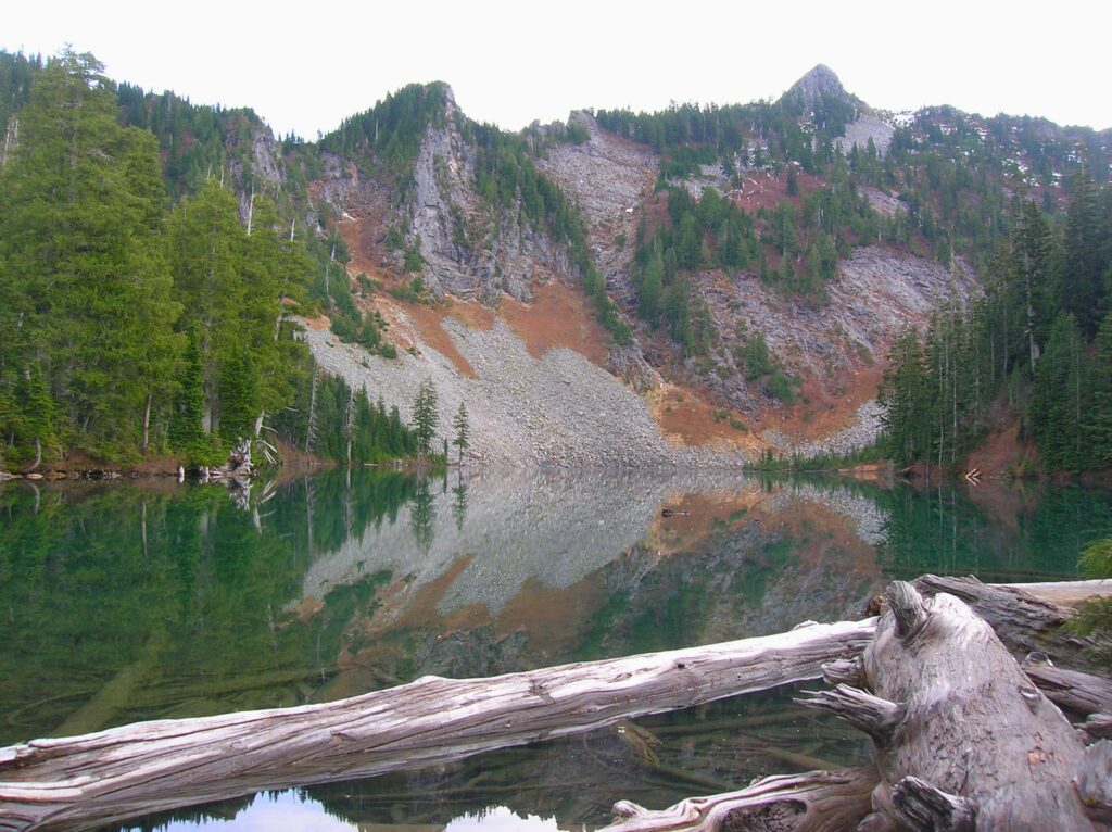
Quick Facts: Location: Sultan Basin Land Agency: Washington Department of Natural Resources Roundtrip: 13.8 miles Elevation Gain: 2,140 feet Green Trails Map: Index WA- No. 142 Notes: Dogs must be on leash; All hikers are required to stop and register (no fee) at kiosk at Olney Pass upon entering Sultan Basin Watershed. Access: From Everett…
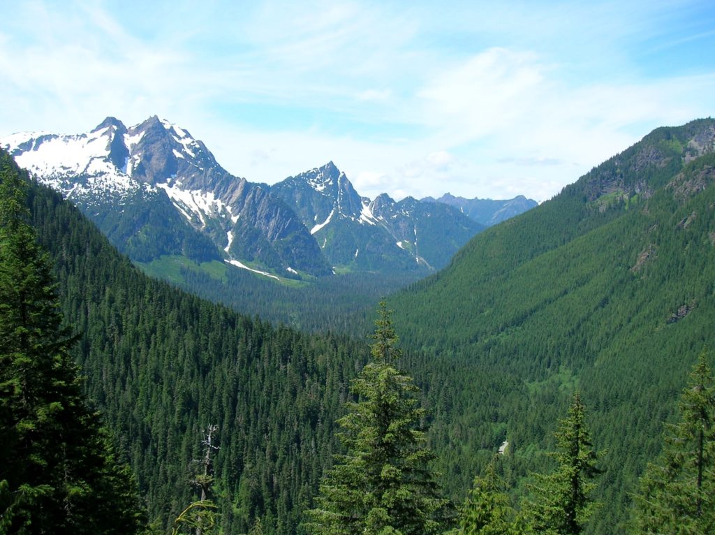
Read MoreMartin Lake–Heart of the Golden Lakes
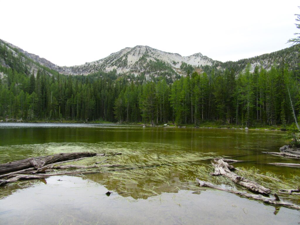
Quick Facts: Location: Methow Valley, WA Distance: 13.4 miles round trip Elevation Gain: 2300 feet Contact: Okanogan-Wenatchee National Forest, Methow Valley Ranger District Maps: Green Trails Methow Valley 51SX Recommended Guidebook: Day Hiking North Cascades (Mountaineers Books) Notes: trail open to motorcycles Trailhead directions: From Twisp drive south on SR 153 and turn right onto…
Read MoreSwauk Forest Discovery Trail—Golden forest beneath the Diamond Head
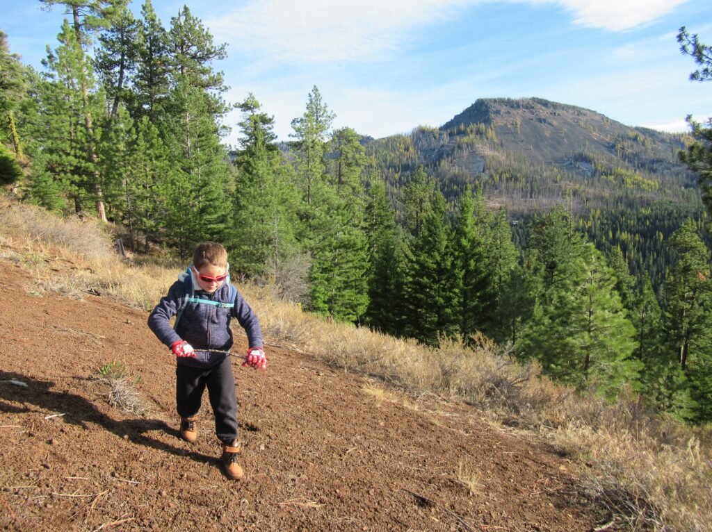
Quick Facts: Location: Blewett Pass Land Agency: National Forest Service Roundtrip: 2.8 miles Elevation Gain: 400 feet Green Trails Map: Wenatchee/ Mission Ridge, WA- No 211S Contact: Cle Elum Ranger District: Okanogan-Wenatchee National Forest Access: From Cle Elum follow WA 970 east for 7.0 miles to US 97. Continue north on US 97 for 14.0…
Read More