Snohomish County
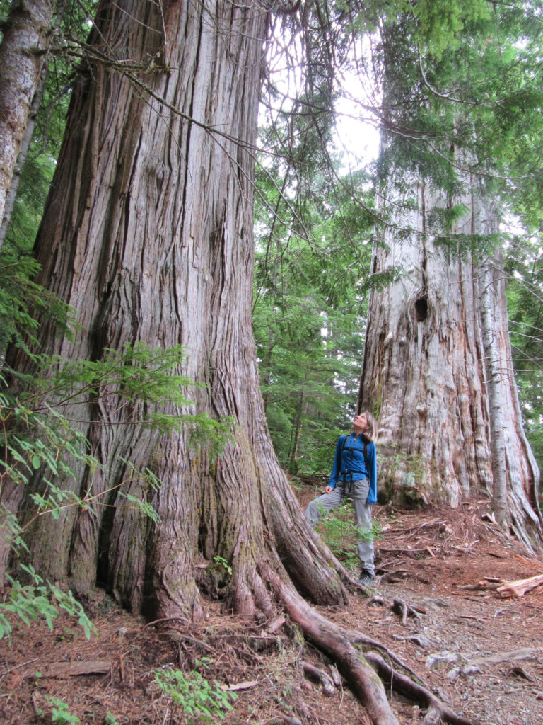
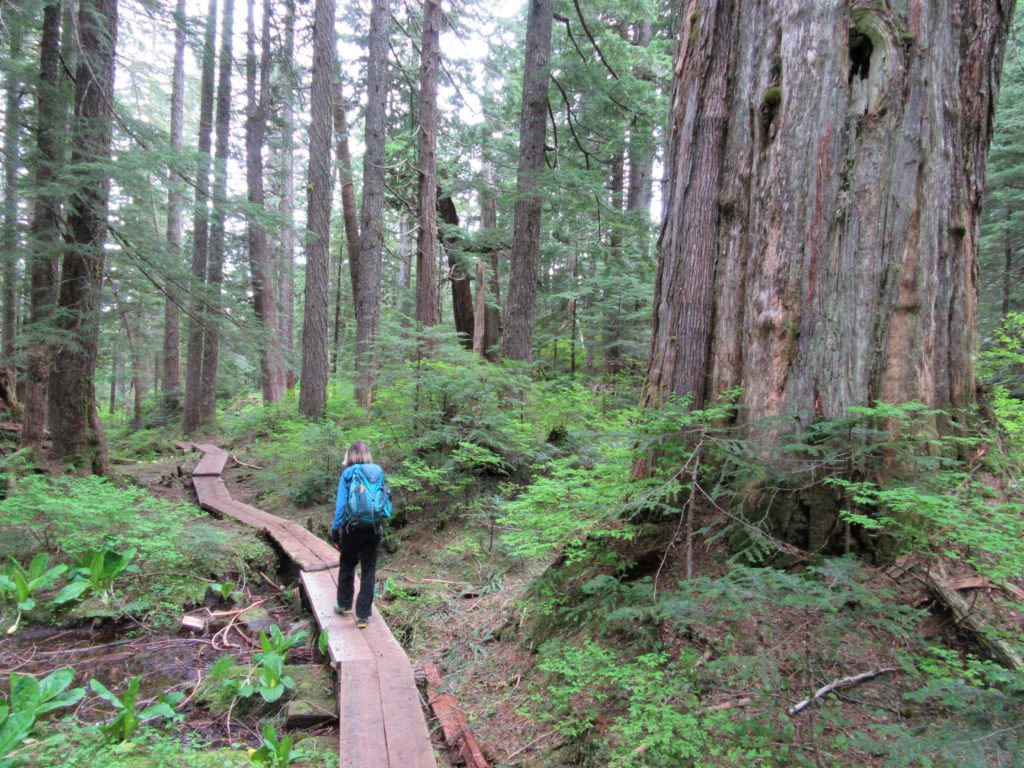
Bald Eagle Peak — Old-growth, stunning views, and solitude
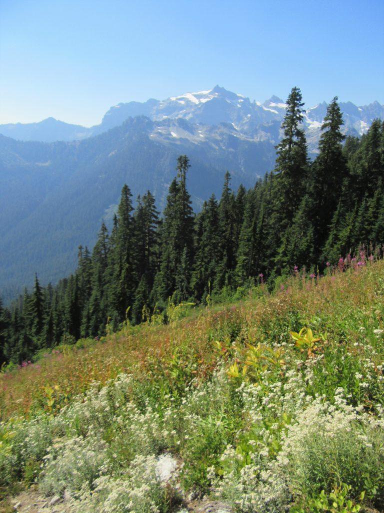
Quick Facts: Location: Henry M Jackson Wilderness Land Agency: National Forest Service Round Trip: 13.0 miles Elevation Gain: 2800 feet Contact: Darrington Ranger District, Mount Baker-Snoqualmie National Forest Green Trails Maps: Mountain Loop Highway 111SX Notes: FR 49 is rough in spot requiring a high clearance vehicle; Northwest Forest pass required; dog-friendly, exceptional old-growth, wilderness regulations…
Read MorePinnacle Lake — Pretty little lake perched on a shoulder of Mount Pilchuck
Quick Facts: Location: Mountain Loop Highway, near Granite Falls Land Agency: Mount Baker-Snoqualmie National Forest; Washington State Parks Roundtrip: 4.2 miles Elevation gain: 1,100 feet Green Trails Maps: Mountain Loop Highway 111SX Contact: Darrington Ranger District: Mount Baker-Snoqualmie National Forest Notes: access road is rough, high clearance vehicles recommended. Access: From Granite Falls follow the…
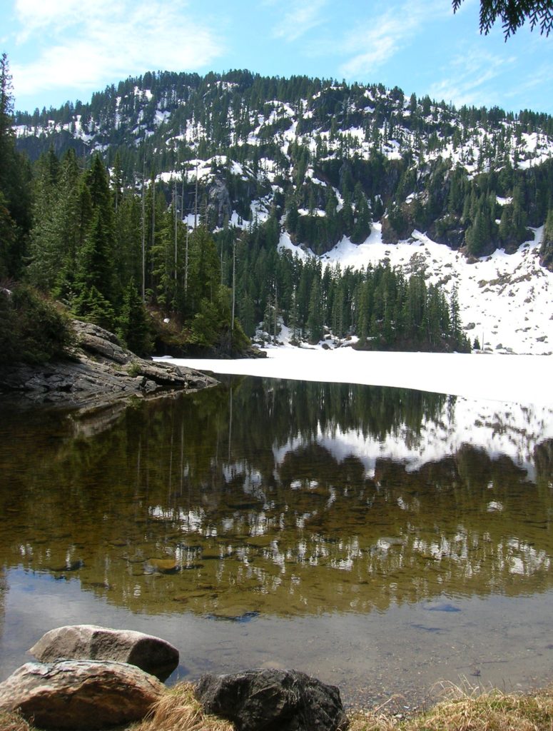
Read MoreTwin Lakes (Monte Cristo) — Follow a rugged old miner’s path to a remote basin
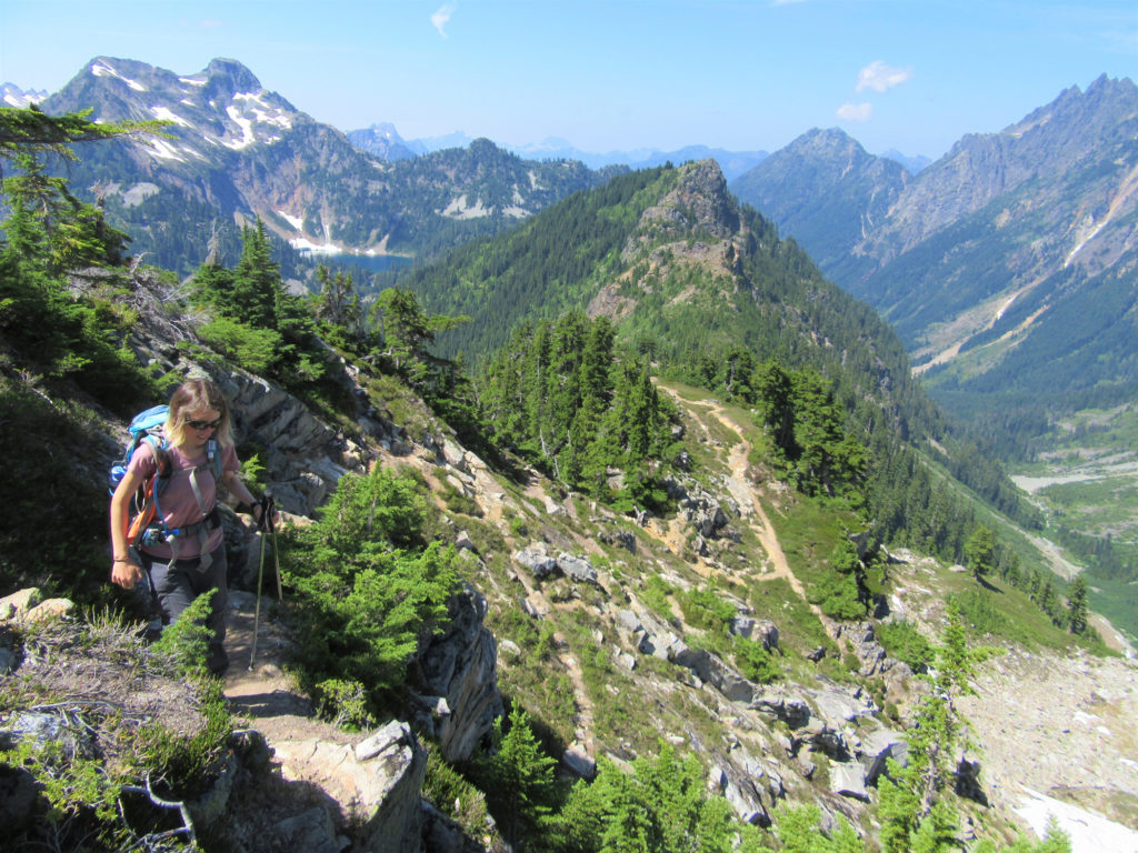
Quick Facts: Location: Mountain Loop Highway near Barlow Pass Land Agency: Mount Baker-Snoqualmie National Forest Roundtrip: 17.0 miles Elevation gain: 3,900 feet Green Trails Map: Mountain Loop Highway no. 111SX Contact: Darrington Ranger District: Mount Baker Snoqualmie National Forest Notes: Northwest Forest Pass or Interagency Pass required; A washout at the Twin Bridges requires…
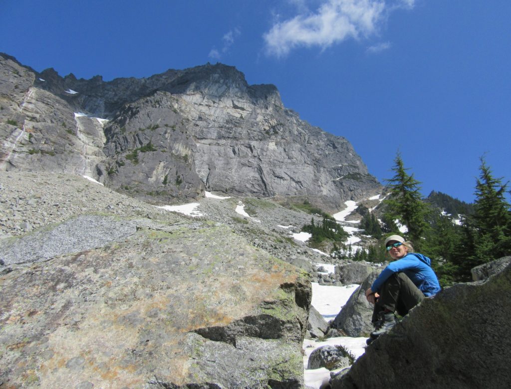
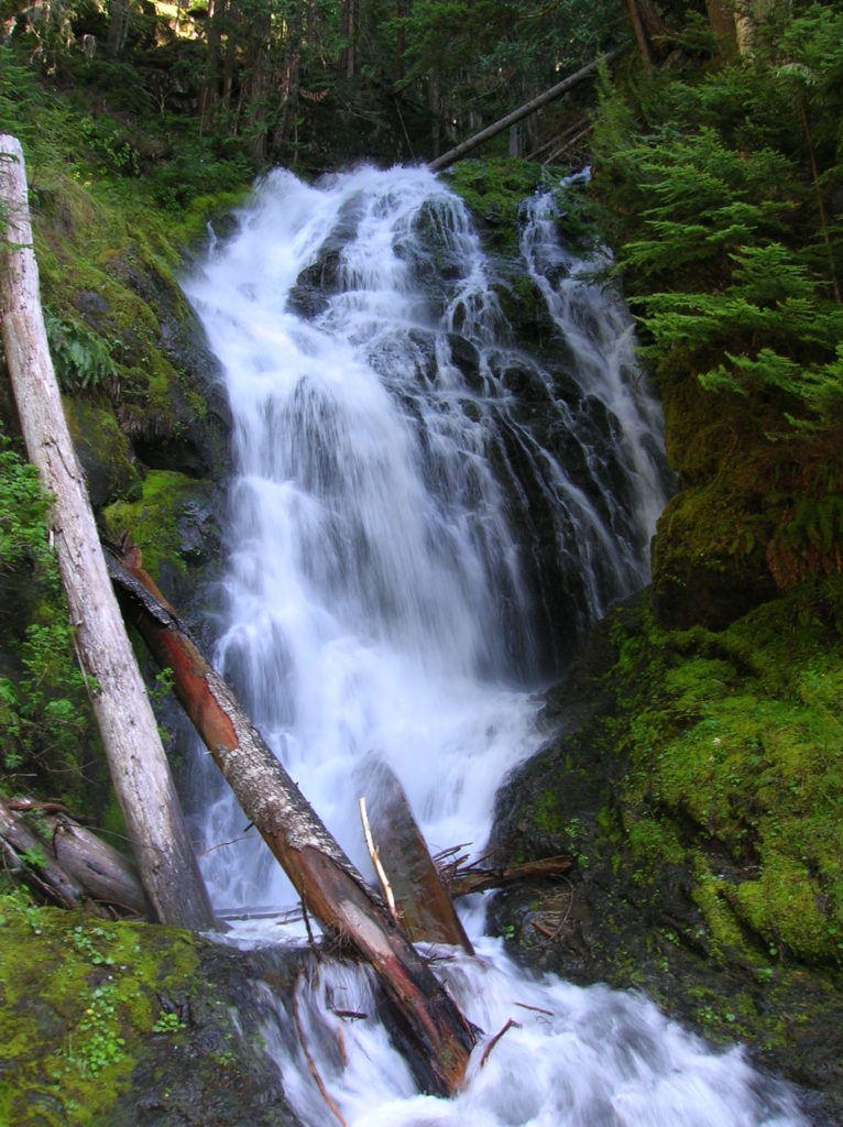
Read MoreSilver Lake─Precious body of water above old mining district

Quick Facts: Location: Mountain Loop Highway near Granite Falls Land Agency: Mount Baker-Snoqualmie National Forest Roundtrip: 13.0 miles Elevation Gain: 2,100 feet Green Trails Map: Mountain Loop Highway 111SX Access: From Granite Falls, follow the Mountain Loop Highway east for 31 miles to Barlow Pass. Hike begins by walking up gated Monte Cristo Road. Note: Northwest…
Read MoreBedal Basin–Lonesome and beautiful basin beneath awe-inspiring Sloan Peak
Location: Mountain Loop Highway Land Agency: Mount Baker-Snoqualmie National Forest Roundtrip: 5.2 miles High Point: 4,650 feet Elevation gain: 1,900 feet Difficulty: challenging Green Trails Maps: Mountain Loop Highway No. 111SX Contact: Darrington Ranger District: Mount Baker Snoqualmie National Forest Access: Take Exit 208 off of I-5 following SR 530 east for 32 miles to Darrington.…
Read MoreChokwich Trail─Chock full of solitude
Quick Facts: Location: Mountain Loop Highway near Darrington Land Agency: Mount Baker-Snoqualmie National Forest Roundtrip: 7.0 miles Elevation Gain: 900 feet Green Trails Map: Mountain Loop Highway no.111SX Note: NW Forest Pass required Access: From Granite Falls follow the Mountain Loop Highway east for 31 miles to Barlow Pass and end of pavement. Continue for 3.5 miles turning…
Read MoreAshland Lakes─old growth forest serenity
Quick Facts: Location: Mountain Loop Highway Land Agency: National Forest Service Roundtrip: 5.5 miles Elevation Gain: 800 feet Green Trails Map: Mountain Loop Highway no. 111SX Contact: Darrington Ranger District: Mount Baker- Snoqualmie National Forest Access: From Granite Falls follow the Mountain Loop Highway east to the Verlot Visitors Center. Proceed for 4.6 more miles turning…
Read MoreLake Evan and Boardman Lake–Enjoy an easy hike to two family friendly lakes
Quick Facts: Location: Mountain Loop Highway near Granite Falls Land Agency: Mount Baker-Snoqualmie National Forest Roundtrip: 2.0 miles Elevation gain: 300 feet Difficulty: easy (with some rough footing) Green Trails Map: Mountain Loop Highway 111SX Contact: Darrington Ranger District: Mount Baker-Snoqualmie National Forest Access: From Granite Falls, follow the Mountain Loop Highway east to the Verlot…
Read MoreLangus Waterfront Trail─A slough of surprises await just minutes from downtown Everett
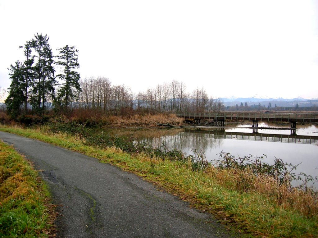
Quick Facts Location: City of Everett Land Agency: Everett Parks and Recreation Department Roundtrip: 4.0 miles Elevation Gain: None Access: From Everett, take Exit 195 off of I-5 turning left onto East Grand Ave. In 0.5 mile bear right onto East Marine View Drive and follow for 1.0 mile to SR 529. Continue north on SR…
Read MoreRiver View Quarry Trail─Trail along the Snohomish River is a cut above
Quick Facts: Location: Lord Hill Regional Park Land Agency: Snohomish County Parks Roundtrip: 2.0 miles Elevation Gain: 275 feet Access: From Monroe, exit SR 522 onto Main Street heading west and immediately coming to a roundabout. Bear right onto Tester Road and proceed 3.0 miles to a T-intersection just after passing under SR 522. Turn left and proceed to South…
Read More