Oregon
Horse Creek Trail–Trot through towering coastal old-growth forest
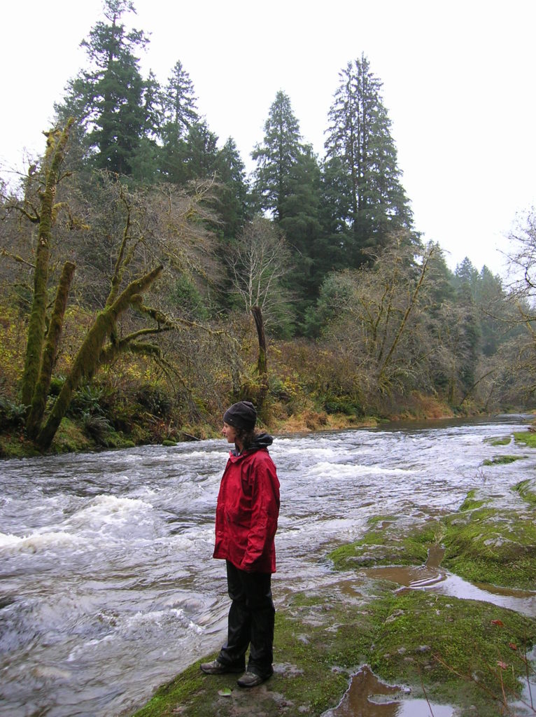
Quick Facts: Location: Drift Creek Wilderness, Siuslaw National Forest Land Agency: National Forest Service Roundtrip: 7.2 miles Map: Online from Forest Service Elevation gain: 1,400 feet Difficulty: moderate Contact: Central Coast Ranger District (Waldport), Siuslaw National Forest Notes: Drift Creek Wilderness is south of Newport. Do not confuse with popular Drift Creek Falls near Lincoln…
Read MoreTomlike Mountain–There’s much to like about this Columbia River Gorge peak
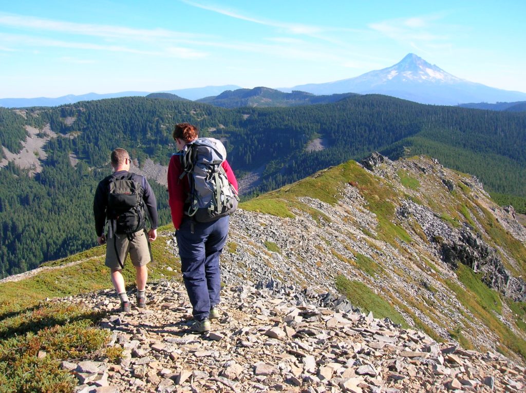
Quick Facts: Location: Mark Hatfield Wilderness, Columbia River Gorge, Oregon Land Agency: Mount Hood National Forest Roundtrip: 6.0 miles Elevation gain: 1,300 feet Green Trails Map: Columbia River Gorge -West No 428S Contact: Mount Hood National Forest, Hood River Ranger Station Notes: Northwest Forest Pass or Inter-agency Pass Required Recommended Guidebook: Day Hiking Columbia River…
Read MoreMount Pisgah–Hike to a promising land of spectacular wildflowers
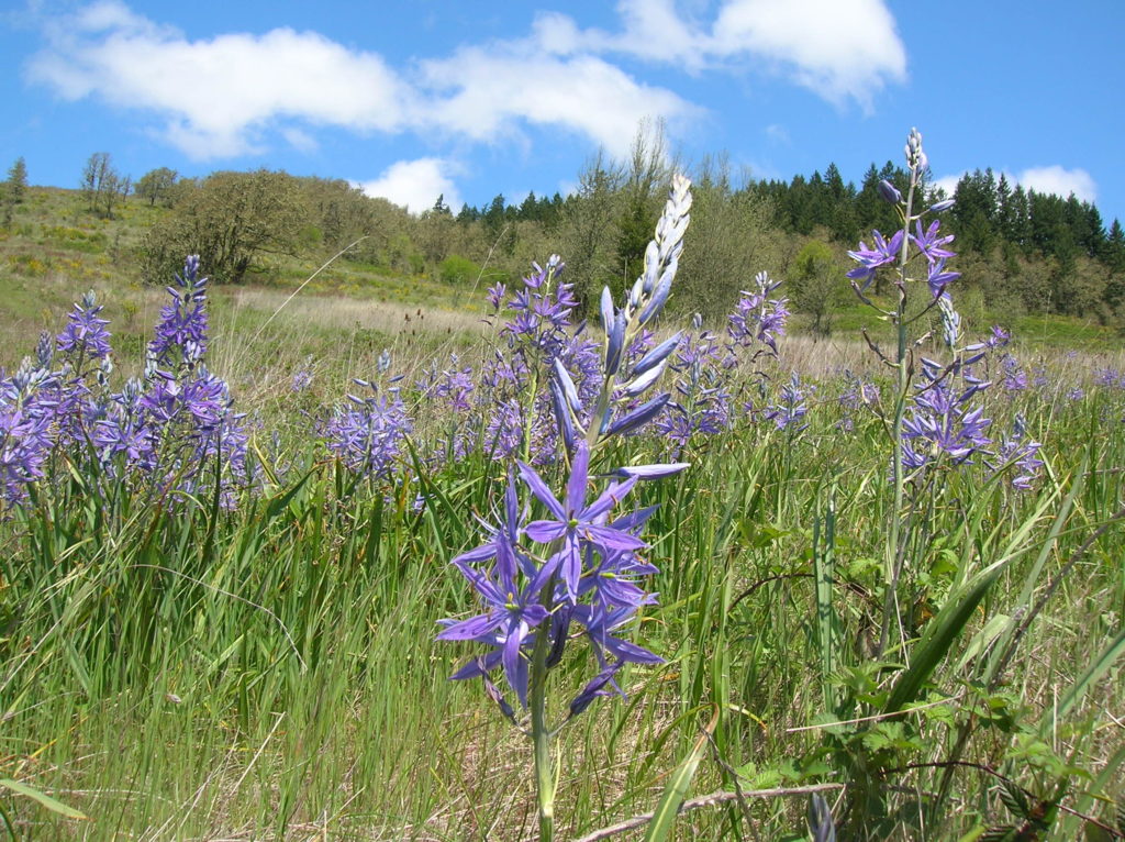
Quick Facts: Location: Willamette Valley south of Eugene Land Agency: Lane County Parks Roundtrip: 3.0 miles Elevation gain: 1,050 feet Map: Park map available online Contact: Friends of Buford Park and Mount Pisgah Notes: $5.00 day use fee; dogs must be leashed Access: From Eugene follow Franklin Blvd (Exit 189 I-5 southbound or Exit 188B northbound…
Read MoreOaks Bottom Wildlife Refuge– Portland’s Premier Wildlife Refuge
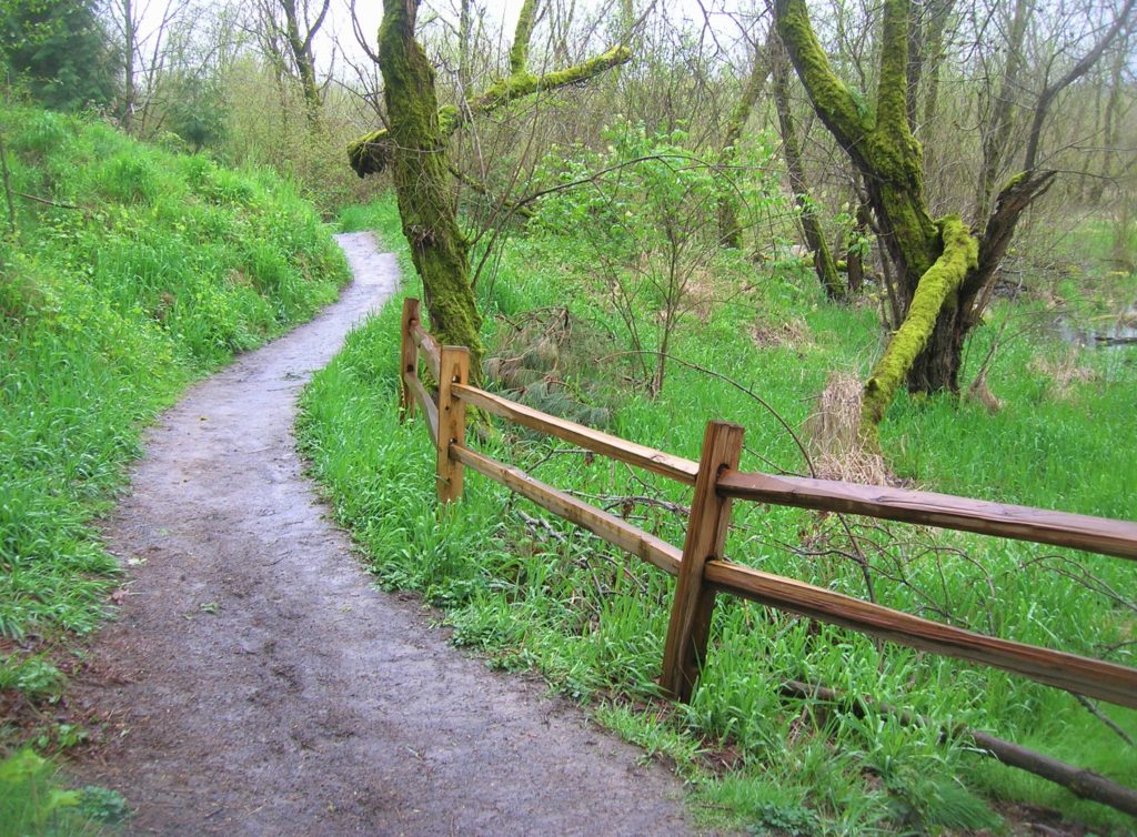
Quick Facts: Location: Sellwood neighborhood, Portland, Oregon Land Agency: Portland Parks and Recreation Roundtrip: 2.8 miles Elevation gain: 60 feet Contact: Portland Parks and Recreation Notes: dogs must be leashed Access: From Ross Island Bridge follow US 26 east (Powell Boulevard) immediately turning right onto SR 99E (SE McLoughlin Boulevard). In just over one mile exit…
Read MoreTrail of Ten Falls–Hike through a canyon of thundering cascades!
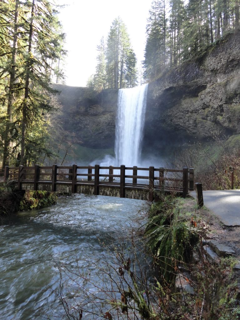
Quick Facts: Location: Silver Falls State Park near Silverton, Oregon Land Agency: Oregon State Parks Distance: 7.2 miles Elevation Gain: 600 feet Contact: Silver Falls State Park Notes: Dogs prohibited; $5.00 per vehicle entrance fee Access: From Salem, Oregon follow SR 22 east from I-5 for 5 miles to Exit 7. Then follow SR 214…
Read MoreLookout Mountain — Look out to Mount Hood and beyond
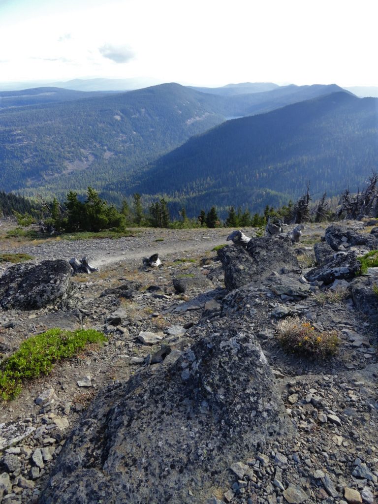
Quick Facts: Location: Badger Creek Wilderness Land Agency: National Forest Service Roundtrip: 2.5 miles Elevation Gain: 550 feet Contact: Barlow Ranger District Mount Hood National Forest Notes: Northwest Trail Pass or interagency pass required Green Trails Map: Mount Hood Climbing / Timberline Trail no. 462SX Access: From Portland: Follow I-84 east to Exit 64 in Hood River. Then…
Read MoreTom McCall Point─Legendary Columbia River Gorge Wildflower Display
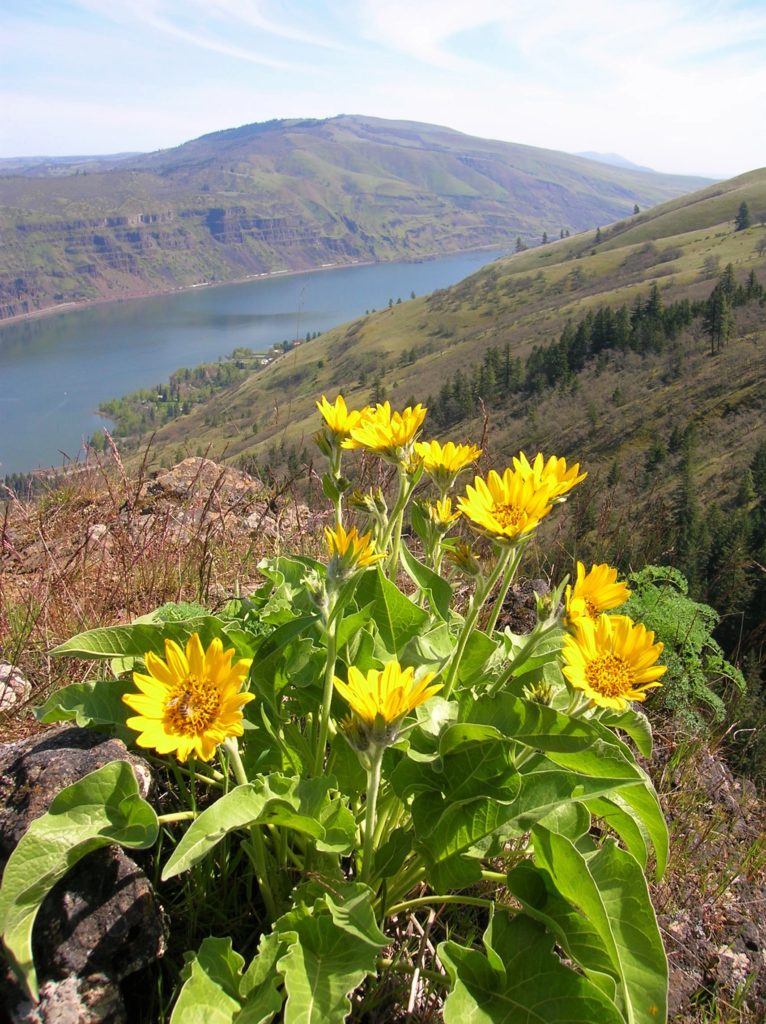
Quick Facts: Location: Columbia River Gorge National Scenic Area Land Agency: Oregon Nature Conservancy and Mayer State Roundtrip: 3.2 miles Elevation Gain: 1,000 feet Notes: Dogs prohibited; Trail closed from Nov 1 through Apr 30 to limit tread damage. Practice Leave No Trace Principles Green Trails Map: Columbia River Gorge East No. 432S Contact: Oregon…
Read MoreBalch Creek–Dramatic Ravine a Forest Park highlight
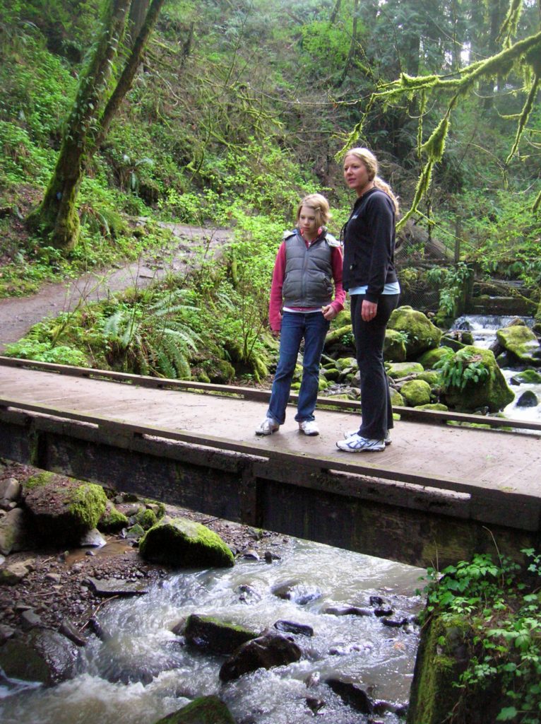
Location: Forest Park, Portland, Oregon Land Agency: Portland Parks and Recreation Roundtrip: 2.4 miles High Point: 425 feet Elevation gain: 300 feet Difficulty: easy Green Trails Map: Forest Park No 426S Contact: Contact/permits: Portland Parks and Recreation ; Forest Park Conservancy; Notes: dogs must be leashedAccess: From downtown Portland, follow NW Vaughn Street west turning…
Read More