Coast Hikes
Penrose Point State Park
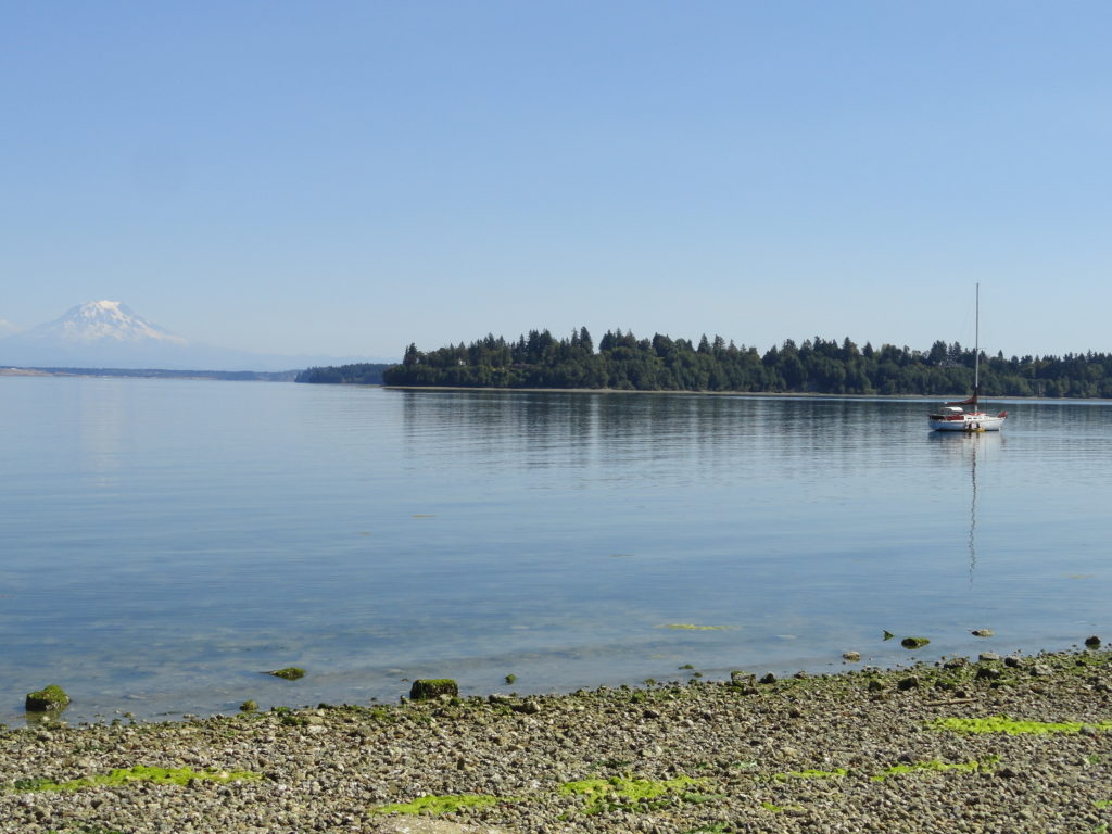
Madronas, big maples and sweeping views of Mount Rainier Quick Facts: Location: Key Peninsula Land Agency: Washington State Parks Round Trip: 2.5 miles of trails Elevation Gain: 200 feet Contact: Penrose Point State Park Detailed Information: Urban Trails Kitsap (Mountaineers Books) Notes: Discover Pass required, Dogs permitted on leash Access: From Purdy (just north of…
Read MoreCape Flattery─Hike to the northwestern most point in Washington State

Quick Facts: Location: Olympic Peninsula Coast Land Agency: Makah Nation Reservation Roundtrip: 1.5 miles Elevation Gain: 300 feet Contact: Makah Indian Nation Green Trails Map: Cape Flattery, WA- No 98S Notes: Dogs allowed on leash, Makah Recreation Pass required ($20, available at Washburn’s General Store ,the Makah Museum and several other locations in Neah Bay).…
Read MoreBeards Hollow─Just in the Nick of Time for razor clam season

Quick Facts: Location: Long Beach Peninsula, Pacific County, WA Land Agency: Washington State Parks Contact: Cape Disappointment State Park Roundtrip to Beards Hollow: 1.0 mile Elevation Gain: 50 feet Roundtrip to North Head Lighthouse: 3 miles Elevation Gain: 300 feet Access: From Ilwaco, take Loop Spur State Road 100 in either direction to Beards Hollow…
Read MoreHorse Creek Trail–Trot through towering coastal old-growth forest
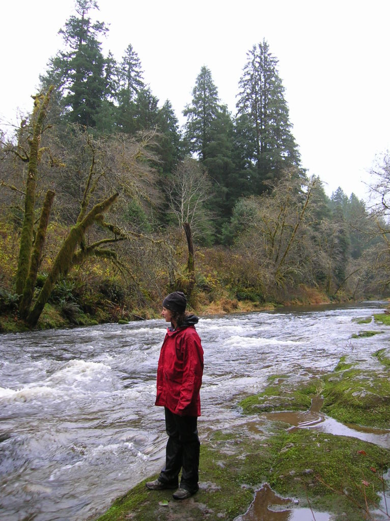
Quick Facts: Location: Drift Creek Wilderness, Siuslaw National Forest Land Agency: National Forest Service Roundtrip: 7.2 miles Map: Online from Forest Service Elevation gain: 1,400 feet Difficulty: moderate Contact: Central Coast Ranger District (Waldport), Siuslaw National Forest Notes: Drift Creek Wilderness is south of Newport. Do not confuse with popular Drift Creek Falls near Lincoln…
Read MoreNorth Head Lighthouse–Hike to a headland at the mouth of the Columbia River
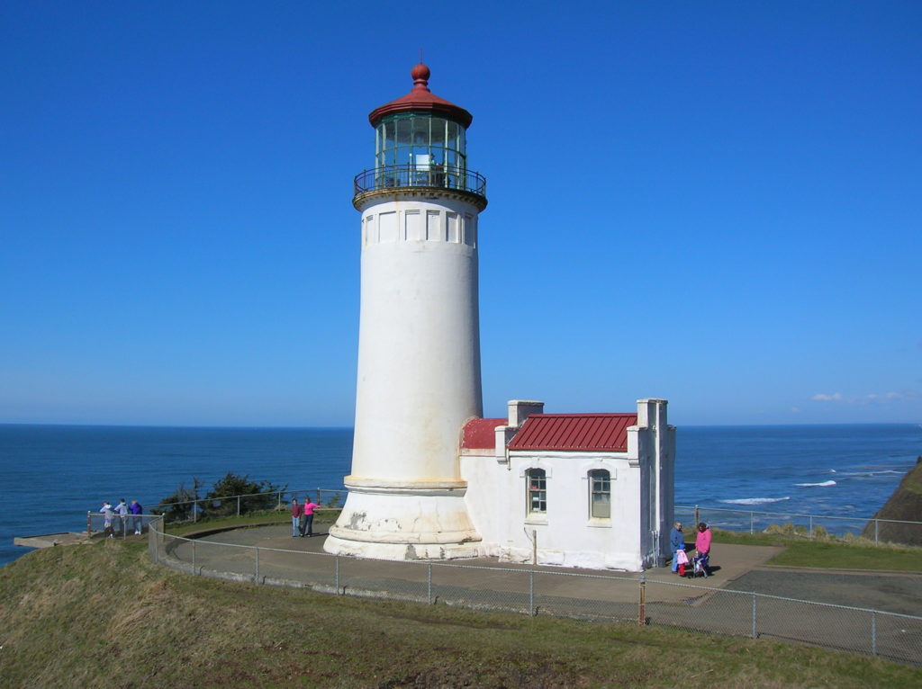
Location: Cape Disappointment State Park, Long Beach Peninsula Land Agency: Washington State Parks Roundtrip: 4.2 miles Elevation gain: 300 feet Contact: Cape Disappointment State Park Notes: Discover Pass required; Dogs must be leashed Good to Know: kid-friendly, snow free winter hike, historic Access: From Kelso follow SR 4 west to Naselle. Turn left onto SR…
Read MoreIceberg Point — Maritime scenery will leave you frozen in astonishment
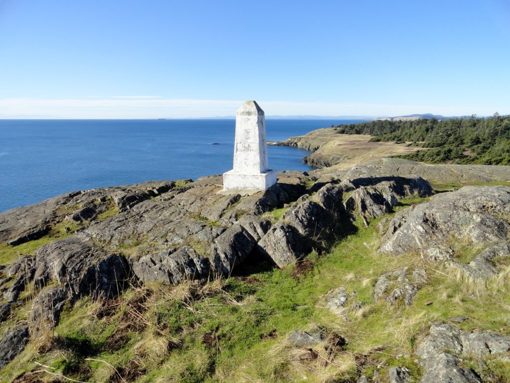
Quick Facts: Location: San Juan Islands National Monument Land Agency: Bureau of Land Managment Roundtrip: 3.8 miles Elevation gain: 380 feet Contact: San Juan Islands National Monument, Spokane District Office BLM Notes: Dogs permitted on leash; do not park beyond Agate Beach Park; access is via private property which owners have generously granted permission—stay on…
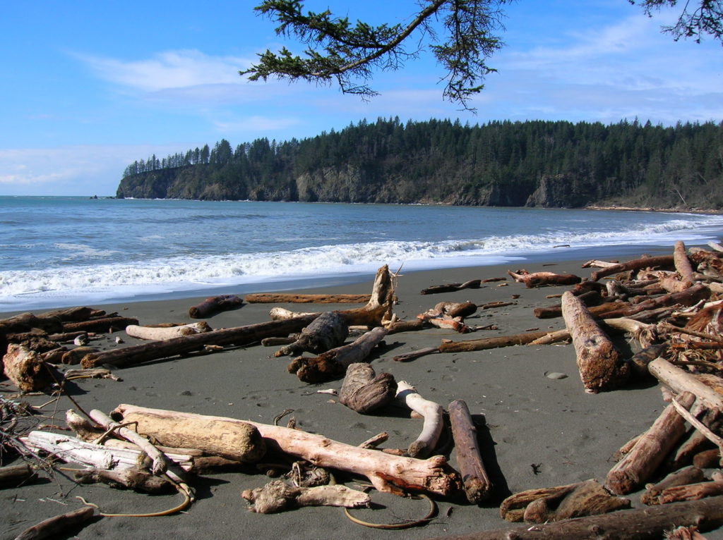
Read MoreHole in the Wall–walk a wilderness beach to a big natural arch

Quick Facts: Location: Olympic Peninsula Coast Land Agency: Olympic National Park Roundtrip: 4.0 miles Green Trails Map: Olympic Beaches 99S Elevation Gain: None Contact: Olympic National Park Access: From Forks, drive west on SR 110 to Quillayute Prairie. Here SR 110 splits. Bear right (Mora Road), and drive 5.0 miles to the trailhead at road’s end.…
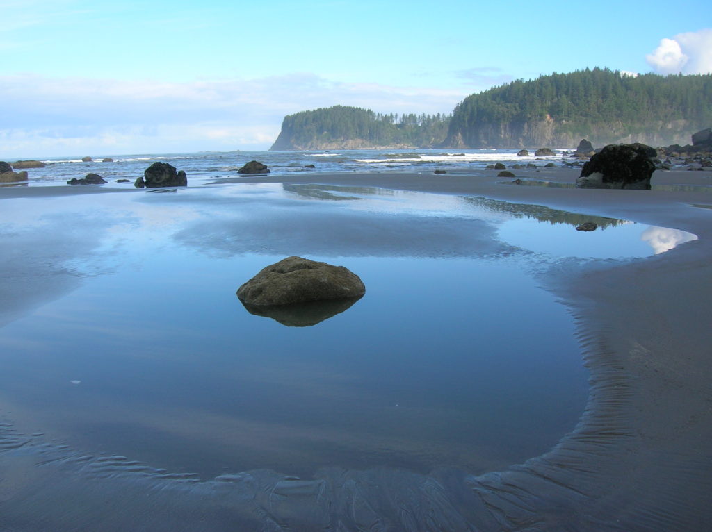
Read MoreThird Beach– First Rate and second to none!
Quick Facts: Location: Olympic Coast near Forks Land Agency: National Park Service Roundtrip: 2.6 miles Elevation gain: 300 feet Contact: Olympic National Park Wilderness Information Center Green Trails Map: Olympic Beaches 99s Notes: Dogs Prohibited Recommended Guidebook: Day Hiking Olympic Peninsula 2nd edition (Mountaineers Books) Good to Know: kid-friendly, snow free winter hike; beach walking;…
Read MoreJefferson Cove─A great place to go forth on the Fourth!
Quick Facts: Location: Olympic Coast, Olympic National Park Land Agency: National Park Service Roundtrip: 5.0 miles Elevation Gain: minimal Green Trails Map: La Push No. 163S Note: Dogs prohibited; Check tides – can only be done in a low tide; permits required to camp. Access: From Forks travel south on US 101 for 15 miles…
Read MoreFort Flagler Loop─Old defense post now protects undeveloped Puget Sound coastline
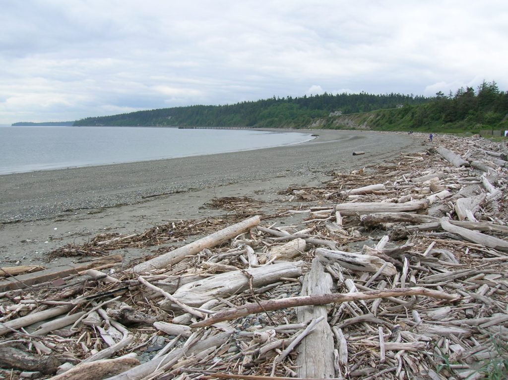
Quick Facts: Location: Marrowstone Island Land Agency: Washington State Parks Contact: Fort Flagler State Park Roundtrip: 5.6 miles Elevation Gain: 200 feet Access: From Kingston Ferry Terminal, follow SR 104 west for 15 miles turning right onto SR 19. Continue north for 9 miles to Chimicum turning right onto Irondale Road and proceeding 1.6 miles…
Read More