Central Cascades
Lake Janus — quiet alternative to nearby Lake Valhalla
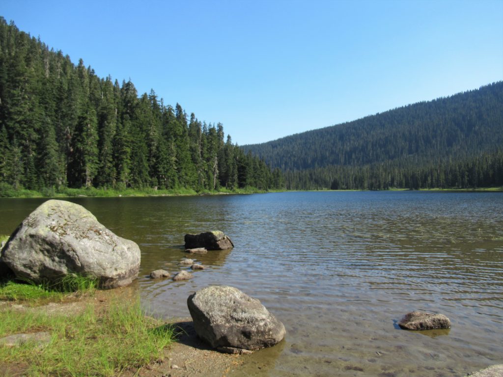
Quick Facts: Location: Pacific Crest Trail near Stevens Pass Land Agency: Mount Baker-Snoqualmie National Forest Roundtrip: 6.5 miles Elevation gain: 1,550 feet Green Trails Map: Benchmark MT- No. 144 Contact: Skykomish Ranger District: Mount Baker -Snoqualmie National Forest Notes: Self-issued free wilderness permit available at trailhead. Wilderness regulations apply. No fires allowed near lake. Practice…
Read MoreGrizzly Peak — It’s a long hike, but not a bear of a hike!
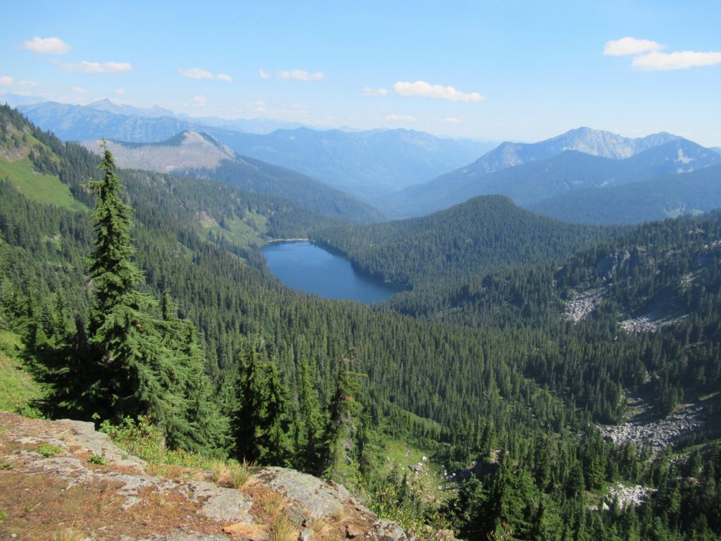
Quick Facts: Location: Pacific Crest Trail, Henry M Jackson Wilderness, Stevens Pass area Land Agency: Mount Baker-Snoqualmie National Forest Roundtrip: 16.4 miles Elevation gain: 3,400 feet Difficulty: difficult Green Trails Map: Benchmark MT- No. 144 Contact: Skykomish Ranger District: Mount Baker-Snoqualmie National Forest Access: From Everett, head east on US 2 to Stevens Pass. Continue…
Read MoreDishpan Gap—Crimson carpets at the headwaters of the Sky!
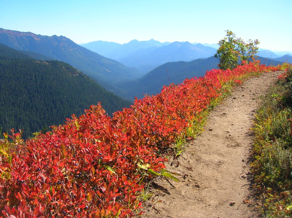
Quick Facts: Location: North Fork Skykomish River Valley Land Agency: Mount Baker-Snoqualmie National Forest Roundtrip: 17.4 miles Elevation Gain: 3,100 feet Contact: Skykomish Ranger District: Mount Baker-Snoqualmie National Forest Green Trails Map: Monte Cristo- No. 143, Benchmark Mtn- No. 144 Special Note: Northwest Forest Pass or Interagency Pass required; wilderness rules apply Access: From Everett…
Read MoreBenchmark Mountain–The meadows here measure up among the best
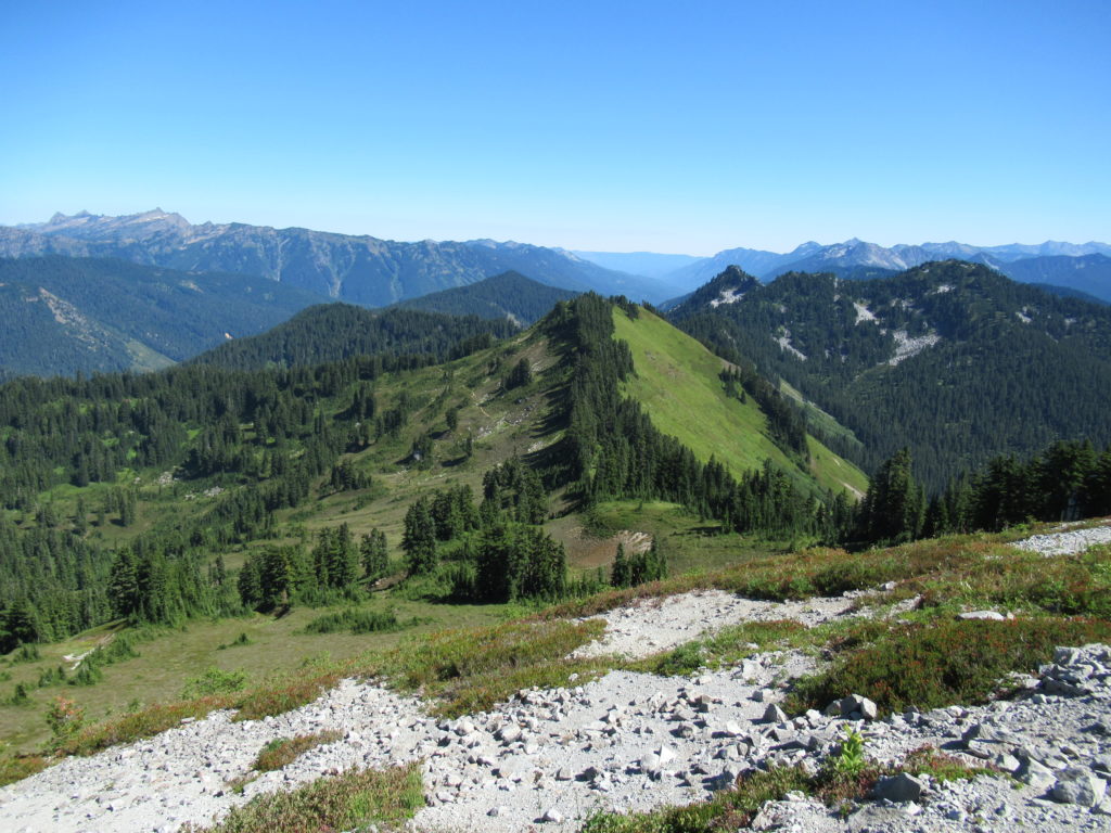
Quick Facts: Location: North Fork Skykomish River Valley Land Agency: Mount Baker-Snoqualmie National Forest Roundtrip: 14.2 miles High Point: 5,816 feet Elevation gain: 3,700 feet Green Trails Maps: Monte Cristo, WA-No. 143, Benchmark MT- No. 144 Contact: Skykomish Ranger District: Mount Baker-Snoqualmie National Forest Note: Northwest Forest or Interagency Pass Required Access: From Everett head…
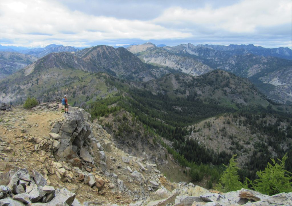
Read MoreNorth Navarre Peak–The Summer Blossom Trail blooms with extensive views!
Location: Sawtooth Ridge near Lake Chelan Land Agency: Okanogan-Wenatchee National Forest Roundtrip: 5.0 miles Elevation gain: 1,550 feet Contact: Chelan Ranger District: Okanogan-Wenatchee National Forest Green Trails Map: Prince Creek- No. 115 Notes: access is via a long and bumpy gravel road. Four-wheel drive recommended. Good to Know: Exceptional wildflowers; exceptional views; backpacking options; exceptional…
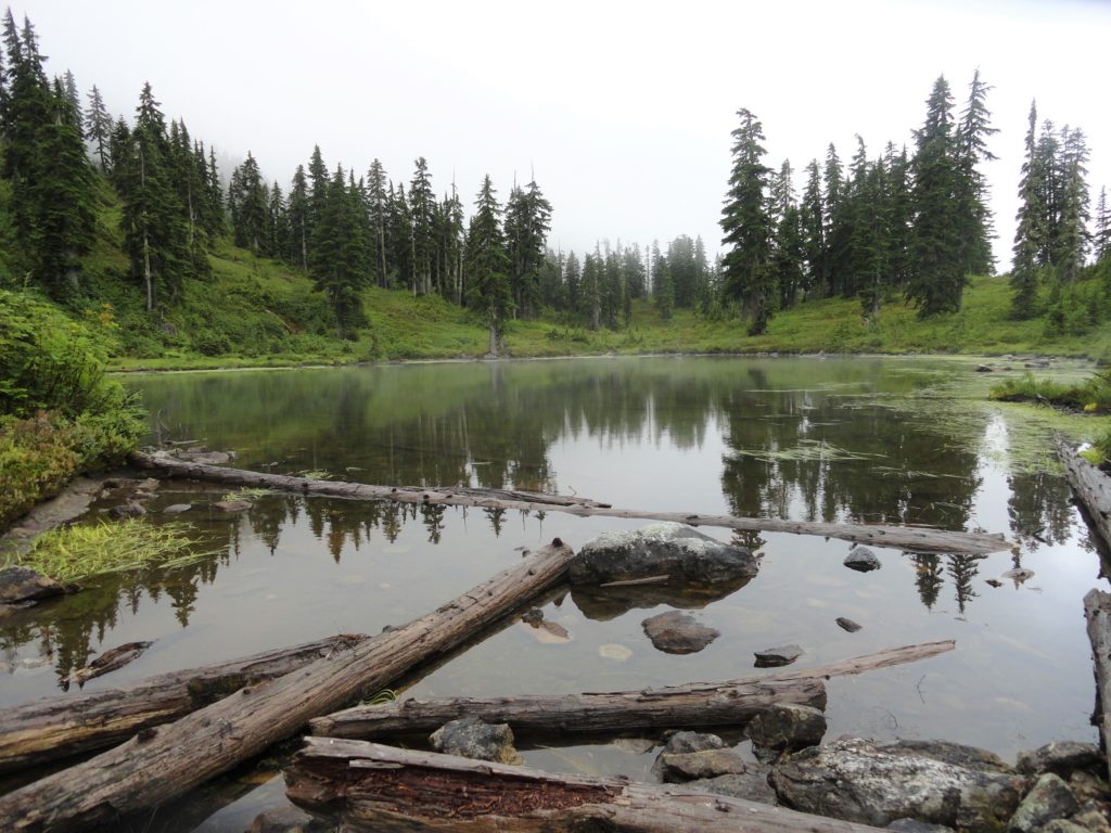
Read MoreFortune Ponds–Two little tranquil bodies of water deep within the Henry M. Jackson Wilderness
Quick Facts: Location: Beckler River Valley Land Agency: Mount Baker-Snoqualmie National Forest Service Roundtrip: 13.0 miles Elevation Gain: 2,700 feet Green Trails Map: Benchmark Mtn- No. 144 Recommended Guidebook: Day Hiking Central Cascades Access: From Everett head east on US 2 for 50 miles to Skykomish turning left onto the Beckler River Road (FR 65). Continue north for 6.9 miles…
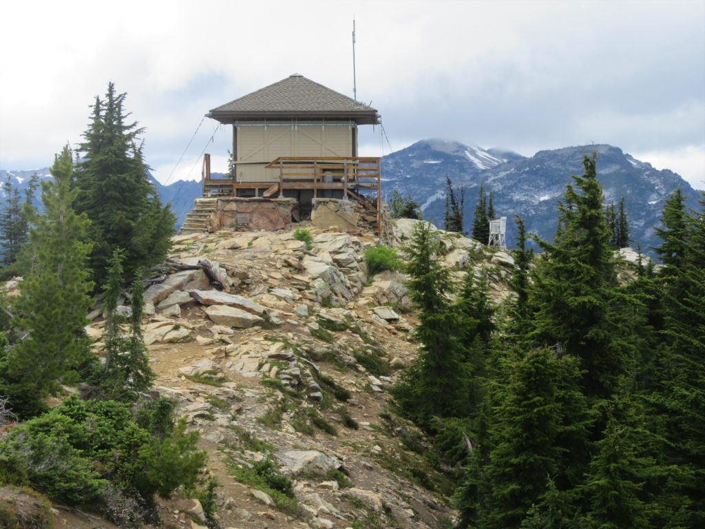
Read MoreAlpine Lookout –Wallow in good views and a chance to see a mountain goat or two
Quick Facts:Location: Stevens Pass-Lake Wenatchee regionLand Agency: Okanogan-Wenatchee National ForestRound Trip: 10.0 milesElevation Gain: 2,600 feetContact: Wenatchee River Ranger District (Leavenworth): Okanogan-Wenatchee National Forest Green Trails Map: Wenatchee Lake- No. 145Recommended Guidebook: Day Hiking Central Cascades (Mountaineers Book)Notes: NW Forest Pass or Interagency Pass Required.Several miles of trails on this hike are also open to mountain bikes…
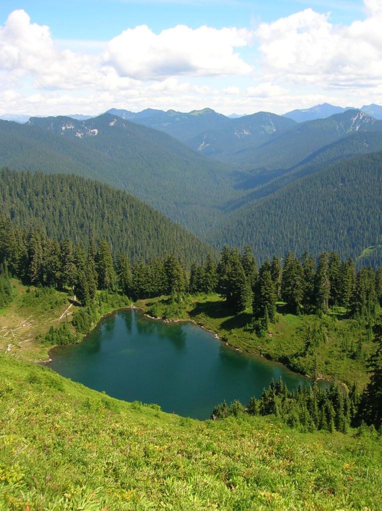
Read MoreJohnson Ridge–Ridgeline hike in the Wild Sky Wilderness
Location: Beckler River near Skykomish Land Agency: Mount Baker-Snoqualmie National Forest Roundtrip: 9.0 miles High Point: 5,540 feet Elevation gain: 2,650 feet Difficulty: difficult Green Trails Maps: Alpine Lakes West Stevens Pass No. 176S Contact: Skykomish Ranger District: Mount Baker-Snoqualmie National Forest Access: From Everett head east on US 2 for 50 miles turning left onto…
Read MoreBeaver Lake Loop–wetland wonderland on Lord Hill
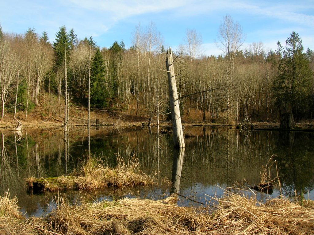
Location: Lord Hill Park near Snohomish Land Agency: Snohomish County Parks Roundtrip: 2.2 miles High Point: 650 feet Elevation gain: 200 feet Difficulty: easy Contact: Snohomish County Parks Notes: Dogs must be on leash; Map available online Access: From Everett, head east on US 2 for 8.0 miles and take 88th Street SE Exit. Turn right…
Read MoreLowell Riverfront Trail—Out of industrial ashes a riverside trail and park are born
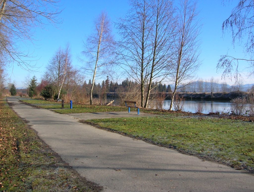
Quick Facts: Location: Lowell neighborhood, city of Everett Land Agency: Everett Parks and Recreation Contact: Everett Parks and Recreation Department Roundtrip: 4.0 miles Elevation Gain: None Access: From Exit 192 on I-5 in Everett head east on 41st Street. Turn right (south) onto 3rd Ave and proceed for 1.2 miles to four-way stop. Turn left onto…
Read More