Best Spring Hikes
Guillemot Cove─Quiet nature retreat on Hood Canal
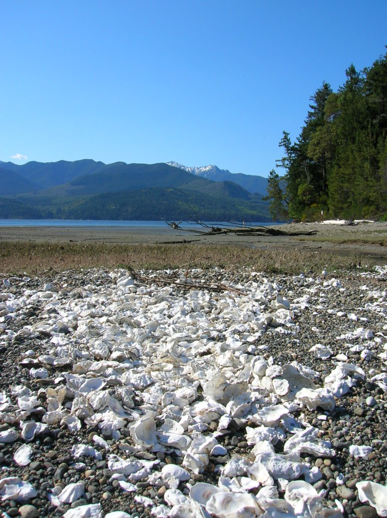
Quick Facts: Location: Kitsap Peninsula Land Agency: Kitsap County Parks Roundtrip: 2.5 miles Elevation Gain: 350 feet Contact: Kitsap County Parks Notes: Dogs prohibited. Access: From Bremerton, follow SR 3 North to Newberry Hill Road Exit. Then head west for 3.0 miles turning right onto Seabeck Highway. Continue for 5.0 miles to Seabeck turning right…
Read MoreBilly Frank Jr. Nisqually National Wildlife Refuge– Delightful hiking on the delta
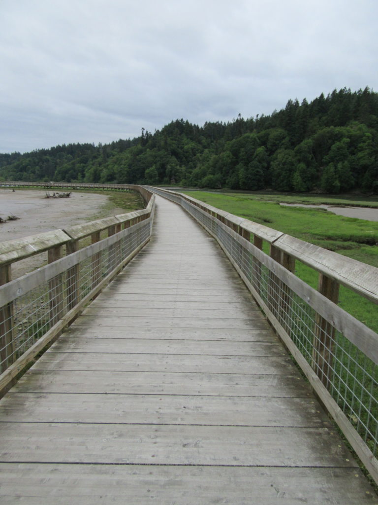
Quick Facts: Location: Nisqually River Delta Land Agency: United States Fish and Wildlife Service Roundtrip: 4.2 miles Elevation Gain: minimal Contact: Billy Frank Jr. Nisqually National Wildlife Refuge Map: Refuge Map Notes: $3.00 per four adults entrance fee; or Interagency Passes accepted; dogs prohibited; Northern end of the Nisqually Estuary Trail is closed from October to…
Read MoreTradition Lake Plateau
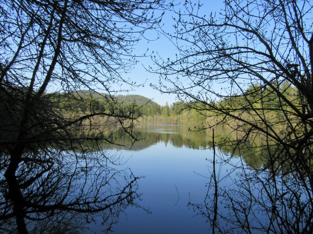
Wander family-friendly trails at the base of Tiger Mountain Quick Facts: Location: Issaquah Alps Distance: more than 8.9 miles of trails Elevation Gain: up to 250 feet Contact: Washington DNR and City of Issaquah Recommended Guidebook: Urban Trails Eastside (Mountaineers Books) Notes: Discover Pass required; parking lot fills fast on weekends requiring street parking (permissible…
Read MoreMainline Trail—Hike through the heart of the Paradise Valley Conservation Area
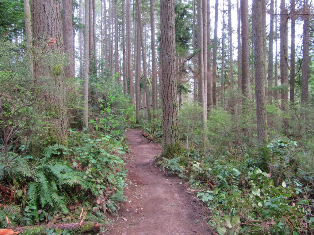
Quick Facts: Location: Maltby Land Agency: Snohomish County Parks Roundtrip: 3.2 miles Elevation Gain: minor ups and downs Access: From SR 522 in Maltby (5.0 miles east of Woodinville; 8.0 miles west of Monroe) head east on Paradise Lake Road for 1.7 miles to trailhead. Notes: Dogs must be on leash. Park open 7 am…
Read MoreRooster Rock State Park- Hike above the Columbia River Buffs!
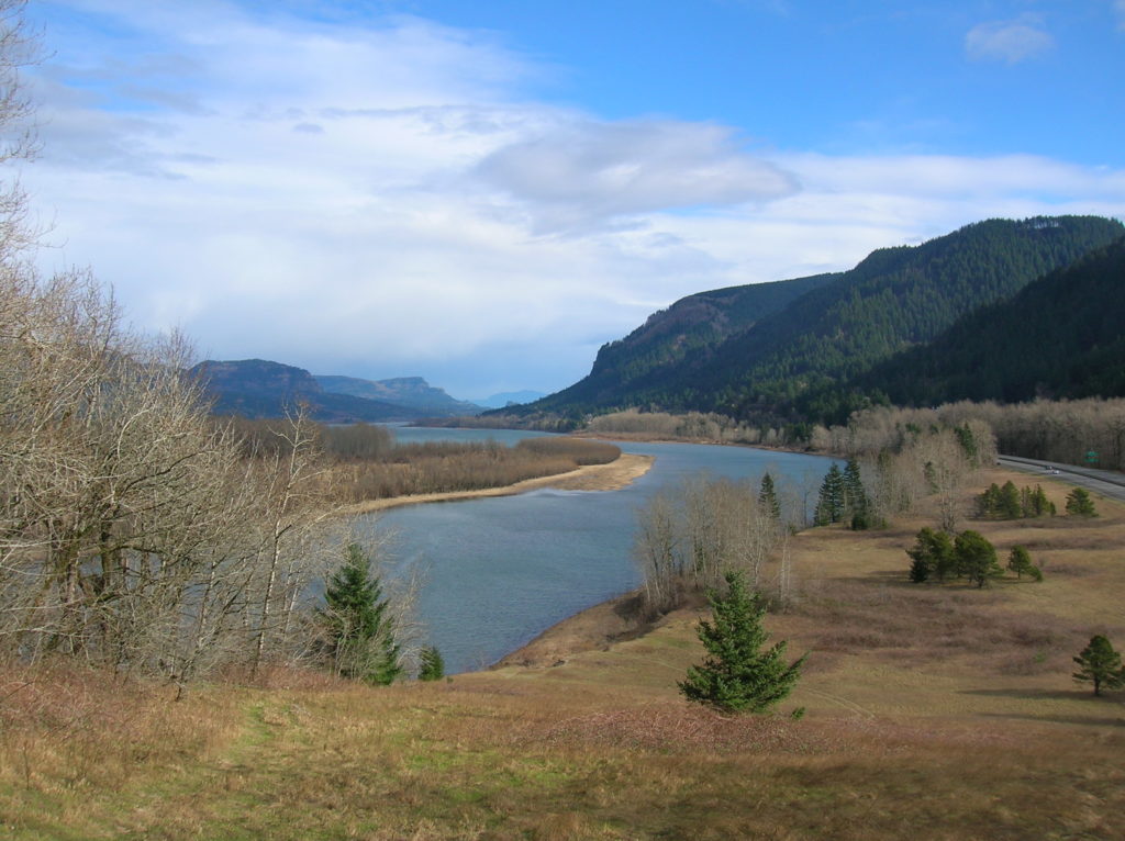
Quick Facts: Location: Columbia River Gorge, Oregon Land Agency: Oregon State Parks Roundtrip: 3.3 miles Elevation Gain: 300 feet Contact: Oregon State Parks Notes: $5.00 day use fee or $30 annual pass; dogs must be leashed Green Trails Maps: Columbia River Gorge West No. 428S Access: From Portland follow I-84 east to Exit 25. At .5…
Read MoreFortson Ponds –An old mill site on an emerging long distance trail
Quick Facts: Location: Darrington Land Agency: Snohomish County Parks Roundtrip: 2.0 miles Elevation gain: none Difficulty: Easy Contact: Snohomish County Parks Green Trails Map: Mountain Loop Highway 111SX Notes: Dogs allowed on leash Access: From Exit 208 on I-5 (Arlington) travel east on SR 530 for 25.2 miles turning left onto Fortson Mill Road (near…
Read MoreMeadowdale Beach—Reach the Beach through an Emerald Gulch
Quick Facts: Location: Lynnwood Land Agency: Snohomish County Parks Roundtrip: 2.5 miles Elevation Gain: 425 feet Contact: Snohomish County Parks Special Notes: Dogs must be leashed; park open 7 am to dusk: do not park on road Access: From Everett, head 10 miles south on I-5 to exit 183. Follow 164th Street SW west for…
Read MoreRiver Meadows Park─Wander along the Stillaguamish River
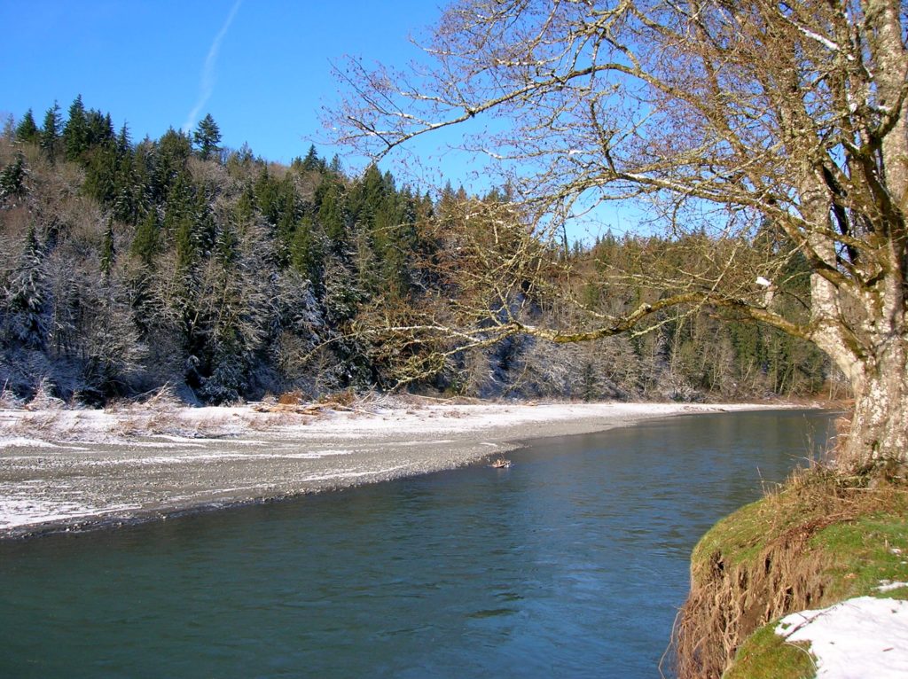
Quick Facts: Location: South Fork Stillaguamish River, near Arlington Land Agency: Snohomish County Parks Roundtrip: 2.5 miles Elevation Gain: 150 feet Contact: Snohomish County Parks Notes: Dogs must be leashed. Access: From Exit 208 on I-5 head east on SR 530 to Arlington. One mile beyond junction with SR 9 (just after crossing the South…
Read MoreTurtlehead — It’s one shell of a view from this Turtleback Mountain summit
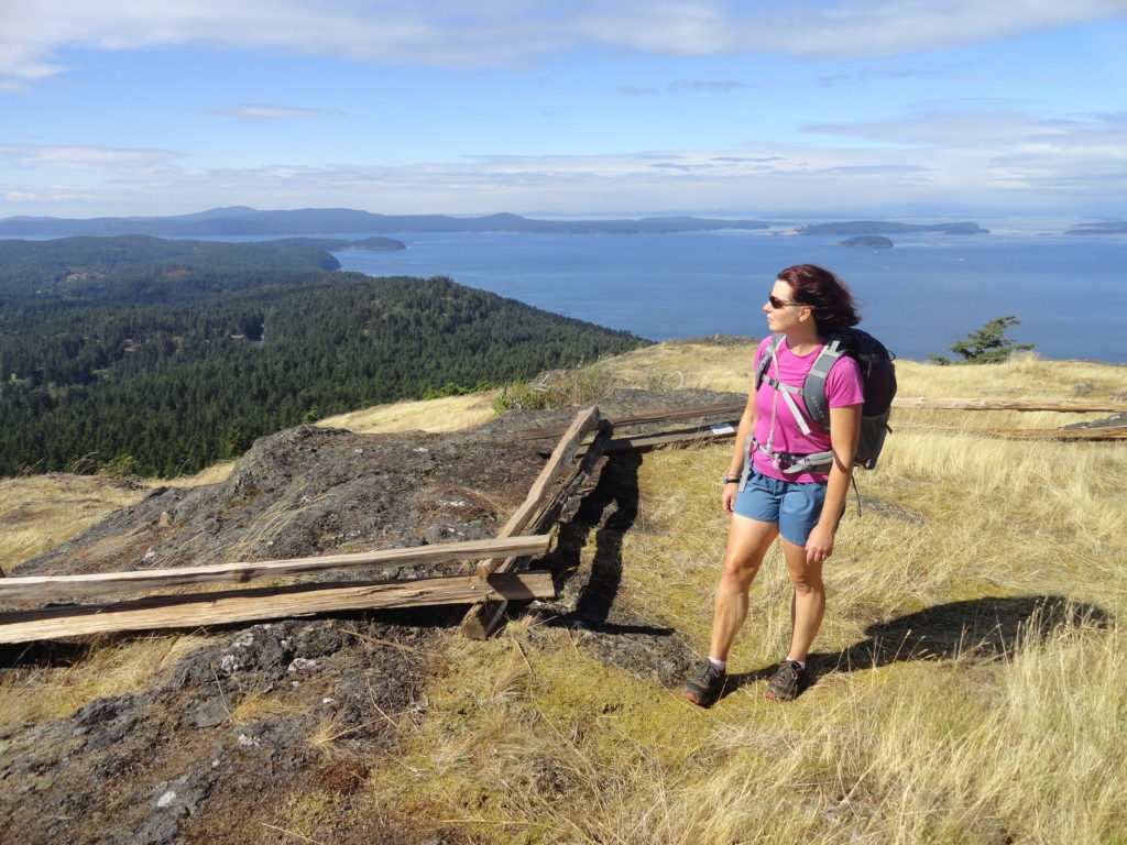
Quick Facts: Location: Orcas Island, San Juan Islands Land Agency: San Juan County Land Bank Roundtrip: 5.6 miles Elevation Gain: 1295 feet Contact: San Juan County Land Bank Notes: Dogs permitted on leash; trail (partial) open to bikes (even days) and horses (odd days) Access: Take Washington State Ferry from Anacortes to Orcas Island. Then head…
Read MoreLittle Cranberry Lake — A perfect complement hike to your Thanksgiving Day celebration
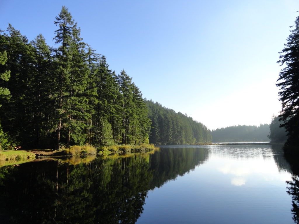
Quick Facts: Location: Anacortes-Fidalgo Island Land Agency: Anacortes Community Forest Lands Roundtrip: 1.9 miles Elevation Gain: 100 feet Access: From Exit 230 on I-5 in Burlington, head west on SR 20 to junction with SR 20-Spur. Continue right on SR 20-Spur to Anacortes. At traffic light near old town, continue left on 12th Street (still SR 20-Spur and12th Street…
Read More