Archives
Quick Facts Location: Stillaguamish River Valley, Arlington Land Agency: Snohomish County Parks Roundtrip: 1.0 miles Elevation Gain: none Contact: Snohomish County Parks; www1.co.snohomish.wa.us/Departments/Parks/ Notes: Dogs must be on leash. Access: From Exit 208 on I-5, head east on SR 530 for 4.0 miles to Arlington. Continue east on SR 530…
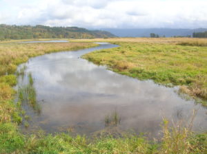
Quick Facts Location: Columbia River Gorge National Scenic Area Land Agency: US Fish and Wildlife Roundtrip: 2.8 miles Elevation Gain: none Contact: www.fws.gov/ridgefieldrefuges/steigerwaldlake Green Trails Map: Columbia River Gorge West No. 428S Notes: Dogs prohibited; section of trail closed from Oct 1—Apr 30 for wildlife protection. Access: From Vancouver head…

Quick Facts Location: Lake Crescent, Olympic National Park Land Agency: National Park Service Roundtrip: 8.0 miles Elevation Gain: 250 feet Contact: Olympic National Park; www.nps.gov/olym Green Trails Map: Lake Crescent, No. 101 Notes: Dogs are prohibited. Access: From Port Angeles, follow US 101 west for 17 miles turning right onto…
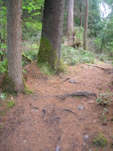
Quick Facts Location: Maltby Land Agency: Snohomish County Parks Roundtrip: 3.8 miles Elevation Gain: 75 feet Special Note: Dogs must be leashed. Contact: Snohomish County Parks; www1.co.snohomish.wa.us Access: From SR 522 in Maltby (5.0 miles east of Woodinville; 8.0 miles west of Monroe) head east on Paradise Lake Road for…
Quick Facts Location: Northern Snohomish County, near Stanwood Land Agency: Northwest Organization for Animal Help (N.O.A.H.) Roundtrip: 0.5 mile Elevation Gain: 25 feet Contact: www.thenoahcenter.org Notes: Hiking with dogs encouraged but they must be leashed. Access: From Everett, head north on I-5 to Exit 215. Head east on 300th Street…
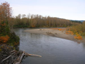
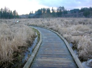
Quick Facts Location: Northern Snohomish County, near Stanwood Land Agency: Stillaguamish Tribe of Indians Roundtrip: 1.0 mile Elevation Gain: 50 feet Contact: www.stillaguamish.nsn.us Notes: Dogs must be leashed. Access: From Everett, head north on I-5 to Exit 210. Turn left heading west on 236th Street NW. Within a .25 mile…
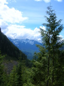
Quick Facts Location: North Fork Skykomish River Valley Land Agency: Mount Baker-Snoqualmie National Forest Roundtrip: 12.0 miles Elevation Gain: 1,200 feet Green Trails Map: Monte Cristo- No. 143, Benchmark Mtn- No. 144 Contact: Skykomish Ranger District: Mount Baker-Snoqualmie National Forest; (360) 677-2414; www.fs.fed.us/r6/mbs Special Note: Northwest Trail Pass required. Access:…
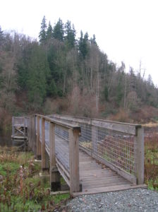
Quick Facts Location: North Fork of the Skykomish River near Index Land Agency: National Forest Service Roundtrip: 8.2 miles Elevation Gain: 2,100 feet Access: From Everett follow US 2 east for 35 miles turning left onto the Index-Galena Road (FR 63). Turn off is just after the bridge crossing of…
Quick Facts Location: South Everett – Mill Creek Land Agency: Snohomish County Parks Roundtrip: 1.5 miles Elevation Gain: none Access: From Exit 186 on I-5 head east on SR 96 (128th Street). Park entrance is on right. Trail begins by pool. Notes: Dogs permitted on leash. Contact: Snohomish County Parks;…
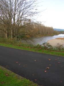
Quick Facts Location: southern trailhead near city of Snohomish Land Agency: Snohomish County Parks Roundtrip: 17.5 miles Elevation Gain: 200 feet Contact: Snohomish County Parks Notes: Dogs must be leashed Access: There are seven major trailheads. Access the northern terminus in Arlington on Armar Road near the junction with 152nd…