Little Si─You won’t sigh over the views from this open summit

Quick Facts:
Location: Snoqualmie Valley
Land Agency: Washington DNR
Roundtrip: 4.6 miles
Elevation Gain: 1,100 feet
Green Trails Map: Green Trails, Mount Si NRCA No. 206S
Notes: Discover Pass Required; dogs must be leashed
Contact: WA Department of Natural Resources, South Puget Sound Region (360) 825-1631; www.dnr.wa.gov
Access: Take I-90 to exit 32 in North Bend turning left onto 436th Ave SE. Follow for .6 mile to a junction turning left onto North Bend Way. Continue for .3 mile before turning right onto Mount Si Road. Reach trailhead in .3 mile.
Good to Know: kid-friendly, dog-friendly, snow-free winter hike
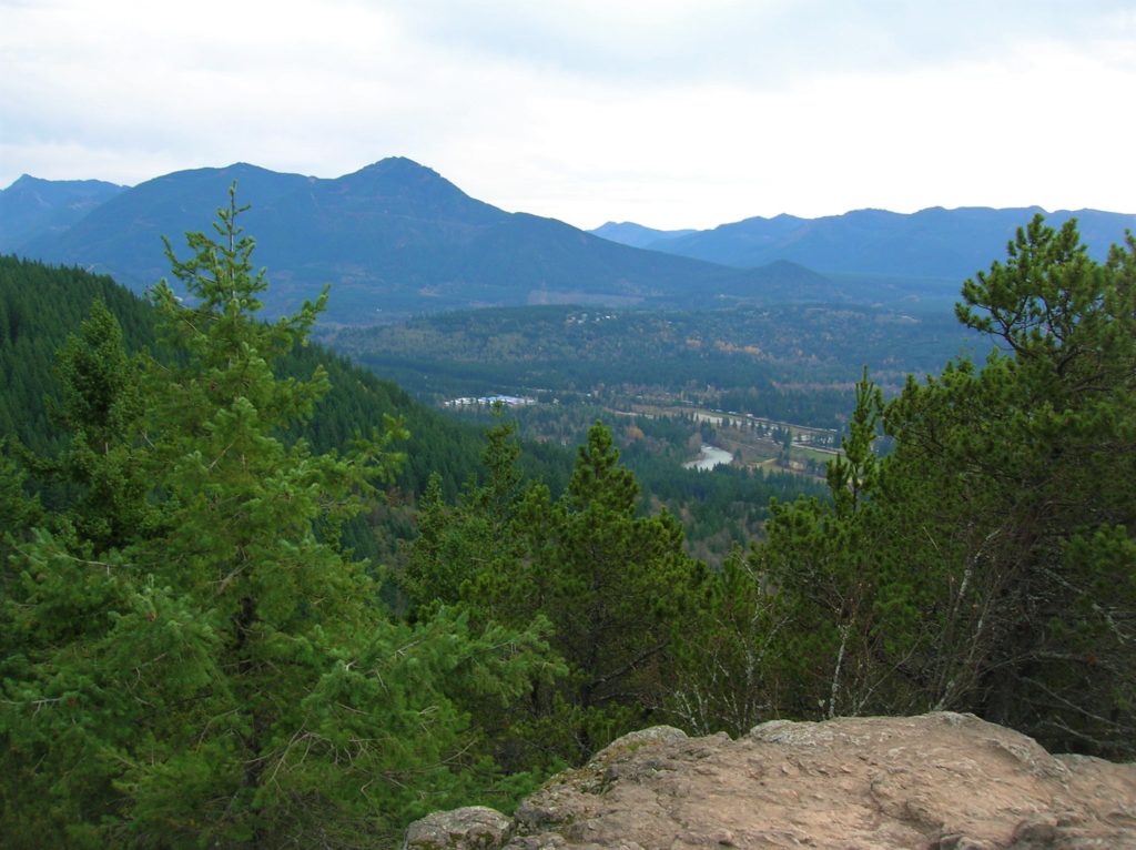
Shadowed by its famous neighbor, 4,167-foot Mount Si, Little Si offers grand views of the Snoqualmie Valley too—but for half the elevation gain. A favorite haunt among area rock climbers, hikers can ascend this protruding thumb via a steep but well-built trail. From this airy summit snuggled up against the massive south face of Mount Si, ogle peaks near and far including Tiger, Cougar, and Rattlesnake.
 From the trailhead immediately start climbing up rocky terrain. At .3 mile come to a junction with the Old Mount Si Trail since resurrected as part of the Boulder Garden Loop. The loop climbs 600 feet and then loses them on its 1.8 mile journey. It makes for a good extension if you need more of a workout .At .5 mile reach the northern terminus of the Boulder Garden Loop and continue left under a canopy of mature second-growth.
Soon afterwards come to a muddy draw passing an old kiosk. Now in a dark forested notch, traverse the base of talus and boulder fields. The trail soon swings around the northern spine of Little Si. Then through a series of tight switchbacks ascend the steep knoll to excellent viewpoints. Now marvel at the Cascade Front and Puget Lowlands spread out before you. Not a bad little hike at all!
For other great snow-free winter hikes in the North Bend and Snoqualmie area, pick up a copy of my Urban Trails Eastside book!
