Moulton Falls

Walk along a wild river to an impressive set of rapids
Quick Facts:
Location: Clark County, WA
Land Agency: Clark County Parks
Roundtrip: 5.4 miles
Elevation Gain: 200 feet
Access: From Vancouver head north on I-5 to Exit 11 following SR 502 east for 6.0 miles to Battle Ground. Turn left onto SR 503 and drive north 5.6 miles turning right onto Rock Creek Road (which eventually becomes Lucia Falls Road). Continue east for 5.3 miles turning right onto Hartwick Road. Reach trailhead in 0.5 mile.
Note: Dogs must be leashed.
Contact: Clark County Parks
Recommended Guidebook: Urban Trails Vancouver WA (Mountaineers Books)
Good to Know: dog-friendly, kid-friendly, snow-free winter hike,
The showy centerpiece of a sprawling greenbelt along the East Fork of the Lewis River, Moulton Falls County Park contains big rapids, big trees, and a big bridge over an impressive chasm. The hike is ideal in winter when visitation is low and water flow over the falls is high. The falls can easily be reached by road, but this hike allows you to get a little workout in and buildup anticipation.
From the trailhead, the way starts out paved descending slightly into a forest of mature evergreens and mossy maples. At 0.8 mile the pavement ends at a picnic area by a small alder-lined pond. Continue hiking and after another half mile parallel the lovely river. While the opposite river bank sports numerous cabins, the surroundings are still fairly wild. The trail traverses thick forest beneath ledges and steep slopes. Pass numerous rapids and cross several side creeks which cascade in winter rains. Admire big cedars too and watch for dippers below and kingfishers above.

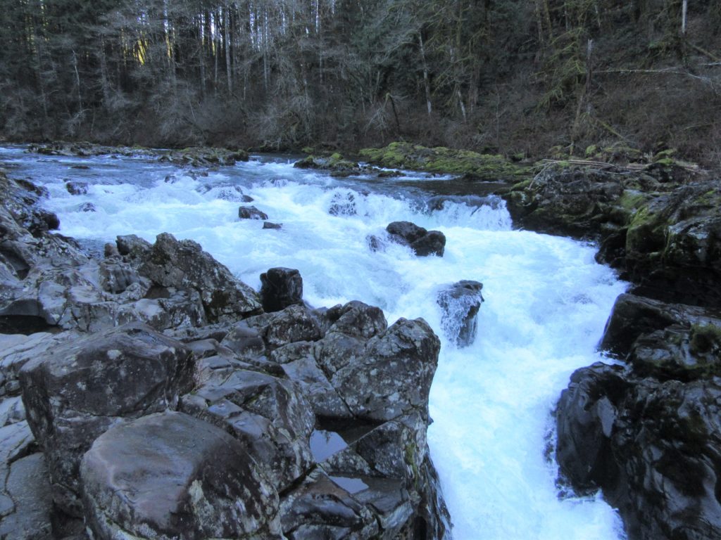
Moulton Falls attraction.
At 2.3 miles, come to the junction with the Bells Mountain Trail which takes off to the Yacolt Burn State Forest. Just beyond are Moulton Falls, a low lying series of rapids that plunge over a rocky shelf. While hardly qualifying as waterfall, they are pretty never-the-less, and pretty popular in the summer months for lounging around.
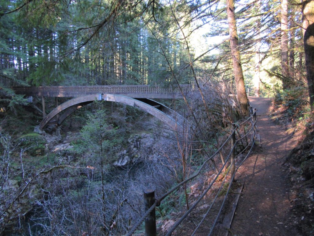
The trail continues up stream passing a picnic spot before approaching a high arched bridge over the East Fork. On the far side of the bridge a trail loops right providing nice glimpses into the rocky river-cradling chasm below. The main trail continues, dropping to a junction. Left goes to river level past a popular swim hole and to the park’s main parking area. The trail right climbs to the park’s upper parking lot. From there you can explore really pretty Yacolt Falls via another trail. Snoop around—then retrace your steps back to your start.
For more detailed information on this hike and many more in Clark County and the Yacolt Burn State Forest, pick up a copy of my Urban Trails Vancouver WA book.
