Archives

Quick Facts: Location: Skykomish River Valley, US 2 Land Agency: Washington State Parks Roundtrip: 11.5 miles Elevation gain: 1,575 feet Green Trails Map: Contact: Wallace Falls State Park Notes: Discover Pass required; Dogs must be leashed; Camping requires a permit-attain from park prior to trip. Access: From Everett, follow US…
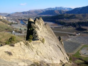
Quick Facts: Location: Wenatchee River Valley near Leavenworth Land Agency: Washington State Parks Roundtrip: 1.5 miles Elevation gain: 400 feet Green Trails Maps: Wenatchee Mission Ridge no. 211S Contact: Peshastin Pinnacles State Park Notes: Discover Pass required; dogs must be leashed. Access: From Leavenworth follow US 2 east for 9…
Quick Facts: Location: Kitsap Peninsula Land Agency: Kitsap County Parks Roundtrip: 2.5 miles Elevation Gain: 350 feet Contact: Kitsap County Parks Notes: Dogs prohibited. Access: From Bremerton, follow SR 3 North to Newberry Hill Road Exit. Then head west for 3.0 miles turning right onto Seabeck Highway. Continue for 5.0…
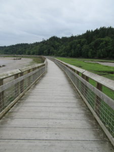
Quick Facts: Location: Nisqually River Delta Land Agency: United States Fish and Wildlife Service Roundtrip: 4.2 miles Elevation Gain: minimal Contact: Billy Frank Jr. Nisqually National Wildlife Refuge Map: Refuge Map Notes: $3.00 per four adults entrance fee; or Interagency Passes accepted; dogs prohibited; Northern end of the Nisqually Estuary Trail…

Wander family-friendly trails at the base of Tiger Mountain Quick Facts: Location: Issaquah Alps Distance: more than 8.9 miles of trails Elevation Gain: up to 250 feet Contact: Washington DNR and City of Issaquah Recommended Guidebook: Urban Trails Eastside (Mountaineers Books) Notes: Discover Pass required; parking lot fills fast on…

Quick Facts: Location: Maltby Land Agency: Snohomish County Parks Roundtrip: 3.2 miles Elevation Gain: minor ups and downs Access: From SR 522 in Maltby (5.0 miles east of Woodinville; 8.0 miles west of Monroe) head east on Paradise Lake Road for 1.7 miles to trailhead. Notes: Dogs must be on…
Quick Facts: Location: Mukilteo Land Agency: Mukilteo Recreation Department Roundtrip: More than 7 miles of trails Elevation Gain: up to 500 feet Contact: Mukilteo Recreation Department Notes: Trail system is currently rough in places and unsigned. Access: From Everett, head west on Mukilteo Blvd (which becomes 5th Street in Mukilteo) for…

Quick Facts: Location: Columbia River Gorge, Oregon Land Agency: Oregon State Parks Roundtrip: 3.3 miles Elevation Gain: 300 feet Contact: Oregon State Parks Notes: $5.00 day use fee or $30 annual pass; dogs must be leashed Green Trails Maps: Columbia River Gorge West No. 428S Access: From Portland follow I-84 east…

Location: William O. Douglas Wilderness, White Pass Land Agency: Okanogan-Wenatchee National Forest Roundtrip: 6.0 miles Elevation gain: 780 feet Green Trails Map: White Pass No. 303 Contact: White Pass Nordic Center Access: From Yakima or Morton follow US 12 to White Pass and proceed north to parking area near Yurt…
Quick Facts: Location: Darrington Land Agency: Snohomish County Parks Roundtrip: 2.0 miles Elevation gain: none Difficulty: Easy Contact: Snohomish County Parks Green Trails Map: Mountain Loop Highway 111SX Notes: Dogs allowed on leash Access: From Exit 208 on I-5 (Arlington) travel east on SR 530 for 25.2 miles turning left…