Ponytail Falls Loop
Behind the scenes beauty!

Quick Facts:
Location: Columbia River Gorge Oregon
Distance: 2.7 miles round trip
Elevation Gain: 450 feet
Contact: Columbia River Gorge National Scenic Area
Maps: Green Trails Columbia River Gorge–West No. 428S
Recommended Guidebook: Day Hiking Columbia River Gorge (Mountaineers Books)
Notes: Dogs allowed on-leash.
Trailhead directions: From Portland or Hood River, follow I-84 to exit 35 and take the Historic Columbia River Highway west for 1.5 miles to the Horsetail Falls Trailhead.
Good to Know: dog-friendly, kid-friendly, exceptional waterfalls, historic
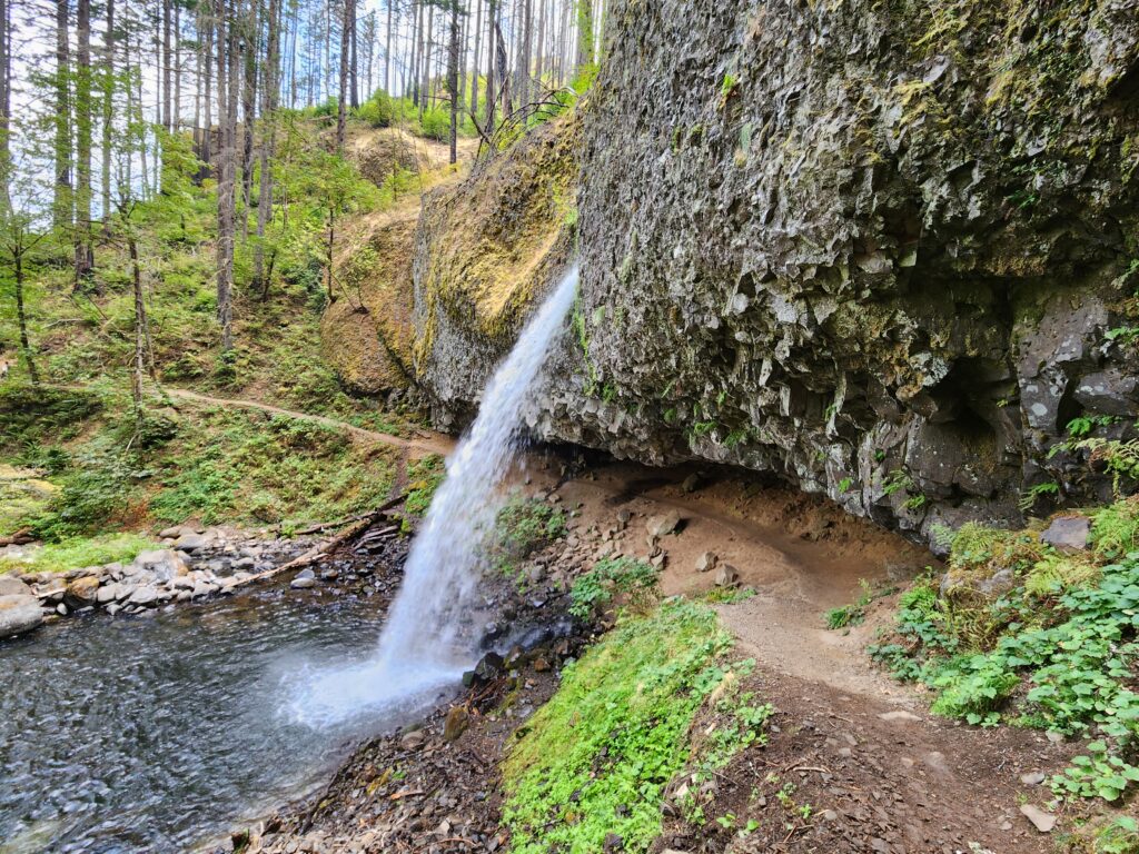
Appropriately named and dramatic Horsetail Falls plummets 176 feet right next to the trailhead. Now start hiking on Horsetail Falls Trail no. 438. Stay right at a junction and continue climbing via switchbacks to the cool amphitheater cradling Upper Horsetail Falls, more widely referred to as Ponytail Falls.
The 80-foot cascade is yet another stunning Columbia Gorge waterfall. Continue hiking following the trail beneath an overhanging basalt ledge behind the falls. Stare right through the streaming water and feel the pulse of the waterfall! Then continue hiking along steep basalt walls, traversing a bench where two unmarked side trails lead right to excellent viewpoints over the Columbia River. Be extremely careful here, especially with children, as the edge is abrupt and the drop precipitous.
Then continue on the main trail over rocky tread beneath more basalt cliffs and through a stretch of the 2017 Eagle Creek Fire. After a short climb, begin descending to a metal bridge spanning the whirling waters of Oneonta Creek. Gaze left, upstream to Upper Oneonta Falls plunging into an emerald punchbowl. Then look downstream toward Lower Oneonta Falls, which is hidden below within a 20-foot-wide, 200-foot-deep slot canyon. Forty-niner Carleton Emmons Watkins named the falls for his hometown in upstate New York—Oneonta is an Iroquois word meaning “place of open rocks.”
After staring at the mesmerizing waters, steeply climb to a junction with the Oneonta Trail. For an excellent side trip, consider hiking left 0.9 mile to thrice delightful Triple Falls. To close the loop head right skirting cliffs and reentering green old growth forest. Bear right at a junction with the Gorge Trail and reach the Historic Columbia River Highway.
Now walk to the right along the highway and veer right on a paved trail which crosses Oneonta Creek at the mouth of its gorge (currently closed to the public). An Oregon version of a Utah slot canyon, the basalt Oneonta Gorge is about a half-mile long, 200 feet deep and only 15 to 20 feet wide. The way then passes through the renovated Oneonta Tunnel, which served motorists from 1914 until 1948. Horsetail Falls comes back into view shortly afterward, indicating the completion of your 2.7 mile loop.
For more details on this hike and 114 others in the Gorge, Silver Star Scenic Area and Cottonwood Canyon State Park pick up a copy of my Day Hiking Columbia River Gorge 2nd edition (Mountaineers Books).
