Mildred Lakes — Brutal trail to a placid trio of backcountry lakes
Quick Facts:
Location: Mount Skokomish Wilderness
Land Agency: Olympic National Forest
Roundtrip: 9.0 miles
Elevation Gain: 2925 feet
Contact: Olympic National Forest, Hood Canal Ranger District,
Green Trails Map: Olympic Mountains East 168SX
Notes: Northwest Forest Pass or Interagency Pass required
Access: From Hoodsport travel north on US 101 north for 13.7 miles turning left onto FR 25 (Hamma Hamma River Road). Continue for 13.3 miles (the last 1.5 miles are rough) to the trailhead.
Good to Know: wildflowers, alpine views, wilderness rules apply, practice Leave No Trace Principles
People who have hiked to these three beautiful backcountry lakes in the Mount Skokomish Wilderness fall into two camps; those who love this trail and those who absolutely detest it. But no matter which camp you fall into—you’ll all agree that this trail is one of the hardest and nastiest in the Olympics.
Never officially constructed, the second half of this trail resembles little more than a way path. It’s extremely steep in places with difficult tread and is not recommended for children and beginning hikers. The trail was forged by tenacious fishermen and masochistic hikers. An entanglement of roots, rocks, and an up-and-down course that defies logic, this trail is notorious for being one of the nastiest in the Olympics. This hike is all about the destination, not the journey.
The trail immediately enters the Mount Skokomish Wilderness. The first mile or so is easy enough. But once you cross a large avalanche chute, commence with the misery. Around fallen logs, over fallen logs, and straight-up rocky and rooty slopes the trail climbs a 3200-foot ridge. Mount Pershing looms in the southeast.
Then through hemlock and huckleberry the trail hightails it off the ridge, descending into a cool forested glen graced by a rushing Huckleberry Creek which needs to be crossed. Teeter on a log or wade across the creek and soon come to another creek crossing, this one much easier.
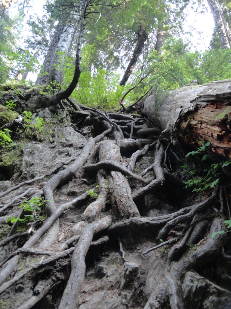
Now the way gets tricky and tough. Ascend a steep ridge and come to a tight ravine. Using roots as handholds, drop into the dank draw before resuming a taxing climb. After clambering over rock, root, and ledge—and gaining 1000 feet in elevation in less than .7 mile—the insanity ends on a heather-draped ridge crest. Wander along the open ledge, enjoying excellent views of Mount Cruiser and the Sawtooth Range, but no lakes.
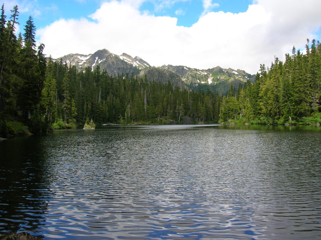
Your punishment isn’t over yet. Now Drop 250 feet through marshy mosquito breeding grounds before finally coming to the first lake. Set in deep old timber with a backdrop of rugged summits, the scene is serene and it’s all yours—you deserve it. Scramble over more root and rock to the far side of the lake for good fishing, resting posts and campsites. Share the abundant trout with the resident osprey.
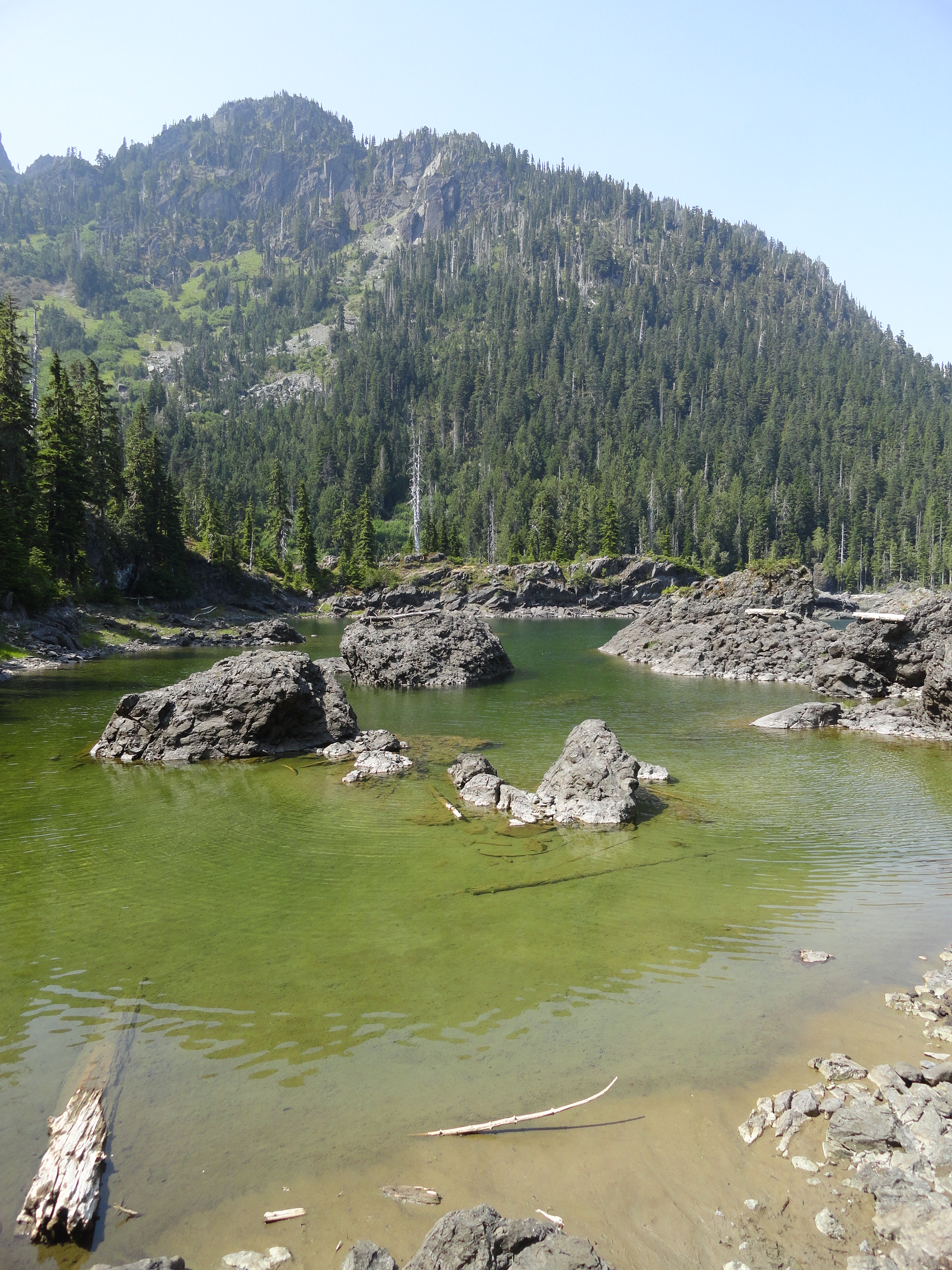
Then head to upper Mildred, one of the largest backcountry lakes in the Olympics. Cross lower Mildred’s inlet stream and follow a rough path through heather meadows to reach it. The middle Mildred Lake can be reached by following a rudimentary path that takes off from the upper lake path.
The Mildred Lakes Trail is one of 136 featured hikes in my Day Hiking Olympic Peninsula 2nd Edition (Mountaineers Book). For more details on this hike and others (including many not found in other guides), pick up a copy of this book—the number one selling and most trusted guidebook on hiking in the Olympics—today!
For information on where to stay and on other things to do on the Olympic Peninsula, check out Northwest TripFinder