Perry Creek─Old growth, a cascade, sublime views to rugged peaks

Quick Facts:
Location: Mountain Loop Highway
Land Agency: National Forest Service
Roundtrip: 11.4 miles
Elevation Gain: 3.500 feet
Green Trails Map: Mountain Loop Highway 111SX
Recommended Guidebook: Day Hiking North Cascades 2nd edition (Mountaineers Books)
Contact: Darrington Ranger District: Mount Baker-Snoqualmie National Forest
Access: From Granite Falls follow the Mountain Loop Highway east for 27 miles to trailhead.
Good to know: dog-friendly, exceptional old-growth, Practice LNT principles
Sharing a trailhead parking area with the popular Mount Dickerman Trail, don’t let the crowded parking lot discourage you. Most of those cars belong to hikers heading for Dickerman’s steep slopes. Perry Creek is a much quieter hike—a trail less traveled. But you’ll be rewarded with more than just a peaceful journey on this hike. You’ll get to traverse lovely ancient forests, pass a crashing cascade and take in splendid views from gorgeous alpine meadows.

Much of the way traverses the Perry Creek Research Natural Area (RNA); a 2,066-acre protected tract. Established by the Forest Service after years of advocacy from noted botanist Art Kruckeburg and the Washington Native Plant Society, the RNA contains many rare plants including; male fern, leathery grape fern, and maidenhair spleenwort.
After gently sweeping across Mount Dickerman’s lower slopes, you’ll come to the old trailhead access and soon break out of forest to cross an open avalanche slope. On rocky terrain but a gentle grade, work your way up the valley undulating between forested groves and brushy avalanche slopes. Look across the valley below to the long ridge of Stillaguamish Peak. Look out over the valley behind to Big Four’s imposing north face. And look straight up Mount Dickerman’s frightening cliffs.
Soon after hopping across a feet-soaking creek, enter magnificent primeval forest and come upon Perry Creek. Pause to admire it cascading down a deep, narrow cleft. Then cross the creek which can be tricky during periods of heavy rains and snow melts. The trail takes a steeper turn heading up slopes cloaked in ancient cedars and firs.
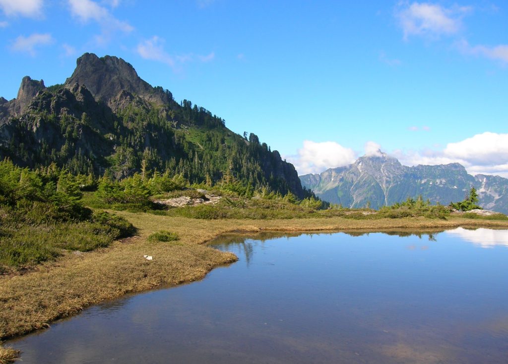
After some really steep going the enveloping forest begins yielding to heather meadows. At 5.3 miles, you’ll come to an unmarked junction. The trail left, abandoned but well-used travels through magnificent meadows to Stilliguamish Peak. It’s a worthy destination for experienced hikers. You want to continue right steeply climbing another 300 feet to a 5,250-foot flowered and grassy bench punctuated with delightful tarns and graced with splendid views out to Big Four, Glacier Peak, Mount Pugh, and Forgotten Mountain. And speaking of Forgotten, that 6,005-foot peak can be reached by continuing on a sketchy at times way trail to the base of the summit block. From there it’s a rocky scramble best suited for experienced off-trail travelers and mountain goats.
Perry Creek is one of 136 hikes in my best-selling Day Hiking North Cascades 2nd edition (Mountaineers Books). Pick up your copy today for more detailed info on this and many other hikes. Happy Hiking!
