Wallace Lake—Tranquil waters above thundering falls

Quick Facts:
Location: Skykomish River Valley
Land Agency: Washington State Parks
Roundtrip: 8.2 miles
Elevation Gain: 1,500 feet
Green trails Map: Index, WA-No. 142
Access: From Everett follow US 2 for 28 miles east to Gold Bar. Just before Milepost 28 turn left onto 1st Street (signed for Wallace Falls State Park). Proceed for .4 mile to a four way stop. Turn right onto May Creek Road and continue for 1.5 miles to Wallace Falls State Park and trailhead.
Notes: Discover Pass required; dogs must be leashed. Parking limited. Plan a weekday hike and/or arrive early in the morning.
Contact: Wallace Falls State Park
Good to Know: Snow-free Winter Hike, Dog-friendly, kid-friendly
Wallace Falls State Park is one of the state’s and Snohomish County’s most spectacular places—and not surprisingly, popular as well. Here within this 4,735-acre park the Wallace River tumbles over 265 feet in a series of stunning and thundering waterfalls. A well built and well trodden trail takes you along the river to stunning viewpoints of the falls. On a sunny weekend the trail is lined with folks from all walks of life savoring the stupendous beauty of this special place.
If you arrive at the park and the parking lot is overflowing with vehicles prompting you to think that perhaps there might be just a tad too many hikers on the trail—don’t despair. Consider hiking to Wallace Lake instead where only a fraction of the park’s hikers venture off to. A fairly large lake above the falls and away from the crowds, it makes for a wonderful alternative destination to the falls, or a nice destination in its own right.
Wallace Lake was once reached by a long and unappealing logging road, but that all changed thanks to the WTA). You can now access the lake via the Greg Ball Trail; a path envisioned by and honoring one of the greatest trail advocates this state has ever had. Ball was a former board member and director of the WTA. In 1993 he launched the organization’s volunteer trail maintenance program which has since grown into the largest state-based program of its kind. In 2004 at the age of 60, tragically, Greg passed away after battling cancer. He had designed this trail to Wallace Lake and it was finished in his memory by volunteers from WTA and through support from the Spring Trail Trust.
Start your hike by following the crowds on the main trail toward Wallace Falls. Soon come to a junction. Left follows the Old Rail Grade Trail 2.2 miles before terminating at the Greg Ball Trail. Right heads 1.1 miles along the Wallace River before coming to a junction leading 0.2 mile to the Greg Ball Trail. Either way will work but the shorter way will be more crowded.
The Greg Ball Trail begins from the old RR grade. The trail is a pure joy to walk. Follow alongside and above the North Fork of the Wallace River, climbing gently and meandering through maturing second growth. At about 3.0 miles from the trailhead you can catch glimpses of the river cascading down a narrow chasm. About a half mile farther the trail terminates at a DNR Road. Turn right on the road for 0.1 mile to a junction with an old road taking off left. Follow this near level forested way for 0.5 mile to the southern tip of Wallace Lake.
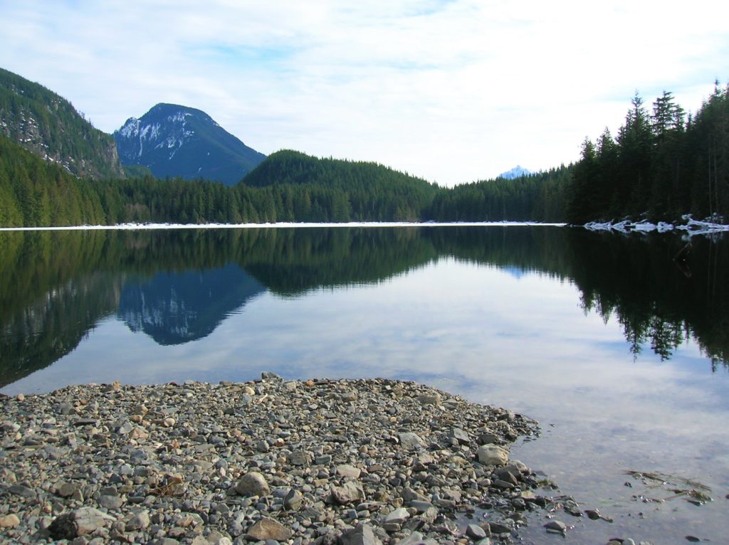
This is a pretty spot in heavy timber with picnic tables and an attractive bridge, but the northern end of the lake at Pebble Beach is much nicer. To reach it, head left following another old woods road. After a half mile arrive at the beach, a gravelly outwash at the base of a small talus slope. Find yourself a nice sun warmed log and enjoy the view across the placid lake to what’s colloquially referred to as Zeke’s Hill and Mount Index peeking in the distance. Savor the serenity here away from the thundering falls and their crowded trails.
For more detailed information on this hike and many more along the US 2 Corridor, Consult my best-selling Day Hiking Central Cascades 2nd edition. Book includes 136 hikes from Sultan to Chelan. Get your copy today!
