Warrior Rock Lighthouse─A scenic and historic hike on Oregon’s largest island
of Oregon’s non-coastal lighthouses
Quick Facts:
Location: Sauvie Island (Portland, Oregon)
Land Agency: Oregon Department of Fish and Wildlife
Roundtrip: 6.5 miles
Elevation Gain: 10 feet
Access: From downtown Portland, follow US 30 west for just shy of 11 miles turning right onto the Sauvie Island Bridge. Follow Sauvie Island Road passing Cracker Barrel Grocery in .3 mile (where parking permits can be purchased) turning right onto Reeder Road at 2.1 miles. Then follow Reeder Road for 12.7 miles to its end and trailhead.
Notes: Dogs must be leashed; Sauvie Island Wildlife Area Parking permit required.
Contact: Sauvie Island Wildlife Area
Good to Know: Kid-friendly, dog-friendly (on leash), exceptional bird-watching, historical, snow-free winter hike
Hike on Oregon’s largest island among stately cottonwoods and sandy beaches to Warrior Rock home to one of the state’s two non-coastal lighthouses. Located a mere 10 miles away from downtown Portland, 24,000-plus acre Sauvie Island with its population of about 1100 is nearly all wildlife preserve and agricultural lands. And this island is rife with history, too. On October 28, 1792, Lt. William Broughton sailing for Captain George Vancouver visited the rocky tip of the island where he was met by 23 canoes carrying 150 Chinook Indians dressed in war attire. He quickly made peace and subsequently named the point, Warrior Rock (he also named Mount Hood for his admiral). Lewis and Clark came through in 1805 and 1806. In 1836 French-Canadian Laurent Sauvé began managing several dairy farms for the Hudson’s Bay Company at nearby Fort Vancouver. The island bears his name.
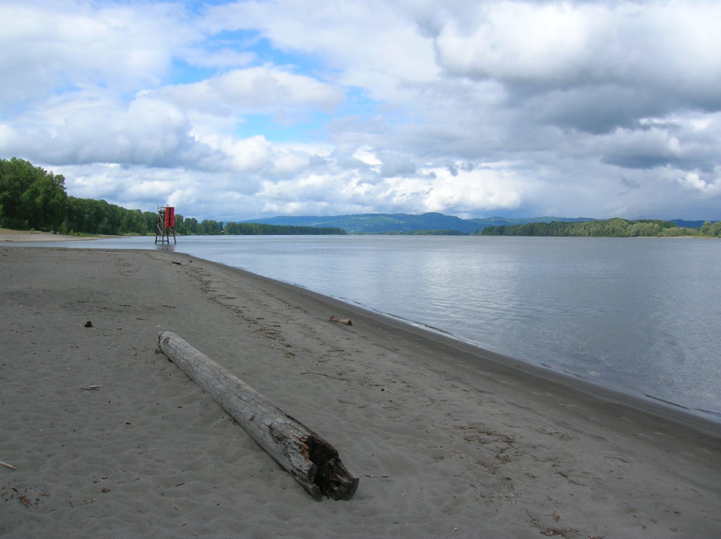
Start by walking out on the fine sandy beach and heading north. After a quarter mile head up on the riverbank picking up an access road for the wildlife management area and proceed right. At .5 mile bear right onto the more lightly traveled older road. Now follow this delightful way under a canopy of giant cottonwoods to the lighthouse. Several trails diverge left and right offering access to beaches and sloughs. Soothing bird song fills the air occasionally interrupted by the harsher sounds of large vessels plying the river.
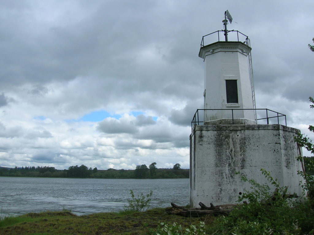
After coming to a small meadow the way bends rights to end at the 1930-built lighthouse. The currents are pretty strong here being close to the confluence with Washington’s East Fork of the Lewis River. Views are good up and down the river. Directly across the river is the Ridgefield National Wildlife Refuge. Walk a nice beach just to the north of the lighthouse and snoop around the tip of the island for views of the city of St Helens across the Multnomah Channel. On the trip back, if the weather is good look for Mount Hood and Mount St Helens hovering in the distance.
For more information on this hike and others within the Portland-Vancouver region check out my Day Hiking Columbia River Gorge book (Mountaineers Books)
For information on fun things to do, great places to stay and wonderful places to eat at–visit Northwest TripFinder!