Barnaby Buttes

Mega-fauna hot spot in the Kettle River Range
Quick Facts:
Location: Kettle River Range
Land Agency: National Forest Service
Distance: 7.4 miles
Elevation Gain: 1975 feet
Contact: Colville National Forest Three Rivers Ranger District
Recommended Guidebook: Day Hiking Eastern Washington (Mountaineers Books)
Access: From Kettle Falls, travel west on SR 20 for 14 miles turning left onto FR 2020 (South Fork Sherman Creek Road). Continue 6.5 miles and bear left onto FR 2014 (Barnaby Creek Road) and after .3 mile turn right onto FR 2014-500 (high clearance necessary). Then drive for 2.4 miles to trailhead.
Good to Know: kid-friendly, dog-friendly, exceptional wildlife habitat, practice Leave No Trace Principles, summer wildflowers, historic fire lookout site
One of the loneliest spots in the southern reaches of the Kettle River Range, Barnaby Buttes offers sweeping views across northeastern Washington and excellent chances for spotting some of the area’s mega fauna. There are two routes that lead to the former lookout tower on the Buttes’ north peak. The approach from the east is the preferred route.
The way starts on an old fire road climbing through a thick stand of lodgepole pine and western larch. The way is oft littered with moose and deer droppings; and plenty of tracks left in the tread by these ungulates and of the predators that pursue them—particularly cougars and coyotes. The trail eventually enters the 1988 White Mountain burn zone. New greenery has since reclaimed the large burn area, but plenty of silver snags and blackened logs still remain providing excellent habitat for insects and birds.
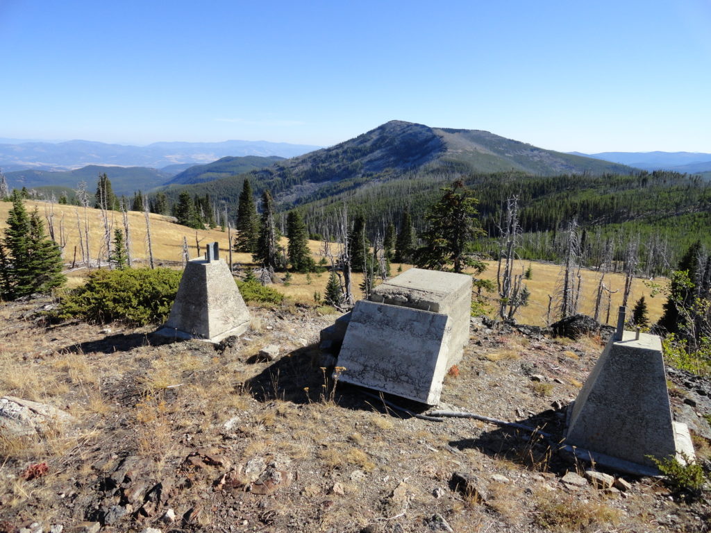
At 2.6 miles the trail comes to a junction with the Kettle Crest Trail. Head right for 0.8 mile and reach a junction. Now follow a fading trail right to the old lookout site. If you lose the way, just make north across an open slope aiming for the 6,534-foot summit graced with aspens and junipers.
All that remains of the fire lookout is a concrete stairway. Sit on it and enjoy the view east to the Selkirk Mountains; south to White Mountain and Grizzly Mountain; west to Thirteenmile, Fire, Granite and Moses Mountains; and north to Edds and Bald Mountains. See too if you can catch a glimpse of Roosevelt Lake shimmering below to the east.
For detailed information on this and many other hikes in the Kettle River Range, pick up a copy of my and Rich Landers’ Day Hiking Eastern Washington book.
