Windy Pass
Easy wanderings high on the Pacific Crest Trail
Quick Facts:
Location: Harts Pass area
Land Agency: National Forest Service
Distance: 7.6 miles
Elevation Gain: 900 feet
Contact: Okanogan-Wenatchee National Forest, Methow Valley Ranger District
Map: Green Trails Methow Valley Pasayten Wilderness 51SX
Notes: Northwest Trail Pass or Interagency pass required
Access: From Winthrop, drive State Route 20) west for 13.2 miles to the Mazama turnoff just past milepost 180. Proceed north for 0.4 mile to Mazama. Then turn left at the intersection, following Harts Pass (Lost River Road). The pavement ends in 6.7 miles, and the road becomes Forest Road 54. Continue for 12 miles to Harts Pass and bear right onto spur 600 towards Slate Peak reaching the trailhead at first switchback in 1.4 miles. Parking limited
Good to Know: kid-friendly, dog-friendly, practice Leave No Trace Principles, sweeping views, summer wildflowers, Pacific Crest Trail
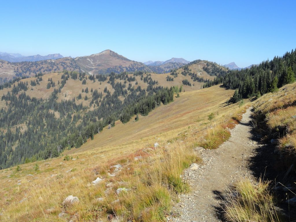
Walk through rapturous alpine gardens and admire endless columns of icy and rocky spiraling peaks. Look out across some of the wildest wilderness remaining on the North American continent and let your senses whirl. Best of all—you’ve hardly broken a sweat for all this beauty.
From the lofty trailhead quickly access the PCT in a clump of hardy larches. Then head north skirting beneath the 7400-foot summit of Slate Peak. Below, Slate Creek drains a basin bearing scars from fortune seekers past and present. In its mining heyday, two boomtowns, Barron and Chancellor played host below to hardscrabble prospectors and profiteers. The towns have all but disappeared, but the surrounding hillsides still sport deep scars; ecologically devastating lesions. Some of the mining claims are still active.
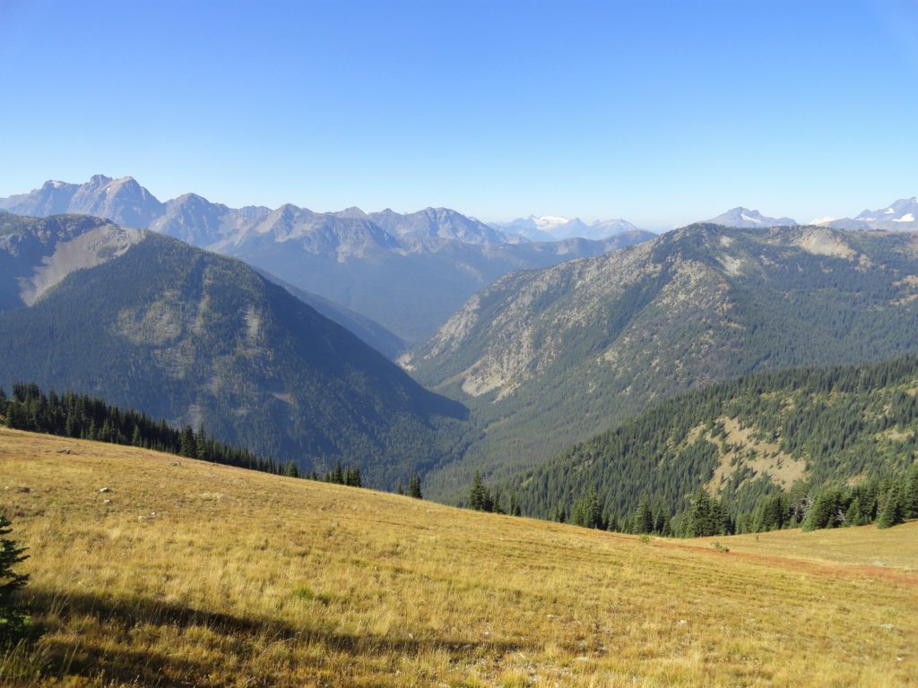
Lift your eyes from the basin and gaze out at a landscape unblemished with prominent peaks. Giants Jack and Crater dominate the northwest. Baker too makes its presence known. Ballard and Azurite occupy the southwest. And straight ahead are a plethora of peaks in the Pasayten country.
Round Slate Peak into a small basin where melting snowfields provide the first waters to Benson Creek. Round a small knoll and marvel at the continuous floral shows displayed prominently along the trail. Arnica, anemone, aster, paintbrush, gentian, harebell, cinquefoil, phlox, and groundsel-they’re all here and more.
The trail next approaches Buffalo Pass, but opts not to cross it, continuing instead along the western slopes of yet another knoll. Now losing a couple of hundred feet the trail skirts Indiana Basin before descending a little more to reach Windy Pass. Here an old mining road leads left to Barron passing a large structure en route. The trail enters the half-million-plus acre Pasayten Wilderness, one of the largest roadless areas in Washington. Head back when ready on a generally uphill return.
For detailed information on this and many other area hikes, pick up a copy of my best selling Day Hiking North Cascades book.