Old Kettle Falls Trail
Hike through an old town site along a tamed river

Quick Facts:
Location: Lake Roosevelt, Stevens County, WA
Land Agency: National Park Service
Roundtrip: 2.6 miles
Elevation Gain: minimal
Contact: Lake Roosevelt National Recreation Area
Detailed Information: Day Hiking Eastern Washington (Mountaineers Books)
Notes: Dogs permitted on leash
Access: From Kettle Falls head west on SR 20-US 395 for 2.2 miles and turn left onto Boise Road. Continue for 1.6 miles bearing right where Boise Road bears left to become the Old Kettle Road. Then soon come to the Kettle Falls Campground. Park near Ranger Station for trailhead.
Good to Know: bird-watching, historic, lighthouse, kid-friendly, dog-friendly, practice Leave No Trace Principles
Kettle Falls are gone along with the original town site of same name. In 1939 the impounded waters of the Grand Coulee Dam claimed them. The town was relocated to higher ground to the east. And the falls which French-Canadian fur traders called Les Chaudieres—the Kettles, for the huge, kettle-shaped holes in the ledge below them are now a fading memory. Walk this trail through abandoned homesteads and try to imagine the great fishery that was once here before “progress” claimed it.
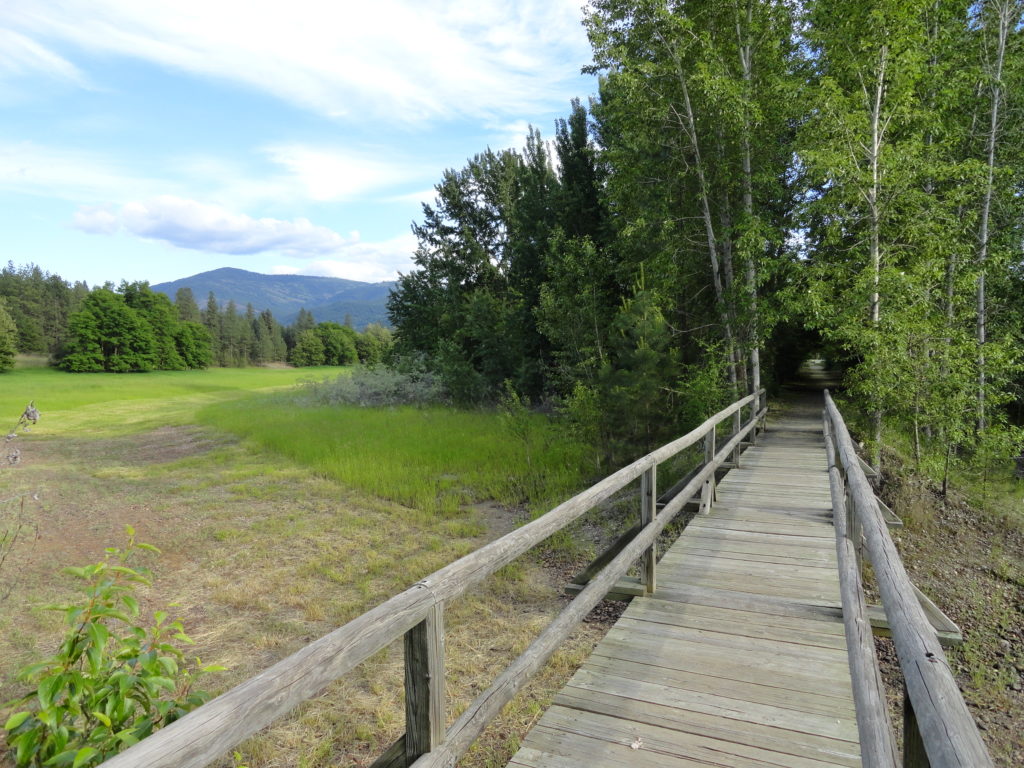
Like the old town site it travels through, this trail is missing from most maps. It’s an easy nearly flat walk that while lacking stunning scenery—is full of interesting historic relics. The forest is attractive, especially in the autumn and the surrounding wetlands teem with birds. Deer too are plentiful here. Head south on the trail and pass the boat launch access road. Then continue to a bridge spanning a draw lined with aspens. The trail utilizes an old road for a brief moment; then veers left to pass an old foundation and reaches the group camp road.
The trail continues past the road, coming to old homesteads, pastures, orchards, and thickets of young pines and old locust trees. After a little more than a mile reach a junction. Stay right following the trail through a pine forest along a sandy bluff. At 1.3 miles the trail ends, but when the water level is low you can continue out a little farther on the flats of the Columbia River. Reflect on what the river once looked like here just down from the falls. These grounds were occupied by Native Peoples for more 9,000 years. And the area was once the second largest fishery on the Columbia River.
For detailed information on this hike and many other great hikes throughout Eastern Washington, pick up a copy of my and Rich Landers’ Day Hiking Eastern Washington (Mountaineers Book).
For information on where to stay and on other things to do in Northeastern Washington, check out Northwest TripFinder

