Red Pass─High Portal to Glacier Peak
Quick Facts:
Location: North Fork Sauk River
Land Agency: Mount Baker-Snoqualmie National Forest
Roundtrip: 20.6 miles
Elevation Gain: 4,300 feet
Contact: Darrington Ranger District: Mount Baker Snoqualmie National Forest (360) 436-1155; www.fs.fed.us/r6/mbs
Green Trails Map: Mountain Loop Highway 111SX
Special Note: Northwest Trail Pass required.
Access: From Darrington, travel south on the Mountain Loop Highway for 16 miles turning left onto FR 49. Continue for 6.7 miles to a junction signed for Sloan Creek Trail. Turn left and reach trailhead in 0.1 mile.
Recommended Guidebook: Backpacking Washington 2nd Edition (Mountaineers Books)
Good to Know: dog-friendly, wilderness rules apply, old-growth, exceptional alpine scenery, wildflowers, backpacking, practice Leave No Trace Principles
One of the few western approaches to the magnificent alpine country surrounding Snohomish County’s highest summit, 10,541-foot Glacier Peak is via the North Fork Sauk River Trail. It’s a long journey through magnificent old-growth forest and then up steep open slopes; but the trail is good and the scenic vistas, alpine gardens, and off-trail explorations are well worth the time and effort. Plan on at least a one night backpack to Red Pass, the lofty portal to Glacier Peak just north on the Pacific Crest Trail from where the North Fork Sauk Trail terminates. If you have two or three nights, there are miles of ridges and meadows to further explore.
From the trailhead, immediately enter ancient forest. Stay to the right with a junction for Red Mountain soon entering the Glacier Peak Wilderness. Pass numerous gargantuan cedars en route—some measuring over 9-feet in diameter! At just over 2.0 miles stay left at the Pilot Ridge Trail junction.
At 5.0 miles reach a backcountry camping area near crashing Red Creek (el. 2,800 feet). Cross the fierce waterway on a bridge—then continue deeper into the wilderness. At about 6.5 miles come to the old but still standing Mackinaw Shelter. Good campsites surround it.
From this point forward, the trail climbs—rapidly and with determination, tackling 3,000 vertical feet in three miles! Utilizing a seemingly endless number of switchbacks, the trail angles upward through brushy (and hot in direct sunlight) avalanche chutes before reaching more inviting alpine meadows. At 9.0 miles, high on a flowered ridge, reach the Pacific Crest Trail. Good but busy campsites can be found about a mile south just below 5,900-foot White Pass.
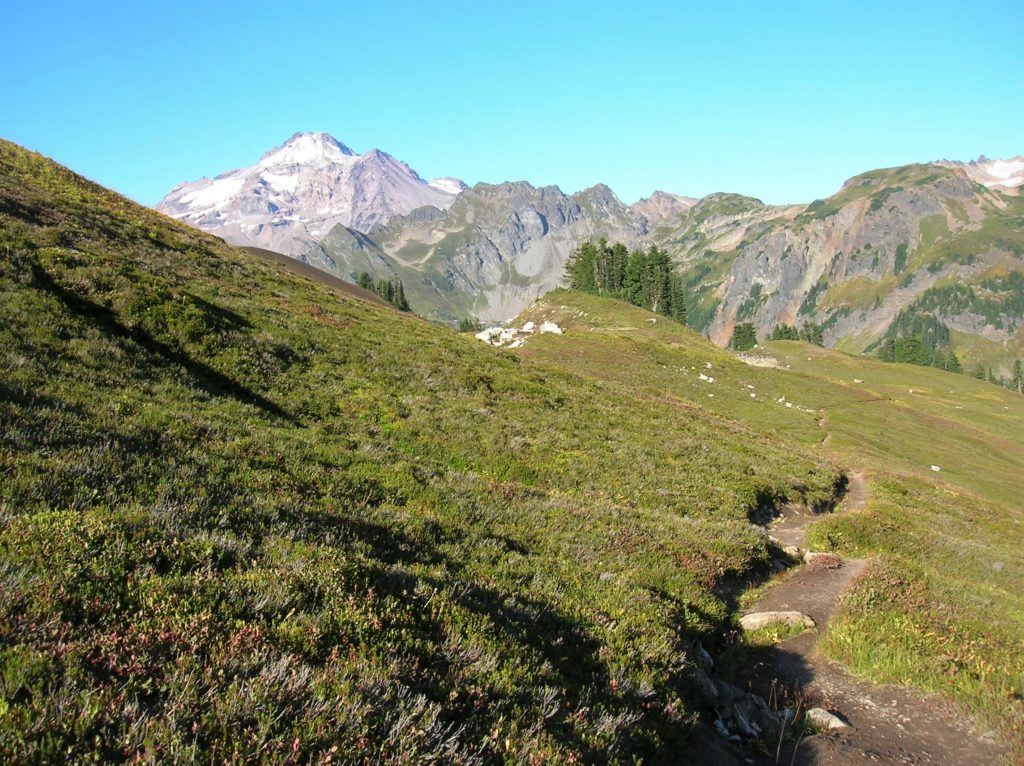
But better camps and more dramatic scenery lies to the north in meadows at the head of the White Chuck River beneath the massive volcanic snow cone, Glacier Peak. Head left on the Pacific Crest Trail traversing high open slopes with spectacular views south to waves of emerald ridges, rocky peaks, and serrated summits.
After about 1.3 miles, reach 6,450-foot Red Pass, a tight gap between 7,000-foot White Mountain and Portal Peak. Now descend across alpine tundra to heather meadows to parkland meadows all under the wrathful eye of Washington’s fourth highest summit. The White Chuck River here is merely a babbling creek inviting you to find a nice campsite near its banks and be lulled to sleep in this magnificent backcountry paradise.
Rest up and consider exploring the nearby White Chuck Cinder Cone, White Mountain or the White Chuck Glacier after you’re recharged!
For detailed information on the hike to Glacier Meadows and 79 other superb backpacking adventures in Washington, pick up a copy of my best selling Backpacking Washington 2nd edition