Benchmark Mountain–The meadows here measure up among the best

Quick Facts:
Location: North Fork Skykomish River Valley
Land Agency: Mount Baker-Snoqualmie National Forest
Roundtrip: 14.2 miles
High Point: 5,816 feet
Elevation gain: 3,700 feet
Green Trails Maps: Monte Cristo, WA-No. 143, Benchmark MT- No. 144
Contact: Skykomish Ranger District: Mount Baker-Snoqualmie National Forest
Note: Northwest Forest or Interagency Pass Required
Access: From Everett head east on US 2 for 50 miles turning left onto the Beckler River Road (FR 65). Continue north for another 15.0 miles and just after crossing North Fork Skykomish River come to a junction. Turn right onto FR 63 and proceed for 4.3 miles to road’s end and trailhead .
Good to know: Dog-friendly, exceptional wildflowers, exceptional views, exceptional old-growth, exceptional huckleberries
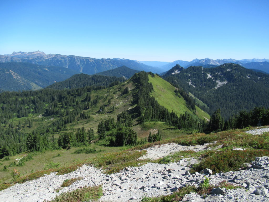
When it comes to supreme alpine meadows, Benchmark Mountain is the benchmark in the Central Cascades. Highpoint on one of the most spectacular ridgeline hikes in the Cascades, West Cady Ridge—the only thing superseding the flowers is the views. The hike is long and there’s quite a little climbing involved, but excellent views begin in 4.0 miles making a shorter trip a satisfying option.
Start by heading off into luxurious ancient forest. Cross the North Fork Skykomish River on a bridge above a small gorge; then begin climbing—gently at first. The trail winds through some of the biggest and oldest trees in the Skykomish Ranger District. Left out of the 1984 Washington Wilderness Bill, permanent protection was afforded these trees on May 8, 2008 when President George W. Bush signed a bill (sponsored by Senator Patty Murray and Representative Rick Larsen) establishing the Wild Sky Wilderness.
At approximately 2.0 miles reach a densely forested gap between West Cady Ridge and Excelsior Mountain. Real climbing now begins as the trail steeply marches up the spine of West Cady. Huckleberry and mountain ash become more profuse as the forest canopy thins. Views out to surrounding peaks grow as you continue upward through heather meadows. At 3.5 miles crest a 4,700-foot knoll, a good spot to call it a day if you feel like climbing no more. Enjoy views north across the valley to Columbia and Monte Cristo Peaks and west across Jack Pass to snow-faced Spire Mountain.
The views and the meadows only get better, so carry on if you’ve got the drive. Continuing along the high ridge the trail dips 100 feet to a small saddle before cresting a 4,825-foot knoll. Enjoy excellent views of Bald Eagle Mountain and Glacier Peak north, Fortune and Evergreen Mountains south. Drop 200 feet into a berried flat. Up another knoll, down a little again then up, up and away up to a 5,350-foot knoll. Behold the view west over the North Fork Sky Valley and peaks and slopes north and south now part of the Wild Sky Wilderness.
Enter the Henry M. Jackson Wilderness traversing parkland meadows blotched with small tarns. After dropping 200 feet by a small tarn, climb to an easy to miss junction near a cluster of mountain hemlock. Veer left here and after .3 mile pop up on Benchmark Mountain’s 5,816-foot elongated summit. Flowers! And views! Lots of views—some of the finest in all the Cascades.
Benchmark Mountain is one of my 100 Classic Hikes in Washington. Pick up the book for more details on this hike and to find about the other 99 classics hikes!

For more detailed information (including maps) on this hike and many others nearby, consult my Day Hiking Central Cascades guidebook.
