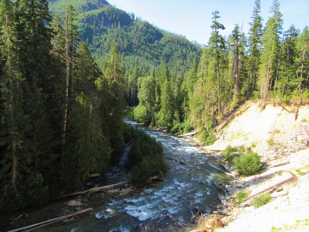
Thunder Creek– Stroll alongside a tumultuous creek through a striking old-growth forest
Quick Facts:

Location: Ross Lake National Recreation Area
Land Agency: United States National Park Service
Distance: 12.0 miles
Elevation Gain: 750 feet
Contact: North Cascades National Park Complex
Green Trails Map: North Cascades Ross Lake 16SX
Notes: Dogs permitted on leash, permits required for camping
Access: From Marblemount drive State Route 20 east for 24 miles. Just past milepost 130, turn right into the Colonial Creek Campground and proceed 0.5 mile to the trailhead, near the amphitheater at the day-use area. Additional parking can be found near the boat launch.
Good to Know: kid-friendly, exemplary old-growth, dog-friendly, backpacking opportunities, Practice Leave No Trace Principles
Hike into one of the deepest, wildest, and most accessible wilderness valleys in the North Cascades National Park Complex. Pass through groves of ancient cedars and towering firs. Gaze through holes in the forest canopy to jagged peaks cloaked in glacial ice. And while the surrounding high country is blanketed in white, enjoy this hike early or late in the season thanks to its low elevation.
The trail immediately enters an impressive stand of old-growth forest along the shoreline of Thunder Arm, an aquatic protrusion of Diablo Lake. At 0.9 mile pass the Thunder Woods Nature Trail loop, a recommended diversion or short hike option. The way continues on a near-level course past giant trees and big boughs of ferns, reaching Thunder Creek in about 1 mile. Continue alongside the west side of the creek, passing several inviting gravel bars. At 1.3 miles the trail crosses the creek on a large sturdy bridge.
Pass Thunder Camp, set in a centuries-old grove of behemoth firs. Then leaving the riverside, the trail travels through a much younger forest soon coming to a junction with the Fourth of July Pass Trail. Proceed right, cross a creek, and pass a junction with a short side trail that drops back to the river, landing in Névé Camp—a nice place to call it quits if you’re content not to carry on.
Otherwise continue following the trail deeper into the wilderness. The thundering waterway is nearby the trail, always audible but not seen. Undulate between old-growth groves and younger forests that are replacing stands scorched by fires over the last few decades. Enjoy periodic openings in the dense canopy and impressive views of the array of towering peaks that line the valley. Their extensive glacial systems help feed the roaring creek beside you.
Continue on an up and down course coming to a horse camp at 5.8 miles. The way then traverses a bluff above a washout granting good views of the creek below. The trail then descends, crosses a creek and reaches a former junction at 6.0 miles. Here a side trail once crossed Thunder Creek for McAllister Camp. This is a good place to call it a day. Strong hikers can continue another 1.3 miles farther up the Thunder Creek Trail, entering the North Cascades National Park (no dogs) to a big bridge spanning Fisher Creek just before Tricouni Camp. Beyond that, it’s backpacker’s and ultra-runner’s territory.
Thunder Creek is one of 136 featured hikes in my fully updated and expanded Day Hiking North Cascades 2nd Edition (Mountaineers Book). For more details on this hike and others (including many not found in other guides), pick up a copy of this book today!

For information on where to stay and on other things to do along the North Cascades Highway, check out Northwest TripFinder
