South Coldwater Ridge — Elk, toppled tractors, and a stunning view of a volcano-formed lake

Quick Facts:
Location: Spirit Lake Highway Mount St. Helens West
Land Agency: Mount St. Helens National Volcanic Monument
Roundtrip: 6.8 miles
Elevation gain: 1525 feet
Difficulty: moderate
Green Trails Map: Mount St Helens 332S
Recommended Guidebook: Day Hiking Mount St Helens
Contact: Mount St. Helens National Volcanic Monument
Access: From Castle Rock follow SR 504 east for 46.2 miles to trailhead.
Notes: Northwest Forest Pass (or interagency pass) required; No dogs; Trail open to bikes
Good to know: Kid-friendly, historic, exceptional wildflowers, Practice Leave No Trace Principles
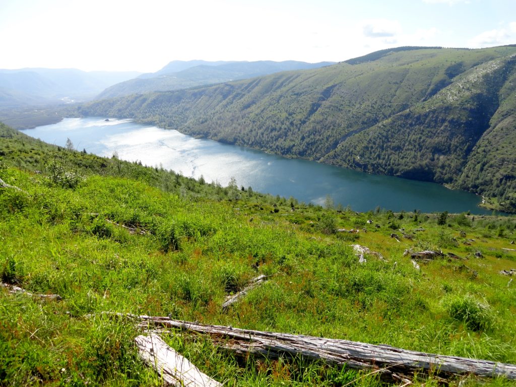
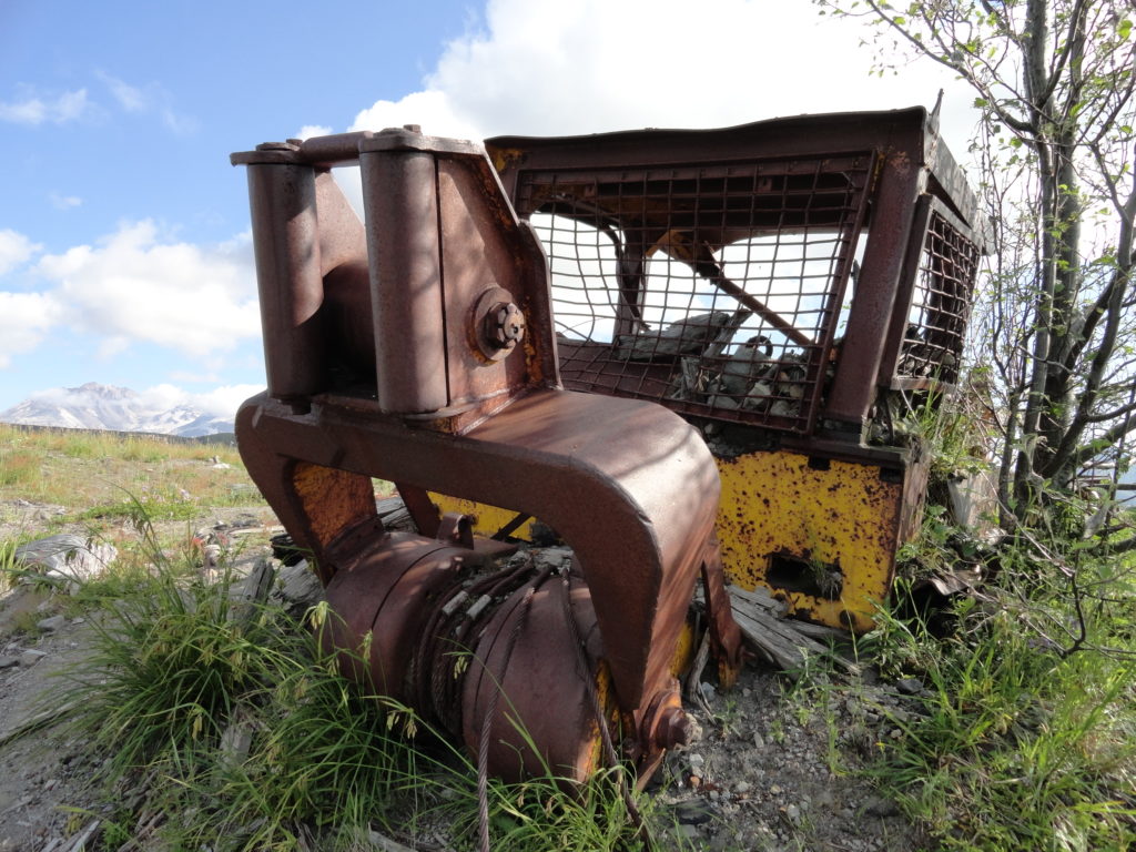
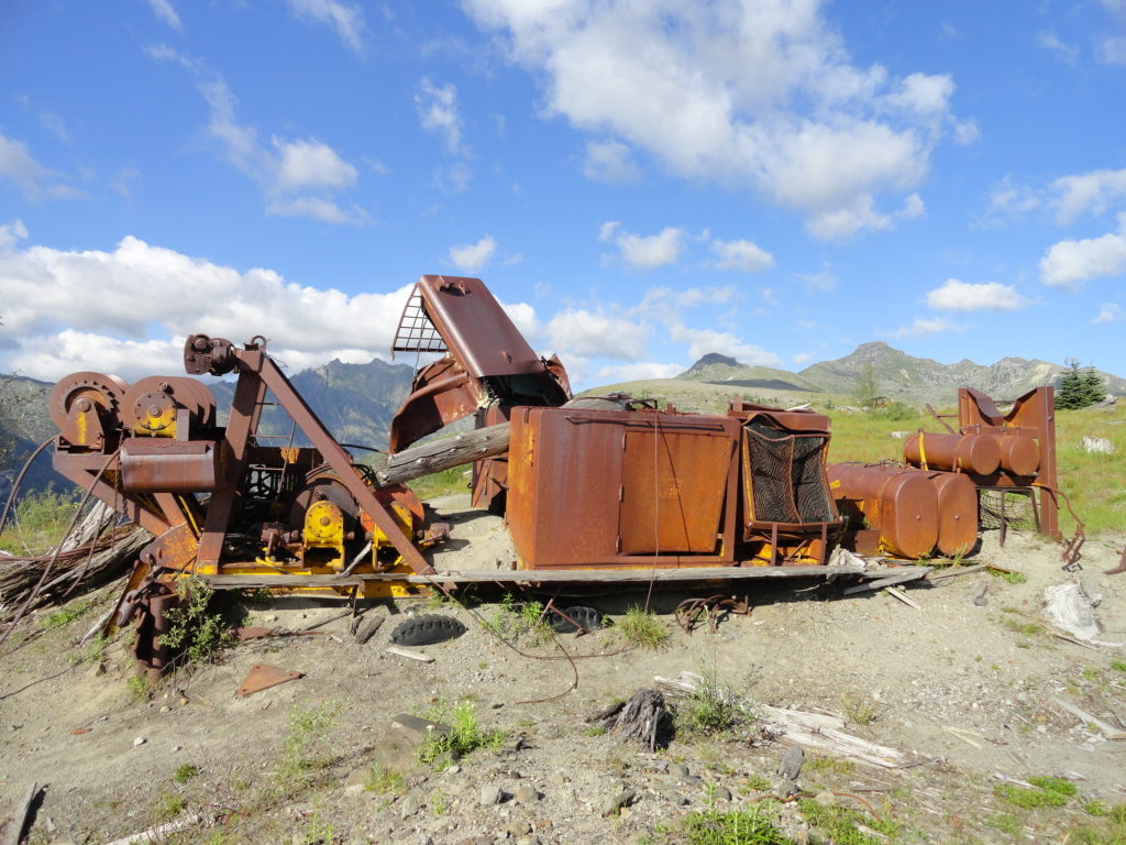
Hike along a ridge above the sparkling waters of Coldwater Lake admiring Nature’s reclamation of a ravaged landscape. Marvel at the deciduous forests rapidly re-greening clearcuts and blowdown trees from past logging and the 1980 blast. Let fields of wildflowers woo you and stand in awe inspecting toppled and mangled logging equipment proving no match to Mother Nature’s volcanic fury.

This is a great early summer trail on the west side of Mount St Helens and one of the area’s quieter trails, too. Wind up South Coldwater Ridge traversing fields of flowers and emerald forests a mere three decades old rapidly transforming a formerly bleak landscape. Much of this ridge was logged in the 1970s. Saint Helens blew down the remaining big trees in May of 1980 to join the big stumps.
After passing through a thickly forested spot, crest an open shoulder of the ridge. Here Coldwater Peak, Johnson Ridge, Castle Lake, the Hummocks and Mount St Helens all come into view—and mainly stay in view as you march forward. Coldwater Lake increasingly reveals more of its sparkling mass too.
At 1.6 miles come to the first of numerous heaps of scattered, toppled, and mangled tractors and logging equipment left behind in the wake of the blast. Weyerhaeuser lost scores of equipment and 12 million board feet of timber (over 2,600 logging trucks worth) from the eruption. The rusted and contorted logging vestiges surrounded by feisty new greenery create wonderful post-apocalyptic themed photographing and drawing opportunities.

The trail continues to climb, albeit more gently now as it follows along a former logging road. Resplendent flowers line the way and views of Coldwater Lake below are simply breathtaking. Coldwater Peak provides a nice backdrop to the east. Keep your senses tuned for elk—they are prolific in this part of the monument.
Continue along the broad open ridge basking in wondrous views. At about 2.9 miles crest a 3900-foot ridge and slowly descend rounding a hanging valley. Soon a half-submerged sure-to-intrigue toppled tractor greets you. Just beyond at 3.4 miles is the junction with the Coldwater Trail—your turning around point. Unless you want to extend this hike by either hiking up or down the Coldwater Trail.

For more detailed information and maps on this hike and every trail (including winter trails and summit routes) within the Mount St. Helens National Volcanic Monument, pick up a copy of my (co-written with Aaron Theisen) Day Hiking Mount St. Helens guidebook (Mountaineers Books)!
For the most comprehensive and up-to-date map of the Mount St Helens National Volcanic Monument, pick up the brand new Green Trails Mount St Helens Special Series 332S Map.
For great family-friendly ideas on where to stay and other places to play near Washington’s most famous volcano, consult Northwest TripFinder.
