Lower Gray Wolf River– A nice place to hang out with the pack

Quick Facts:
Location: Northeast Olympic Peninsula
Land Agency: Olympic National Forest
Roundtrip: 7.0 miles
Elevation gain: 900 feet
Contact: Hood Canal Ranger District, Quilcene
Green Trails Map: Olympic Mountains East no. 168SX
Notes: wilderness rules apply
Recommended Guidebook: Day Hiking Olympic Peninsula
Good to Know: dog-friendly; kid-friendly; easy backpacking options, Buckhorn Wilderness
Access: From US 101 near the Sequim Bay State Park entrance, drive 0.9 mile on Louella Road turning left onto Palo Alto Road. Continue for 5.8 miles bearing right onto Forest Road 2880. After 1.7 miles bear right onto FR 2870 and proceed 1.8 miles to trailhead.
Hike along the tumbling, churning Gray Wolf River through groves of old-growth conifers. A perfect destination for a spring woodland flower hike—there’salways an excellent chance of spotting a big critter along the way, too.
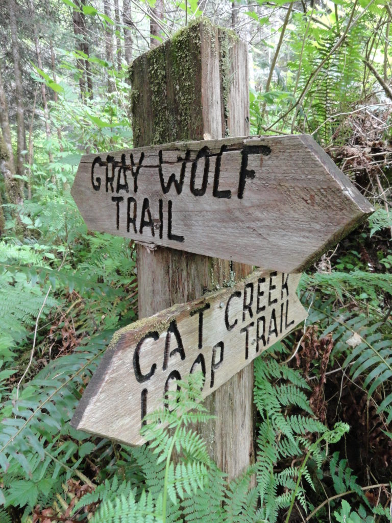
The way starts on an old logging road. Descending, take in good views of Maynard Mountain and the portal to the Gray Wolf Canyon. Eventually enter mature forest and come to a junction with the Cat Creek Loop Trail. An alternative route, it takes off left dropping steeply along Cat Creek through an ancient cedar grove, and then follows a portion of the old Gray Wolf Trail to return to the main trail 0.5 mile farther.
The main trail continues right leaving the old roadbed, and entering a cool old-growth forest of fir and hemlock. Now descending to the river, enter the Buckhorn Wilderness and reach Two Mile Camp at 1.5 miles. Traverse a sun-kissed bottomland, then drop back to river level reaching Cliff Camp. Now hike along the river feeling cool breezes funneling down the surging waterway. Continue along the river passing another camp then once again climb above it.
Enjoy good views of the Gray Wolf crashing through a tight canyon gorge. Then descend a little making your way back to river bottom. Here at 3.5 miles call it quits, as the trail ends at a narrow rocky gorge that once housed a high bridge.
Fording the river here is extremely dangerous. If you want to further explore the Gray Wolf Valley, use the Slab Camp Creek Trail. Right now, sit by the lovely waterway, letting its rapids mesmerize and its resident dippers entertain you.
Lower Gray Wolf River is one of 136 featured hikes in my bestselling Day Hiking Olympic Peninsula Book 2nd edition. For more details on this hike and others, pick up a copy of this book—the number one selling and most trusted guidebook on hiking in the Olympics—today!
For information on where to stay and on other things to do on the Olympic Peninsula, check out Northwest TripFinder